
Northern areas to see the most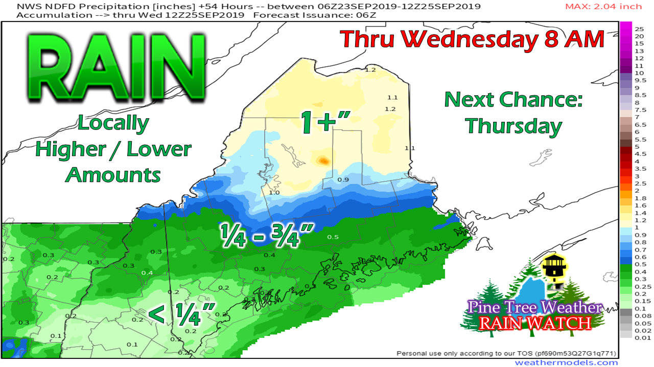 The forecast posted for this event here on Friday has held up fairly well. Northern areas appear to get the bulk of the rain, while southern areas appear to end up on the short end of the gauge. Portland has recorded just 0.16" of total rainfall for September (2.40" below normal), and will be lucky to double that total by Tuesday morning. On the flip side, Caribou has recorded 2.78" of rainfall, which is 0.37" above normal, and could add another inch to the surplus by the time this event wraps up early Wednesday. Timing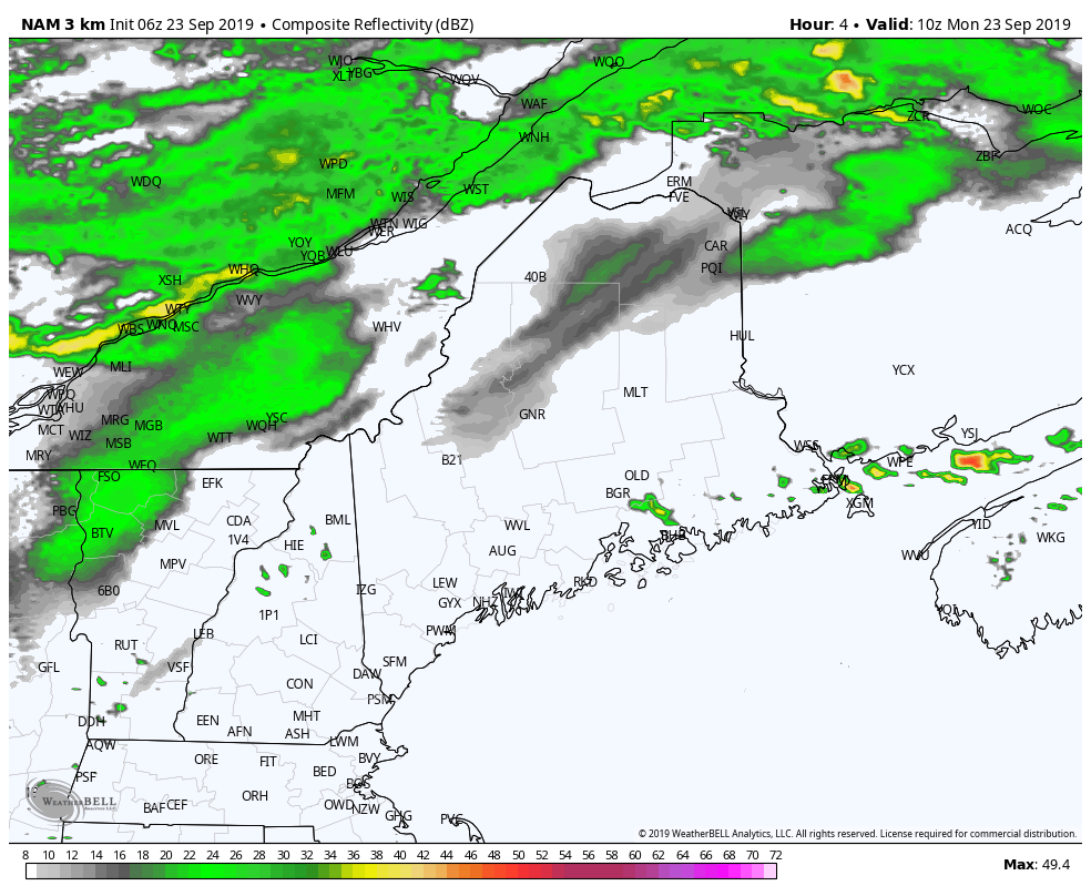 A cold front slowly drifts south Monday. Showers overspread northern and western areas during the day, then arrive at the coast by late afternoon. There is a chance for a thunderstorm as the advancing colder air aloft encounters warm, humid air to the south and east. 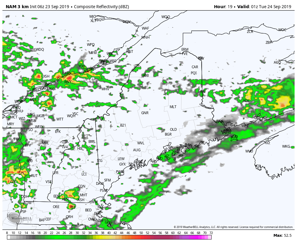 A upper low shifts the rain to the east Monday night into Tuesday. There could be rumble of thunder overnight in areas. At this point, severe weather is not expected. 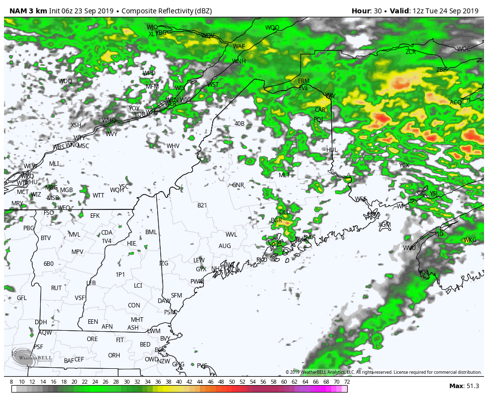 For Tuesday, the upper low spins across the region towards the Canadian Maritimes. There may be enough energy around to touch off showers and thunderstorms in the western and central parts of the state Tuesday evening. All shower activity appears to come to an end overnight into early Wednesday morning. A summer time feel to the temperatures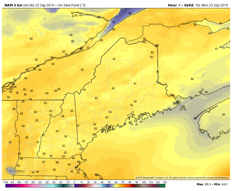 It will be on the muggy side for much of the state to start off on Monday, but as the cold front advances, drier air works into the area. It appears to be a more comfortable night for northern areas, with the dew point slowly dropping over western areas overnight into Tuesday. The coastal plain appears to hang onto the humidity until Tuesday morning, with drier conditions arriving there Tuesday afternoon. Tuesday night will be comfortable everywhere, with dew points continuing to drop into the 40s by Wednesday morning. 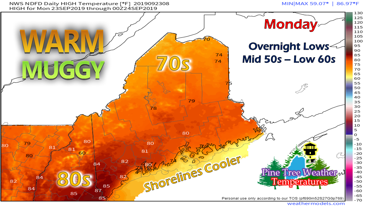 With the warm and sticky conditions, hydration and staying cool will be the concern of the day for those working outside and for the scholar athletes. Temperatures could feel as warm as upper 80s and close to 90° over southwestern areas. It will be a beautiful ocean beach day as the shorelines stay cool in the 70s. Please support Pine Tree WeatherA special thank you to those that have signed up to be monthly contributors on my Patreon page and to those who have mailed checks to me. This a labor of love here. I don't mind the 4 AM wake up calls (2 AM for snow days) to formulate a forecast, create graphics then write it all out for your consumption, so long as I have the financial support from you to continue to do so. There is no media or marketing influence here. No model forecast bias. No political or scientific agenda. It's just Maine weather, plain and simple. I would appreciate your support to continue this for 2020. Contributors are donation on average of $5 per month / $60 per year either through Patreon or by check. No amount is too small. This is Maine, most of us are on tight budgets, and having been there myself, I understand the struggle. All I ask is to do what you can. If you can't do anything financially right now, that is totally understandable. Please pass along what I do to others and help this site to grow!
Thank you for your support! ► ► For the latest official forecasts, bulletins and advisories, please check in with the National Weather Service in Gray for western and southern areas, or Caribou for northern and eastern parts of Maine. For more information from me, please check the Pine Tree Weather Facebook page as well as my Twitter feed. Always stay weather aware! - Mike |

Mike Haggett
|


