Nothing major, but stay on alert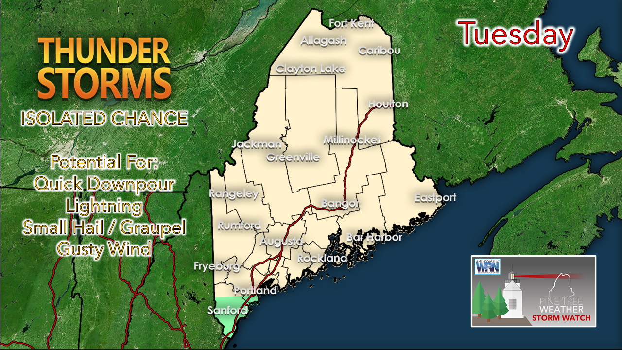 A good portion of the state runs the risk of an afternoon thunderstorm as an upper-level low and trough pass through the region today. This set up is not optimal for any severe storms. Cold air aloft meets the warmth generated at the surface which sets up the possibility for some isolated thunder through sunset. Another unstable day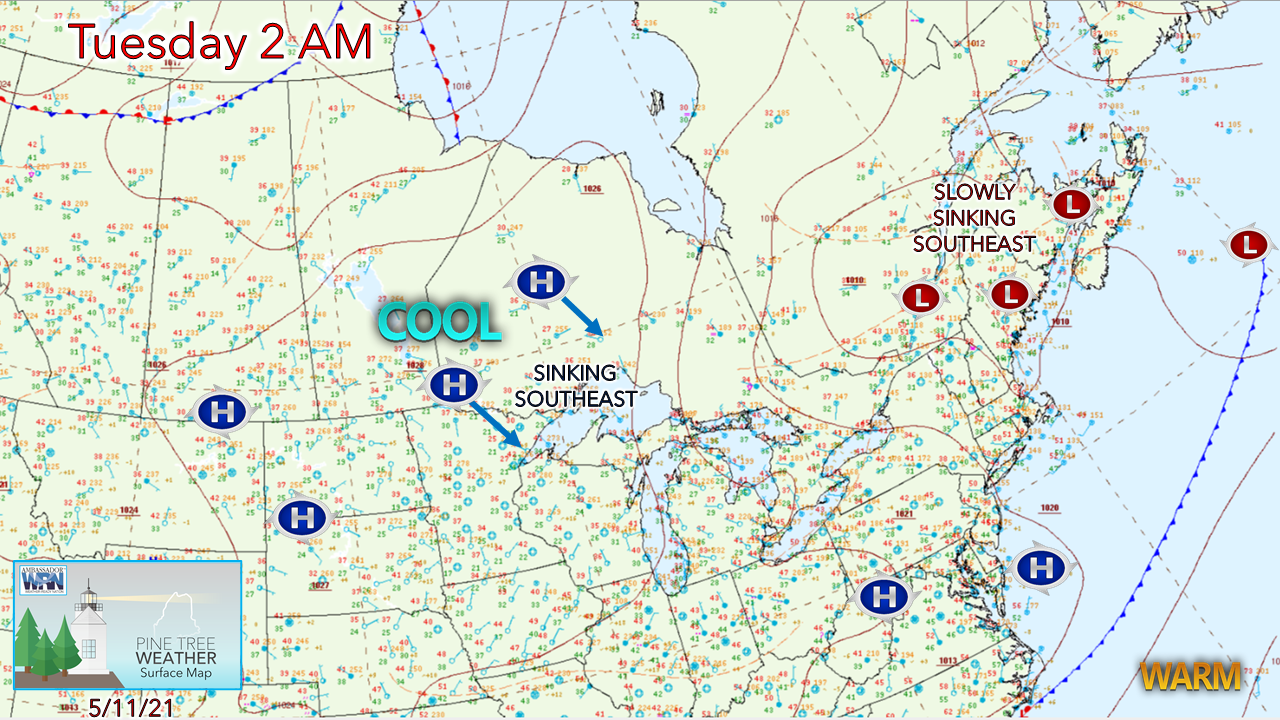 Weak areas of low pressure along the shortwave upper-level trough sink to the southeast during the day. An upper-level low over the Great Lakes slides eastward and slowly pushes the trough through the region through Wednesday morning. 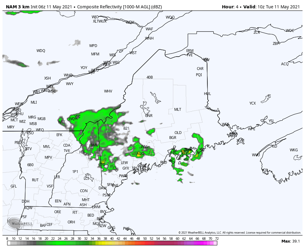 Forecast radar image from 6 AM to 8 PM Tuesday shows the upper-level low sliding eastward and reaching the state Tuesday afternoon into the evening. The cold pool aloft associated with it meets up with the daytime heating of the day and sets up the risk for showers and an isolated thunderstorm. The main threat for rainfall is over the northern part of the state, with widely scattered activity over southern areas. Western and southern areas can expect breezy conditions Tuesday afternoon as a west wind develops with the arrival of the upper low. One last chance for snow Tuesday night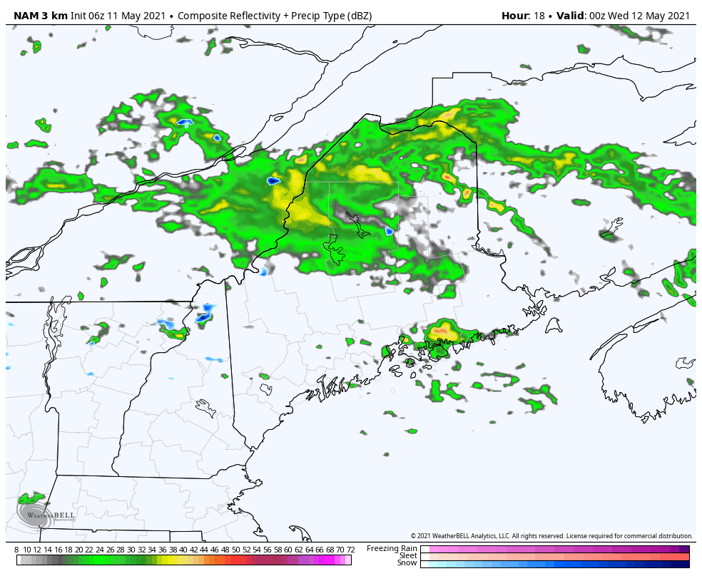 Forecast radar loop from 8 PM Tuesday to 6 AM Wednesday shows the rotation of the upper-level low moving into New Brunswick and the push of the upper-level trough to the southeast. Under this scenario, cold air advection could bring snow showers to higher elevations in the western mountains overnight, with any flakes ending soon after daybreak Wednesday morning. Snowfall accumulations will be light, if any. Spot showers possible for Wednesday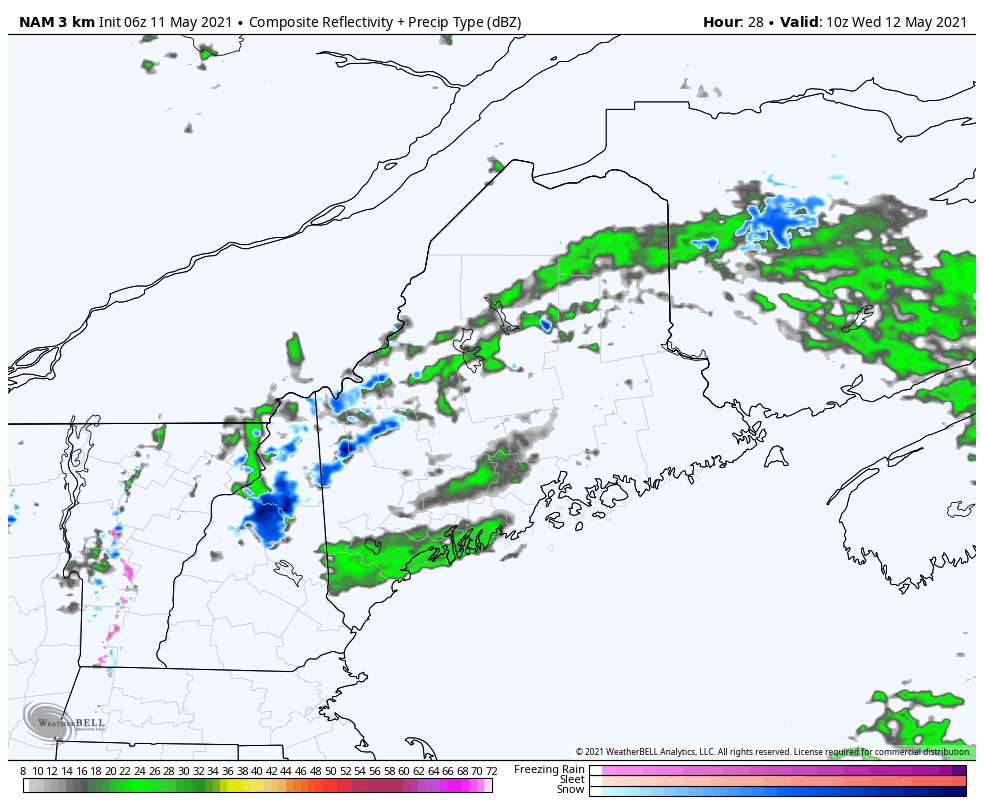 Forecast radar loop from 6 AM to 8 PM Wednesday indicates the threat of widely scattered showers attributed to low pressure over eastern Quebec and cyclonic flow associated with it at the surface from the northwest. The low spins upper-level shortwave disturbances through the area, which brings the risk of a widely scattered shower through the day. With the low slowly moving east, expect a similar scenario for Thursday. Friday appears dry region wide. Showers are possible in the afternoon both Saturday and Sunday as a series of upper-level shortwaves pass through the region. Join the weather community as a storm spotter!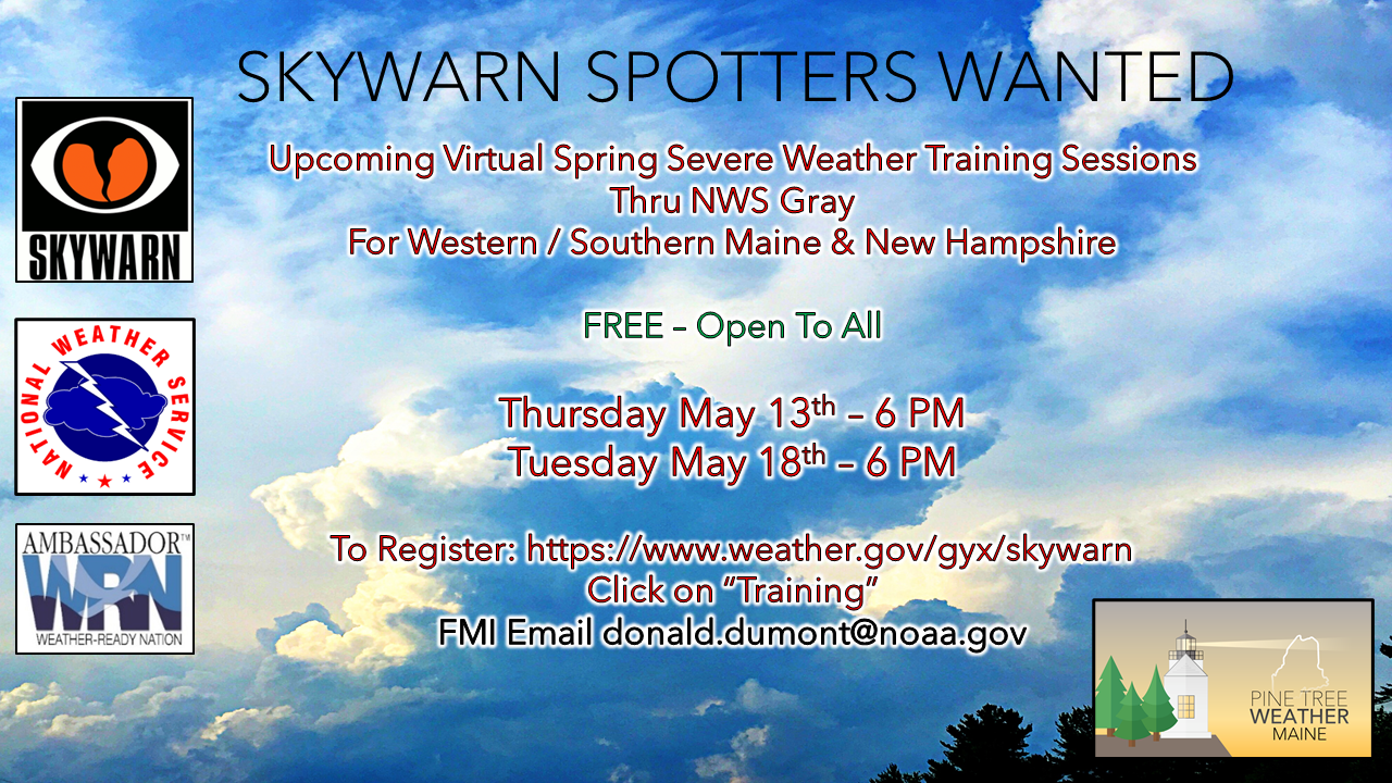 Here's a wonderful way to become active in the weather community and help the US National Weather Service Gray ME, broadcast media and forecasters like myself with storm reports. This information is vital during and after an event for forecasting and alerting purposes. I can't tell you how many times I have seen the importance of these reports in the past 9+ years I have been involved. Pine Tree Weather followers have stepped up in the past and participated, and with the readership base continuing to grow, I know there are more out there. This is the spring/summer session which discusses severe weather, what to look for, and how to report it. These sessions run for about 90 minutes. They are fact filled, educational and interesting. You can get the whole family involved from the comfort and safety of home. Once completed, you will get your spotter ID, and will be ready for the season ahead. For those who trained for the winter session, this will complete your full year training. It's important to have both sessions done. The link to register is here ► https://www.weather.gov/gyx/skywarn#fragment-2a If you need more information, please contact Donald Dumont, the Warning Coordinating Meteorologist at NWS Gray via email [email protected] or message me directly. Seven-day temperature outlook through Monday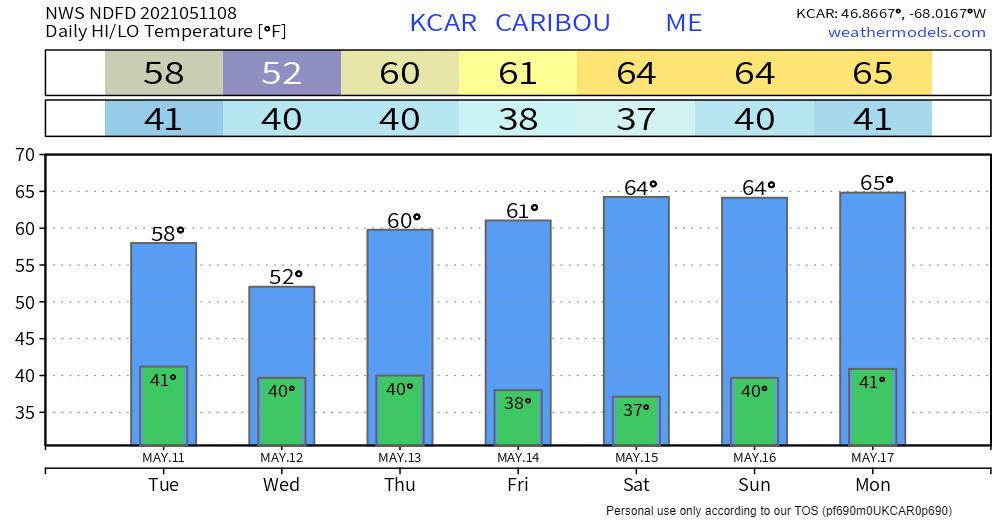 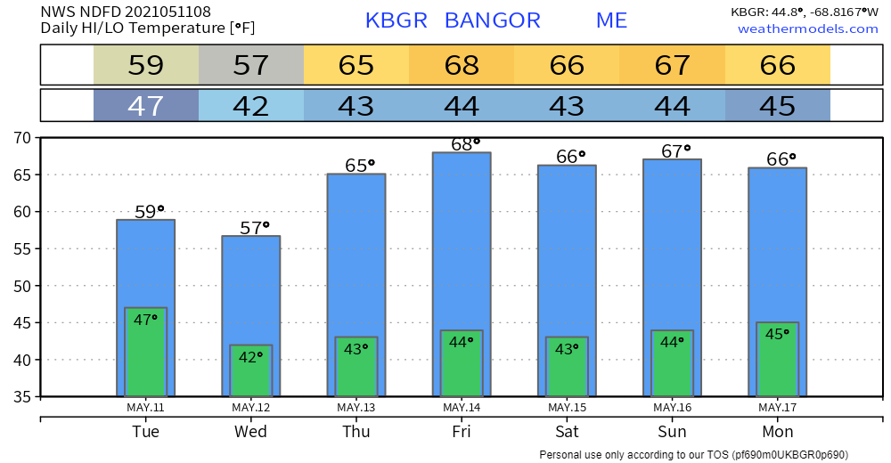 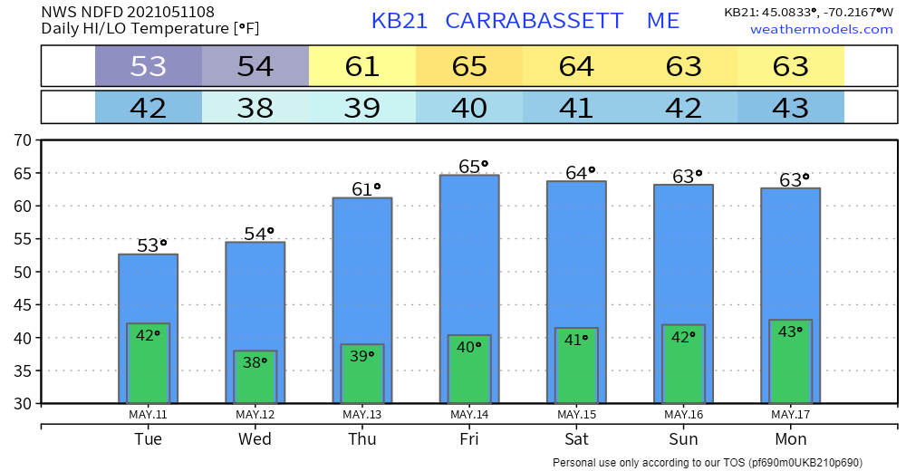 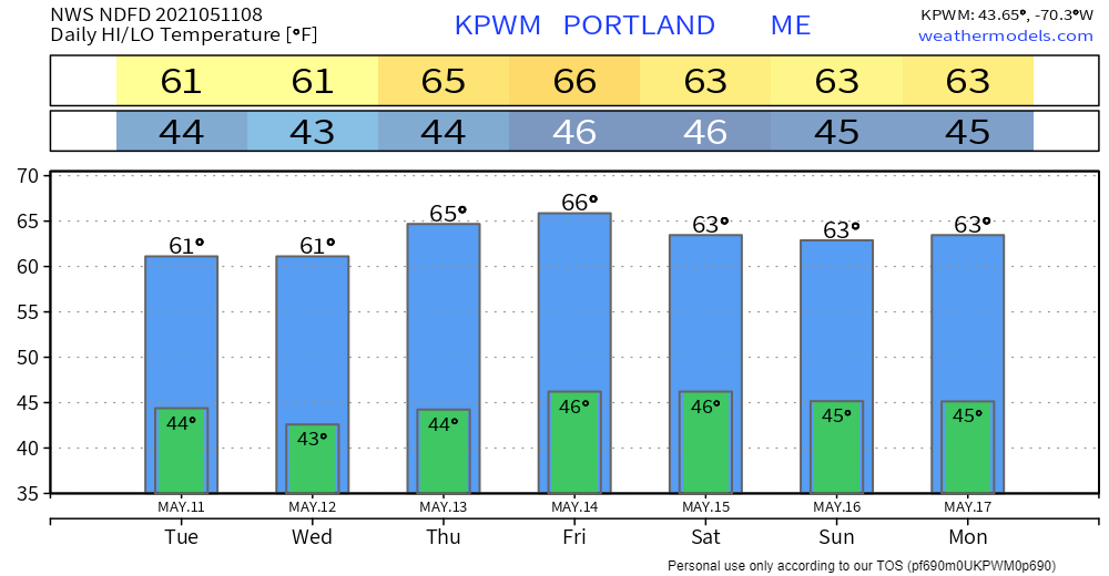 Be prepared to receive alerts and stay updated!
For more information in between posts, please follow Pine Tree Weather on Facebook and Twitter.
Thank you for supporting this community-based weather information source which operates by reader supported financial contributions. Stay updated, stay on alert, and stay safe! Thank you as always for your support! - Mike |

Mike Haggett
|