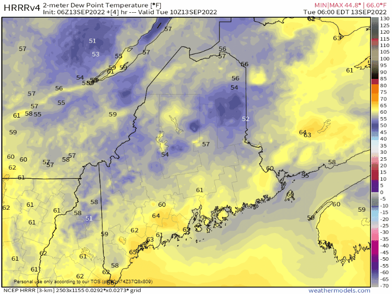
Warm front moves northeast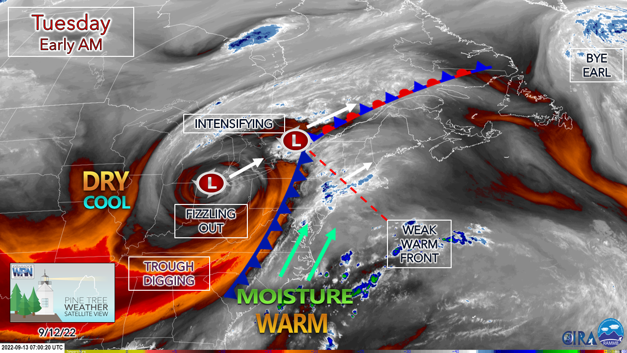 While gathering data and setting up graphics for the post, a radar indicated tornado warning was issued at 4:35 AM for Kings and Queens in New York City, which is an eye opener for both location and time of day. It's a good indication of a weak warm front creating spin in the atmosphere and will be the main point of concern for the folks to the south and east of the region. The other factor is the threat of flash flooding, with reports by spotters to the NWS New York office confirming that with the early morning storms. 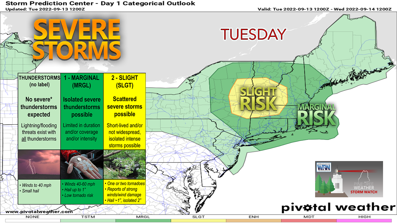 It could be a rough day for eastern New York, the southern two-thirds of Vermont, southwestern New Hampshire and western Massachusetts. I suspect a severe thunderstorm watch is likely to come there. For us in Maine, western and far southern areas have a chance for a snarky storm or two, but it will be cloud and timing dependent. As one can tell by stepping outside, the elevated dew points are noticeable, which provides fuel for strong to severe storms. There is also the element of stable air, given the dense fog advisory that was posted for the morning commute. Timing is also a question mark, as the best chance for activity comes later in the day as the sun is about to set. There are a lot of negatives which create doubt for severe storm potential for Maine, but all it takes is about an hour of sun in the mid to late afternoon hours to light the fuse. Given the amount of humidity around the area, heavy rain to the point of localized flash flood potential is the main concern. There could be torrential downpours in spots that will cause reduced visibility, along with ponding on roadways and potential hydroplaning on the faster roadways. Showers in the morning, storms later in the day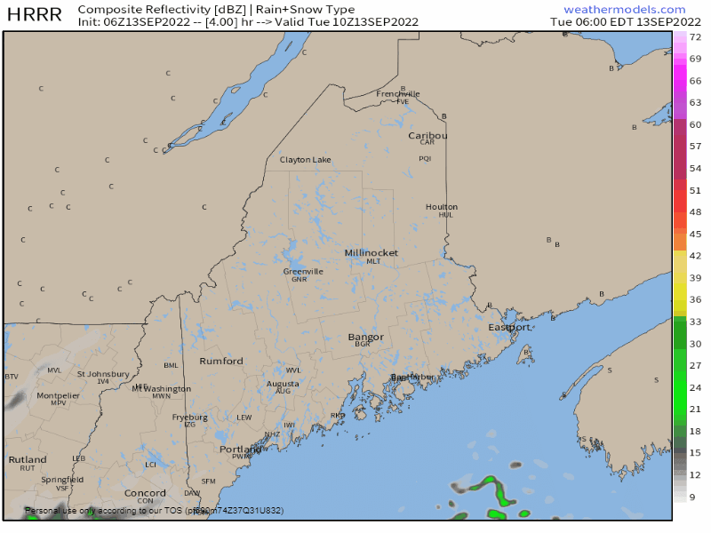 Tuesday 6 AM to 6 PM - As the warm front advances northeast, the risk for rain showers increases during the morning over southern and western areas, in the afternoon for the north and east. Cloud debris from the morning activity over southern and western areas plays a role in what happens in the afternoon. 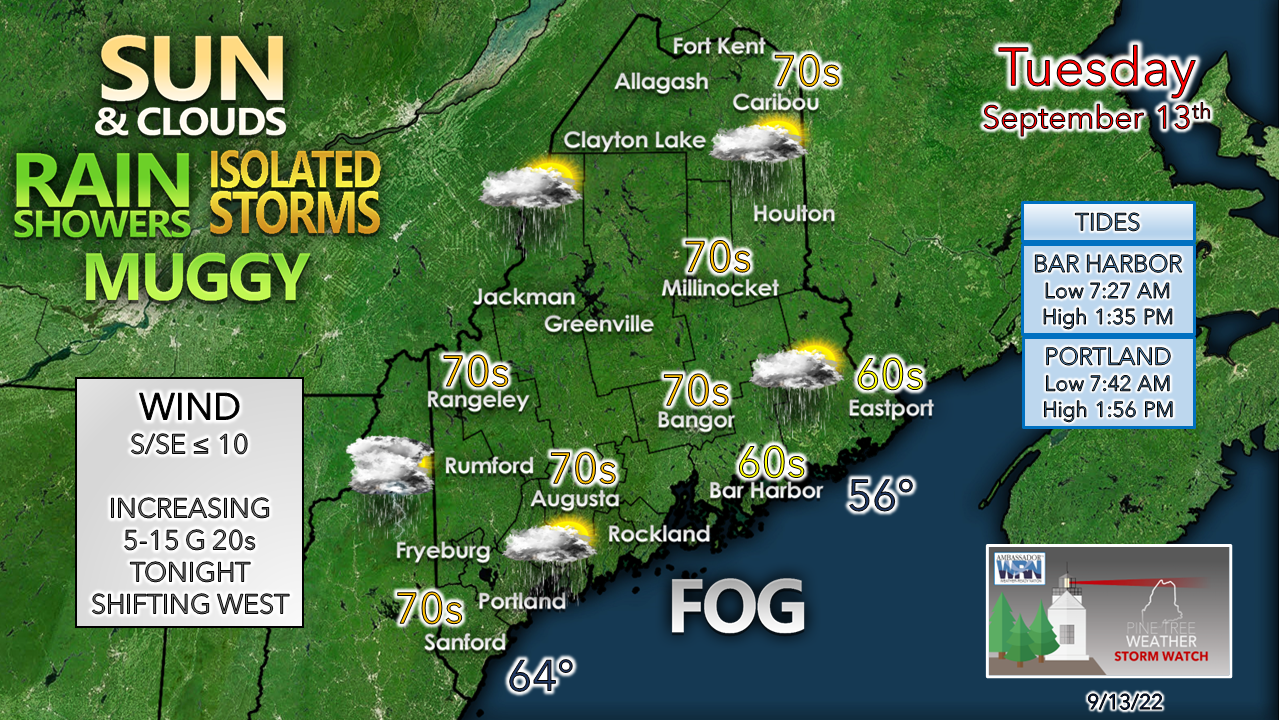 With the light south/southeast flow off the ocean, stable air is likely to hold for Cumberland County northeastward. The western mountains, foothills, Sebago Lake region southwest into York County have the best chance for a late afternoon storm. As the cold front approaches and then passes through, the wind will pick up overnight into Wednesday morning. Showers with a chance of rumbles overnight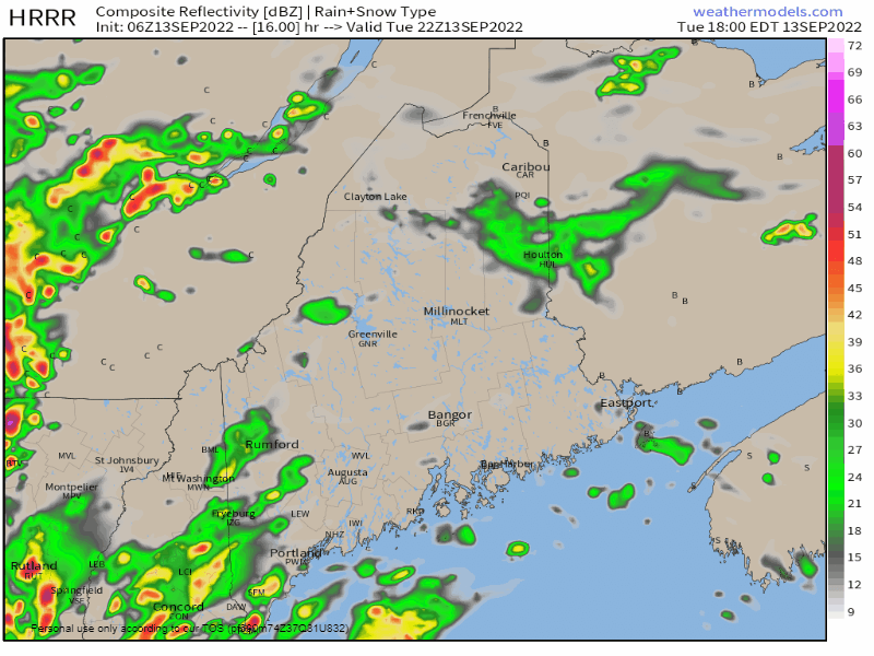 Tuesday 6 PM to Wednesday 6 AM - Low pressure riding along the St. Lawrence River intensifies on its way northeast. This could bring some flashes of lightning and rumbles along with downpours overnight into early Wednesday. Second and third shifters may see some areas of fog overnight where heavy rain falls. Showers for the north through Wednesday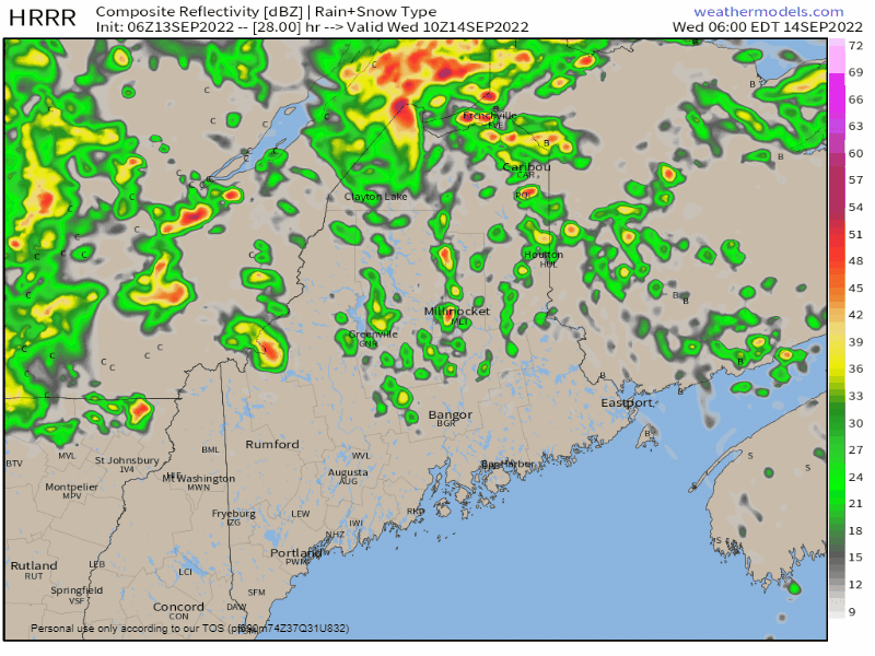 Wednesday 6 AM to 6 PM - As the low intensifies and spins away, reinforcing frontal boundary waves pinwheel showers through the mountains and north during the day. Scattered showers in the morning become widely scattered in the afternoon, ending by evening. I am going with a Flying Trash Can Alert for Wednesday with gusts reaching 30-35 mph. Heads up for those who have residential waste pick up. Secure your cans and totes as best as possible. Pick up or tie down any loose objects that could go airborne, like grill covers. While the risk is low, some isolated power outages are possible. Dry air funnels into the region Wednesday |

Mike Haggett
|