|
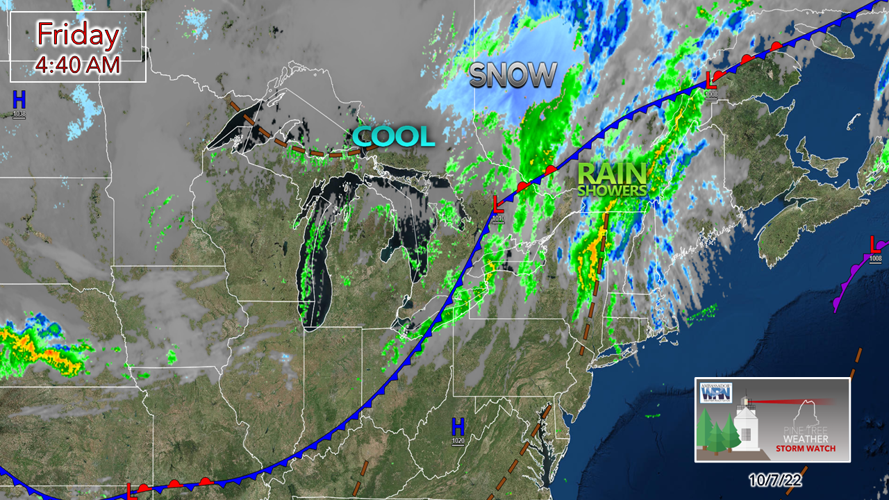
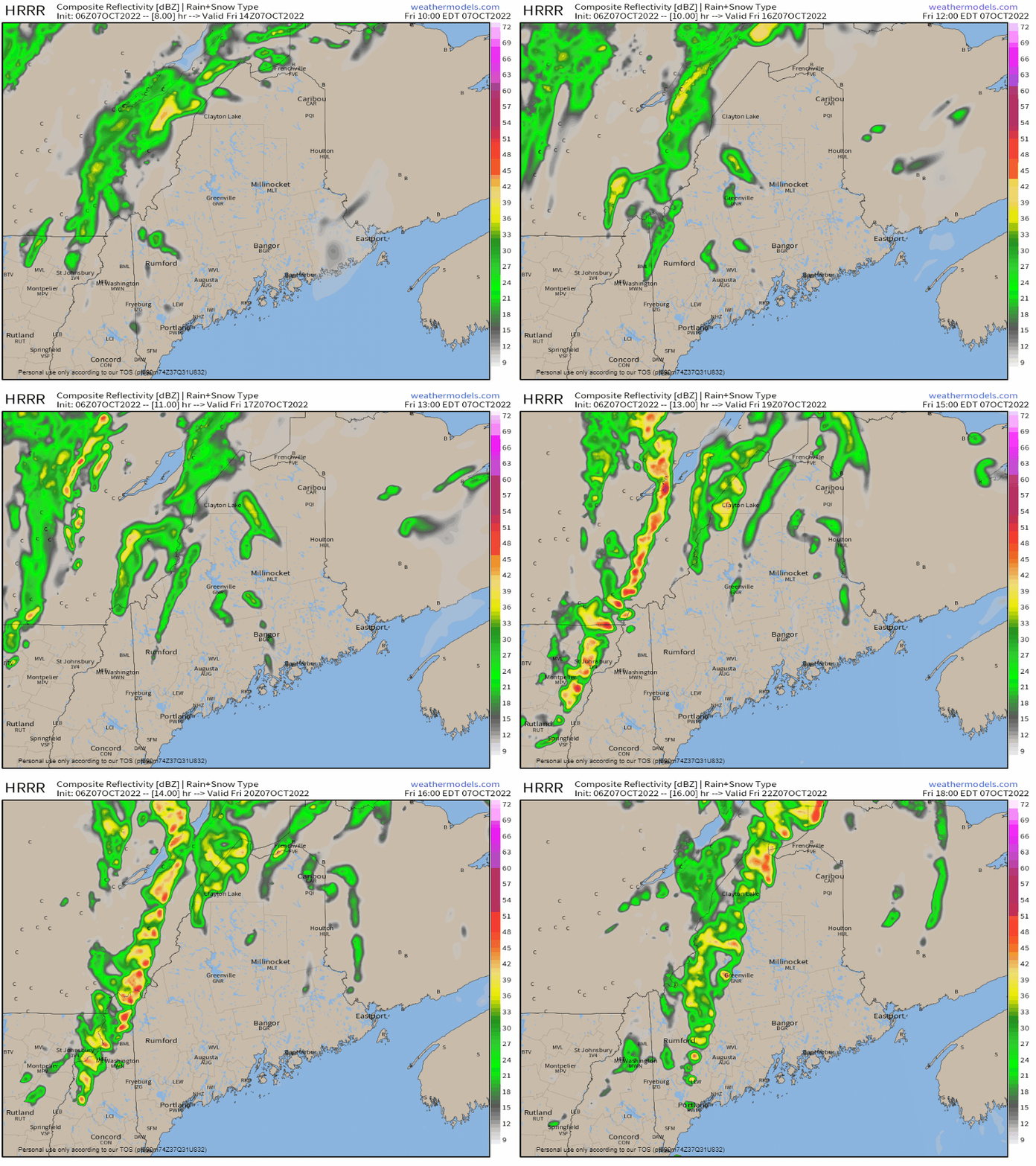
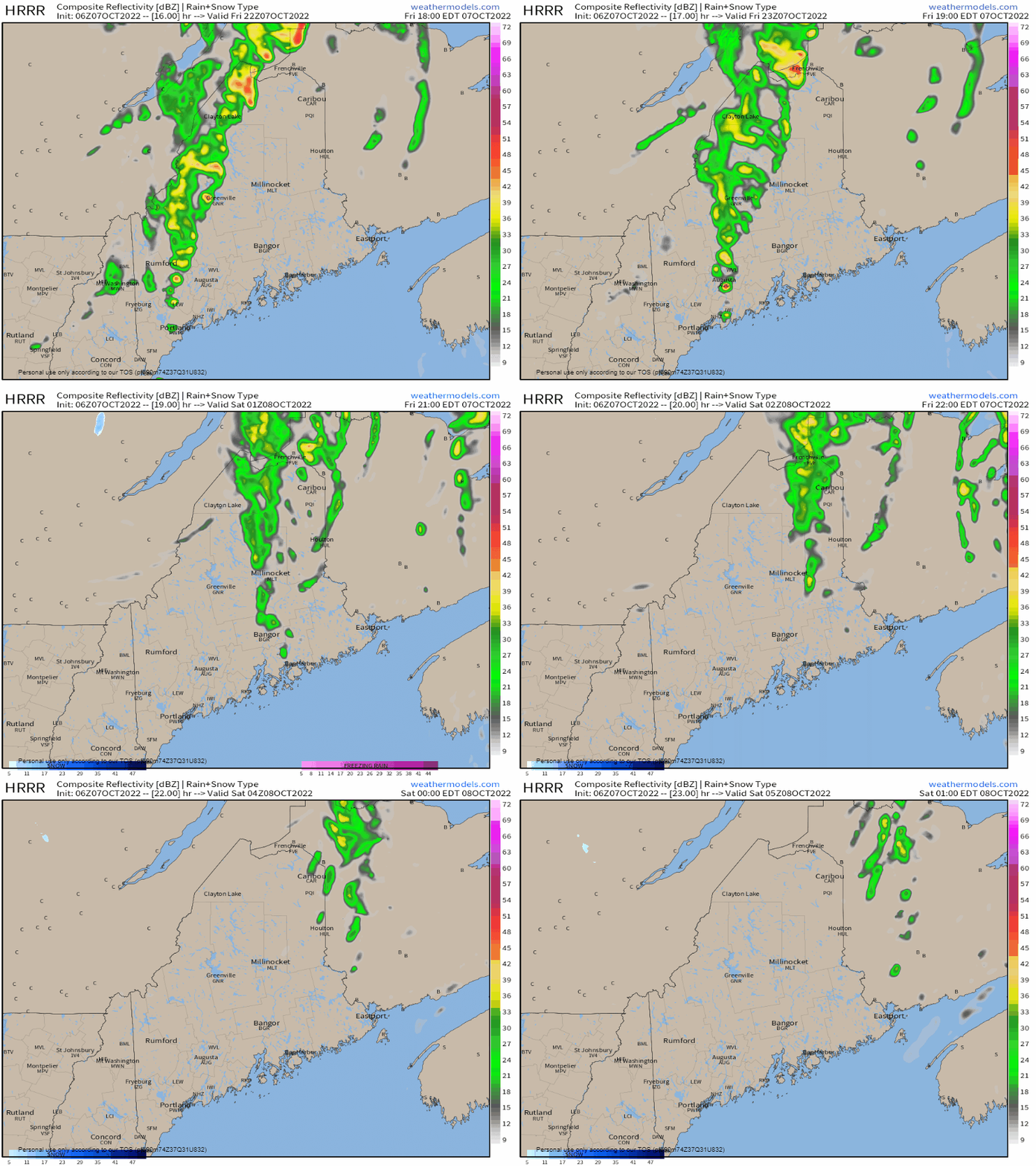
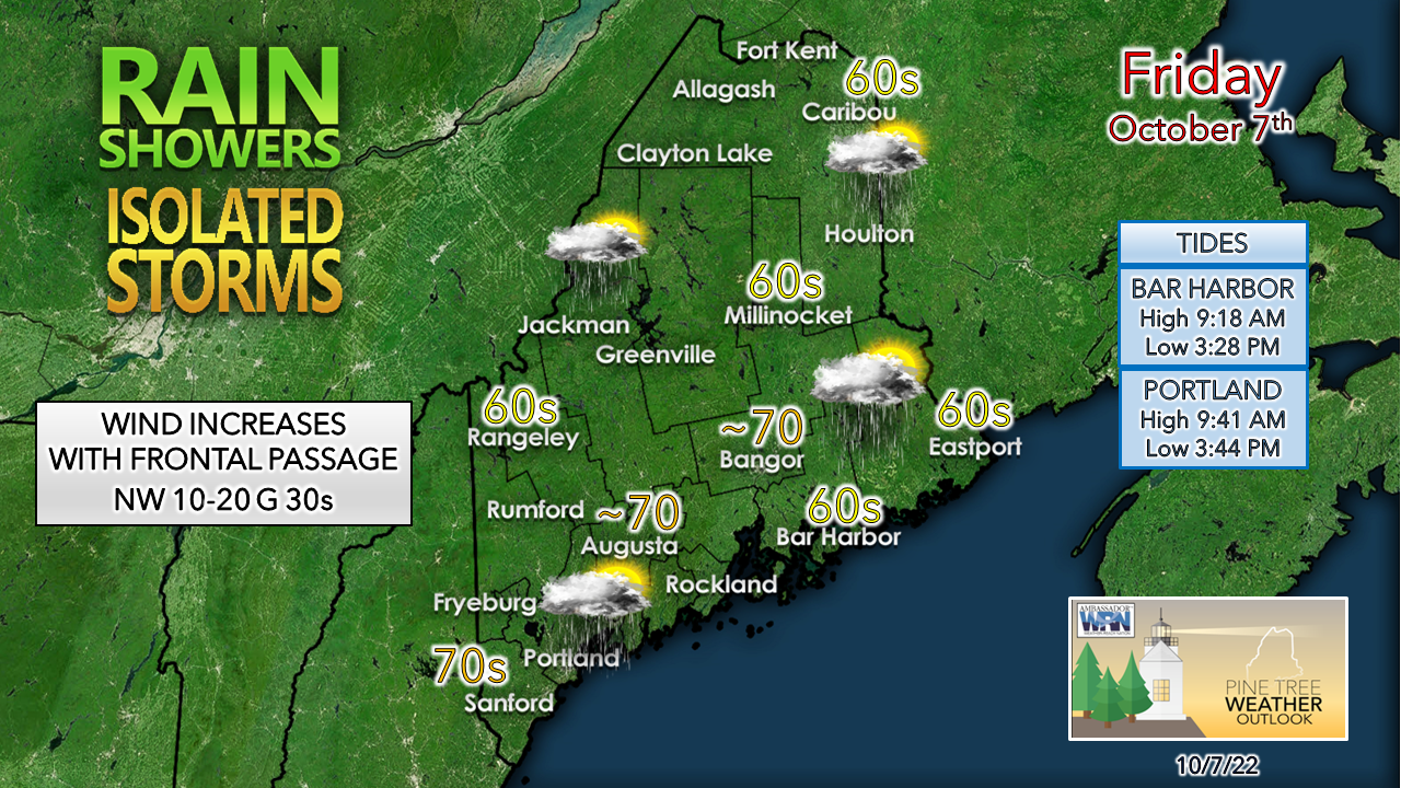
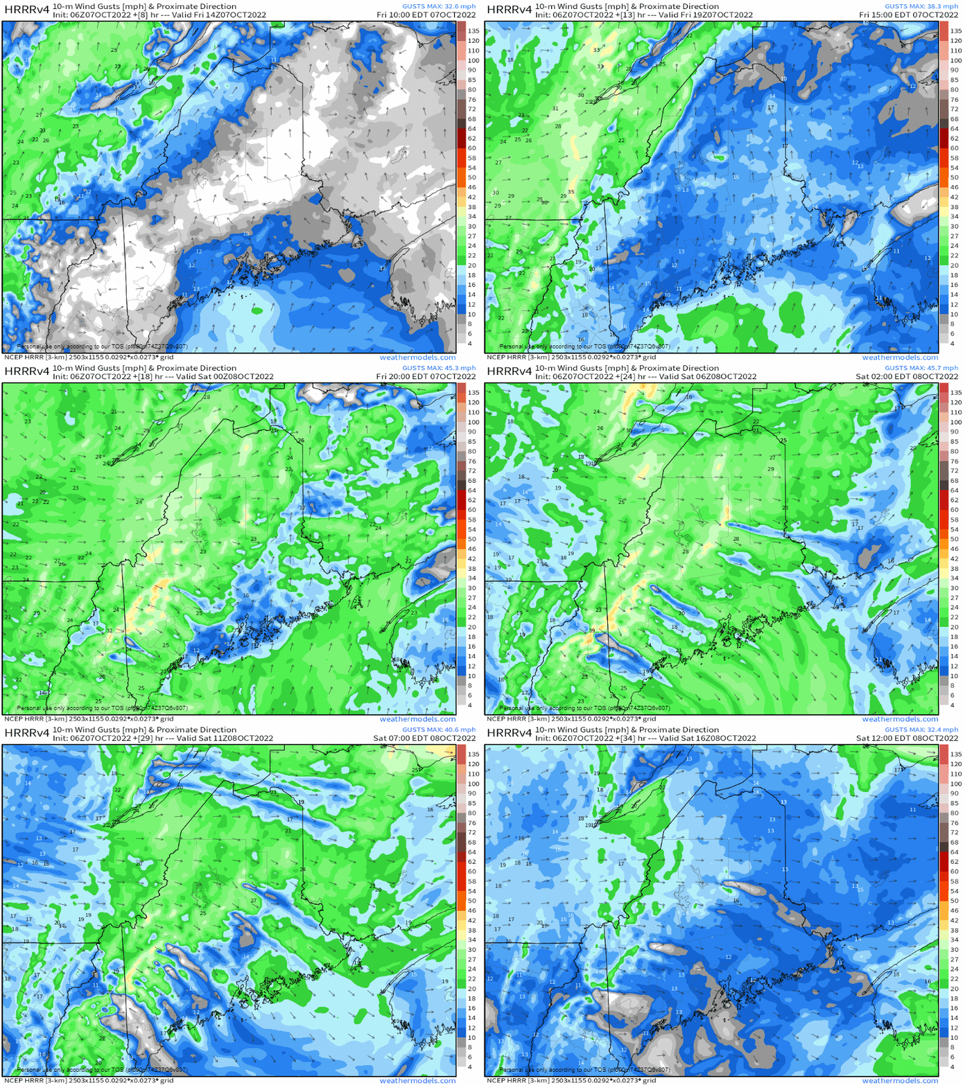
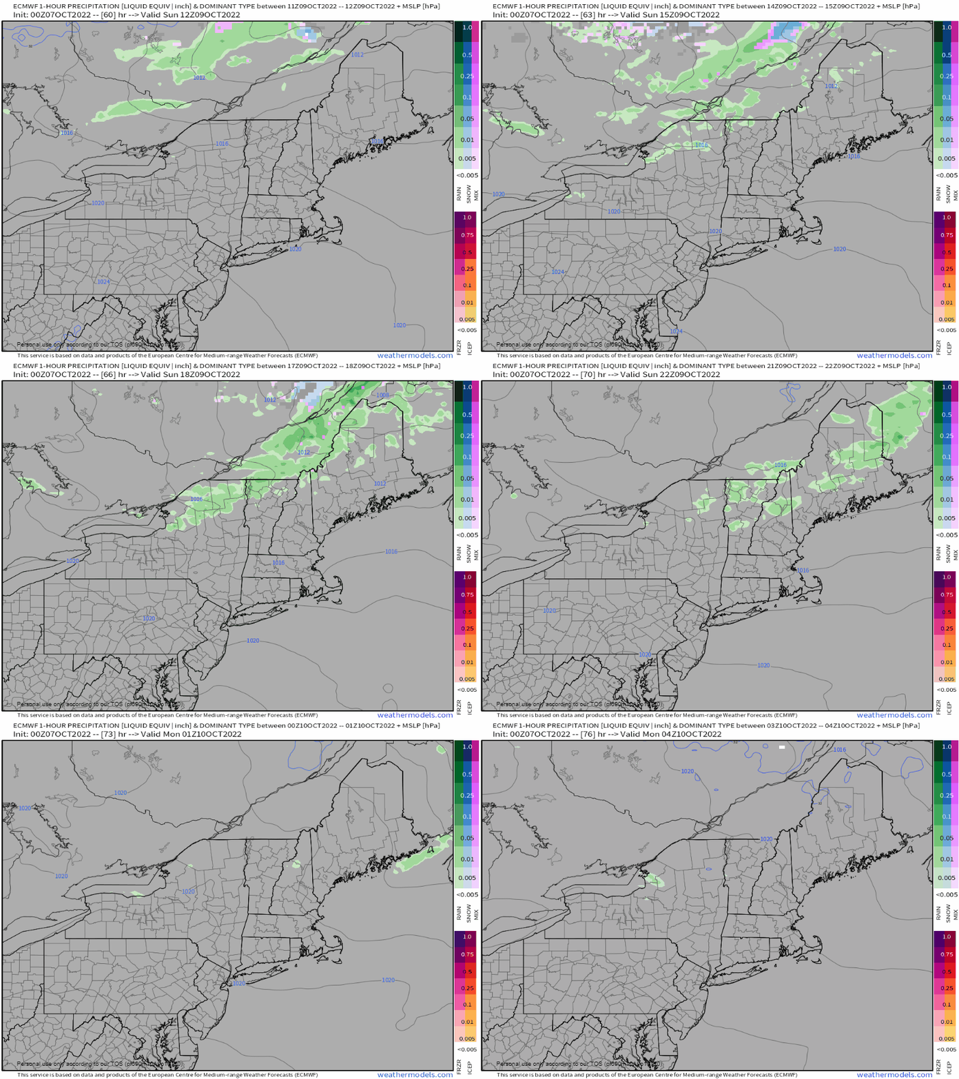
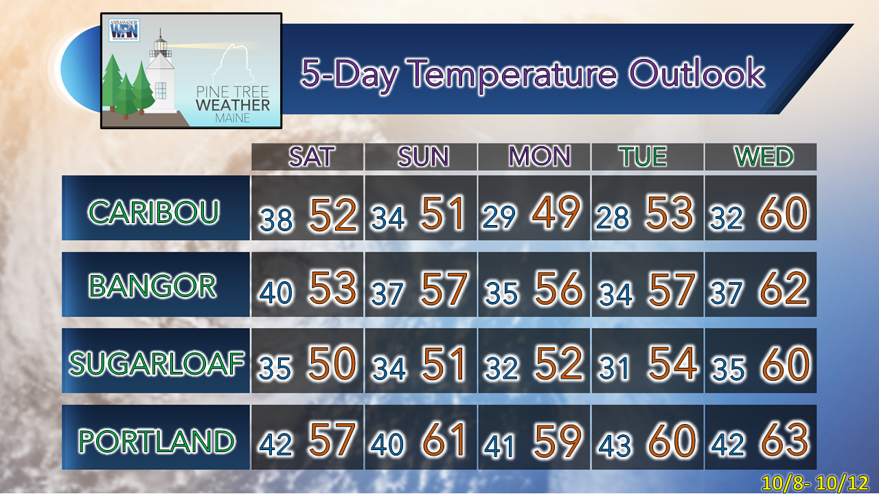
Greetings! A quick personal update here. I've been fairly quiet this week due to a round of COVID. I was knocked out of work for a week and returned to the office Thursday. I am alright, and my family is also. The weather pattern has been fairly quiet, so if there was ever a good time to get sick, this was it. I should be updating a bit more frequently now that it has passed. Sharp cold front passes through FridayThere is that four letter word over western Quebec that is almost as polarizing as politics. The Abitibi region will likely brush off some snow accumulated on vehicles as they head out to work Friday morning, a reminder of where we are at with the calendar. The higher elevations may see some flakes tonight, with Mount Washington a lock to get some snow out of this. I am not bullish on the snowliage idea, though. Between the wind and clouds, there may not be much to see Saturday morning. Friday 10 AM to 6 PM - The north and the mountains have the best chance for shower during the day. I am a bit concerned for a late day thunderstorm may impact the start of high school football games, but I see no reason why the games won't be played. The risk for severe is very low. The Storm Prediction Center indicates the threat for thunder for the region, but as of early Friday morning minimizes the severe threat. Given the dynamics and timing, I don't see where other than a couple sparks, a gust of wind and a quick hit of rain is about all that can be expected, if a storm pops. Friday 6 PM to Saturday 1 AM - The front passes through Friday night and exits northern areas by around midnight. Southwestern areas up into central Maine have one more chance to hit 70°. Looking at long term ideas, outside of some freak warm spell, this may be the final time 70° may be achieved until spring. For folks wanting to stretch their legs oceanside, high tide runs mid-morning. Wind increases and gets gusty overnight into SaturdayFriday 10 AM to Saturday Noon - I am concerned that our beautiful foliage is going to take a fairly significant hit in the peak zones as a northwest wind cranks behind the front. Wind gusts in the 30s overnight may cause some isolated power outages given the leaves on the trees as well. The long shadows of the mountains may spare some spots heading into Saturday. The wind slowly diminishes Saturday afternoon over the coastal plain, but for the north and mountains, expect it to be Saturday night for it to die down. A weak cold front passes through SundaySunday 8 AM to Monday Midnight - A weak clipper system is expected to bring another round of showers on Sunday and may grace the higher elevations with a snow shower or light mixed precipitation upon passage. I don't expect a whole lot of precipitation to come from this, enough to be a nuisance more than anything else. Expect the wind from the west to pick up after the passage and be gusty into Monday, with more leaf drop likely. Temperature outlook through WednesdayExpect Saturday to be a chilly one, especially in the mountains and north with the stiff breeze which will make it feel like the low 40s (upper 30s for higher elevations). Monday appears to be the coolest day overall before temperatures moderate going into midweek. Next chance for rain after Sunday appears Thursday into Friday, and it may be a soaker. Thank you for supporting this community-based weather information source which operates by financial contributions from people like you. Stay updated, stay on alert, and stay safe! - Mike NOTE: The forecast information depicted on this platform is for general information purposes only for the public and is not designed or intended for commercial use. For those seeking pinpoint weather information for business operations, you should use a private sector source. For information about where to find commercial forecasters to assist your business, please message me and I will be happy to help you. |
Mike Haggett
|

