
Certainly not a washout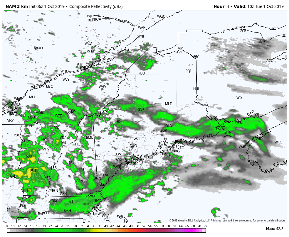 The trend continues for varying intensity of showers through Tuesday into the night. Morning showers will pass through, clouds may break up and allow some sun in, which may touch off some widely scattered thunderstorms Tuesday afternoon into the evening. Any storms that form may have gusty winds and downpours. Severe threat is very low. Off and on shower activity is on track to continue overnight. 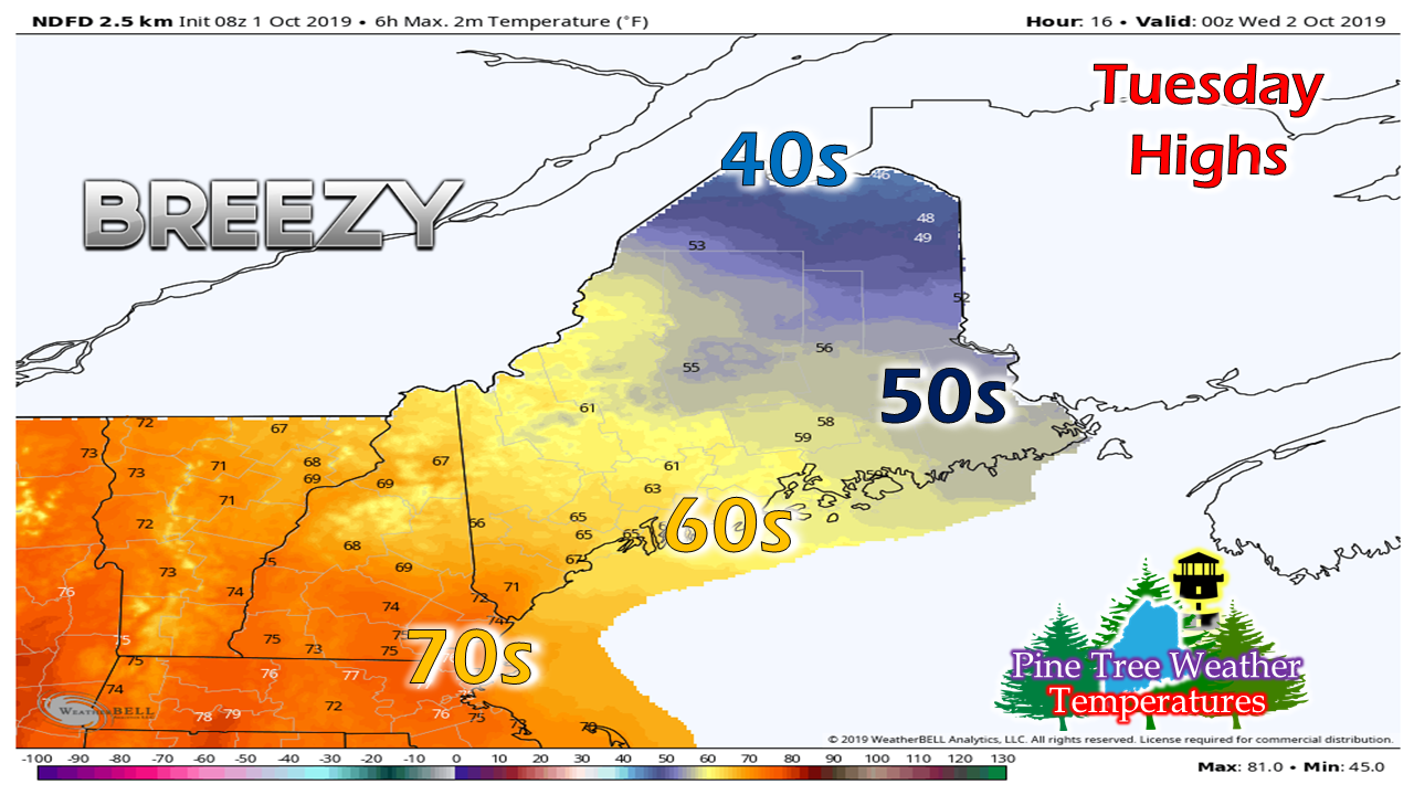 A wide contrast of temperatures for the state as cloud cover keeps the north and east chilly and pokes of sunshine will warm southern and western areas. Dew points will be on the increase thanks the moist air from the warm front. It may be a touch muggy for southwestern areas through early Wednesday. Expect the day to be breezy with gusts from the south in the 20+ mph through the day. Cold front passes through Wednesday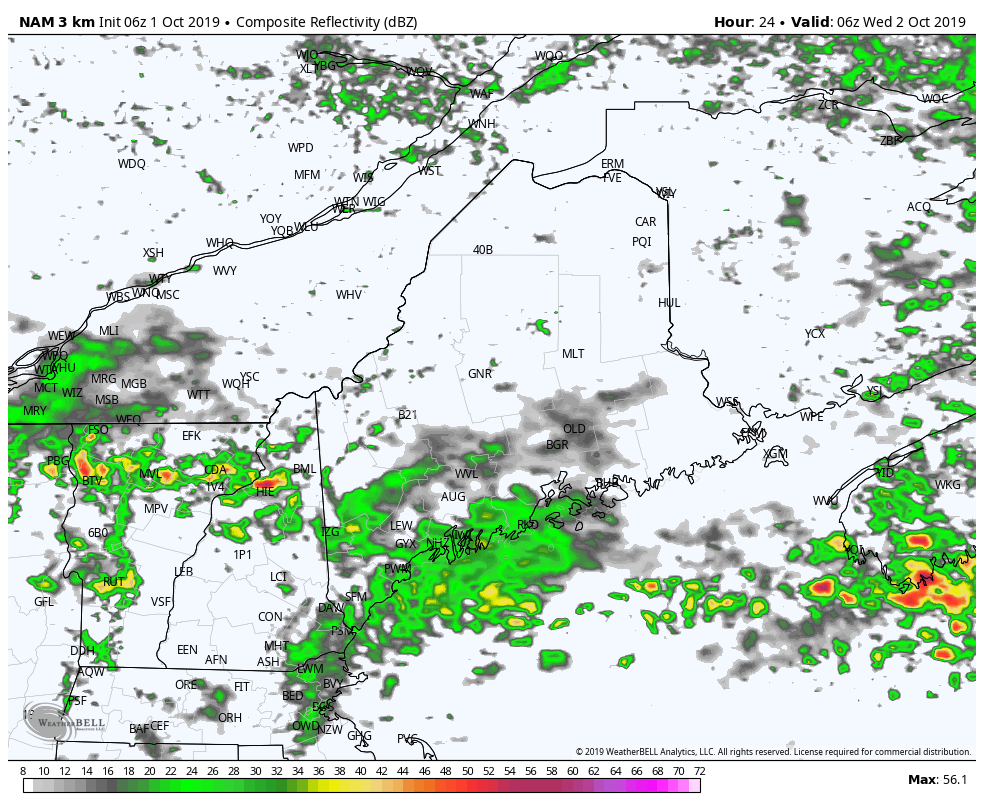 Showers will continue mainly for southern, western and eastern areas Wednesday as a cold front passes through the region. With the colder air approaching, there runs the risk of an isolated thunderstorm Wednesday afternoon over southern areas. Showers taper off by around midnight Thursday. 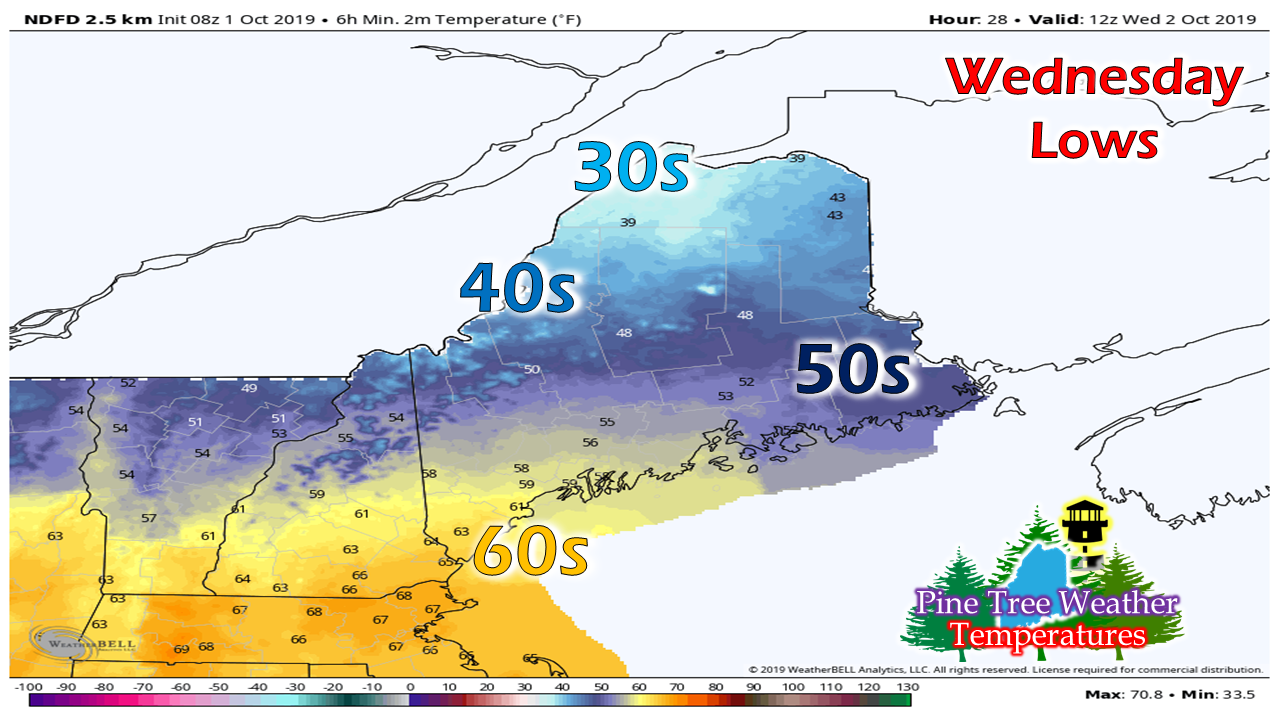 Another large spread in temperature range this time with overnight lows. Temperatures start off in the 30s far north with muggy 60s for southern areas. 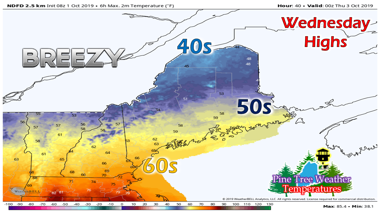 It appears to remain cool in the north with 40s for the high mark Wednesday. Southern areas the warmest of the state with temperatures reaching the 60s. It will be another breezy day as wind shifts to the northwest with gusts in the 20+ mph range, which will blow the latest uptick of humidity for southern areas away by Wednesday night. Rain outlook about the same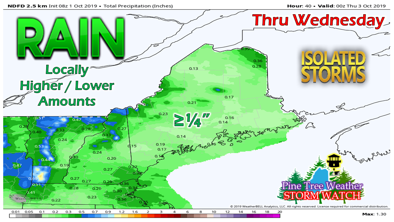 Most areas may get a tenth or two of an inch of rain through Wednesday night. Any areas that get a thunderstorm will get more. I am tracking a potential long wave frontal boundary that may pump some moisture into the region from the Gulf of Mexico Monday into Tuesday. This is the best chance for beneficial rain for the parched southern areas of the state in quite some time. Stay tuned for more on that possibility. Another chilly start Thursday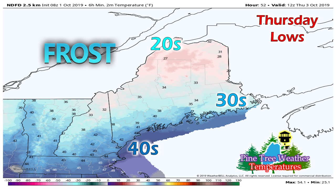 After the cold front passes offshore, high pressure drops in to the southeast from Quebec and sets up shop over the state through the weekend. Expect frosty starts in areas to be in the forecast through the beginning of next week. There remains the chance for some snow showers for the higher elevations Wednesday night into early Thursday, with some light accumulation possible. Quick weekend thoughts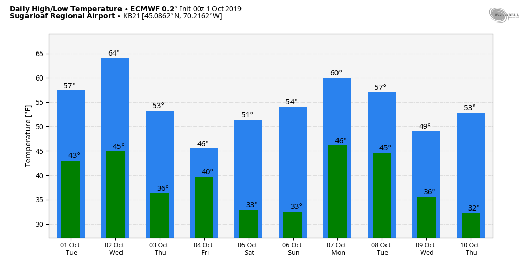 Foliage will be near peak in the mountains and north over the weekend. For those planning on venturing out for a hike, camping trip or a drive can expect sweater weather. Temperatures may rebound for a bit with the potential for the aforementioned long wave front early next week, but the downward slope in daily highs and lows continues after that. It should be a fair, but cool weekend overall. Please support Pine Tree Weather A special thank you to those that have signed up to be monthly contributors on my Patreon page and to those who have mailed checks to me. This a labor of love here. I don't mind the 4 AM wake up calls (2 AM for snow days) to formulate a forecast, create graphics then write it all out for your consumption, so long as I have the financial support from you to continue to do so. There is no media or marketing influence here. No model forecast bias. No political or scientific agenda. It's just Maine weather, plain and simple. I would appreciate your support to continue this for 2020. Contributors are donation on average of $5 per month / $60 per year either through Patreon or by check. No amount is too small. This is Maine, most of us are on tight budgets, and having been there myself, I understand the struggle. All I ask is to do what you can. If you can't do anything financially right now, that is totally understandable. Please pass along what I do to others and help this site to grow!
Thank you for your support! ► ► For the latest official forecasts, bulletins and advisories, please check in with the National Weather Service in Gray for western and southern areas, or Caribou for northern and eastern parts of Maine. For more information from me, please check the Pine Tree Weather Facebook page as well as my Twitter feed. Always stay weather aware! - Mike |

Mike Haggett
|


