
Low-capped hailstorms possible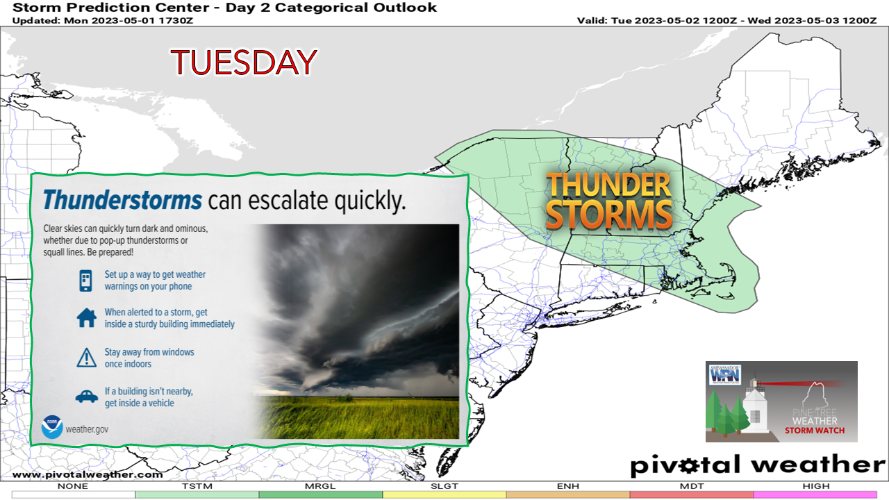 After the slap of the Sou'Easter, and upper low slowly meanders across the region through the end of the work week. As the disturbances pass over aloft, that brings the risk of showers and some low-capped thunderstorms, some of which could produce pea-sized hail and downpours. For folks dealing with the aftermath of the recent storm, as well as those participating in afternoon outdoor work, activities, and/or school athletics, you are on notice to keep an eye-to-the-sky for some atmospheric shenanigans. 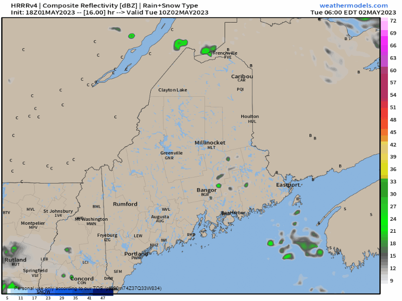 Tuesday 6 AM to Wednesday 6 AM - After a mainly dry start to the day with a few isolated showers possible in the morning, showers become more widespread in the afternoon. It will be in the afternoon over southwestern areas where the risk exists for some non-severe, low capped thunderstorms to develop, a threat that will last until late in the day as the sun sets. Some showers are possible in the overnight hours, along with some snow for the taller mountain peaks. For those that have dealt with or are currently dealing with the current flood situation, you may get slapped again with some localized flooding with these storms. Hail is a real possibility given the height of the storms may only reach 10-12,000 feet (hence the term "low-capped") where the cold pool aloft can produce ice. 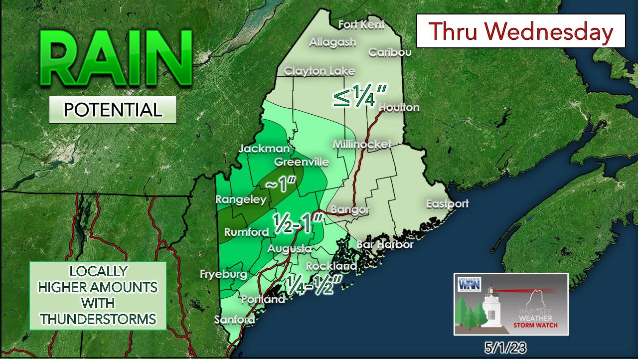 Wednesday will be an off and on showery day with the risk of an isolated storm, once again primarily over the southwest portion of the state. For those travelling in the overnight hours into the morning, expect the potential for areas of fog to reduce visibility in spots. Temperature & outlook through SaturdayThe rain train settles down with just some isolated showers over the interior for Thursday. Friday appears dry with some clouds around as the upper-low departs and may generate a light shower or sprinkle. If the upper-low behaves and exits on time, the weekend should be a good one. If it slows down to our east, there is a risk of a backdoor cold front that may bring showers for Saturday. Stay tuned.  Pine Tree Weather is funded from followers like you. I would appreciate your financial support. Click here for how you can contribute. You may not like the weather, but I hope you like what I do! Please hit the like button on Twitter and Facebook, and share! I sincerely appreciate your support! Stay updated, stay on alert, and stay safe! - Mike NOTE: The forecast information depicted on this platform is for general information purposes only for the public and is not designed or intended for commercial use. For those seeking pinpoint weather information for business operations, you should use a private sector source. For information about where to find commercial forecasters to assist your business, please message me and I will be happy to help you. |

Mike Haggett
|


