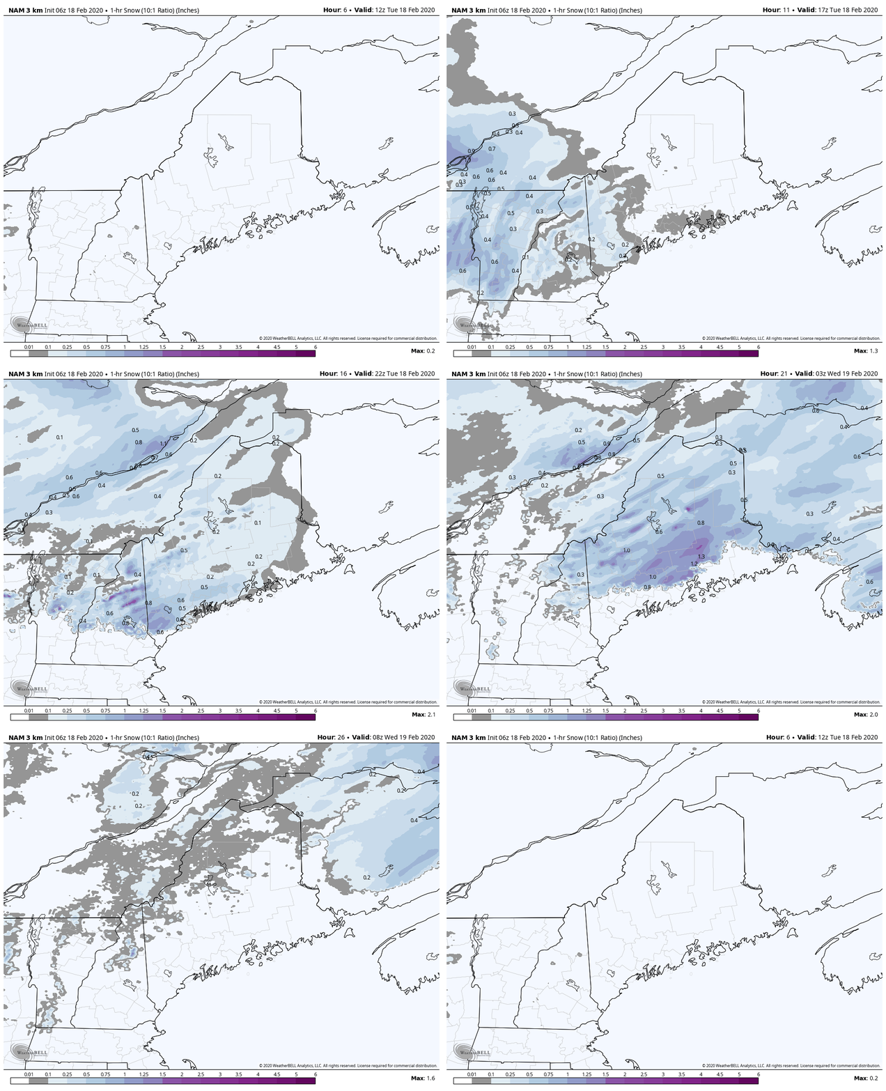
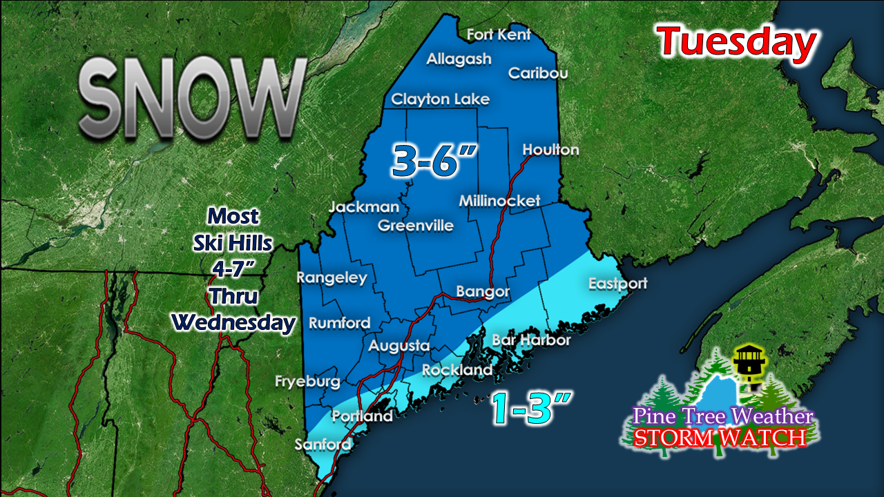
The thump comes this eveningNo changes in thinking on the forecast posted here Monday afternoon. Snow will have a hard time getting started due to very dry air in place, but it will come. Flakes should start piling up over western and southern areas early afternoon, Bangor region by late afternoon. Hourly snowfall idea in the GIF above shows the 1"+ per hour snowfall rates working through western and eastern areas this evening. This is a six to nine hour event for most areas, with exception of the western mountains where the snow machine will continue into Wednesday with snow shower activity through the day. Snowfall forecast remains the same. Ski hills may bust on the high end, with 8 or 9 inches by the time this is over there Wednesday. Coastal York County may come in on the low end, as the transition to rain may come by late afternoon. I do expect some mixing of sleet and/or light ice over the western foothills, Bangor and Calais regions very late in the event. It does not appear to amount to much, and won't affect the final snowfall tally In ice and snow, take it slow. Stay on alert this evening if you are travelling or commuting.
Keep an eye on my Twitter account for updates and observations during the day. ► ► For the latest official forecasts, bulletins and advisories, please check in with the National Weather Service in Gray for western and southern areas, or Caribou for northern and eastern parts of Maine. You can help keep Pine Tree Weather going into the future with a donation of ANY amount now through VENMO @PineTreeWeather, a monthly donation on Patreon or messaging me on Facebook or Twitter to send a check in the mail. Thank you for your support! Always stay weather aware! - Mike |
Mike Haggett
|


