Periods of snow, freezing drizzle and rain Wednesday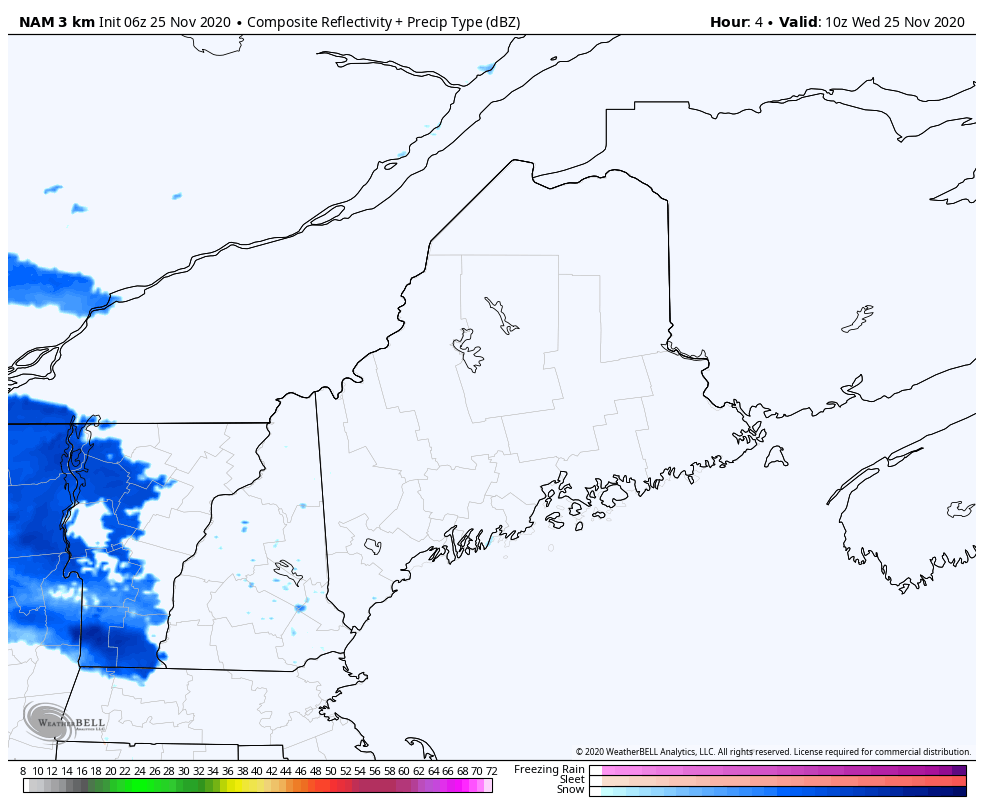 Now we enter into the time of year where we have to watch the surface thermometer and low atmospheric temperatures very closely. It is also the time of year where it is important to pay attention to changing road conditions. That is what is on tap for Wednesday and Thanksgiving. It appears to be snow at the onset for Wednesday, but as warm air invades the lower atmosphere as we head into midday for southwestern areas and later in the afternoon for interior eastern areas, this is where freezing rain and or drizzle could creep into the picture for a time until this round of precipitation ends this evening. There could be slick spots in areas across the state through the evening commute. 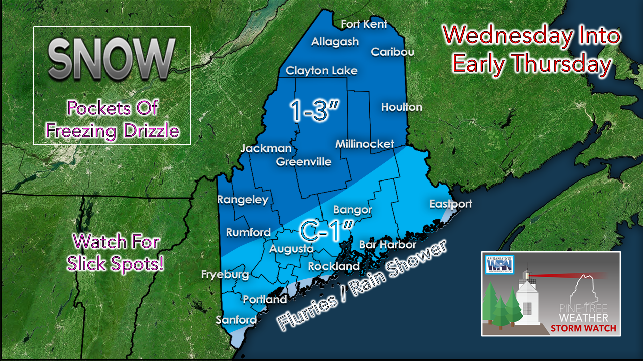 The best chance for 3" of snow will be for northern areas of the state. A Winter Weather Advisory is posted for the north. 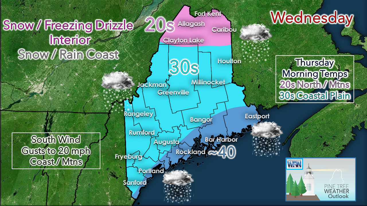 As the warm air tries to nose in at the surface, temperatures could reach 40° along the shorelines. How far inland above freezing temperatures is a bit of a crapshoot. It would not surprise me to see the thermometer hang close to 32° for the southwestern interior on up into the foothills. The southerly breeze may not be strong enough to penetrate a potential cold air damming scenario. With that situation set up on the dinner table, we move into Thanksgiving. Cold air damming concerns for Thanksgiving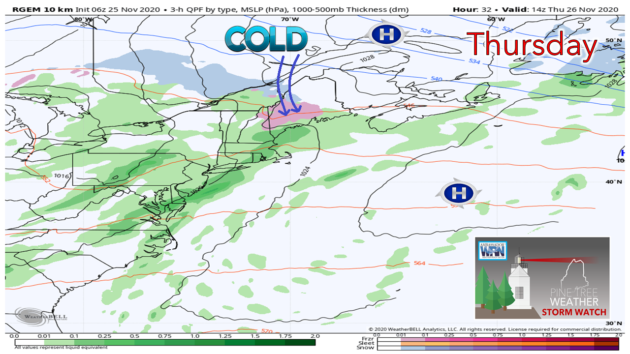 Anytime there is an area of high pressure lurking around to the northeast in winter, that sets up the red flags for potential cold air damming. Warm air can move in aloft with relative ease, but not at the surface. The anti-cyclonic nature of the high tends to trap cold air over interior areas, and we've seen this movie go on around here in winter for years. 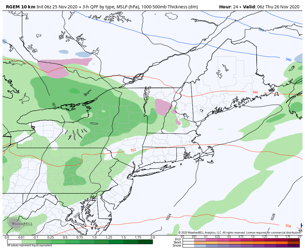 Models have always had a difficult time with cold air damming. Some due to a warmer bias. This RGEM (Canadian short term) loop appears to hold onto the idea of cold air damming longer than others. Since forecasters have the tendency to get bit with the first ice event of the year, myself included in the past, I am not going to take the bait of the warmer solutions. The high to the northeast could be strong enough, and the frontal boundary weak enough to cause issues. I am not 100% convinced this model idea is correct with its idea of freezing drizzle or freezing rain changing to all rain by midday Thanksgiving over the southwest interior. It will be a wait and see situation. For the north, this may be an issue that drags on all day. 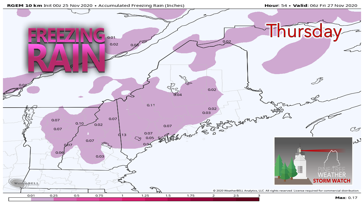 The idea of accumulations of a tenth of an inch of ice for interior areas isn't out of the question. I don't expect this to be a concern for power outages. I do have concerns that this could affect travel, ruin the holiday for the plow crews that have to do a road treatment run or two. For those that are traveling, allow for plenty of extra time, knock 5° off your car thermometer, and take it slow. Areas that see straight rain, especially along the shorelines, may pick up a ½" or so out of it.  Outlook through Sunday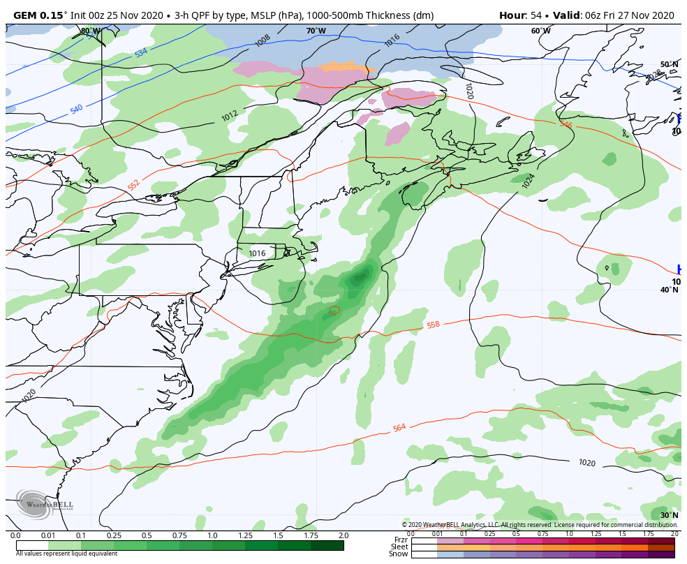 High pressure to the northeast moves east to allow warmer air to penetrate in as we head into Friday. Scattered rain showers are expected through the day. A weak cold front passes through Friday night. Low pressure passing through central Quebec kicks another cold front through Saturday, which may bring snow showers to the north and mountains into the wee hours of Sunday. High pressure brings the sun back during the day on Sunday. Our next storm could be a rain event starting on Monday, and we may be dealing with that into the middle part of next week. Temperature outlook through Tuesday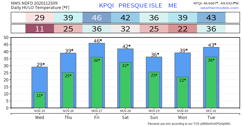 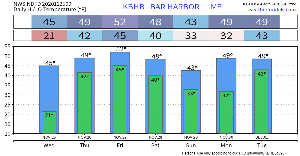 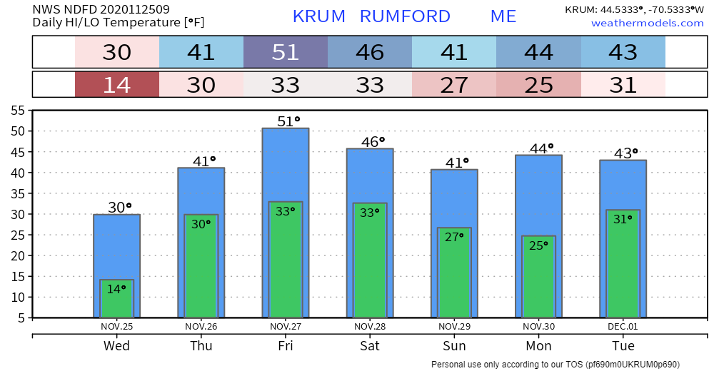 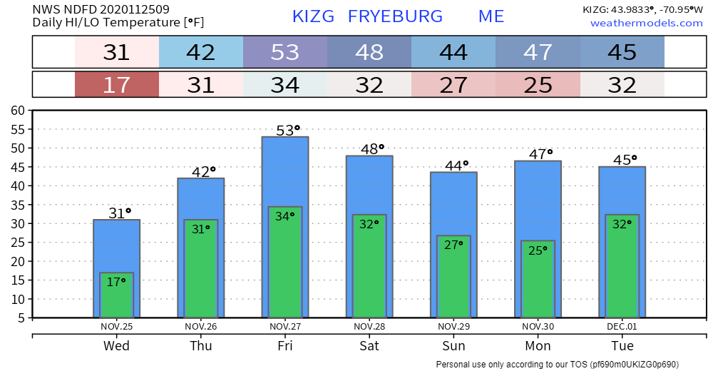 Be aware of the hazards of freezing drizzle!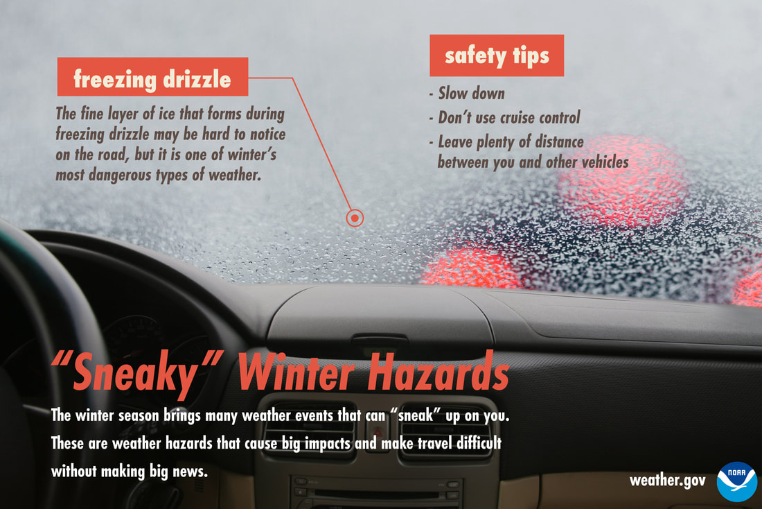 When surface temperatures are below freezing, drizzle will form a thin layer of ice on the roads. This difficult-to-see ice can cause very dangerous travel conditions. When it’s drizzling in the winter, slow down, don’t use cruise control, and keep your distance from other vehicles. Don’t let freezing drizzle sneak up on you! Be prepared to receive alerts and stay updated!
For more information, please follow Pine Tree Weather on Facebook and Twitter.
** FUNDING NEEDED FOR 2021 ** Thank you for supporting this community based weather information source that is funded by your financial contributions. Stay updated, stay on alert, and stay safe! - Mike |

Mike Haggett
|