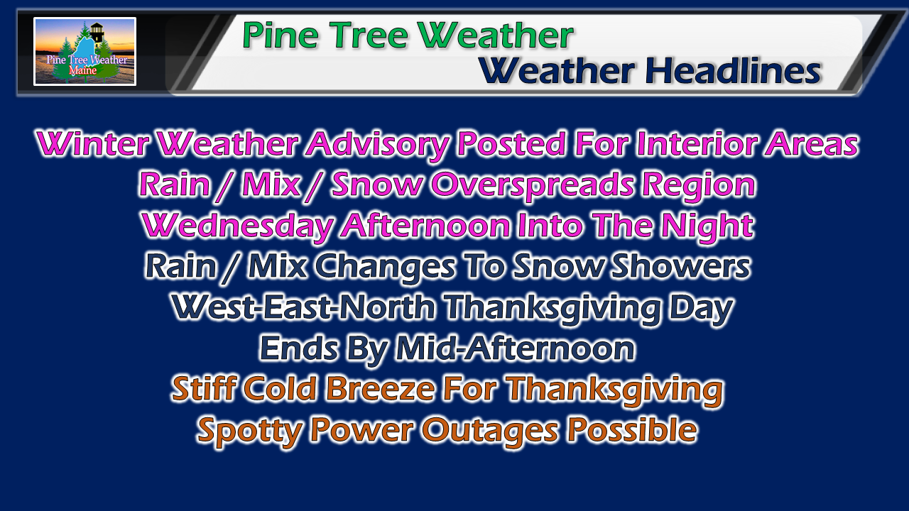
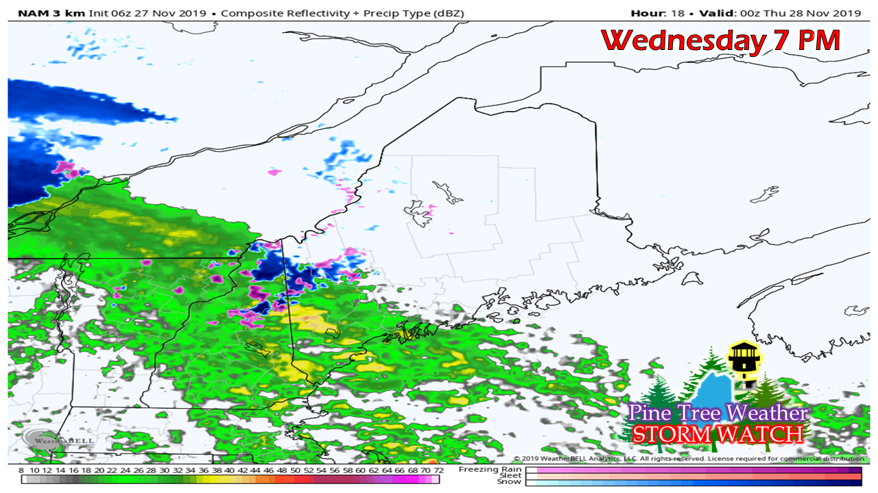
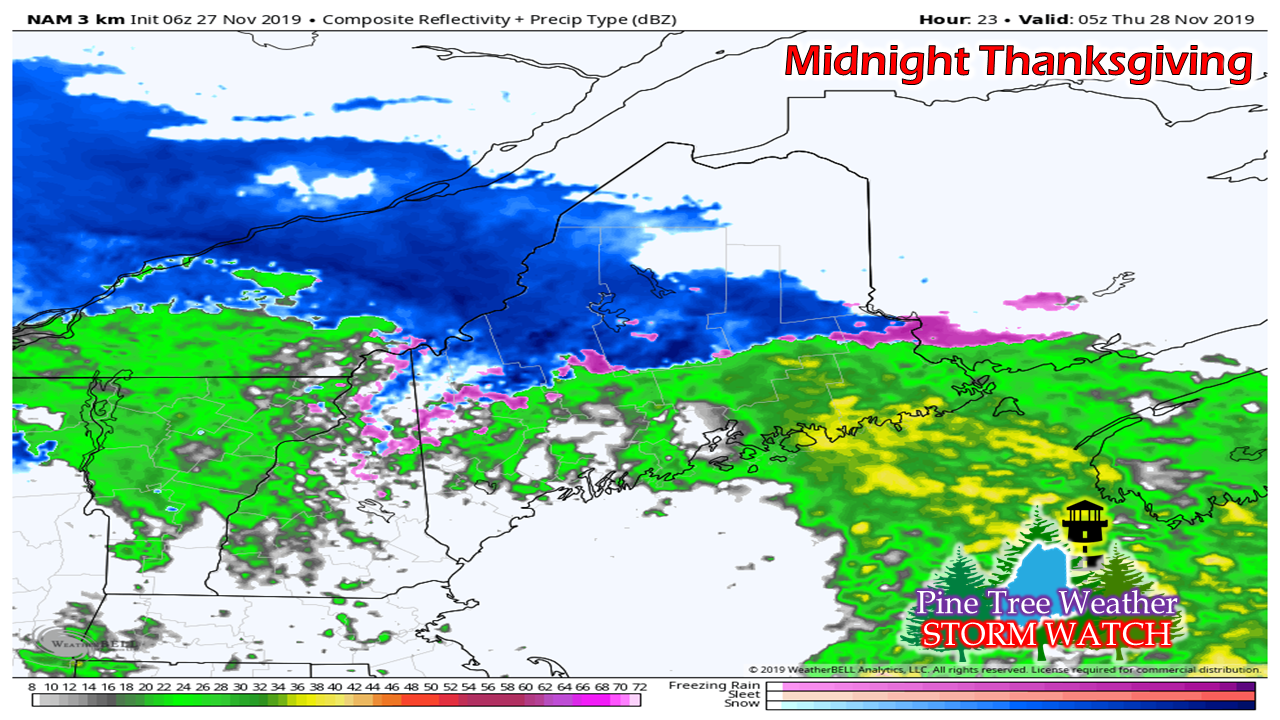
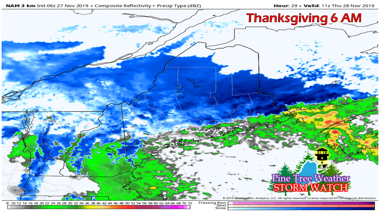
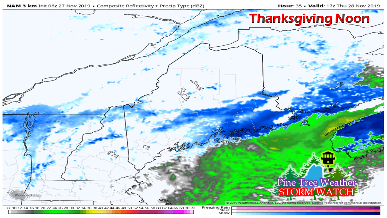
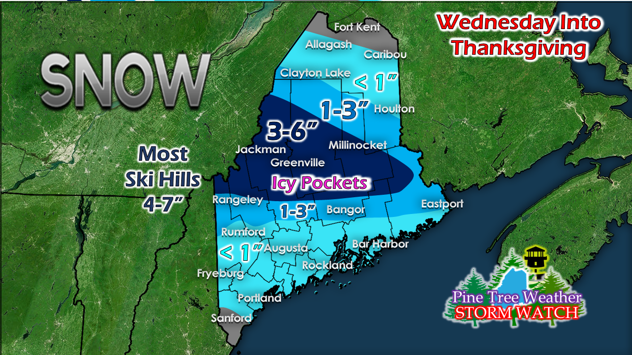
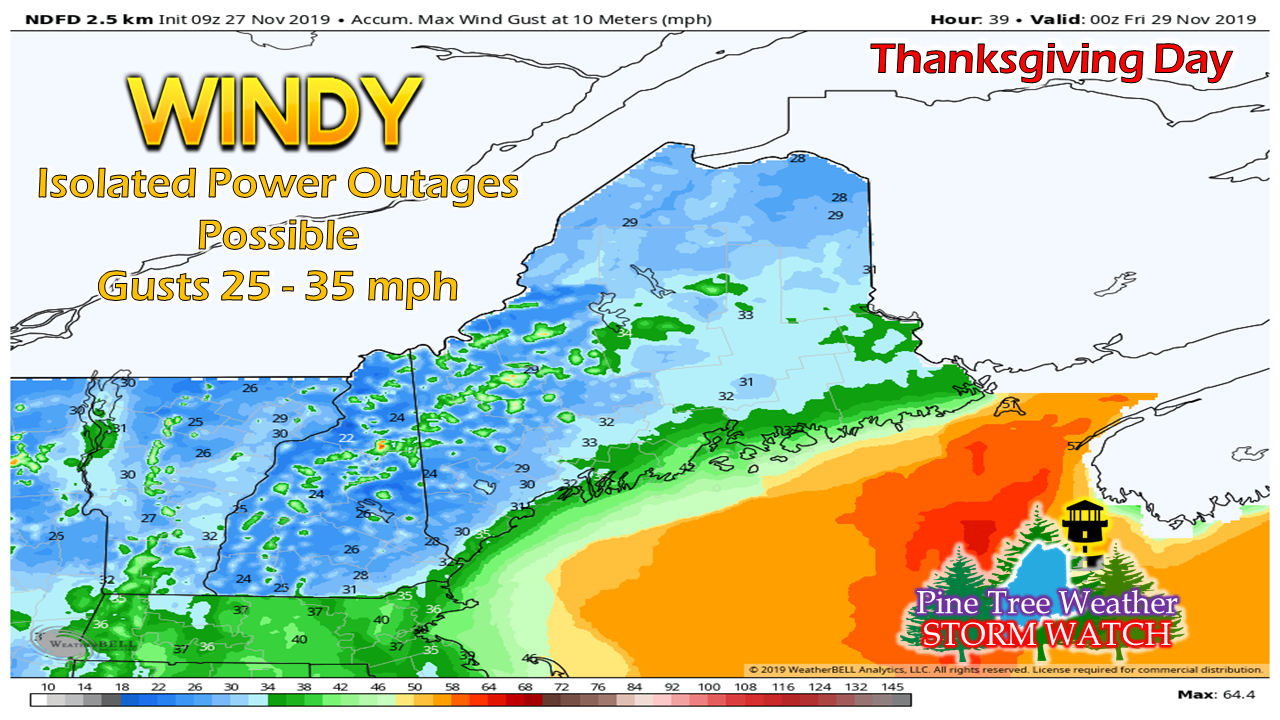
Take your timeThanksgiving travel is challenge enough as it is. Whether it is getting across town to run the last minute errands, or driving a fair distance to be with family and/or friends, the roads are plugged with everyone else doing the same thing. I saw a very bad accident near the Biddeford exit southbound on my way home last night. I just began to pray for those involved. Slow down. It's not worth driving like you're going to be late for your funeral, or to make someone early for thiers. TimingAround the evening commute is when conditions will begin to deteriorate over southern and western areas. For most it will be rain, but the further north, the better chance for slick conditions. Precipitation continues to move north and east into the evening. By midnight, western and eastern areas will have something going on. Southern areas may get a bit of a break as the coastal low begins to form just offshore. By the time the bird goes into the oven, most of the freezing rain and sleet will have turned to snow over the interior. The coastal low has formed by this point and will intensify, which will increase wind. Areas of whiteout conditions are possible for interior areas. By the noon hour, cooler air appears to have overspread most of the region. Areas where there was rain may freeze and cause slick spots as temperatures drop. The last remaining snow showers exit DownEast areas by 2-3 PM. Snow showers persist in the mountains in Thanksgiving night. Update snowfall estimateThe higher the elevation, the higher the snowfall amounts. Pockets of freezing rain and sleet may put a dent in this idea, but maybe not by much. For southern areas, what snow falls will come on Thanksgiving. The main concern won't be so much shoveling, as the ice that may develop on roadways as cooler air drops down behind the coastal low during the morning. A stiff breeze into the weekendThanksgiving will be the height of the wind, but it will remain breezy as the storm stalls south of Newfoundland on Friday. The bitter wind chill holds off until Friday morning as even colder air works into the area, thanks to the stalled storm. While widespread power outages are unlikely, spotty outages are possible. Folks who live along the coast and higher elevations inland may experience loss. If you have a lot of cooking to do, try to get as much done as you can ahead of time before with wind gears up Thanksgiving afternoon. Again, slow downPlease watch on my Facebook page and Twitter for more information. ► ► For the latest official forecasts, bulletins and advisories, please check in with the National Weather Service in Gray for western and southern areas, or Caribou for northern and eastern parts of Maine. ► ► $620 shortfall for the year ahead! You can help keep Pine Tree Weather going with a donation of any amount now through VENMO @PineTreeWeather, a monthly donation on Patreon or messaging me on Facebook or Twitter to send a check in the mail. Thank you for your support!
For more information from me, please check the Pine Tree Weather Facebook page as well as my Twitter feed. Always stay weather aware! - Mike |
Mike Haggett
|

