
The latest... Many areas away from the shorelines are under winter storm warnings, with winter weather advisories posted for most not under warning. Guidance ideas have trended slightly cooler, so some subtle adjustments have been made. This will be a nice snow event for the interior, with snow turning to slush along the coastline. Timeline and snow cast Outflow snow showers ahead of the main event is possible for western and coastal areas during daylight hours, with light accumulations possible. Light to moderate snow falls overnight, with coastal areas seeing the switch to rain for southern areas in the wee hours of Wednesday, DownEast areas soon after. Precipitation ends for southern areas by mid-morning, western areas by early afternoon, and by late afternoon north and east. Some isoldated spicy snow squalls could bring flash accumulations of an inch or so Wednesday night for western, southern and eastern areas. Expect slow travel, and plan your day accordingly. Snow squalls Wednesday night could bring brief whiteout conditions and slick the roads up once again. 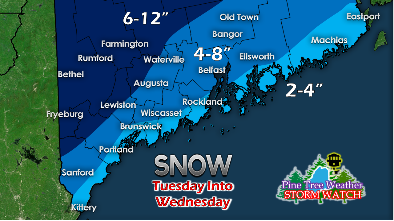 Snow totals have been tweaked up a bit factoring in the colder solutions. Most of the snow along the shorelines will turn to slush as rain takes control, and may wash away all together along the immediate coast. 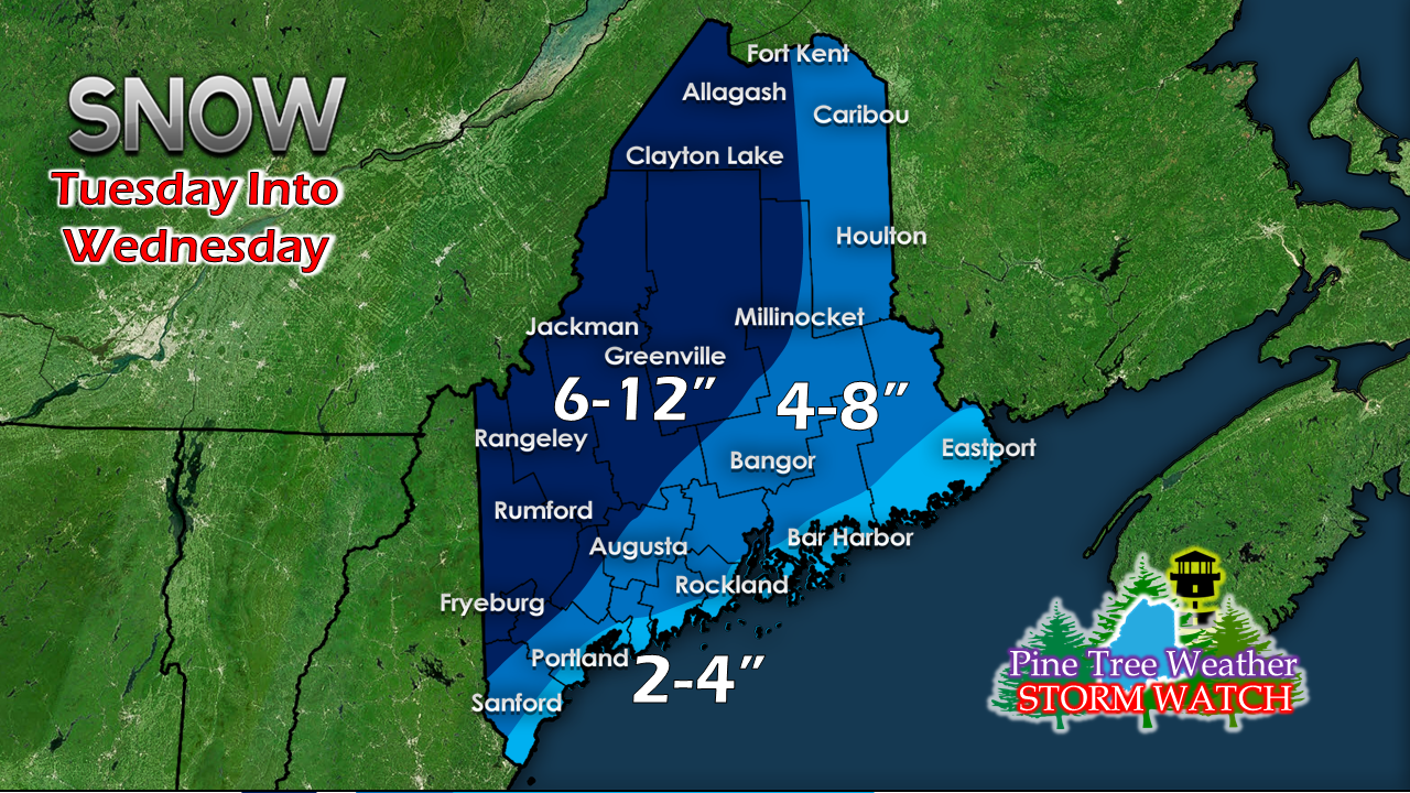 The mountains recover some snow pack lost in last weeks rain. The ski hills are likely to get a foot out of this storm. Bitter cold arrives Thursday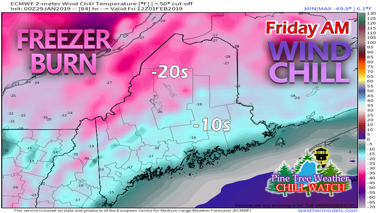 In comparison to the big chill going on in the Midwest, Maine escapes the worst of the deep cold. Model idea presented here for Friday morning appears to be the low point for wind chill. Expect wind chill advisories to be posted for the mountains and north Thursday and Friday. Temperatures slowly moderate as we head into the weekend. Outlook Wednesday through Sunday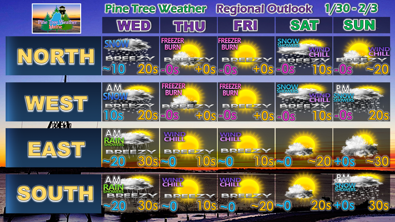 After the storm passes Wednesday, it's quiet and cold into the weekend. A weak clipper may bring some snow showers to the mountains and north Saturday, which may bring an inch or two. A warm front approaches the region Sunday, and may bring some snow showers with light accumulation afternoon into the evening for southern and western areas.
I have revised this graphic in an effort to make it easier to understand. I appreciate any feedback on this or anything else I do. Feel free to pass along comments on Facebook and Twitter. ► ► For the latest official forecasts, bulletins and advisories, please check in with the National Weather Service in Gray for western and southern areas, or Caribou for northern and eastern parts of Maine. For more information from me, please follow the Pine Tree Weather Facebook page and my Twitter feed. ► ► Your financial donations are much appreciated to keep this site funded and for further development. I sincerely appreciate your support not only financially, but also in sharing my efforts with others. Always stay weather aware! - Mike |

Mike Haggett
|


