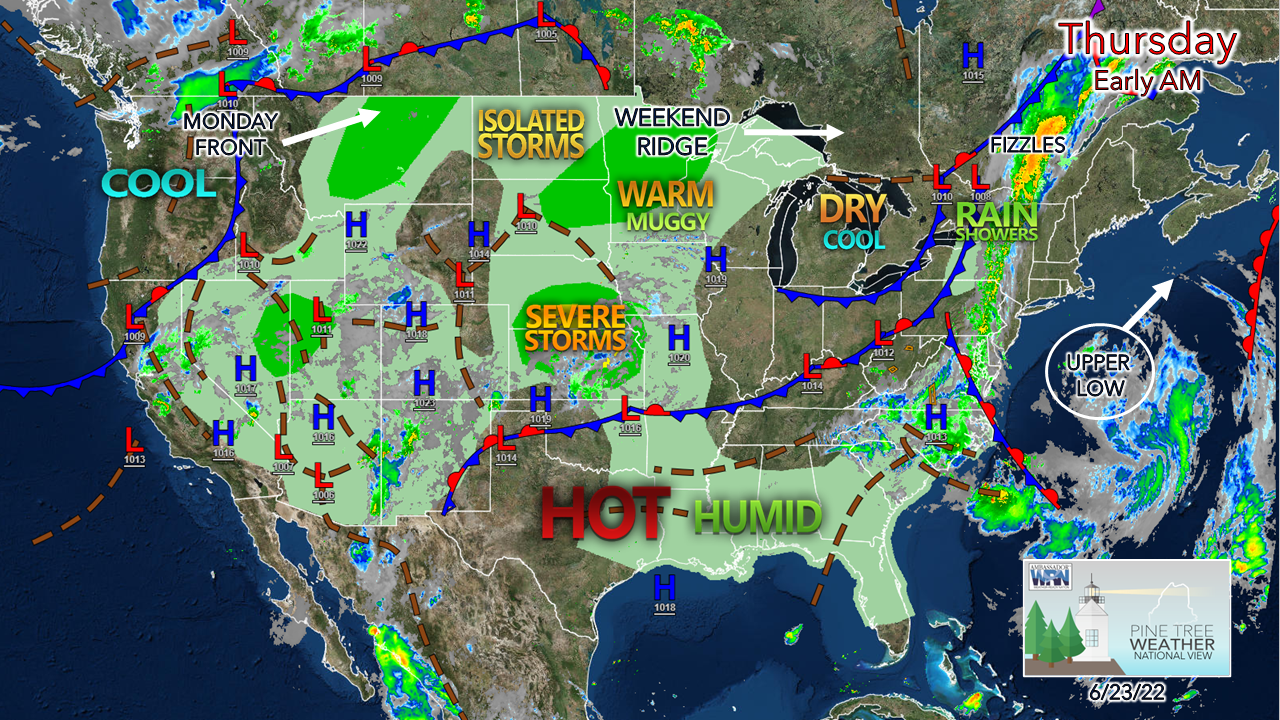
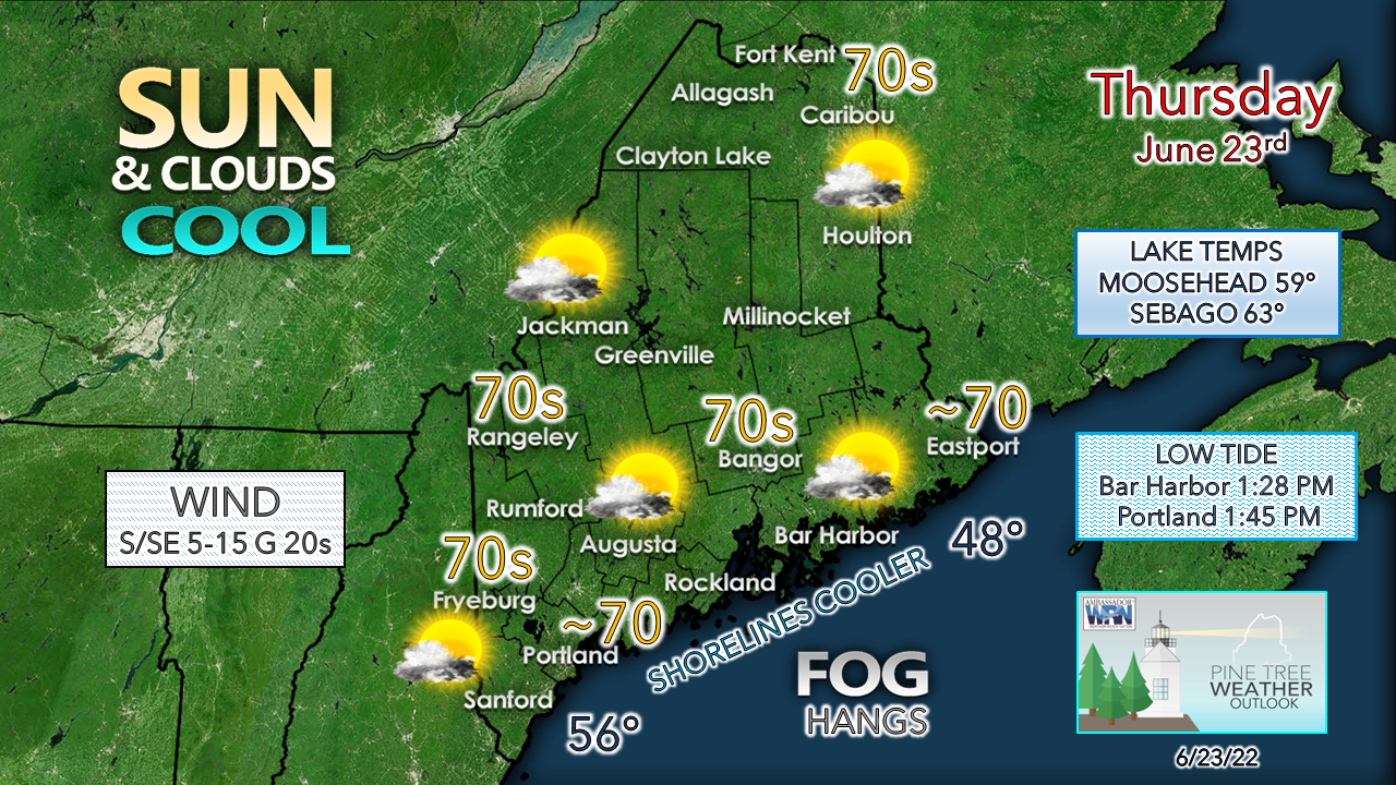
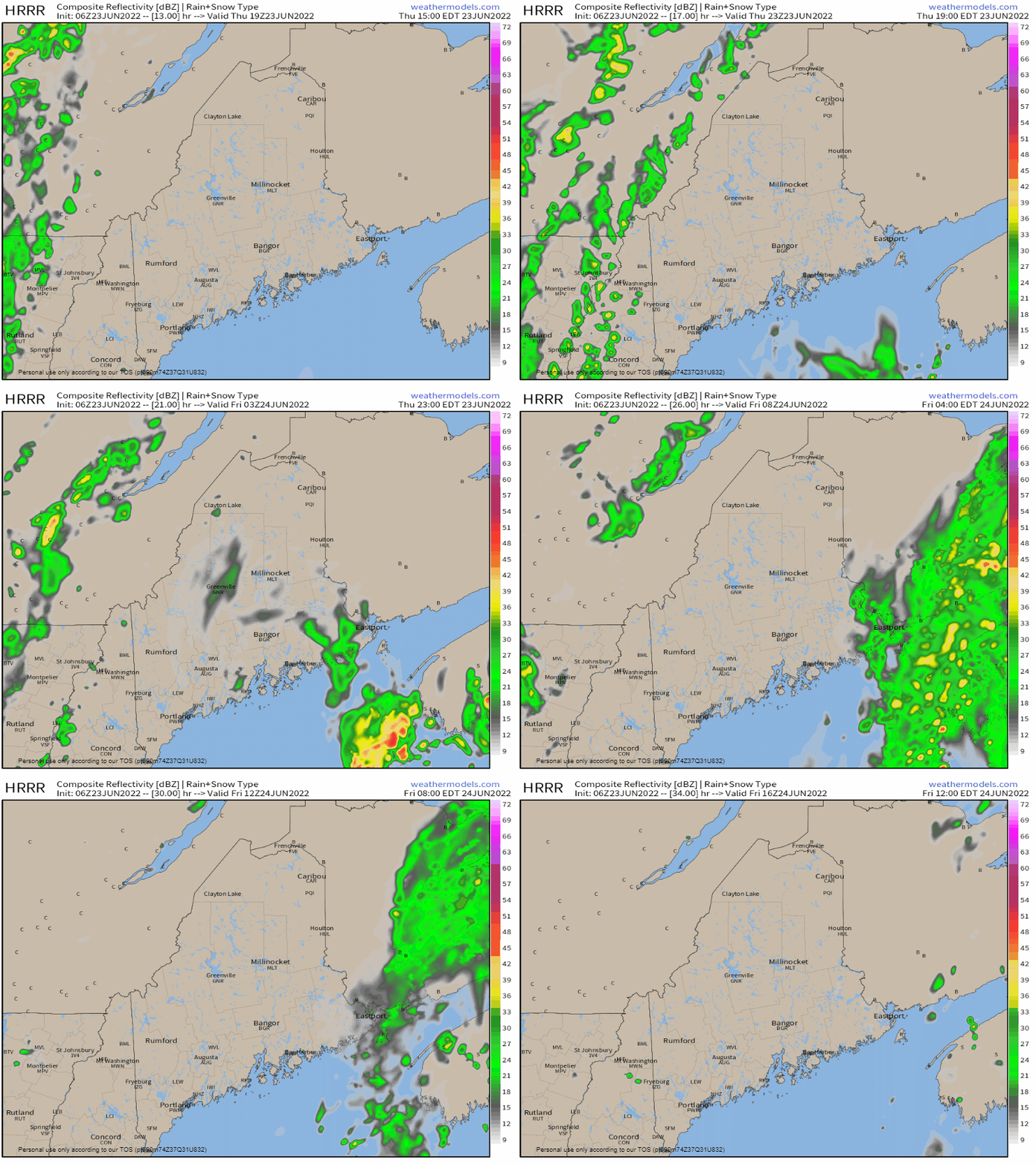
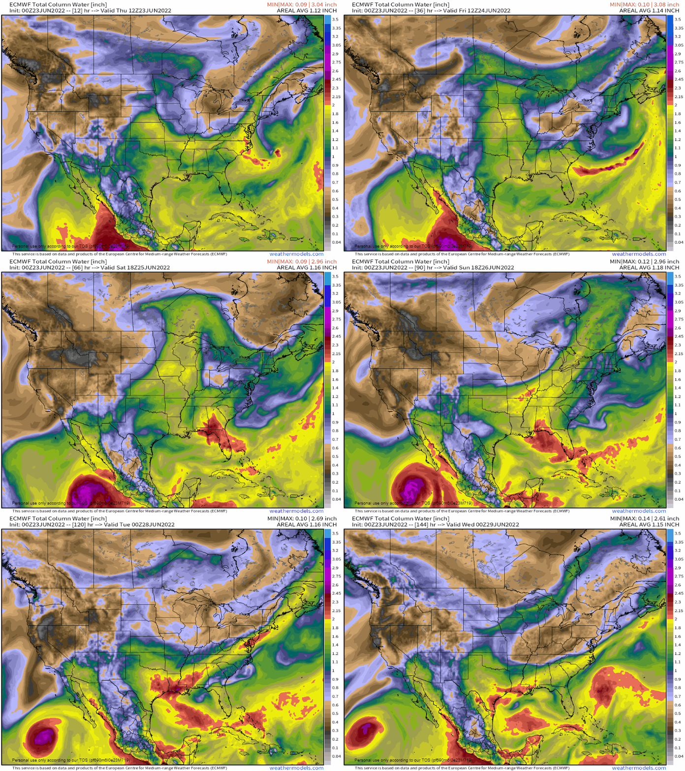
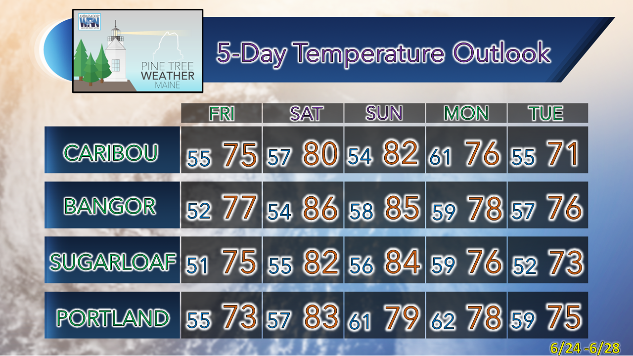
The pattern is about to changeMoisture to the west of the region gets cut off as low pressure over northern Quebec weakens and heads into northern Labrador. An upper low that has brought cool, dry conditions for much of the week turns into an open wave and heads northeast for the Canadian Maritimes. The weak front to the west keeps most of the rain associated with the wave to the east as it departs the region early on Friday. A ridge builds in from the west and brings warmth and a gradual rise in humidity through early next week. For much of the region away from the coast, expect a mainly sunny sky and temperatures slightly on the cool side compared to average. Low stratus and fog may be an issue for the shorelines which could be stubborn and may not allow the sun to break through at all. Add the onshore breeze and it could be a chilly day with temperatures in the low 60s. A few showers around in spots overnight into FridayThursday 3 PM to Friday Noon - A weak cold front approaches from the west and the moisture associated with it gets cut off as it heads east. A few light rain showers are possible along the Quebec border region through late evening. The front steers moisture from the departing open wave to the south over the Bay of Fundy. Some light shower activity is possible for DownEast areas late Thursday night through mid-morning on Friday. Outlook into early next weekThursday 8 AM to Tuesday 8 PM - A look here at precipitable water values which indicate the amount of predicted moisture in the air through early next week. The model shows the building moisture over the Midwest moving east beginning on Saturday. A weak cold front keeps the north and mountains on the dry side for Saturday, with the coastal plain seeing an uptick of moisture. The uncomfortable humidity begins to build in on Sunday and gets stickier heading into Monday. With the uptick in dew points comes the risk of morning fog for the coast. Shorelines are the expected cool spot with the sea breeze expected both days. Afternoon low tides favor plenty of room at the beaches. There is a threat of showers and thunderstorms on Monday. Given the amount of moisture around, there is a chance for severe weather potential, pending on the timing of the front. Drier and cooler conditions are expected for Tuesday. Thank you for supporting this community-based weather information source which operates by financial contributions from people like you. Stay updated, stay on alert, and stay safe! Have a great day! - Mike NOTE: The forecast information depicted on this platform is for general information purposes only for the public and is not designed or intended for commercial use. For those seeking pinpoint weather information for business operations, you should use a private sector source. For information about where to find commercial forecasters to assist your business, please message me and I will be happy to help you. |
Mike Haggett
|

