Slightly cooler than average summer temperatures for Tuesday and Wednesday, rain potential on Friday7/13/2020 Tuesday: Slightly cooler temperatures, isolated thunderstorms by Down East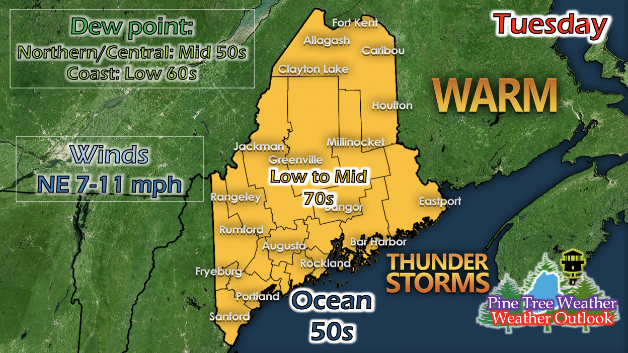 As the small shortwave moves through the state and the low pressure system moves away from the coast, some isolated showers and storms may linger by Down East all day Tuesday until the evening. Some storms and showers may pass through the Portland area in the late afternoon as well, and they originate from New Hampshire and make their way east into the most southern area of the State. Dew points drop a little, and the air is most comfortable when going outside. Afternoon may be a bit breezy, with winds ranging from 7 to 11 mph in the afternoon. Wednesday: Slightly cooler temperatures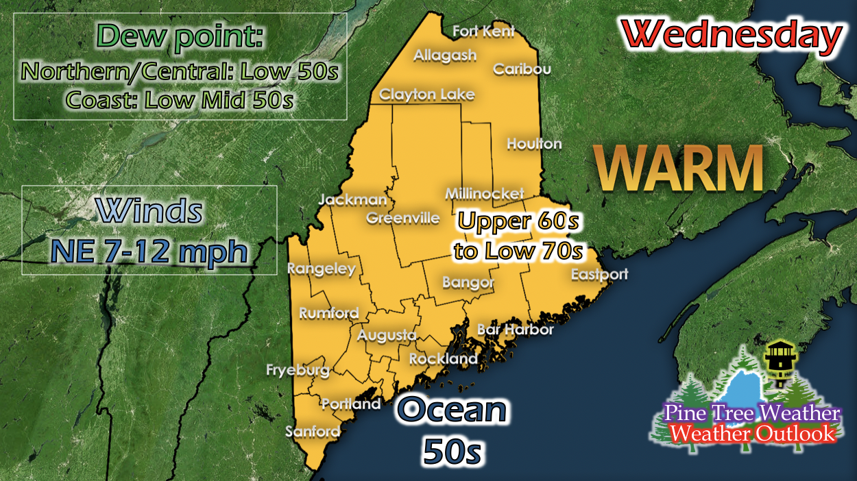 Maine gets one more day of slightly cooler than average summer temperatures as the shortwave makes it's exit and right before a building ridge moves in from the west. No precipitation is expected, since daytime temperatures aren't heating up as much and there isn't as much moisture since dew points dropped. There is some lingering energy, so a very small and weak pop-up shower isn't ruled out for anywhere in the state (most susceptible being Down East, since the recent low pressure system is the closest to that area), but mostly unlikely. Temperatures are at a comfortable upper 60s to low 70s and winds pick up slightly in the afternoon, ranging from 7 to 12 mph. Upcoming potential Friday rain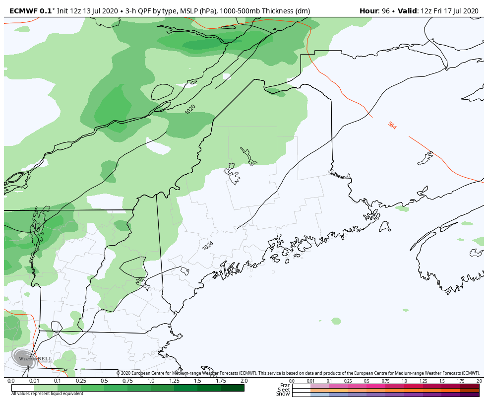 The GIF above runs from 8 AM to 8 PM Friday and shows potential 3-hour liquid precipitation amount from a long-range model. A fairly strong low pressure system way up north in Canada has its fronts reaching down into the New England region. As the warm front passes through the state, some showers (as indicated by the GIF above) is possible. With increasing daytime temperatures due to the upcoming mid-level ridge moving in, instability in the atmosphere increases the confidence of some showers and isolated storms to happen. The GIF simply shows potential amount, but not exact location since it's far out in the week. We'll keep you updated on this potential as we get closer to Friday. Temperature increase after Wednesday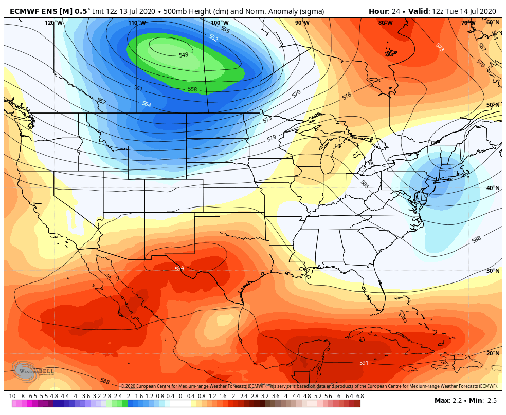 The GIF above runs from 8 AM Tuesday to 8 AM Saturday and shows 500-millibar (mid-level in the atmosphere) height anomalies from a long-range model. What this shows is a negative height anomaly over Maine for Tuesday through Wednesday, and then a strengthening positive height anomaly over Maine for the rest of the time until the end of this run. A negative height anomaly usually means cooler than average temperatures for the area, since the air becomes more compact and dense with the amount of air under that level, and more compact air is typically cooler. Same thing but reversed for the positive height anomaly moving over Maine Wednesday evening. With higher mid-level heights, air expands and warms up with more room for air molecules to move. So the conclusion: Maine is under a slightly cooler than normal daytime temperature pattern for Tuesday and Wednesday, and daytime temperatures will begin to increase on Thursday and into the weekend. Maine Hurricane Preparedness Week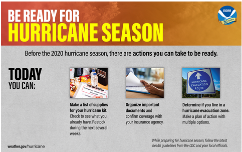 Maine Hurricane Preparedness Week starts this week! The Atlantic hurricane season begins June 1st, but the a typical hurricane's seasons strongest storms start to ramp up around this time of year. To prepare yourself starting today, you can use the info graphic above as a condensed guide. 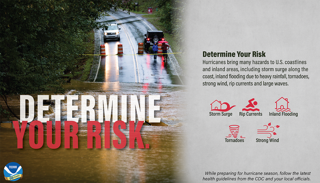 By using the NOAA Coastal Service Historical Hurricane Track Tool, you can find out today what types of wind and water hazards could happen where you live, and then start preparing how to handle them. Hurricanes are not just a coastal problem. Their impacts can be felt hundreds of miles inland, and significant impacts can occur without it being a major hurricane. Help forecast verification, and stay informed!
For more information, please follow Pine Tree Weather on Facebook and Twitter.
Thank you for supporting this community based weather information source that is funded by your financial contributions. Stay updated, stay on alert, and stay safe! Have a great week! - Kaitlyn |

Mike Haggett
|