|
Saturday will be a beautiful day. Any clouds around over southern areas should clear out, and the late April sun to shine strong. Shoreline areas, mountains and north will see highs in the 50s, with 60s possible elsewhere. An onshore breeze developing keeps the oceanside cooler. Get outside! With what is coming, it may be a few days before conditions improve. Storm starts Sunday, ends TuesdayThis storm is a bit of a challenge to forecast based on the fact the upper level energy associated with it is rather disorganized. With what goes on aloft has strong implications as to what happens at the surface. 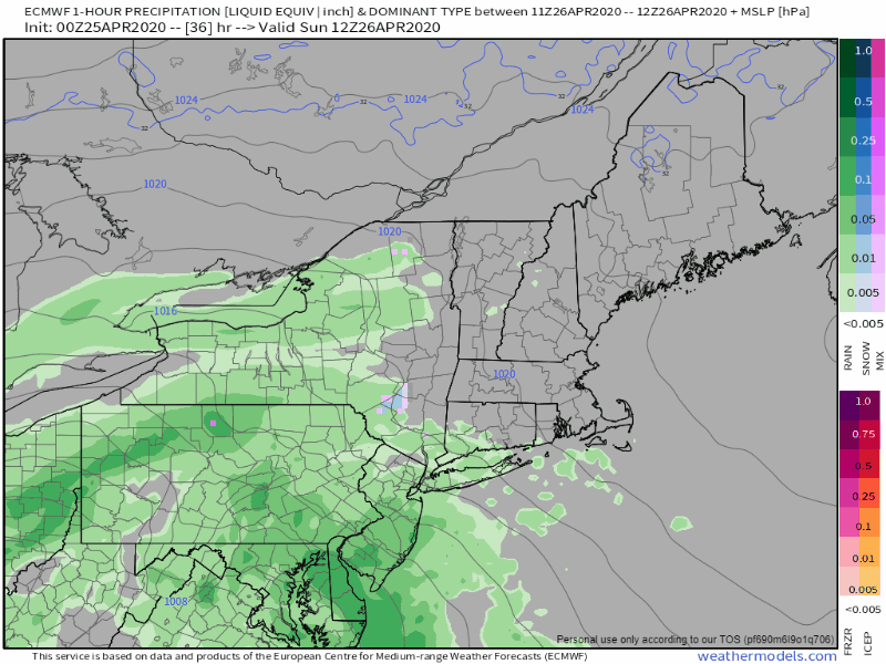 Sunday 8 AM to Monday 8 AM All areas seeing precipitation start off as rain on Sunday. As the heating of the day is removed from the atmosphere, dynamic cooling takes place in the atmosphere. There is plenty of cold air around thanks to a blocking area of high pressure over Quebec. That feature plays a key role in how this whole scenario plays out. Since the upper level energy is rather disorganized and the trough coming in being neutral, the storm does not intensify much through Monday morning. What this means is precipitation will be steady, but it is missing the "thump" factor, which will play a role in accumulations given the current soil temperatures. 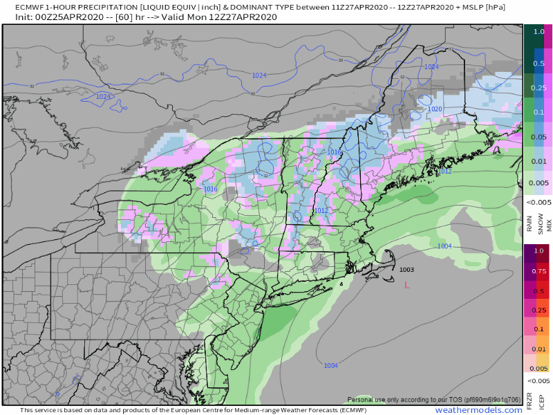 Monday 8 AM to Tuesday 2 PM The upper level energy begins to organize, and as a result, the surface low does as well as we head into Tuesday. The trough aloft begins to tilt negative, and the storm gets its act together as it departs south of Nova Scotia. This occurs Monday night. The heating of the day once again transitions to dynamic cooling, and that brings areas that see rain on Monday during the day, transition to snow again. Now the "thump" factor comes into play, with banding potential which may bring a quick inch or more an hour in places Monday night into Tuesday morning. 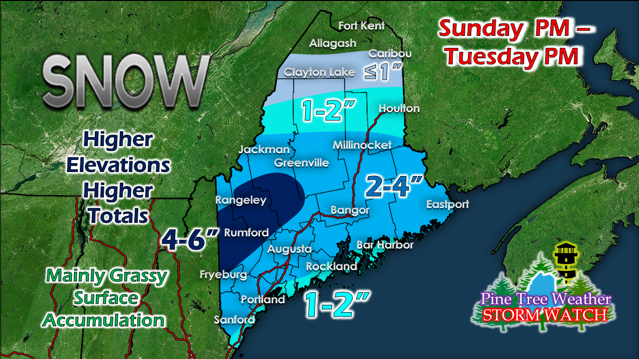 This is three day duration event. The totals here reflect that. This will be one of those types of storms where snow will fall, melt, then fall again due to the dynamic cooling for much of the location. The late April sun angle will do its job to help clean things up during the day Monday (high temps 30s/40s) and Tuesday (high temps 30s/40s) . The higher elevations have the best chance for higher snow totals. The snow will be heavy and wet, fall from the sky in clumps at times, and stick to everything. 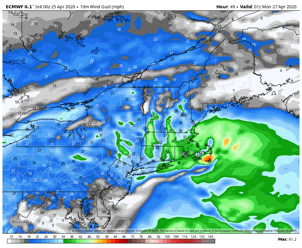 Wind Gust Forecast Idea - Sunday 8 PM to Tuesday 2 PM With the heavy wet snow, add some wind to it, and power loss becomes a concern. While Sunday night will be breezy, Monday night into Tuesday morning is where I have the most concern for outages as the storm organizes, begins to intensify, and moves eastward. Where the snow sticks and where banding sets up has the better chance to lose power supply. Stay tuned for more updates. Help the weather community and stay informed!
► ► For the latest official forecasts, bulletins and advisories, please check in with the National Weather Service in Gray for western and southern areas, or Caribou for northern and eastern parts of Maine.
Thanks as always for your support! - Mike |

Mike Haggett
|