Inverted troughs are stealthy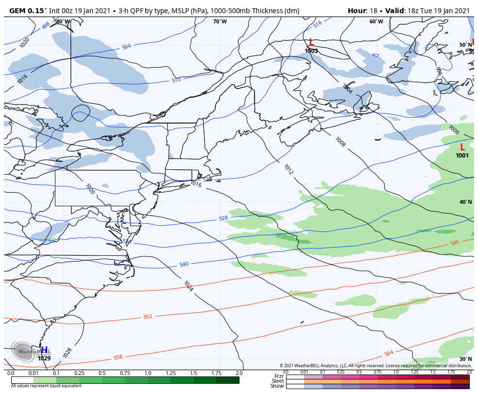 As you browse at the loop presented here, keep close watch on two things. First the rather lazy, flat forming weak surface low over the Gulf of Maine in the wee hours of Wednesday, and the storm that blossoms and explodes after the fact. The set up is upper level energy diving down from the northwest that could have enough energy to set up the weak low, which taps into moisture in the ocean and generate snow. As the energy continues to dive south, it picks up the southern stream which fires up a rapidly developing storm to the southeast and moves east Wednesday. The lazy, flat forming low over the Gulf of Maine is what concerns me, and where the surprise comes in. Depending on the timing of the interaction of the upper level energy setting up the surface low and interacting with warmer than normal ocean temperatures raises the potential here. 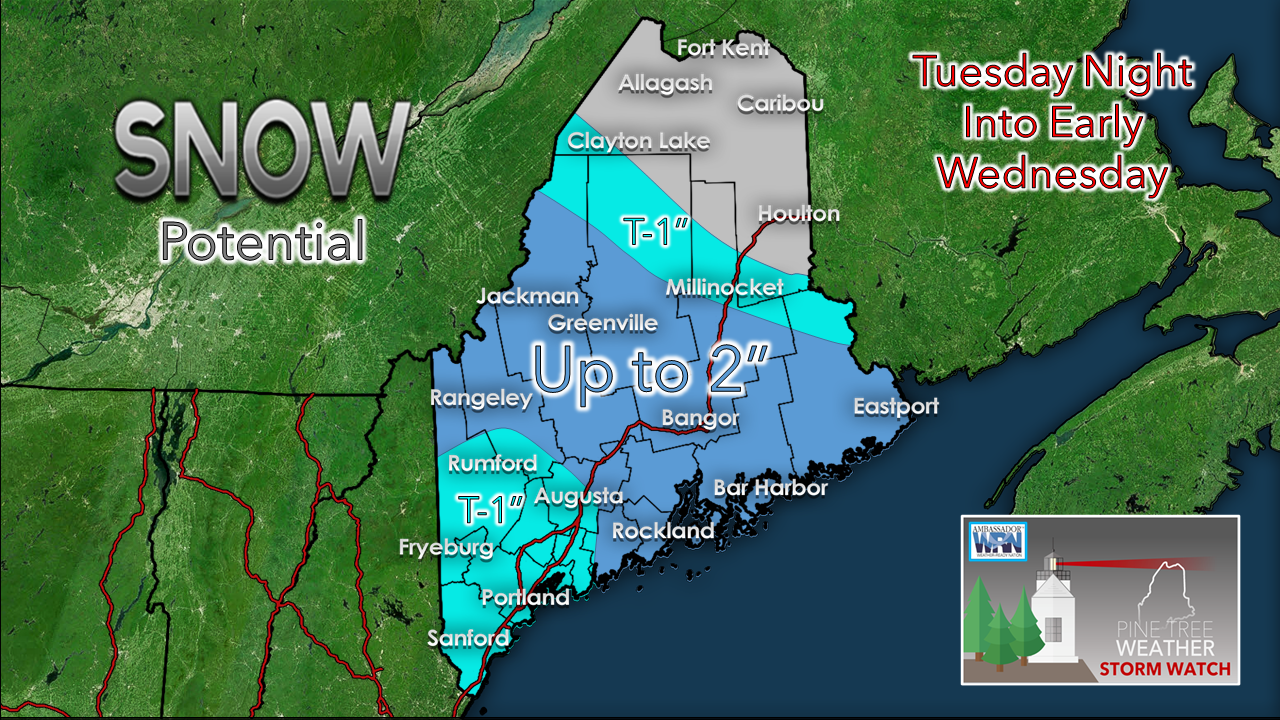 The mountains have the best chance to get a couple inches of snow out of this. DownEast and MidCoast areas near the shorelines could see that much, perhaps more. If a fetch off the ocean sets up right, it could be more than that. For you early birds, you may want to peek outside when you get up to see what is going on in case you need to move some snow before you head out. Expect the potential for slick spots for the morning commute. As always with these inverted trough set ups, there is high bust potential on the low or high end. These are stealthy, and tricky. Another similar set up for Thursday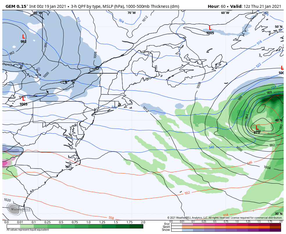 It's almost like I played the same loop over again. This time it could be during the day on Thursday. This one could have a slightly stronger, better organized surface low associated with it. Stay tuned on this. Watching a potential storm for next week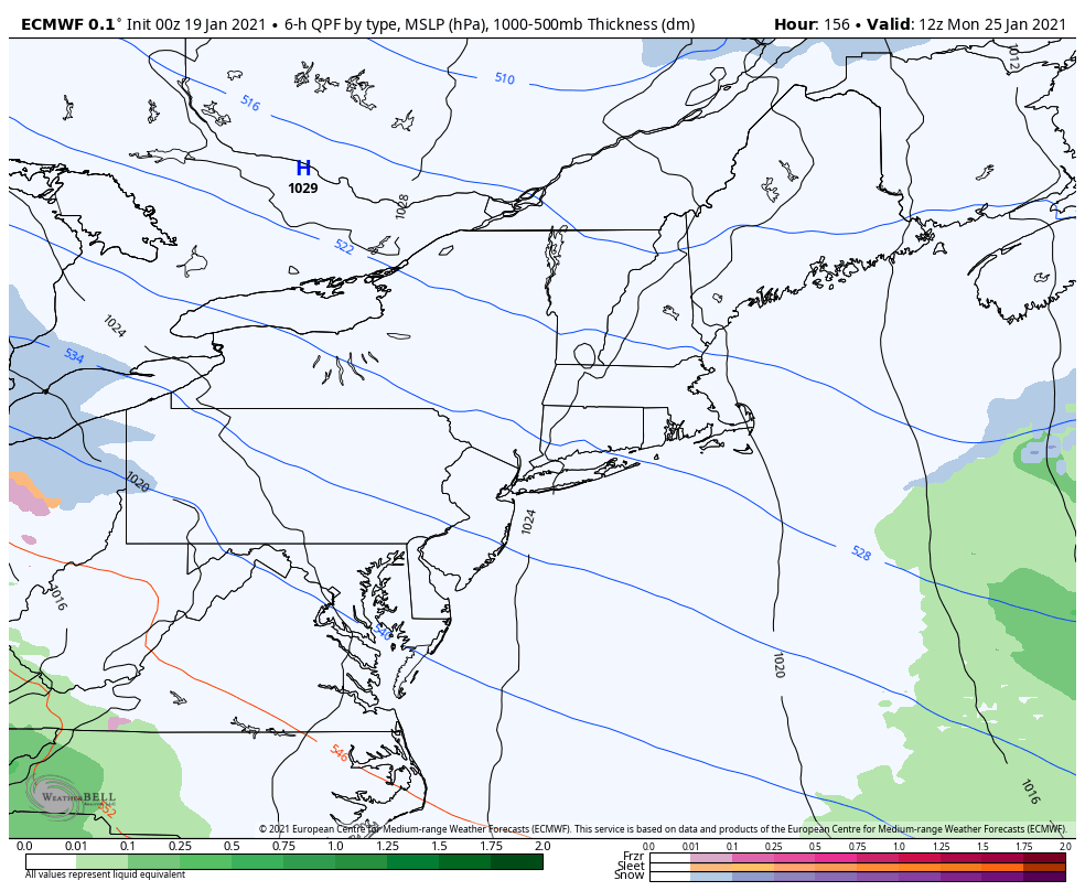 I discussed the pitfalls of deterministic forecasts in the 7-10 day range in the previous update and on Facebook in the afternoon. The overnight deterministic run of the European model here shows the storm nosing northward. It is what is it, another jerky one trick pony idea 8 days out. 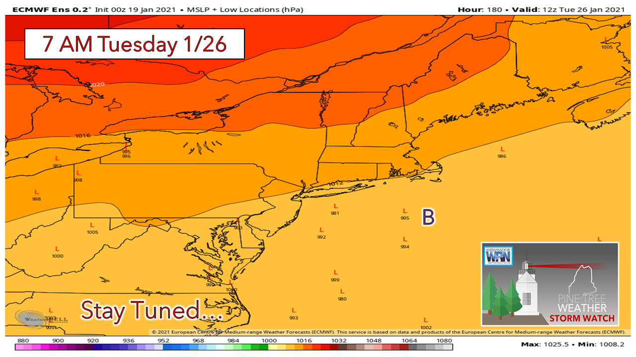 Digging under the hood, out of 51 ensemble members, 5 are in the neighborhood of the benchmark point. As with yesterday, just under 10%. 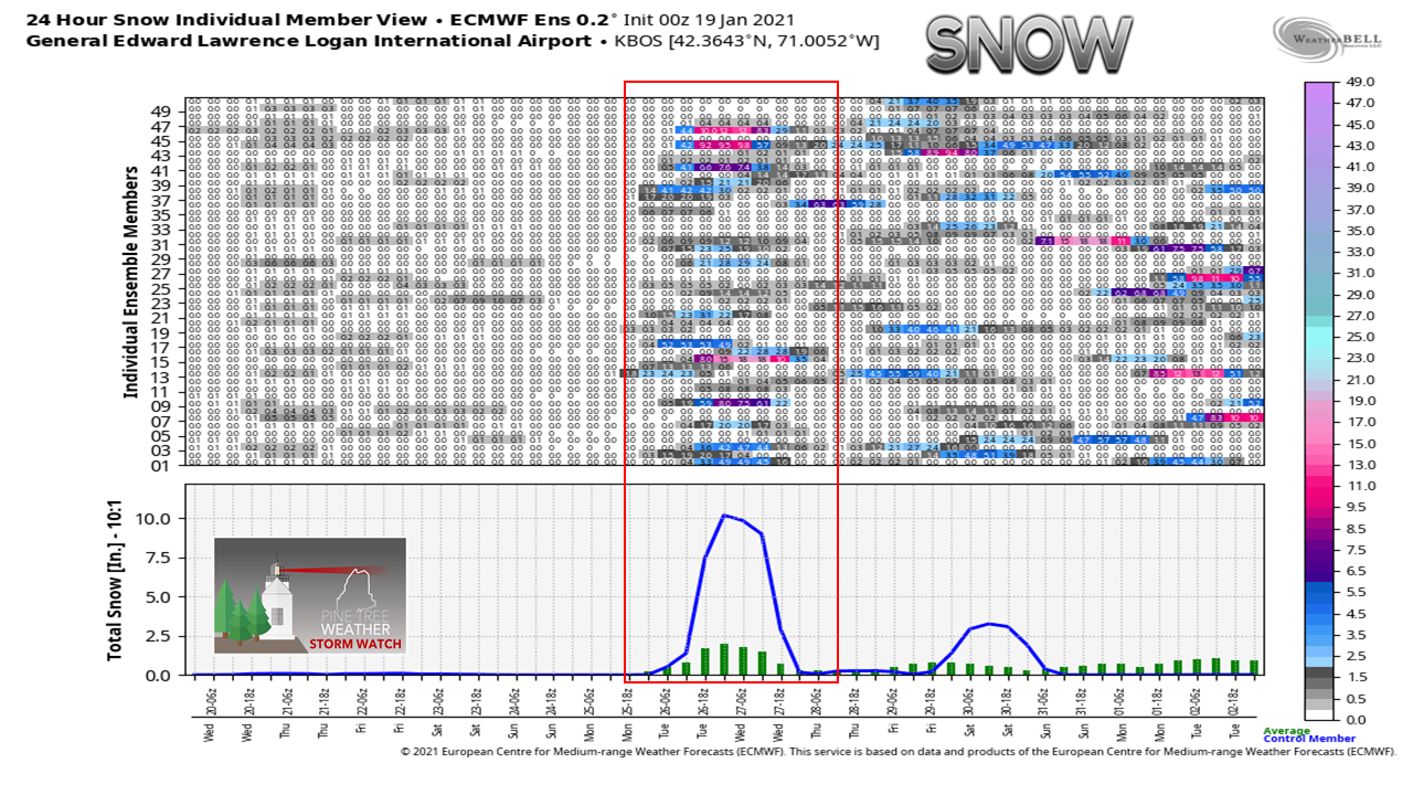 Looking at ensemble ideas for Boston, the control (blue line) expects a solid snow, but the individual members averaged off show much less than that. I want to make this clear. I am on record for a potential storm around the 25th, and while models are doing what they are, I haven't given up on that thought. The pattern is showing signs of shifting. I am tracking this openly with you to show the progression of forecast development, and part of the insanity that models conjure up in the long range. Stay tuned for more on this Wednesday, Temperature outlook through Monday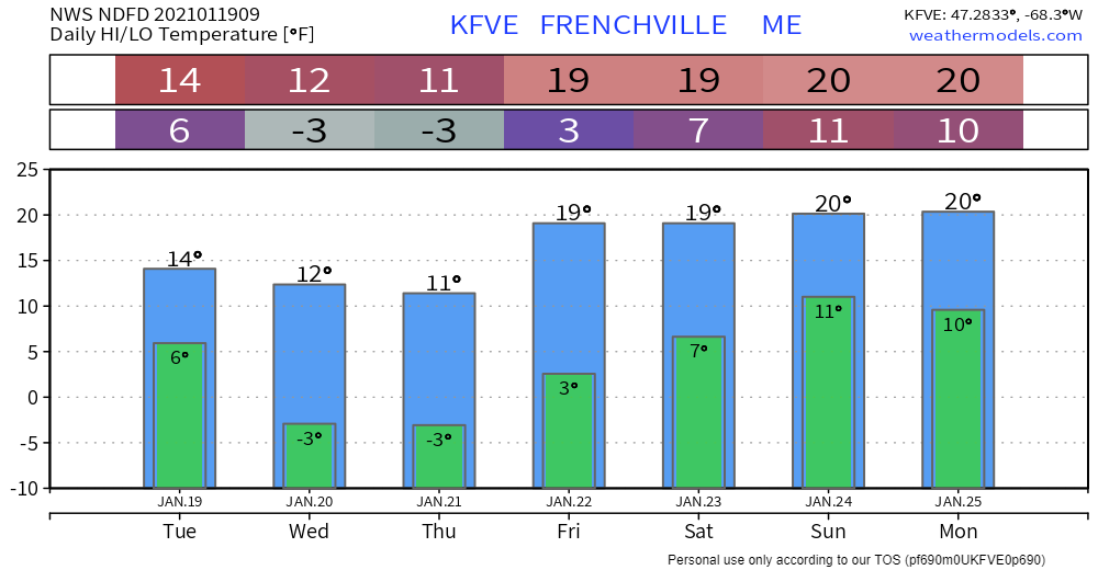 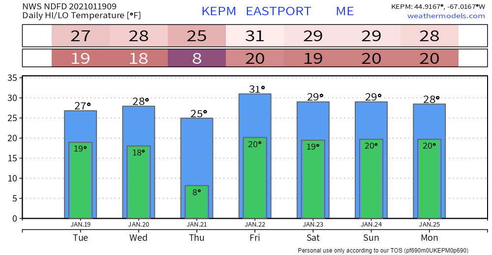 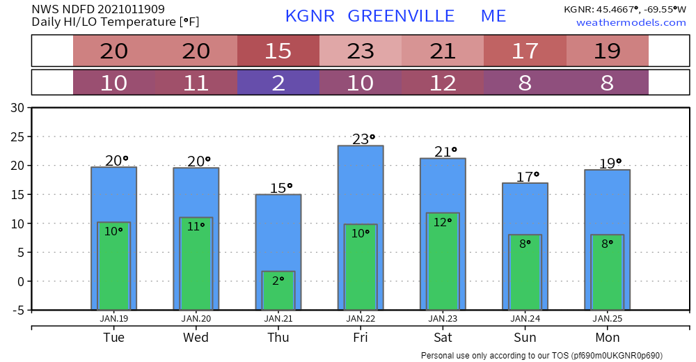 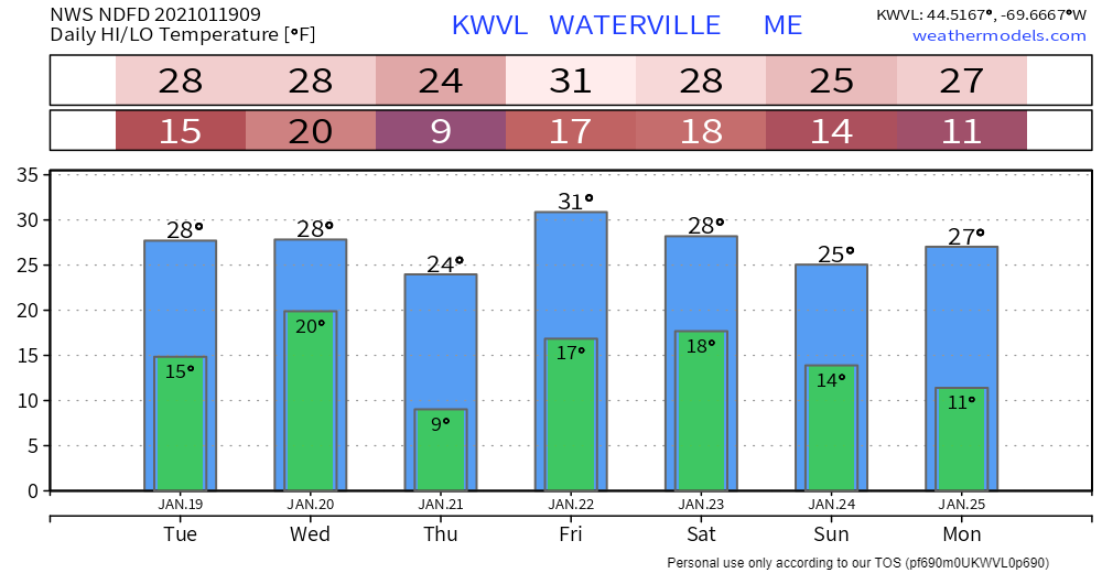 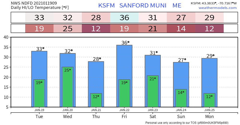 Be prepared to receive alerts and stay updated!
For more information in between posts,
please follow Pine Tree Weather on Facebook and Twitter. Thank you for supporting this community based weather information source operates by financial contributions. Stay updated, stay on alert, and stay safe! - Mike |

Mike Haggett
|