
Spring pattern continues With much attention to the COVID-19 virus is dominating the media, I see this as a special concern for us in Maine. We're in our last days of winter. While this winter overall has been mild, it is a season that isolates our senior citizens and disabled, whether it is snow, ice, rain and/or cold. While the timing is not good, I am just glad we are going through this now rather than November. While it is wise to keep close to our homes, it's also important to get outside when we can. Whether a walk around the neighborhood, a hike in the woods, a trip to the beach, or simply grabbing a chair sitting on a porch or deck, sunshine, fresh air, and nature is good for the mind, body and soul. Monday and Wednesday are the days this week to plan for that. Make an attempt to get out and soak in some sunshine. Give the neighbors and friends a call. They'll appreciate that. We'll get through this. A messy Tuesday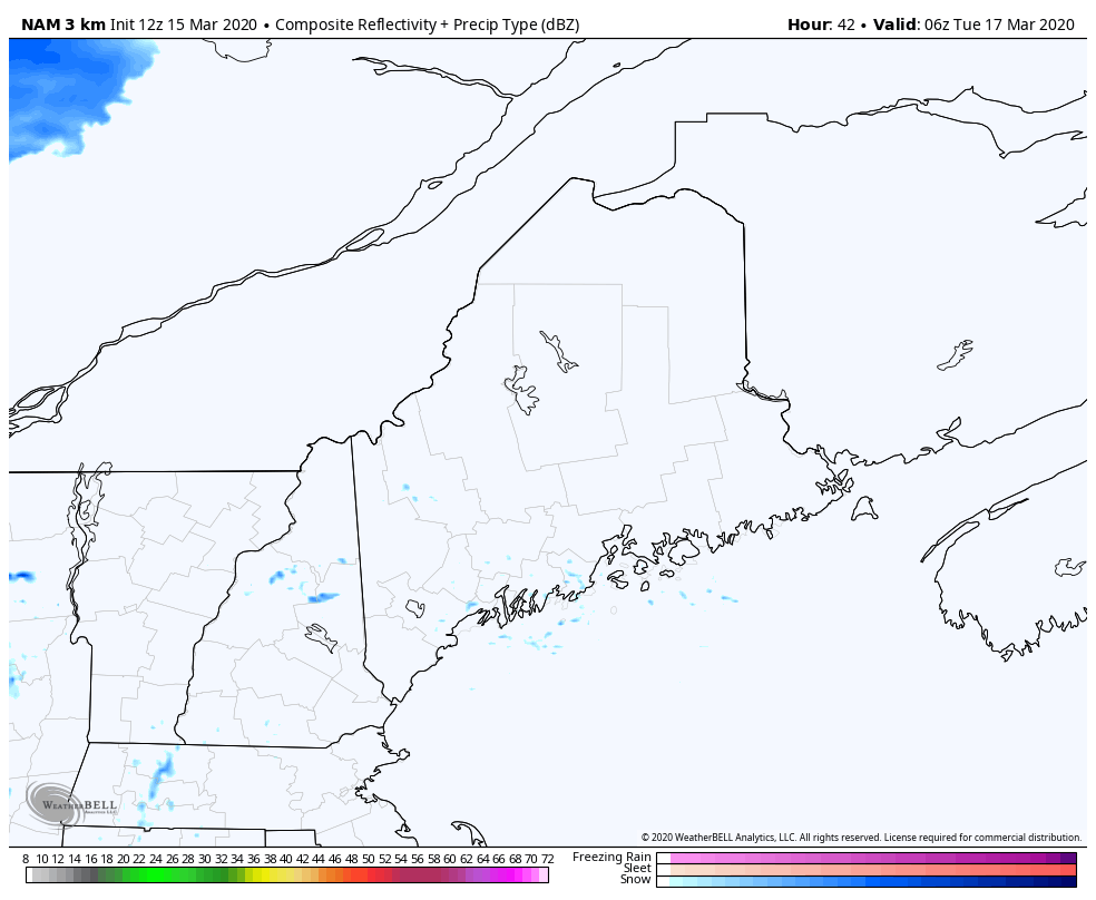 Another quick hitter for the region is on the way Tuesday. Some areas may see some light snow showers for the morning commute, but the main area of precipitation appears to arrive during the day. Precipitation ends from west to east Tuesday afternoon. Some western and southern areas may catch a sunset as the sky clears out Tuesday evening. The wind could be gusty at times, in the 20-30 mph range for much of the state Tuesday afternoon into the evening. 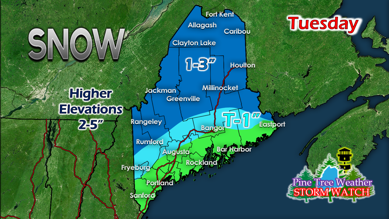 Best chance for snow accumulation will be for the higher elevations. Liquid equivalent precipitation ranges from 0.20-0.40". The coastal plain may see a few flakes to start off, but should change to rain before it can pile up. Unsettled end to the week High pressure moves in Wednesday briefly before moving offshore Wednesday night. A warm front moves in from southwest and brings the chance for a period of snow for the interior Thursday, changing to rain Thursday night into Friday. A cold front works through the region Friday night. Snow showers kick up over the mountains and north overnight into Saturday. The sun is on track to return for Sunday, with breezy conditions to end the weekend. Temperature outlook through the weekFor those where there is little or no snow cover, watch your gardens for bulbs beginning to pop. We'll still have nights where the temperature falls well below freezing statewide into the future. You'll want to cover up your flower beds to protect the spring growth. Temperatures will be a bit cooler than normal to start the week. Friday temperatures will surge well above normal statewide before cooling down Saturday. Our overnight lows are still running above normal for most of the period. 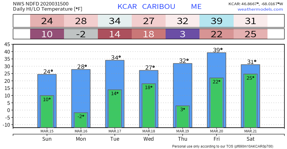 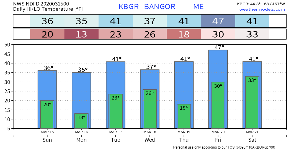 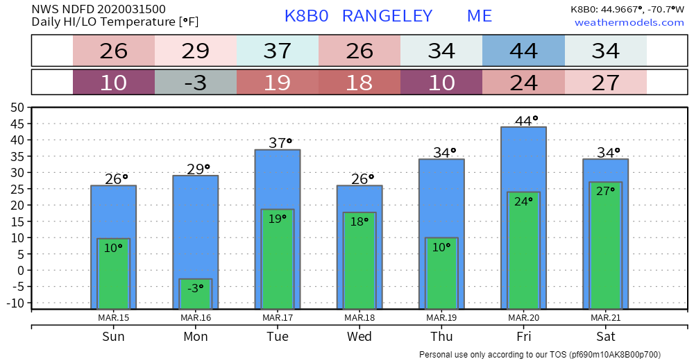 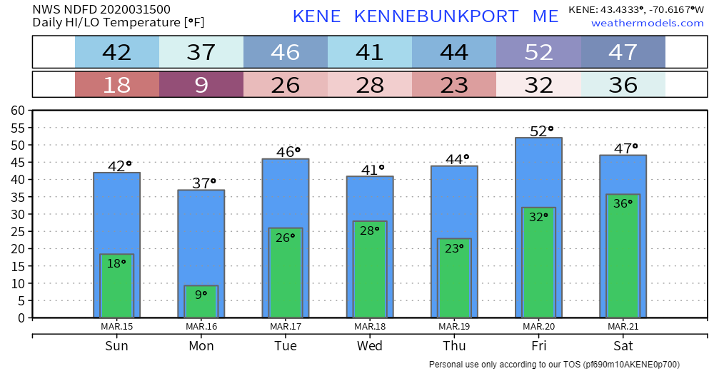 Feel free to use the many pages available on this website for many types of forecasts on rainfall, snowfall, marine, longer range CPC outlooks and maps.
► ► For the latest official forecasts, bulletins and advisories, please check in with the National Weather Service in Gray for western and southern areas, or Caribou for northern and eastern parts of Maine. You can help keep Pine Tree Weather going into the future with a donation of ANY amount now through VENMO @PineTreeWeather, a monthly donation on Patreon or messaging me on Facebook or Twitter to send a check in the mail. Thank you for your support! Always stay weather aware! - Mike |

Mike Haggett
|


