|
A quick note of appreciation to those who have financially donated in the past few days to help me cut the deficit to $425 for 2022. It's great to see your messages and to know that you have my back. Any donation amount is appreciated, whether it is $5 per month on Patreon or through VENMO or by mailing a check, it all helps. You can click on the banner below or the DONATE tab in the menu for more information. Thank you so much! Mixed bag with a breeze for Thursday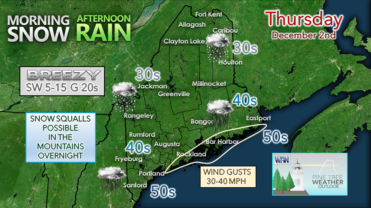 Folks over interior areas should be mindful of snow and potentially some light freezing rain through the morning. As the wind picks up, that brings the temperature up and will take care of any slick spots that may form in the morning. MidCoast and DownEast areas may see wind gusts reach Flying Trash Can levels in the afternoon. If you have outdoor holiday ornaments and lights, make sure they are secure or bring them inside. For those who have the mPing app, today would be a great day to use it. More information on that below. 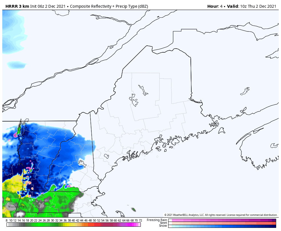 Thursday 5 AM to Friday 1 AM - Two waves of precipitation to deal with. The first wave is associated with a warm front that noses in from the southwest Thursday morning into the afternoon. The second is a cold front that passes through overnight. Folks travelling in the overnight hours should be aware of potential ice as the precipitation of the day freezes up. The warm front passing through Friday morning may set up some snowfall enhancement over the southwest interior as a low-level frontal boundary (similar to what I refer to as a coastal front in winter, but in this case, further inland) 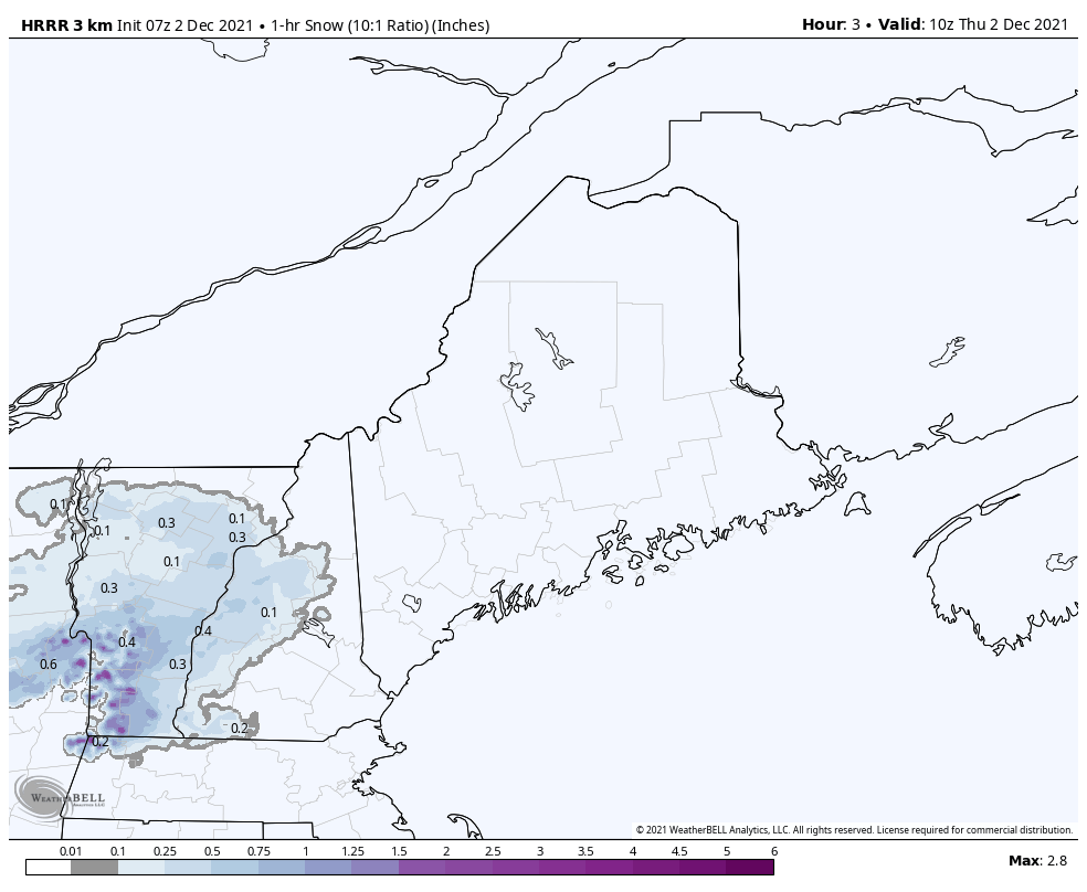 Thursday 5 AM to 3 PM - This short-term model idea of potential snowfall in one-hour increments shows the potential for that enhancement in the Fryeburg / Limington / Sebago Lake region. If this does occur, a quick hit of 1-3" is possible and could grease the roads up. Stay on alert for changing conditions there through mid-morning. 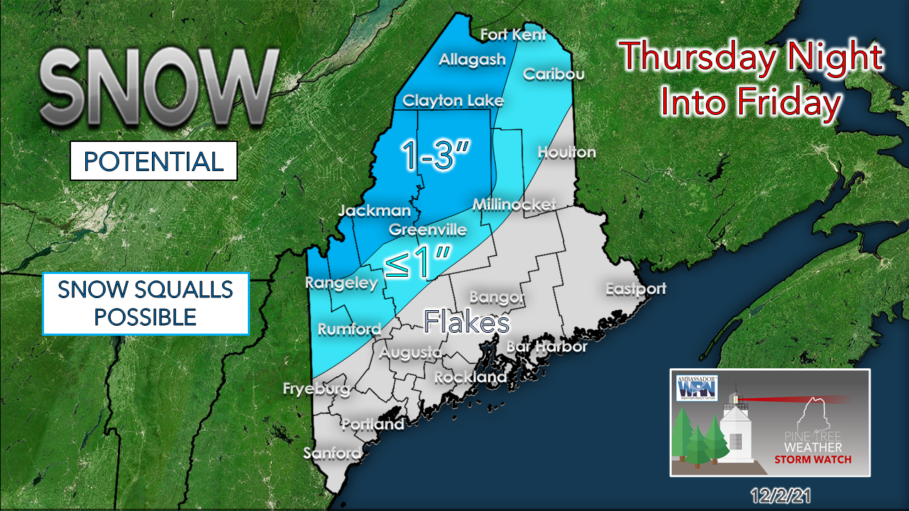 This snowfall map for the overnight hours into midday Friday has been refined a bit. Folks to the northwest of the Bigelows have the best chance to see a couple inches of snow overnight, along with the best chance for snow squalls, also. After the front passes through Thursday day, the wind will crank from the northwest and set up the likelihood of upslope snowfall. Friday remains on track to be breezy and cold with wind chill values in the single digits and teens statewide, and below zero for the ski hills. Winds could gust in the 20-30 mph range, 30-40 mph in the mountains. Snow showers possible for Saturday Saturday 7 AM to Sunday 1 PM - A weak wave is expected to skirt the southwestern areas of the state and could generate snow showers as it passes through late afternoon into early evening. High pressure takes control for Sunday and brings sun and seasonably cool temperatures. Potential for two storms next week Sunday 1 PM to Tuesday 7 AM - High pressure over the region for Sunday slides offshore. An inside runner storm moves in for Monday. The model ideas in the form of liquid, and potentially enough of it to impact the bases on the ski hills. There is also potential for gusty winds on the front and backside of the frontal boundary. Expect Tuesday to be breezy and cold similar to Friday. The cold from Tuesday is the table setter for the next system to watch for Wednesday... 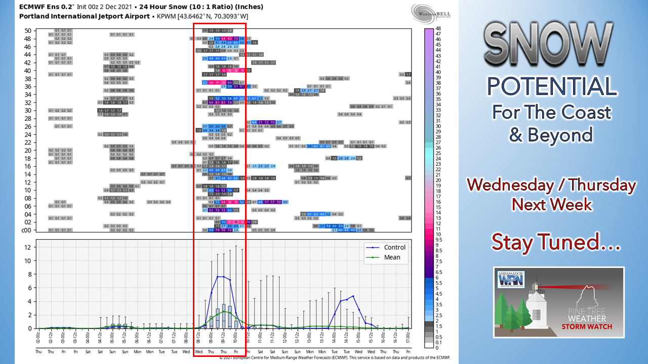 While it is a week out, there is strong ensemble support from other models that this could potentially be the first impactful snow for the coastal plain. Time will tell if this signal is real, and something to stay updated on in the coming days. 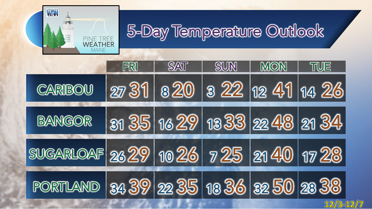  mPING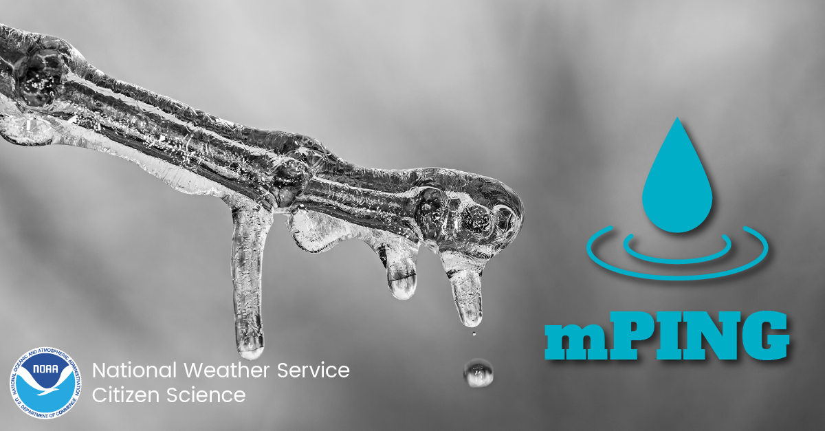 Check out the mPING (Meteorological Phenomena Identification Near the Ground) project. Weird name, cool app! You can report the type of precipitation you see where you are. No need to measure! Use the free mobile app to send reports anonymously. Reports are automatically recorded into a database, which improves weather computer models. The information is even used by road maintenance operations and the aviation industry to diagnose areas of icing. mping.nssl.noaa.gov #CitizenScience Be prepared to receive alerts and stay updated!
 For more information in between posts, please follow Pine Tree Weather on Facebook and Twitter.
Thank you for supporting this community-based weather information source which operates by reader supported financial contributions. - Mike |

Mike Haggett
|