|
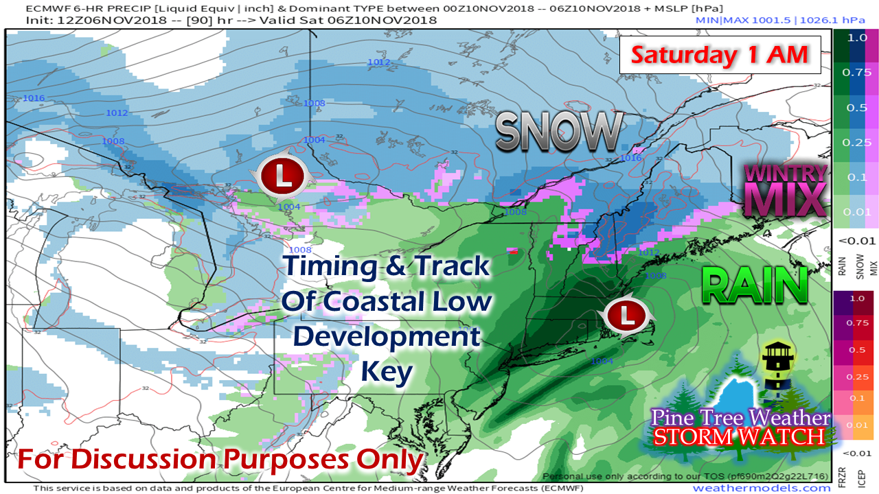
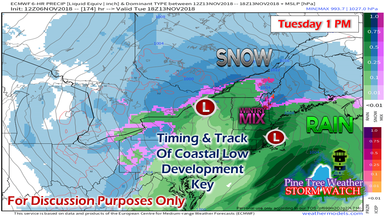
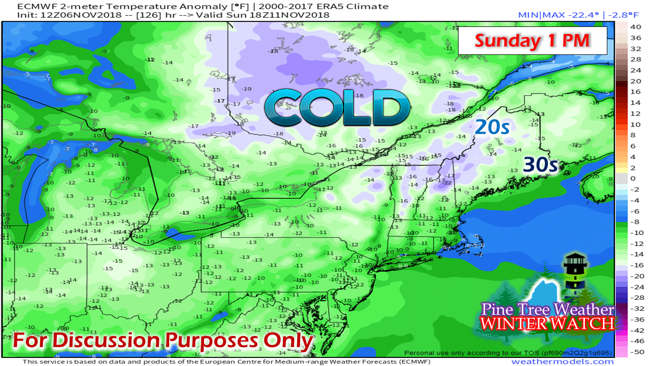
Due to time issues, I am not able to go into as much depth as I normally do. I will not be updating here on Wednesday as I will on the road for most of the day. I may drop something into Facebook or Twitter, so you can check there for more information. Also, a few more folks have told me they are sending donations to keep this operation funded. I sincerely appreciate that. This pledge drive has been ongoing since August. I'd like to get this wrapped up sooner than later as I have another round of bills coming in for the data and graphics I use. Your financial assistance is necessary to keep this website going. I would rather not resort to subscriptions, but donations and amounts will dictate what happens going forward . I've spent well over $10,000 out of my own pocket to do this over the past seven years, and quite honestly, that is enough. I am doing this for you. I need your financial support in order for me to continue. Two rounds of mixed bag stormsRather than get into the "windshield wiper effect" of operational models, the idea remains consistent for snow in the mountains and north, mix roughly for the foothills and interior DownEast regions, and rain primarily for the coast. Cold air damming and how that sets up will tell the tale on who gets what for how long. Timing at this point appears Friday afternoon for western and southern areas, overnight for northern and eastern areas. Heaviest precipitation to fall by around daylight Saturday, ending as scattered rain / snow showers Saturday afternoon. A couple things of importance to point out with this system is that for one, it's a fast mover, and two, it will get windy. The storms that are passing through here are intensifying as they move into the Gulf of St. Lawrence. This trend is going to continue. Keep your emergency supplies stocked. Fast forward to Tuesday, another similar idea. Still time for changes, but the trend is for colder air to continue to work towards the coast. Two weeks ago, these were all mostly rain events. Now we are getting the mixed bag events. It won't be long before these become all snow events. Cold times aheadThis chart here indicates temperature departure from normal, based on data collected from this century. Whereas the region is normally in the upper 30s / upper 40s for daily highs, this idea shows 20s and 30s for potential daily maximum temperatures. It would be one thing if this was a one shot deal, but with the western ridge expanding pole ward, cold air has no where to go but south over eastern areas. This will continue through next week. Some areas in the far north (Estcourt Station, this means you) could be playing around with 0° for overnight lows with single digits possible for the mountains. It appears to warm with the Tuesday storm, and then hit the basement for later next week, with a warmer trend on the way to start Thanksgiving week. Time to fill the oil/propane/kerosene tanks, and switch over the car tread to winter snows if you have not done so already. Stay Updated!For the latest official forecasts, bulletins and advisories, please check in with the National Weather Service in Gray for western and southern areas, or Caribou for northern and eastern parts of Maine.
For more information from me, please follow the Pine Tree Weather Facebook page and my Twitter feed. Please consider making a donation to keep Pine Tree Weather going through the year ahead. My data cost expense is increasing. The operation is 70% funded and needs your help to get through the winter. You can set up a monthly pledge on my Patreon page or send me a message from the Facebook page or direct message on Twitter to get my address to mail a check or set up bill pay. Always stay weather aware, and thank you for your support! - Mike |
Mike Haggett
|


