
|
Just a quick update on my status as I know I have been silent due to the rheumatoid arthritis I have been dealing with. I am doing better. Laying off the phone and social media has helped. I am walking 3½ miles every day before the sun comes up. I am a month in of being gluten and sugar free and feeling great physically. I still have arthritis pain, but it is not as debilitating as it was. The weird thing is my hands feel great swinging a golf club, but to send a text is excruciating at times. It will continue to be "easy does it" for me going forward, with a focus on storms and patterns. Thank you for hanging in there with me. The trend is cool one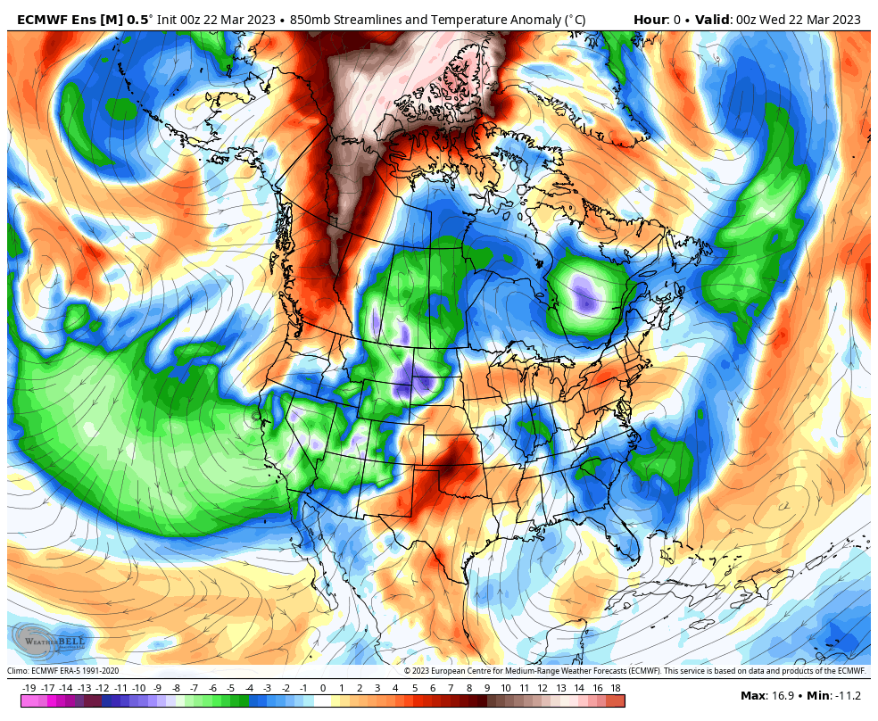 I've been talking about this since Christmas... a back loaded winter. For the skiers and snow lovers, your patience and wishes are coming true. For those slopes that have the base and ability to stay open late, they'll be in good shape. We're ENSO neutral right now, which means a cool trend over the hemisphere. 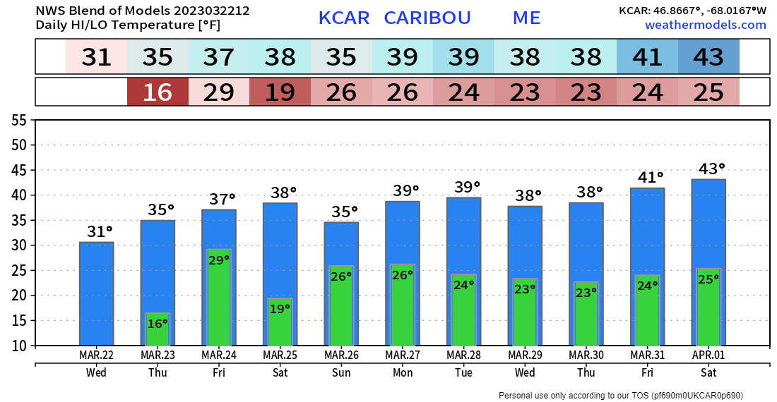 Looking at the NWS Blend of Models from Caribou shows below freezing nights. As long as the cold lurks to the north, snow chances remain possible everywhere. For those longing for green grass and spring flowers, this pattern is going to test your patience. We may be in astronomical spring, but the season doesn't technically start around the 45th parallel until mid-April. Time will tell if it shows up on time. Snow for the north Thursday Wednesday 8 PM to Friday 2 AM - A warm front moves into the area Wednesday night into Thursday and brings snow to the north, some snow, a bit of a mix then to rain over central areas, and a few flakes of snow to rain for the south and DownEast. Snow starts off light overnight into Thursday. An area of low-pressure forms along the front and brings a thump of snow over the north Thursday afternoon, before clearing out early Friday. 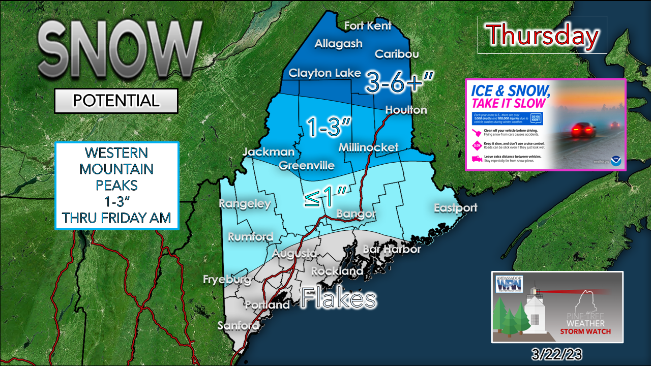 A cold front follows in its wake and brings the western ski hills and north snow showers into Friday. A Winter Weather Advisory is in effect for the crown from 6 AM Thursday to 4 AM Friday. Expect slick spots where you see flakes or a mix. Weekend storm may bring snow everywhere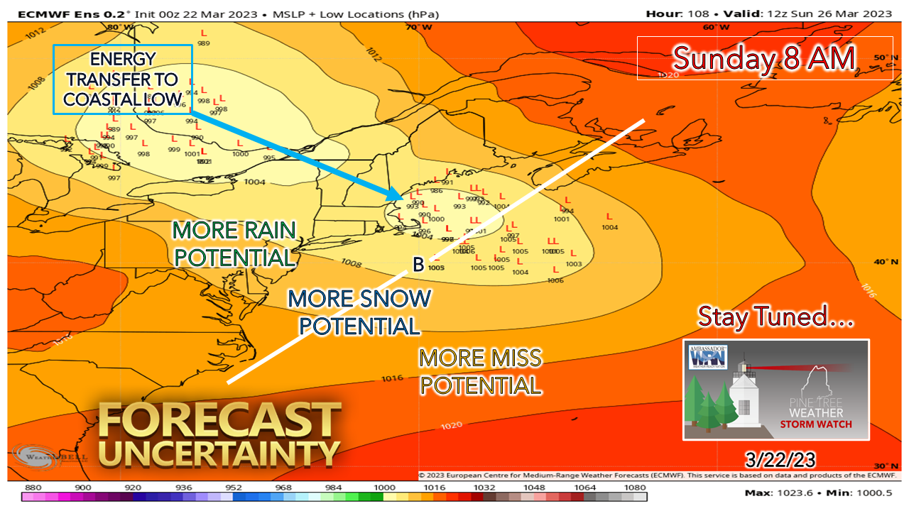 An area of low-pressure is expected to form over the southern Plains on Friday and then tracks into the Great Lakes on Saturday. An upper-level trough digs into the southeast and fires up a coastal low Saturday night into Sunday. The questions at this point are the timing of the development of the coastal low, the track, and how much it will intensify. As you can see, the ensemble spread of the weakening parent low to the northwest and the position of the coastal low is widely scattered. 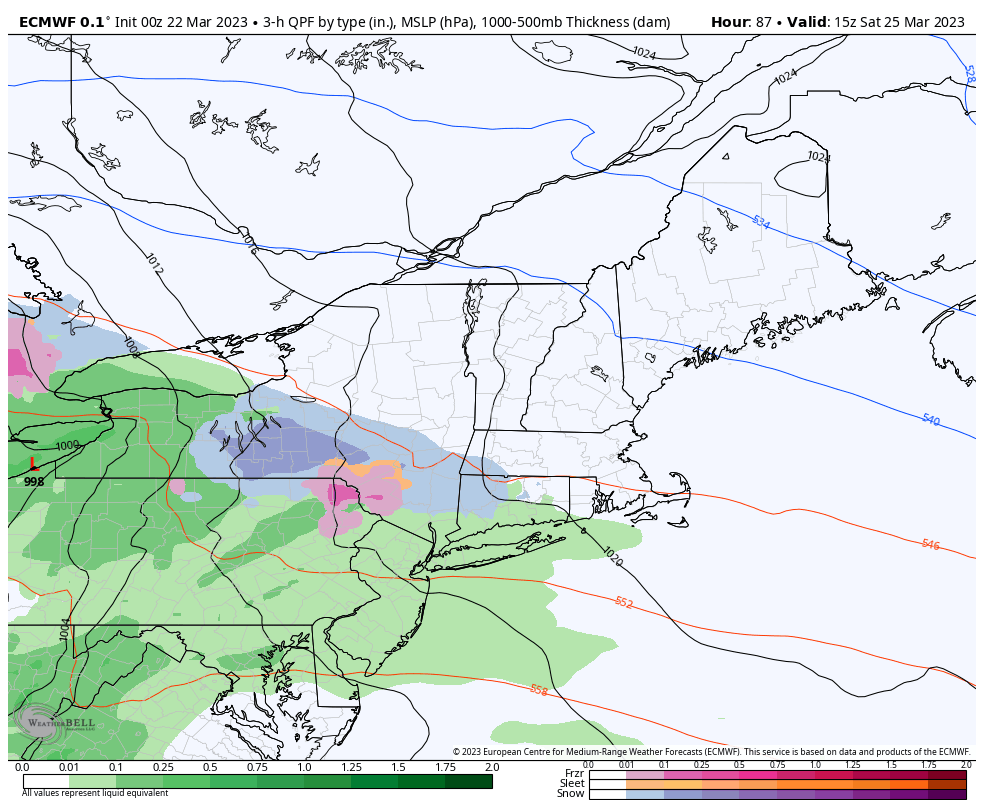 Saturday 11 AM to Monday 8 AM - A rough idea on timing at this point is for precipitation to develop late Saturday afternoon over the southwest and then expand to the northeast Saturday night into early Sunday. With the passage of the system occurring overnight and with cold to the northeast over Labrador, this idea sets up snow potential everywhere. The track will tell the tale of potential for mix and/or rain for southwestern areas, but the idea for now is all areas see frozen precipitation to start off. Precipitation ends from southwest Sunday morning and northeast Sunday afternoon and evening. 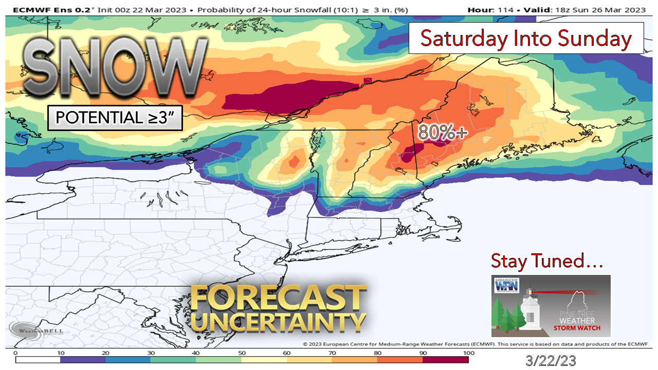 This is a good set up for the western mountains, foothills and north for a 6-12" event. This 24-hour window shown here through 2 PM Sunday cuts north off a bit, but the idea is certainly there. Far southern areas and the southwest coast may escape with minimal snowfall, but it could be a wet, pasty inch or two. Again, there are many questions and few answers at this point. Stay tuned. Oh, and another potential snow event Tuesday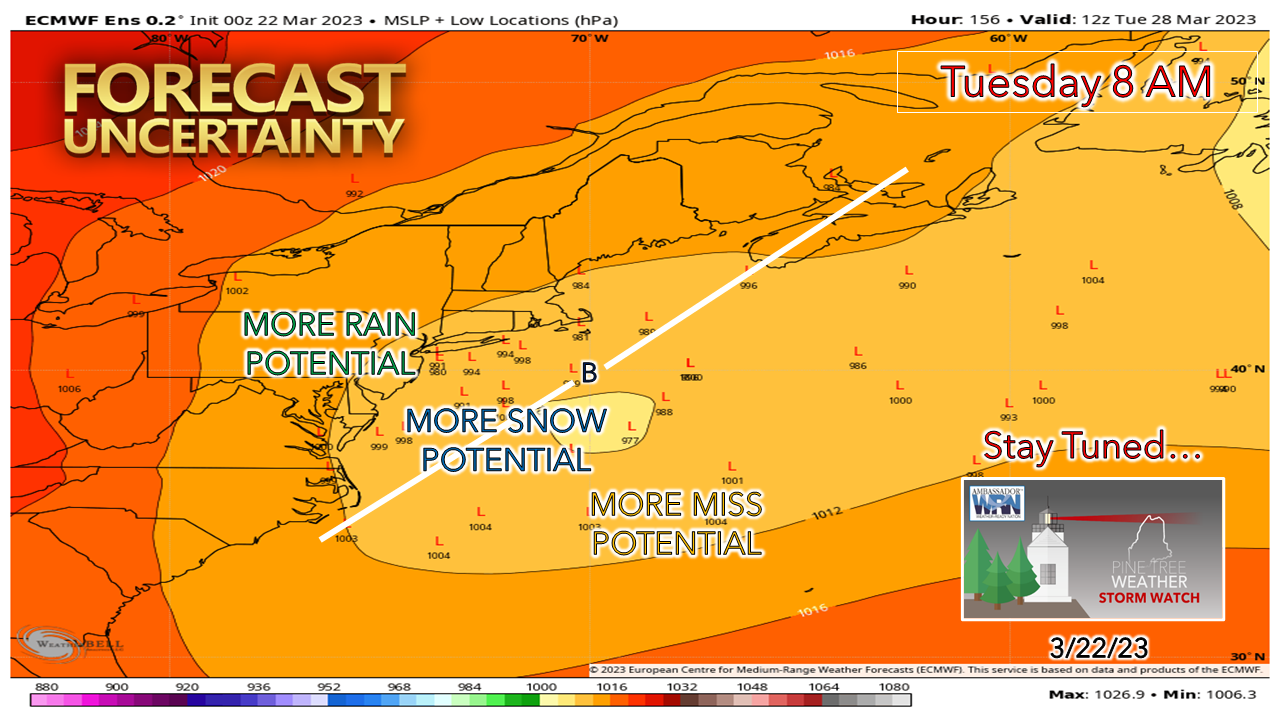 This is a week out, but worth mentioning as the idea fits the pattern. Time will tell if this idea sags southeast and out to sea or moves more to the northwest and turns into something. We'll see what happens.  Pine Tree Weather is funded from followers like you. I would appreciate your financial support. Click here for how you can contribute. You may not like the weather, but I hope you like what I do! Please hit the like button on Twitter and Facebook, and share! Stay updated, stay on alert, and stay safe! - Mike NOTE: The forecast information depicted on this platform is for general information purposes only for the public and is not designed or intended for commercial use. For those seeking pinpoint weather information for business operations, you should use a private sector source. For information about where to find commercial forecasters to assist your business, please message me and I will be happy to help you. |

Mike Haggett
|


