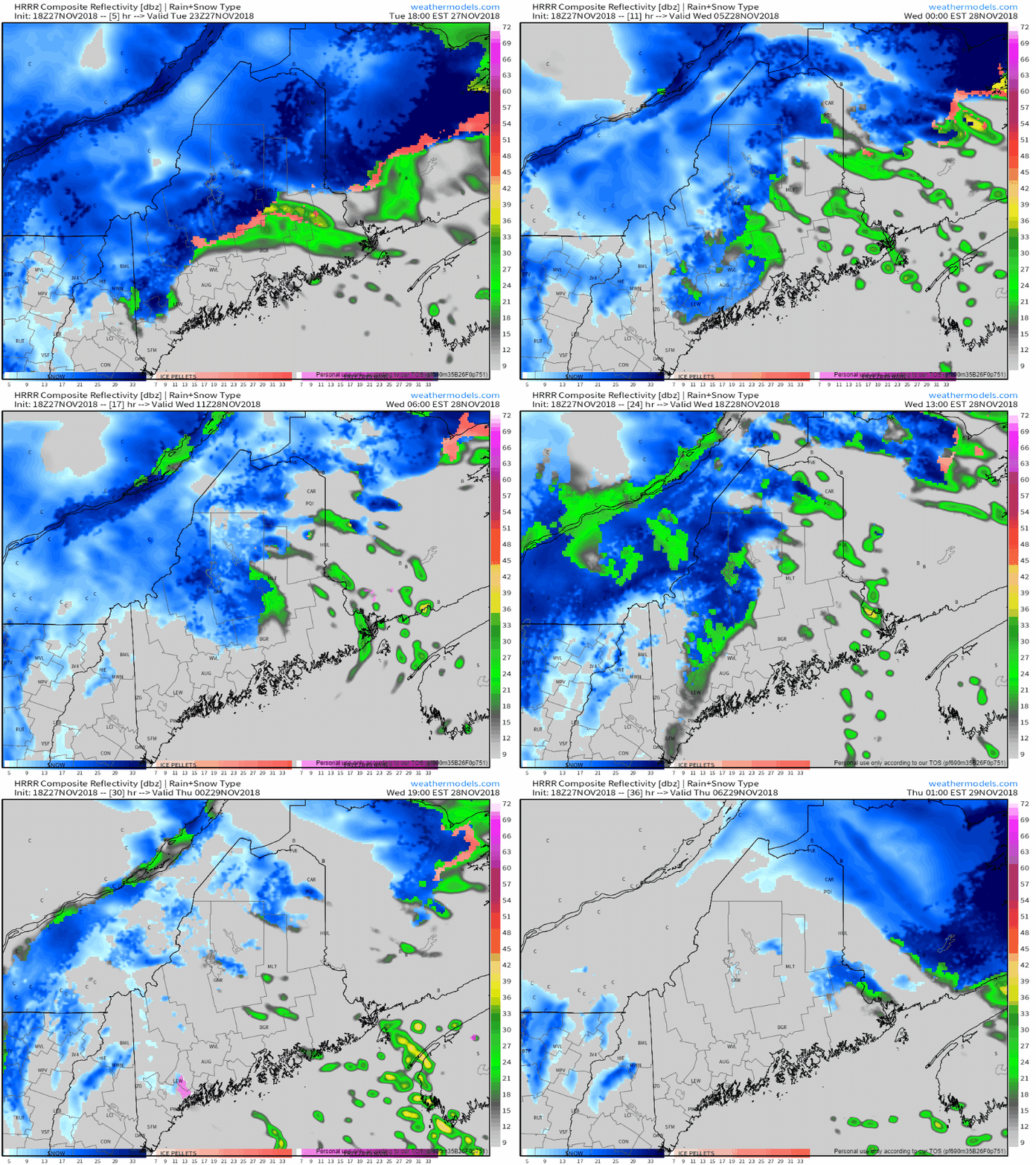
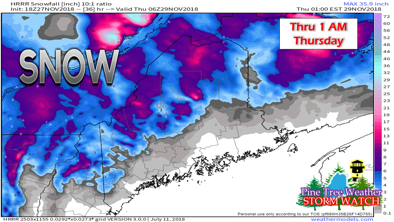
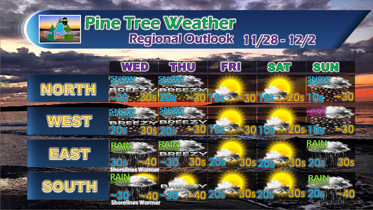
Snowvember Rolls OnAn upper level low will remain parked over the region through Wednesday before moving southeast of the state. The result will be continued snow accumulation in the mountains and north and risk of a shower over southern and eastern areas through Wednesday night. Model generated idea of additional snow to come shows potential for upwards of a foot or more. As the surface low spins itself out, temperatures will get cooler and allow for more fluff factor. Expect continued tricky travel in the north and mountains through Wednesday. Regional outlook through SundaySnow showers are likely to continue around the higher elevations Thursday morning and then dissipate towards the afternoon. The next system of concern approaches Saturday evening into Sunday morning which may bring another icing period for interior areas. Stay tuned. For the latest official forecasts, bulletins and advisories, please check in with the National Weather Service in Gray for western and southern areas, or Caribou for northern and eastern parts of Maine. Your support is valued and appreciated!Please consider making a donation to keep Pine Tree Weather going through the year ahead. My data cost expense is increasing. The operation is 80% funded and needs your help to get through the winter. You can set up a monthly pledge on my Patreon page or send me a message from the Facebook page or direct message on Twitter to get my address to mail a check.
For more information from me, please follow the Pine Tree Weather Facebook page and my Twitter feed. Always stay weather aware, and thank you for your support! - Mike |
Mike Haggett
|


