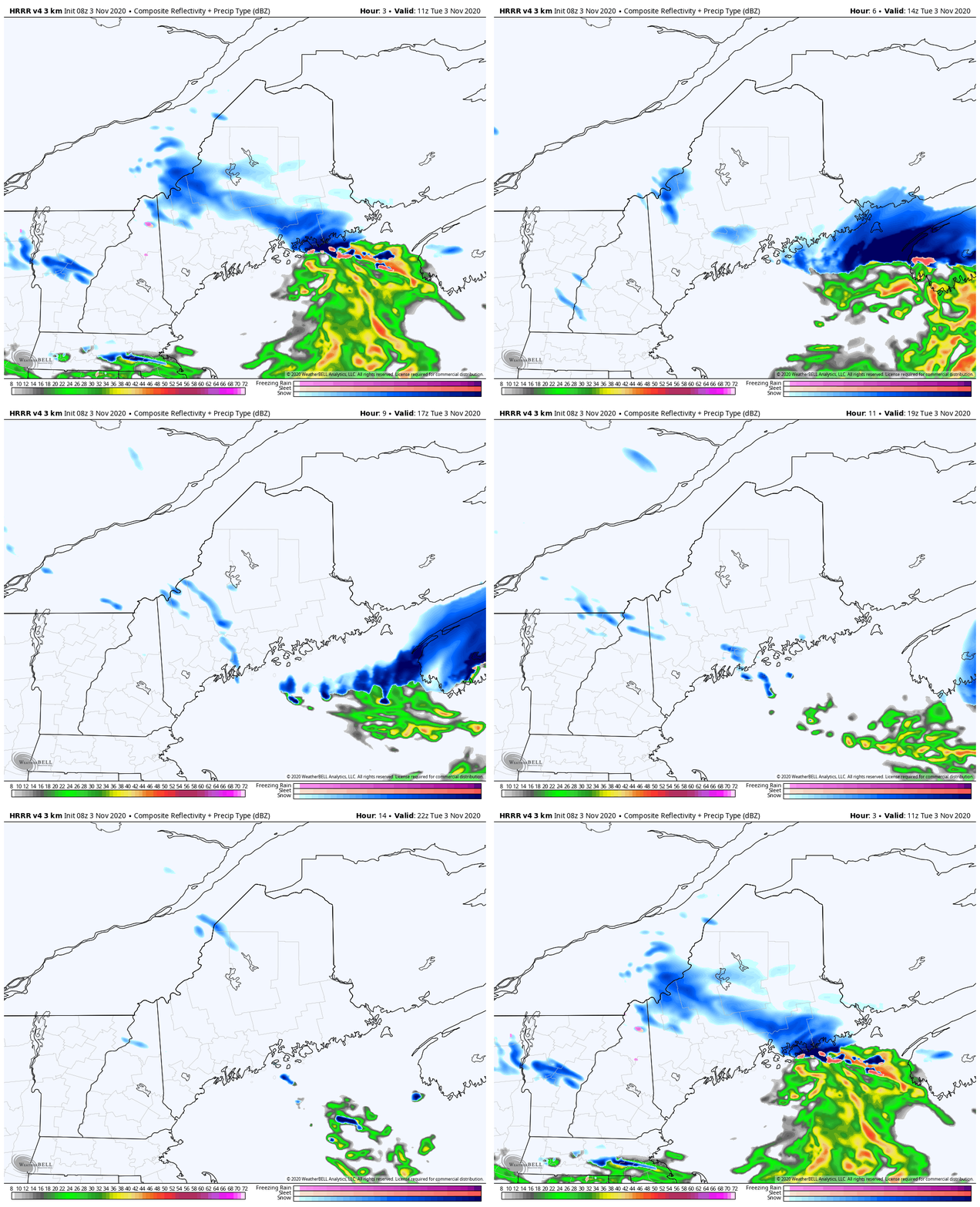
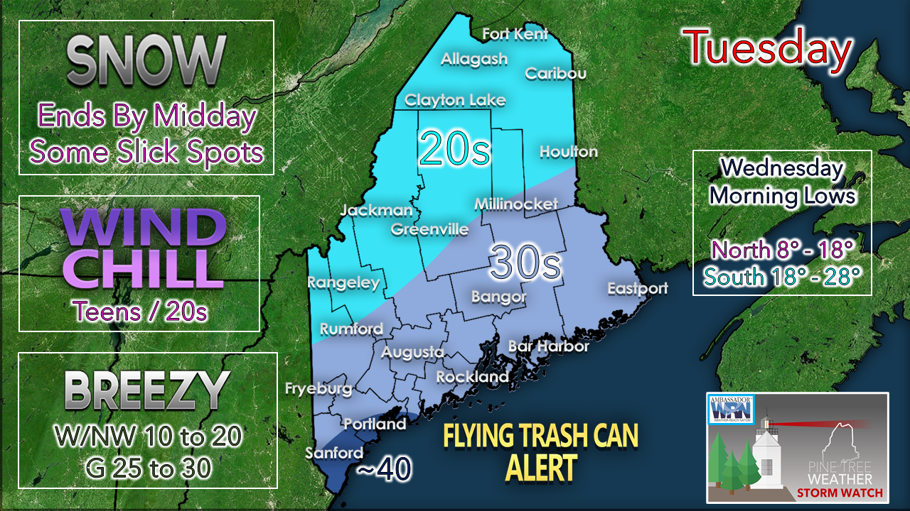
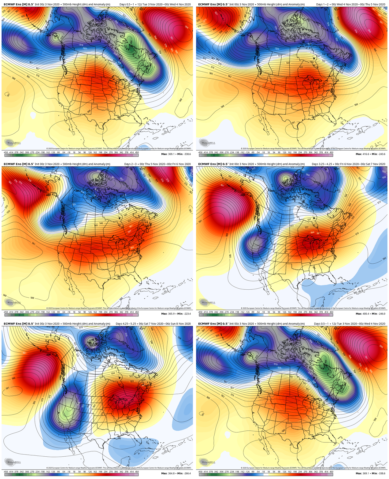
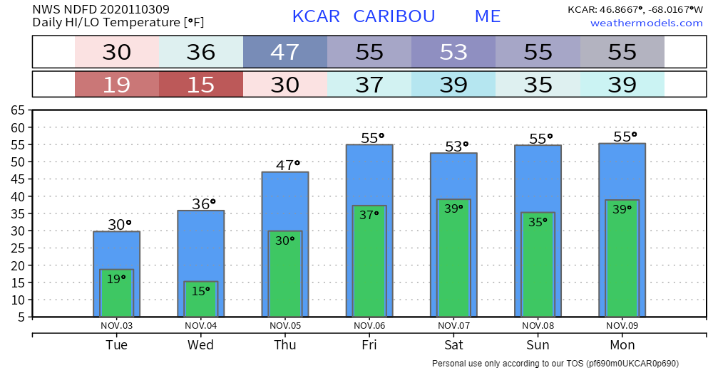
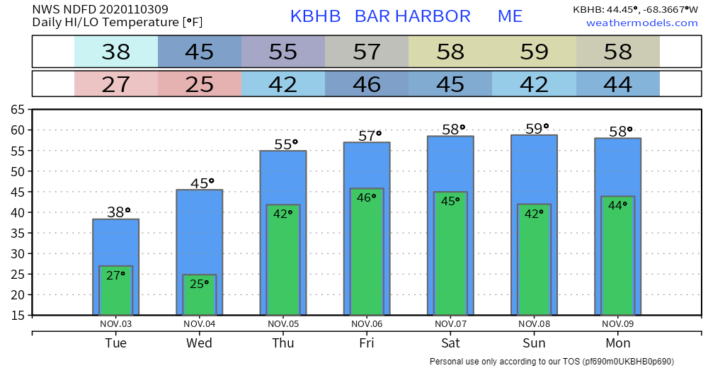
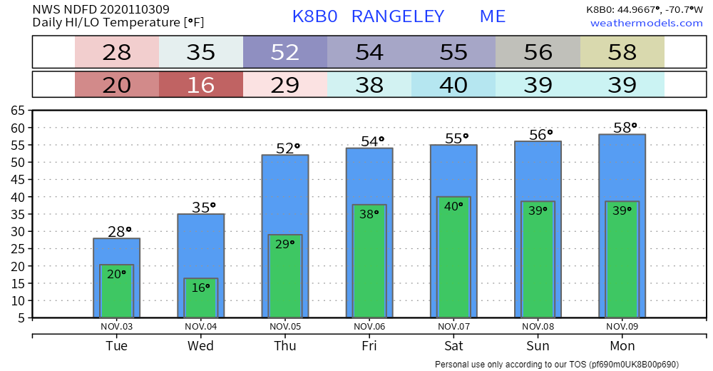
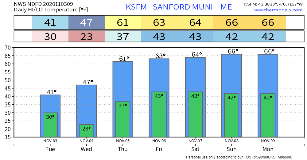
Improving sky during the dayFolks in the western mountains, foothills, central and MidCoast / DownEast regions seeing snow this morning will see it end by around noon. There is potential for a flurry, snow shower or squall through late afternoon as the air column clears out. By early evening, any snow activity ends. The story for most today will be the wind chill. The breeze won't be quite as strong as yesterday, but enough to make it feel like teens north and 20s for the coastal plain. Wind gusts from the northwest in the 25-30 mph range may blow around trash cans, grill covers, and anything else not secured. The breeze relaxes Tuesday night as high pressure settles in, albeit briefly. The high moves east Wednesday morning, and a southwest flow develops and brings a rise in temperatures along with it. Outlook through the weekendIt's a challenge to find any amount of precipitation of any amount until -maybe- the middle part of next week. Northern areas may get an isolated snow or rain shower Wednesday night / Thursday morning, but that appears to be it. The cold trough exits to the east, and a strong ridge builds in as we head into the weekend. Temperatures well above normal are likely to be the rule once the current cold passes east Wednesday. Maybe 70° for a high for southern areas this weekend? We'll see. Temperature outlook through MondayWinter weather awareness weekWhat are the biggest weather hazards this season? Visit our Winter Safety website to get prepared and become Weather-Ready: weather.gov/wrn/winter_safety Be prepared to receive alerts and stay updated!
For more information, please follow Pine Tree Weather on Facebook and Twitter.
** FUNDING NEEDED FOR 2021 ** Thank you for supporting this community based weather information source that is funded by your financial contributions. Stay updated, stay on alert, and stay safe! - Mike |
Mike Haggett
|

