
Ski country is loaded up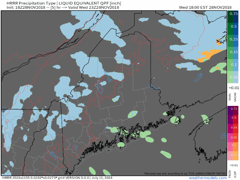 Late Wednesday afternoon Sugarloaf announced they had reached the 30" mark for the storm which began on Monday afternoon. They could end up with 3 feet by the time it ends Thursday morning. I am hearing folks up that way have lost power due to the volume of snow dragging down trees and power lines in the Eustis area. The snow machine will shut down soon, and hopefully those in the dark will get power back soon. The wind is going to pick up on Thursday, with gusts 15-25+ mph, which may cause blowing and drifting of snow, as well as hinder power restoration. 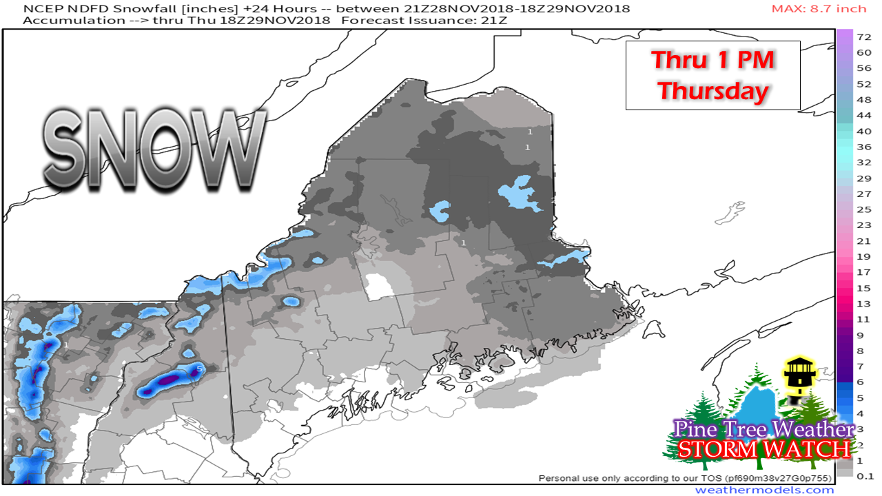 National Weather Service estimates on snow still to come from 4 PM Wednesday through tomorrow morning indicates higher elevations with another 3-6" to come. I am going to eat a bit of crow on this one. I seriously underestimated this one in the higher elevations of western mountains by a foot and a half. Incredible accumulations. And this is only November. Looking ahead to the weekend and next week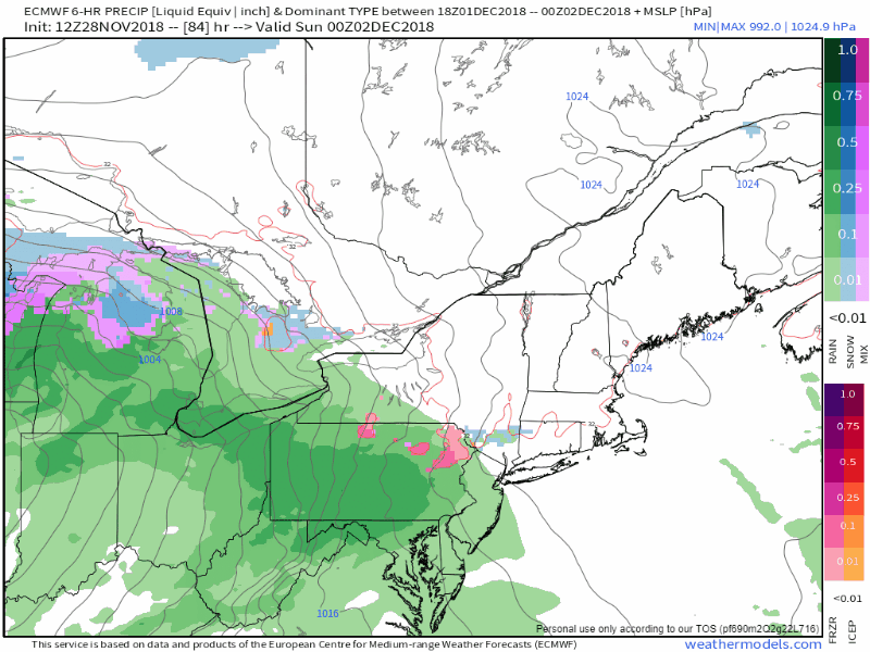 Sunday will be the next system on the way which may start off as ice in the interior but appears for now to change to rain as a warm front kicks through, followed by snow showers from a trailing cold front on Monday. This isn't a big precipitation producer as is appears for now. We'll keep track and see if that idea stays the same, and whether or not cold air damming gets the last laugh on precipitation type for the foothills and mountains as the event gets closer. 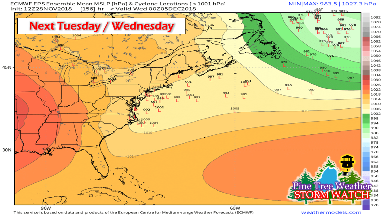 There are two signals to watch as we head into next week. First comes around the Tuesday / Wednesday time frame. With the trailing front dragging cold air into the state Monday, that sets the table for a snow event for at least interior areas. Outside of that, there isn't a whole lot of answers to many questions at this point. 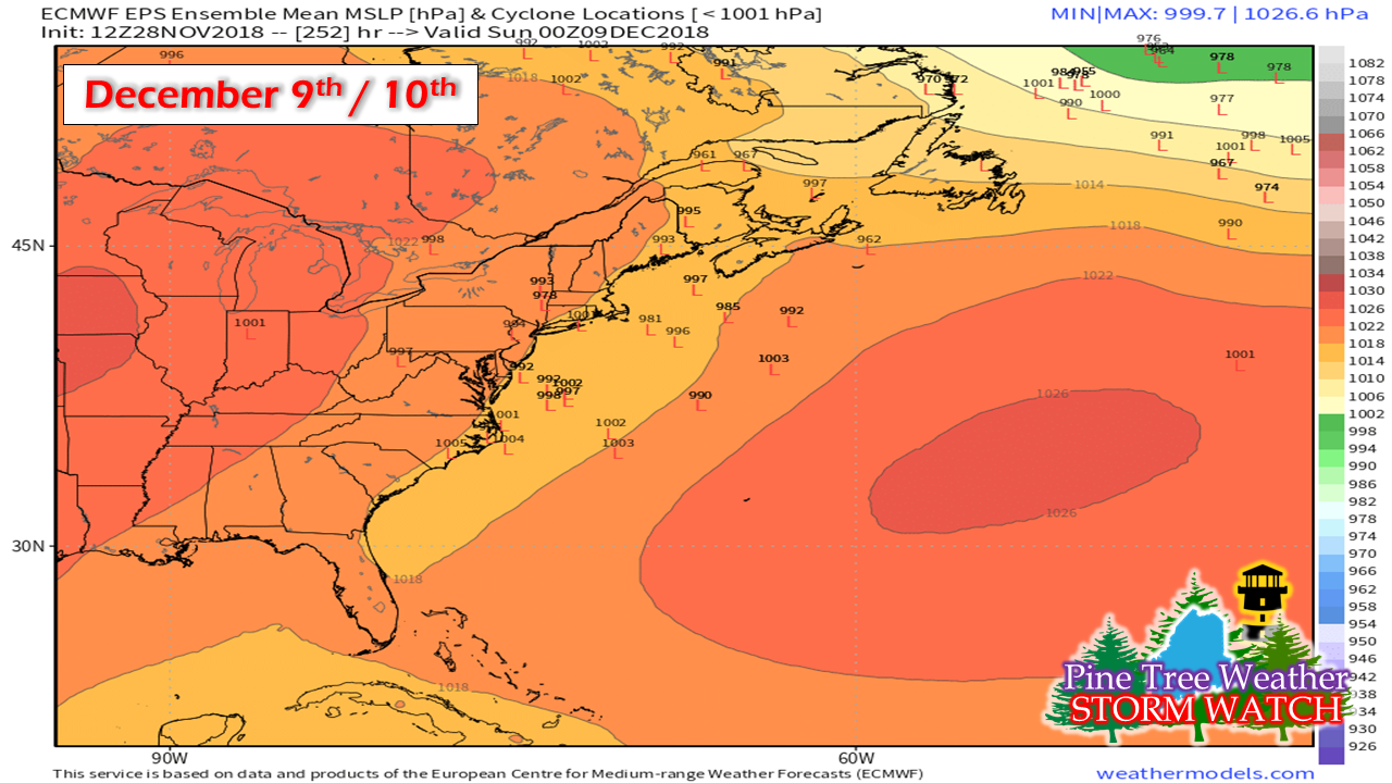 I usually do not like to put the cart this far ahead of the horse but since this idea fits the pattern we are heading into, I will pass along for future reference that the region may be dealing with another storm the second weekend in December. A lot of time for this to change, but something to keep in the back of your minds as we head into next week. Outlook through Monday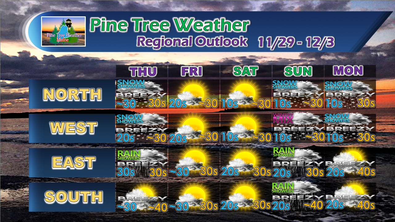 For the latest official forecasts, bulletins and advisories, please check in with the National Weather Service in Gray for western and southern areas, or Caribou for northern and eastern parts of Maine. Your support is valued and appreciated!Please consider making a donation to keep Pine Tree Weather going through the year ahead. My data cost expense is increasing. The operation is 80% funded and needs your help to get through the winter. You can set up a monthly pledge on my Patreon page or send me a message from the Facebook page or direct message on Twitter to get my address to mail a check.
For more information from me, please follow the Pine Tree Weather Facebook page and my Twitter feed. Always stay weather aware, and thank you for your support! - Mike |

Mike Haggett
|


