
Monday starts off cool and breezy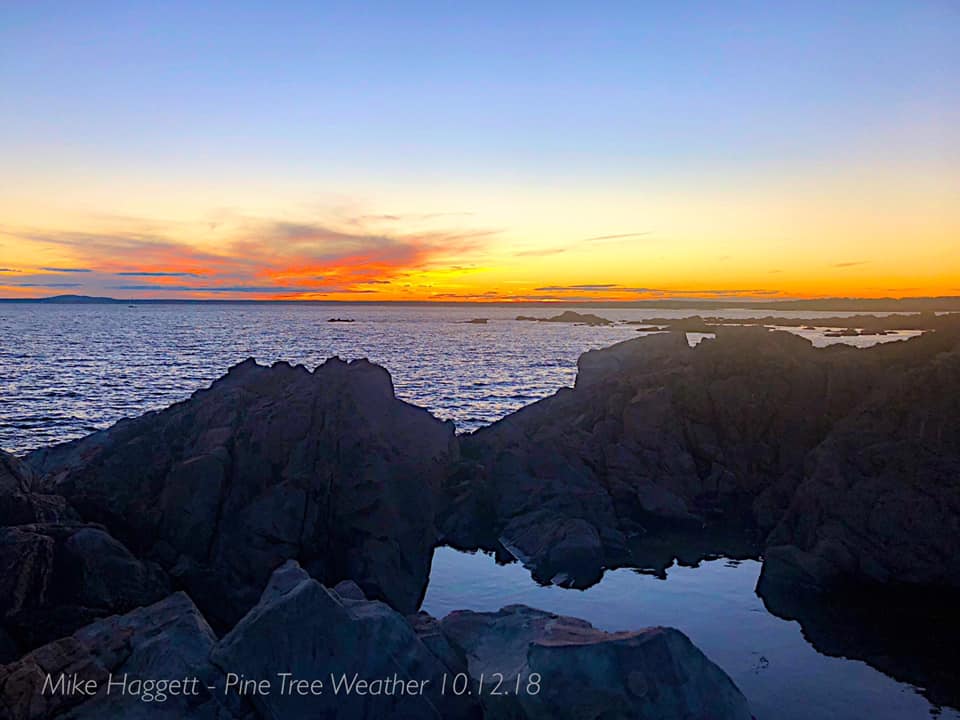 The work week starts off on the right track with mainly sunny conditions statewide. With the approaching system for midweek, the breeze continues. The air flow out of the southwest won't be as gusty as Sunday away from the coast, but it will still kick some leaves up and blow them around a bit. I know folks are trying to do their yard clean ups, which may seem like an effort in futility, but it will be worth it in the long run. Monday will be on the cool side with highs in the 30s north, around 40° in western areas and 40s for the shorelines. The southwest flow will bring temperatures up a bit Monday night and should stay above freezing for most areas other than the high peaks. Tuesday / Wednesday storm a timing and location game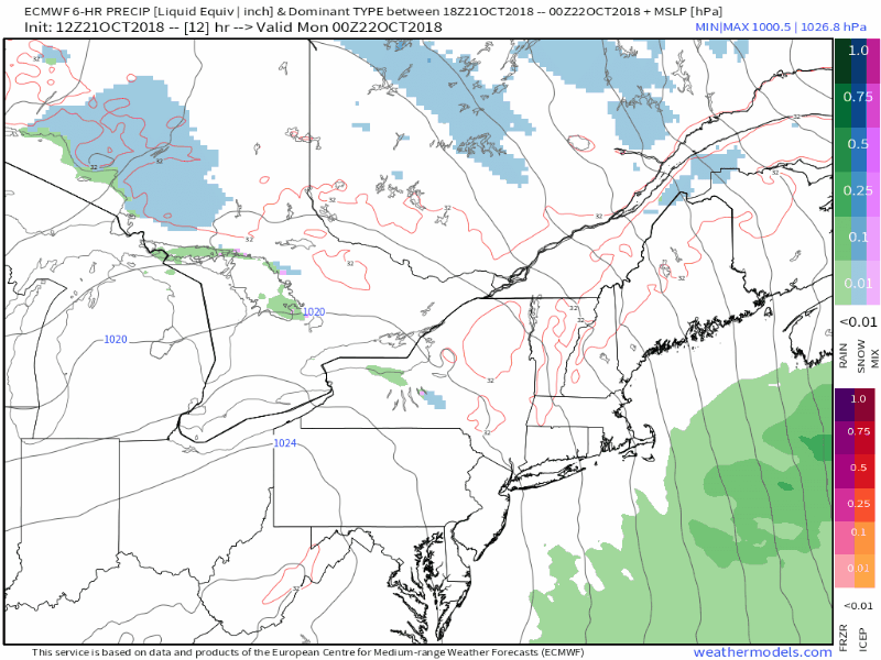 Guidance is getting a better handle on what to expect Tuesday into Wednesday for the region. Higher elevations could see a decent snow event out of this. The question at this point is for lower elevations of the interior and what may precipitation look like once it hits the ground level there. I've been thinking a mix of wet snow/rain for the past couple of days and I see no reason to change that idea. This could be a plowable event for places like Rangeley, Eustis, Carrabassett, Greenville, Chesuncook on up into the Allagash over to Frenchville with 2-6" of snowy paste as it appears for now. It's still a timing and location game of the formation of low pressure in the Gulf of Maine, so this idea could change, but those estimates appear reasonable for now. Tracking storm potential next weekend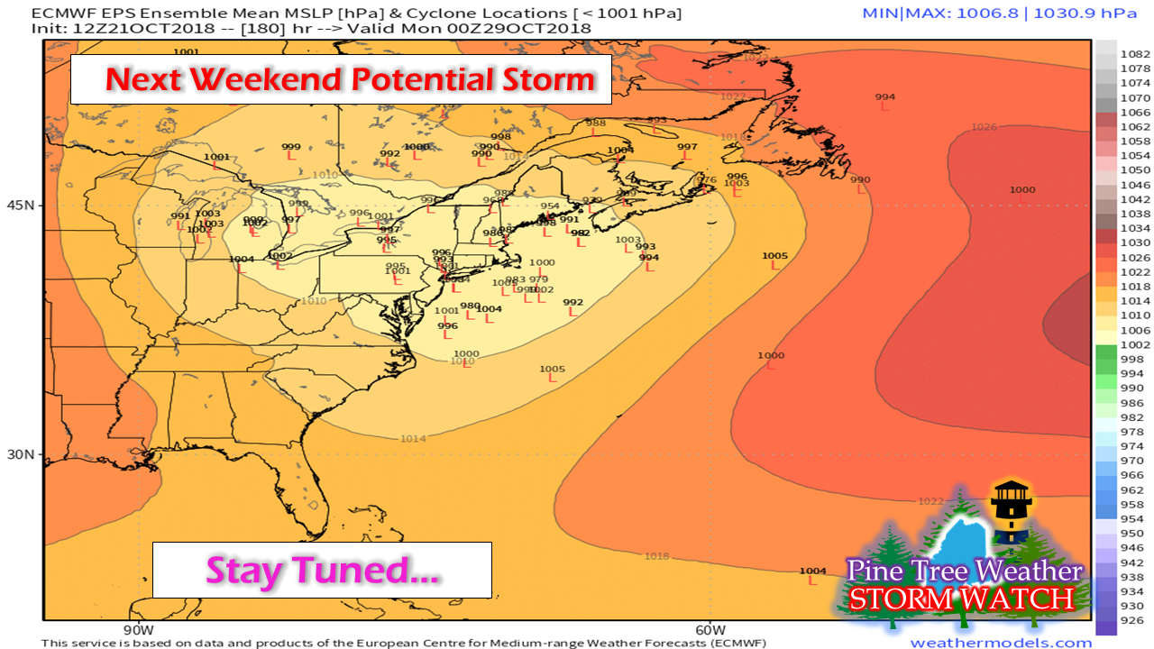 Whether this potential storm is a NorEaster, a SouEaster, a fish storm, or a clipper depends on the timing of the southern component piece that streaming across the central Pacific Ocean. Modeling tends to struggle with southern stream and this is no different. It could be midweek before a better idea is generated. Ensemble ideas like this pictured above casts roughly a 50/50 split on whether coastal or interior track and development. For now it is in the Sunday / Monday time frame, so make a mental note on this for now, and updates will come on details later in the week. Outlook through the work week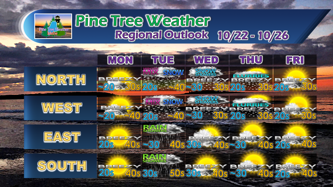 Snow and snow showers appears to linger in north country through the middle part of the week as the forming low moves into the Gaspe Peninsula and stalls until later Thursday. Breezy conditions continue through much of the week ahead and into next weekend.
For the latest official forecasts, bulletins and advisories, please check in with the National Weather Service in Gray for western and southern areas, or Caribou for northern and eastern parts of Maine. For more information from me, please follow the Pine Tree Weather Facebook page and my Twitter feed. Thanks as always for your support! Please consider making a donation to keep Pine Tree Weather going through the year ahead. Check out the donate page on how to contribute. Always stay weather aware! - Mike |

Mike Haggett
|


