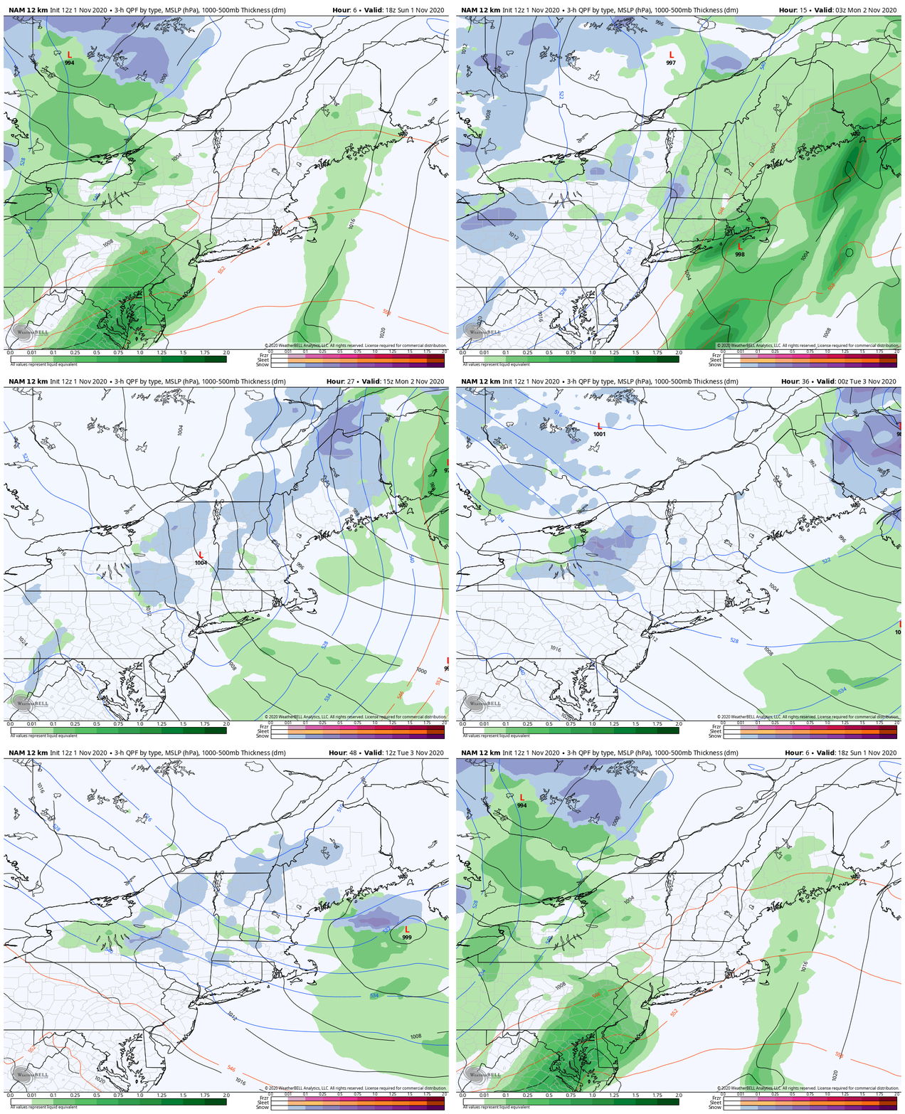
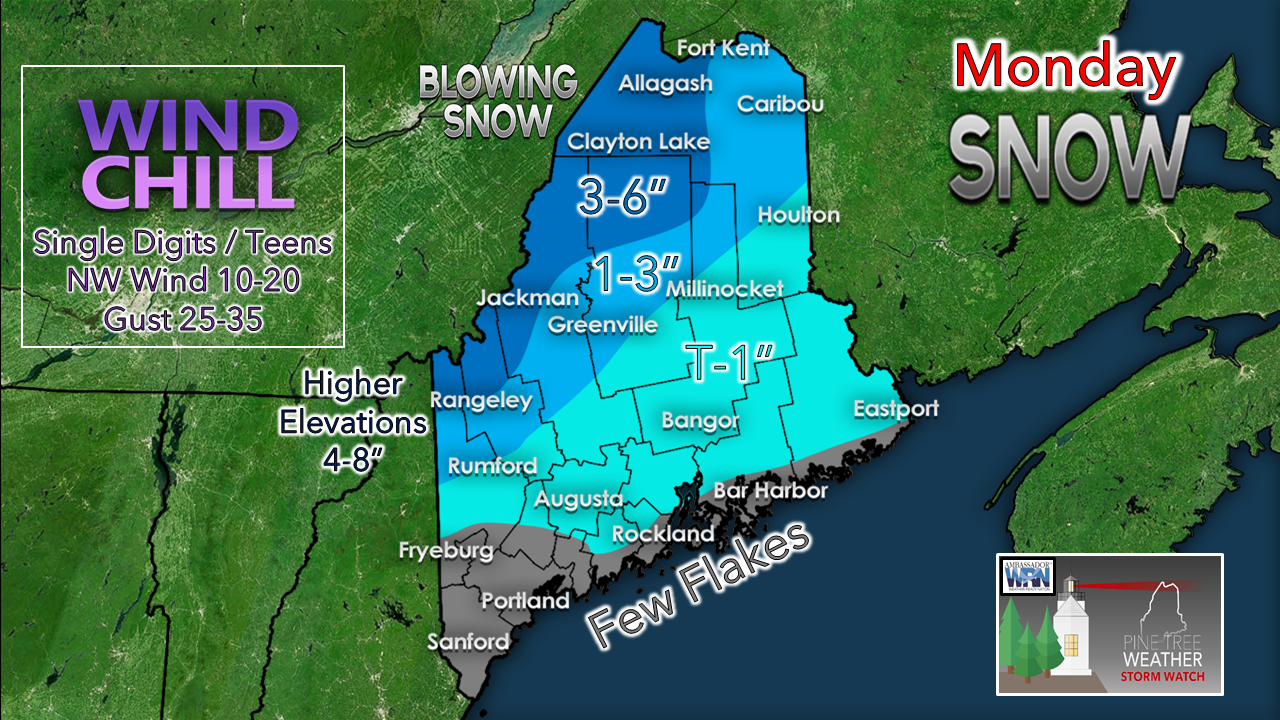
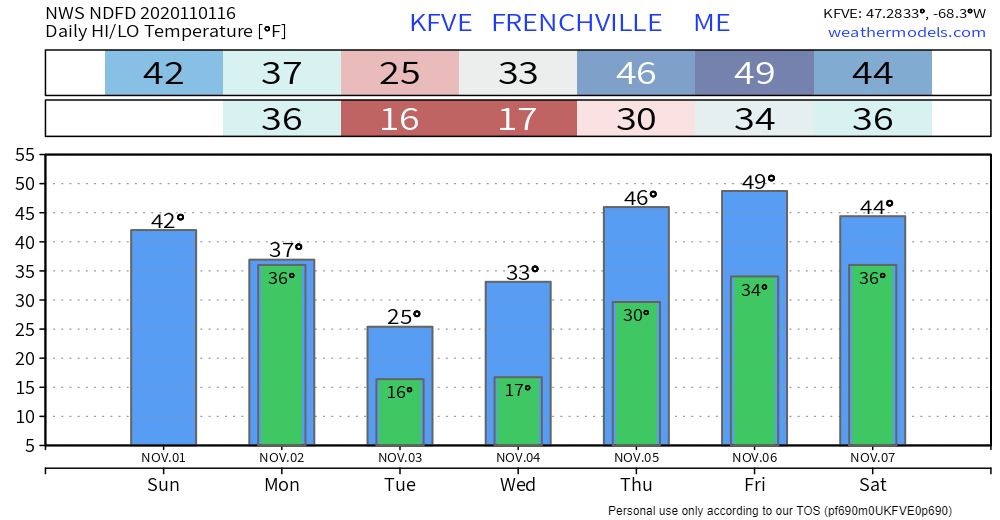
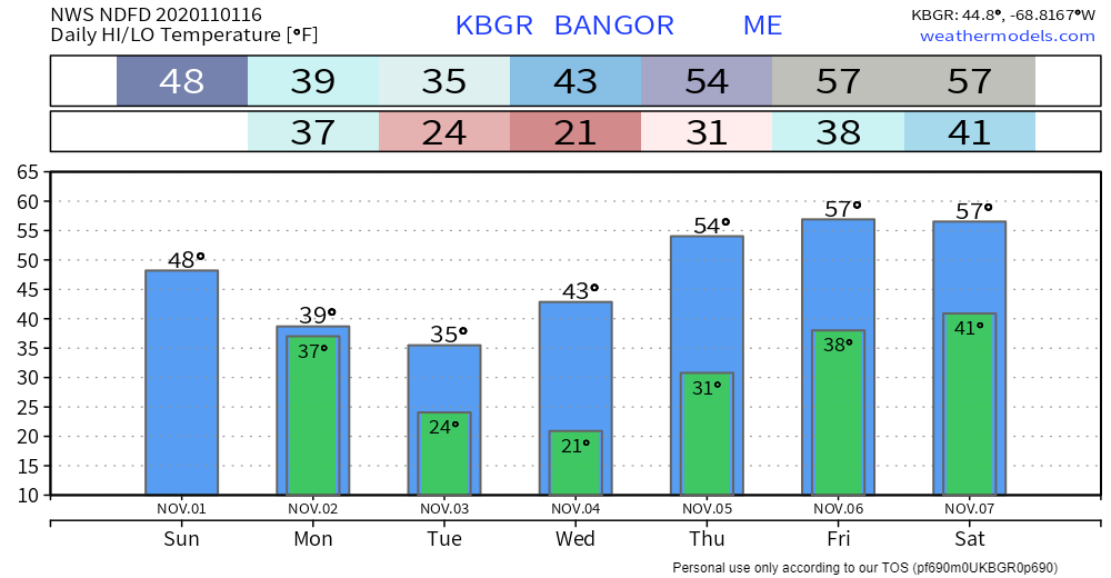
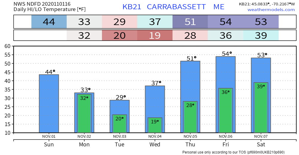
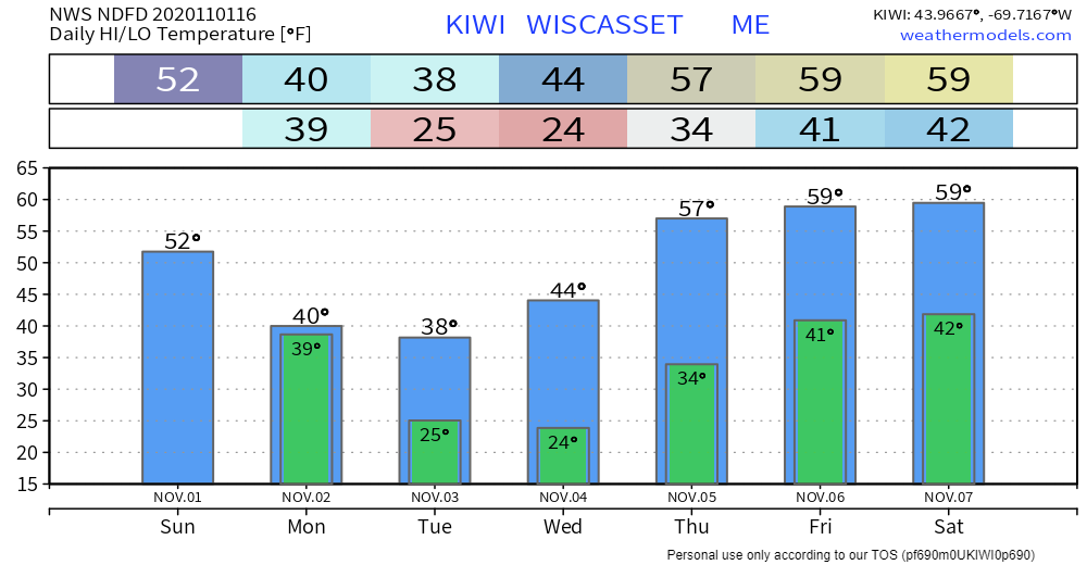
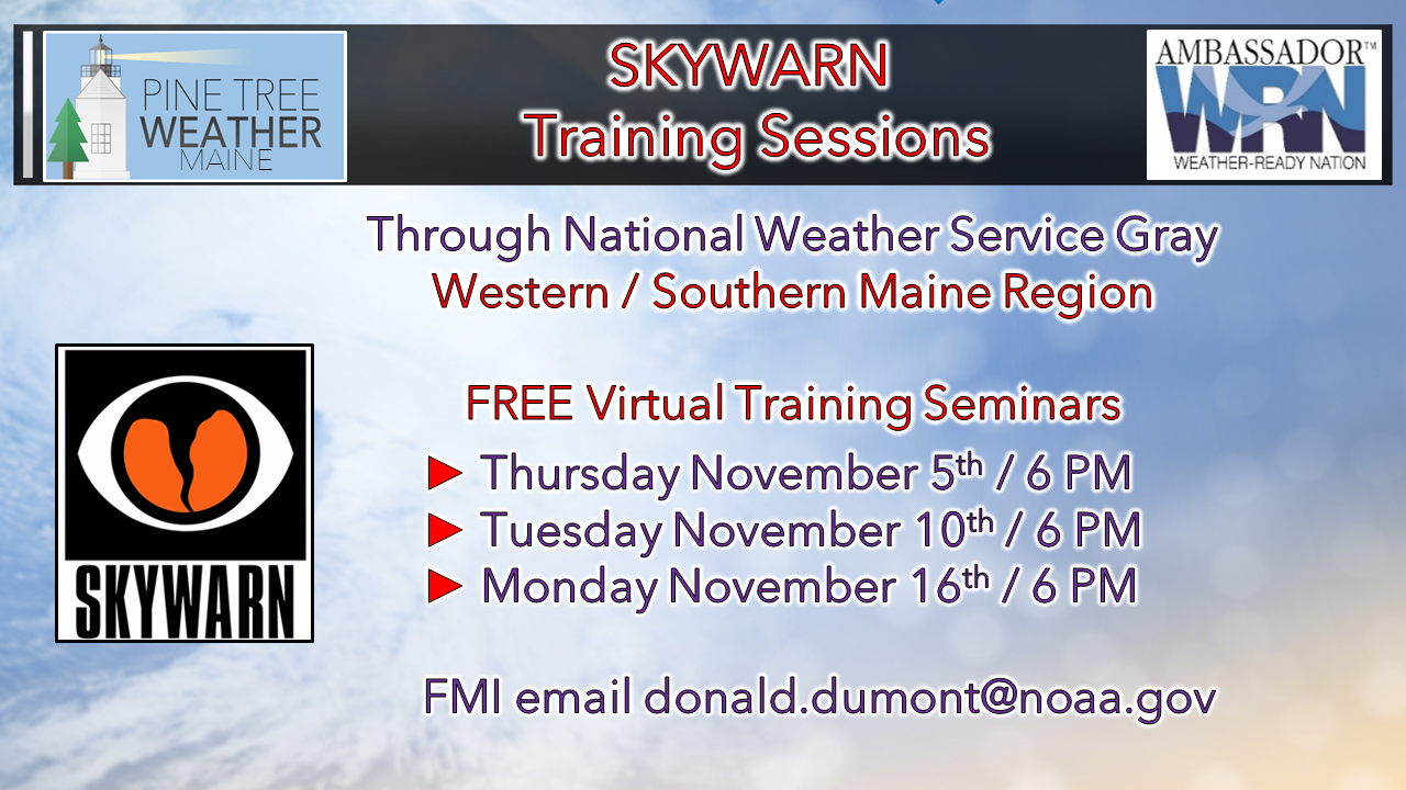
Rain changes to snow MondayA cold front passes through the state Sunday afternoon. Low pressure forms along the boundary offshore south of New England Sunday evening, moves northeast and intensifies on its way to the Canadian Maritimes. Rain showers for the region Sunday afternoon and evening begin to transition to snow early Monday. A weak clipper system slices through western and central New England early Tuesday, bringing another round of snow showers, primarily for the mountains and ending by mid-afternoon. Blowing snow will be a travel concern for the north country as the wind out of the northwest could exceed 45 mph for the higher elevations Monday afternoon into the evening. With the falling temperatures and rainfall amounts from a quarter to three-quarters of an inch may produce ice in spots for southwestern and eastern parts of the state Monday afternoon, also. Folks in all areas will need to bundle up as wind chill values in the single digits and teens are expected Monday. It gets marginally better on Tuesday as the wind decreases a bit, but wind chill values are anticipated to be in the teens and 20s through Tuesday evening. The snow will hang around for a couple of days in the north country until warmer temperatures work in later in the week. Temperature outlook through SaturdayAfter the round of rain and snow to start the week, high pressure takes over through the middle part of the week. As this arctic high moves east, there is a chance for rain for the region Friday as a cold front enters in from the northwest. The region can expect a round of temperature whiplash, as high temperatures are expected to be well below normal Tuesday, then well above normal by the upcoming weekend. Winter SKYWARN Virtual Spotter Training in November |
| BE PREPARED WITH A NOAA Weather Radio. For $20-$40, it could provide important information to you when you need it. The weather bands are standard on most public safety scanners, and newer scanner models. Weather radios can be programmed for auto alert. Click here for more information. |
| ► ► For the latest official forecasts, bulletins and advisories, please check in with the National Weather Service in Gray for western and southern areas, or Caribou for northern and eastern parts of Maine |
** FUNDING NEEDED FOR 2021 **
Thank you for supporting this community based weather information source that is funded by your financial contributions.
Stay updated, stay on alert, and stay safe!
- Mike
Mike Haggett
Kennebunk, ME
Weather-Ready Nation
Ambassador
Certified Weather
Forecaster
Penn State '21
American Meteorological Society
National Weather Association
SKYWARN-CWOP
Matthew 19:26
Please
Support
Pine Tree Weather
In 2024
Archives
July 2024
June 2024
May 2024
April 2024
March 2024
February 2024
January 2024
December 2023
November 2023
October 2023
September 2023
August 2023
July 2023
June 2023
May 2023
April 2023
March 2023
February 2023
January 2023
December 2022
November 2022
October 2022
September 2022
August 2022
July 2022
June 2022
May 2022
April 2022
March 2022
February 2022
January 2022
December 2021
November 2021
October 2021
September 2021
August 2021
July 2021
June 2021
May 2021
April 2021
March 2021
February 2021
January 2021
December 2020
November 2020
October 2020
September 2020
August 2020
July 2020
June 2020
May 2020
April 2020
March 2020
February 2020
January 2020
December 2019
November 2019
October 2019
September 2019
August 2019
July 2019
June 2019
May 2019
April 2019
March 2019
February 2019
January 2019
December 2018
November 2018
October 2018
September 2018
August 2018
July 2018
June 2018
May 2018
April 2018
March 2018
February 2018
January 2018
December 2017
November 2017
October 2017

