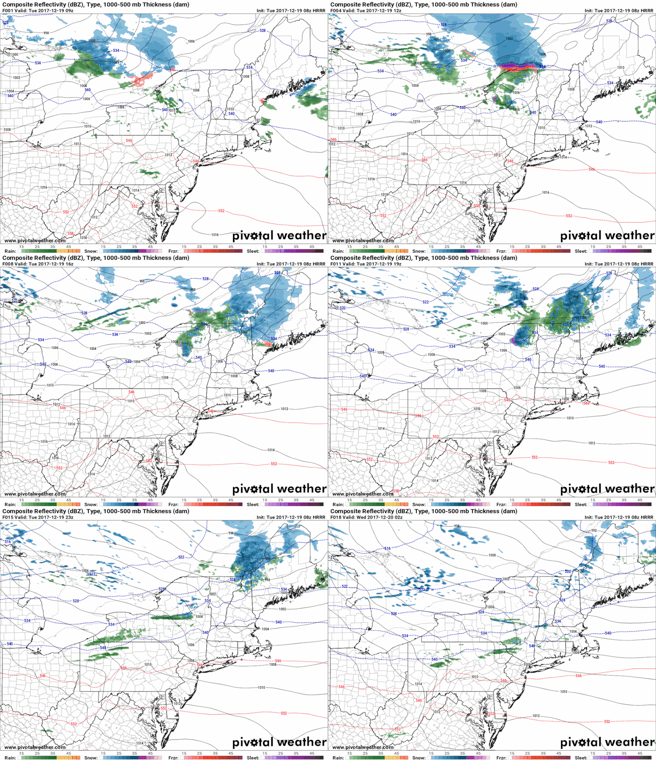
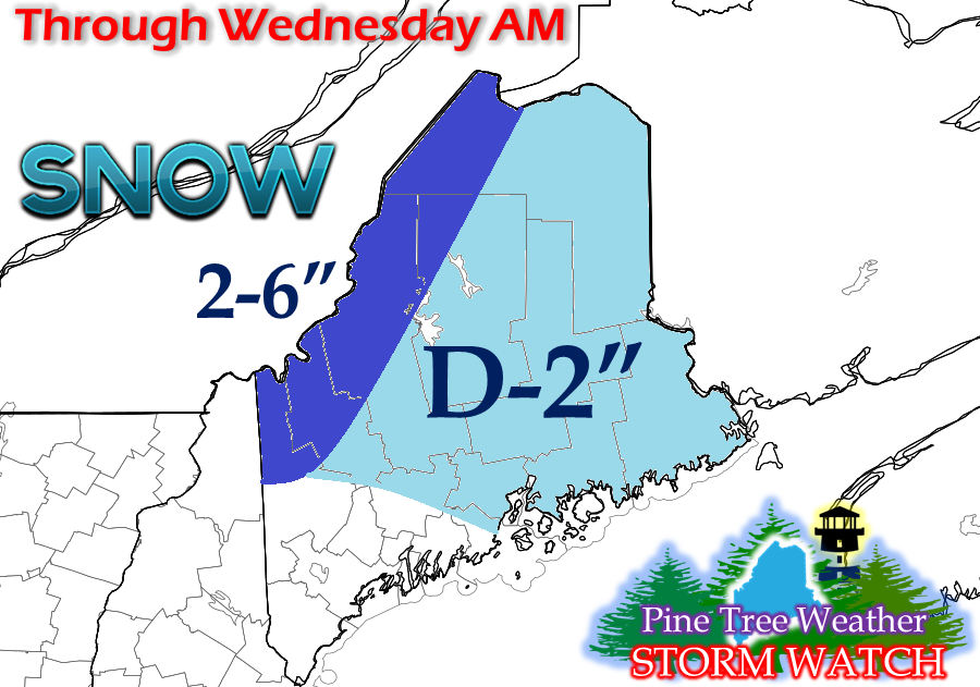
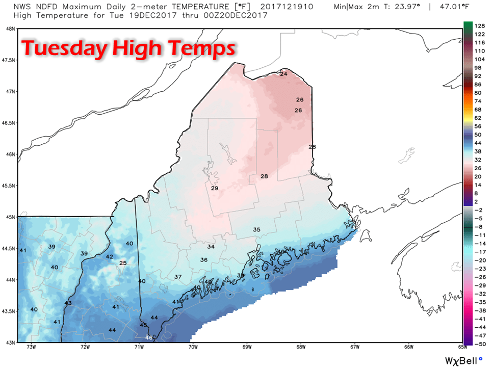
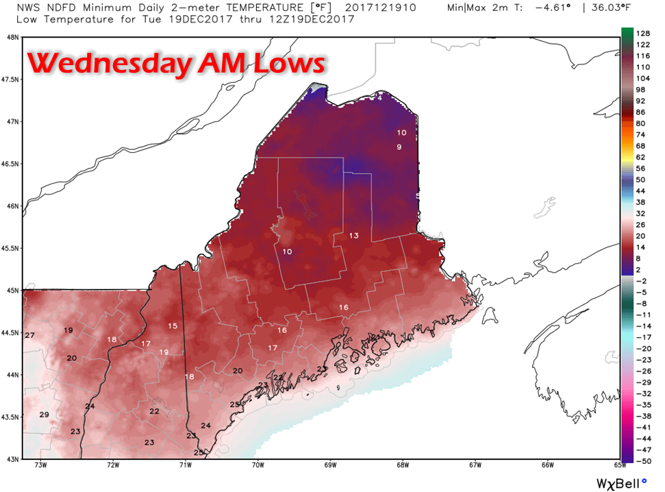
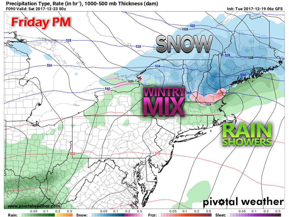
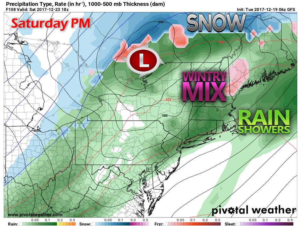
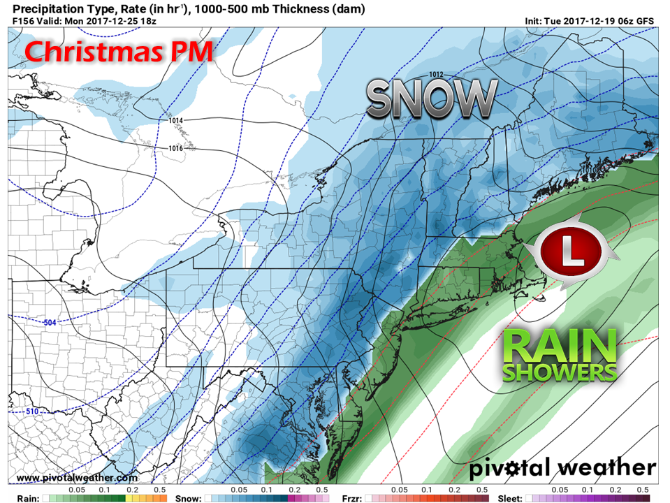
A brief rain shower / mix possible southFor Tuesday, it will be the time for the north to get in on the snow action as a cold front sweeps west to east across the region today. With warm air nosing in over the south and east, there is a chance for a brief rain shower or freezing rain pending on surface temperature. As discussed yesterday, precipitation appears to stay north of the Route 25 corridor between Parsonfield and Portland. The heavier snow falls appears to fall over the international border with Quebec. I expect higher elevations around Katahdin to do well with this also. The ski hills have a nice treat heading into the holiday weekend. For the more populated areas of the south and east will benefit with some above freezing temperatures for the day to help clean the streets up of some ice and snow. For the mountains and north, the mercury will flirt with 32° with cooler highs projected for the crown. For areas that do thaw out Tuesday will see it freeze back up Tuesday night. This may create some untreated slick spots on roadways, parking lots and sidewalks going into Wednesday morning. Outlook into the holiday weekendChristmas weekend starts off with the chance for snow Friday. For what now appears to be an "inside runner" event kicks off with snow for the state during the day. Cold air damming will play a role in precipitation type heading into Saturday. I will forewarn that there is plenty of time for a track shift with this one. The key element of this forecast chart that I believe is on the right course is the potential for sleet and freezing rain for interior areas. Where you see green, just think cold air damming may get a final say in all of this. Models and cold have a tough time agreeing with each other, and for an event this far out, there are reasons to be skeptical. Christmas Eve Sunday appears to be the best day of the weekend for travel. For those inviting friends and family in for the holiday, you may want to consider your guests having an extended stay. Guidance is in good agreement for a storm Christmas Day. Way early to get into specifics, but confidence for now is good to expect a weather event with some sort of travel impact to occur. The 5-Day Outlook page has been updated through Sunday. You can click on the link above to get you there. Personal noteTo make you all aware, my father-in-law is not doing well. At the time of this post, I am not sure how this is going to play out. My family has endured the loss two dear family members unexpectedly in the last 13 months, and we could be dealing with a third one on short notice. We had a trip planned for the holiday weekend that may or may not happen at this point. The short of it is I am taking everything day by day and moment by moment for now. If I drop out of sight, you'll know why. I will try my best to keep you updated, but family comes first.
Any prayers and words of support would be appreciated. - Mike |
Mike Haggett
|

