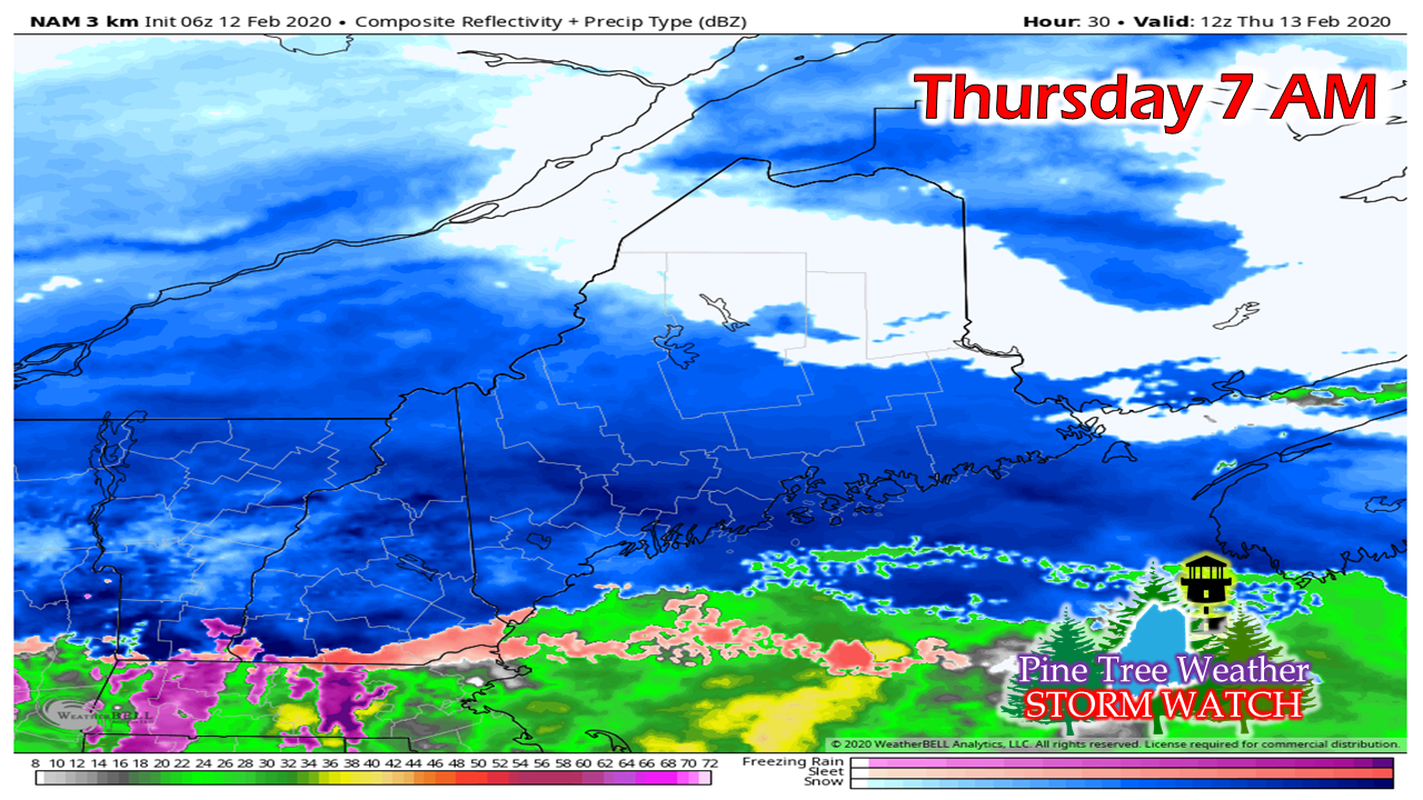
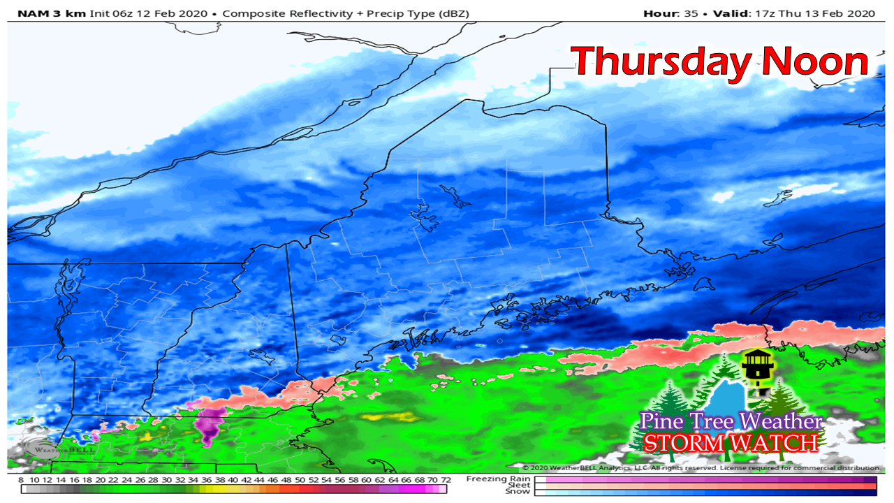
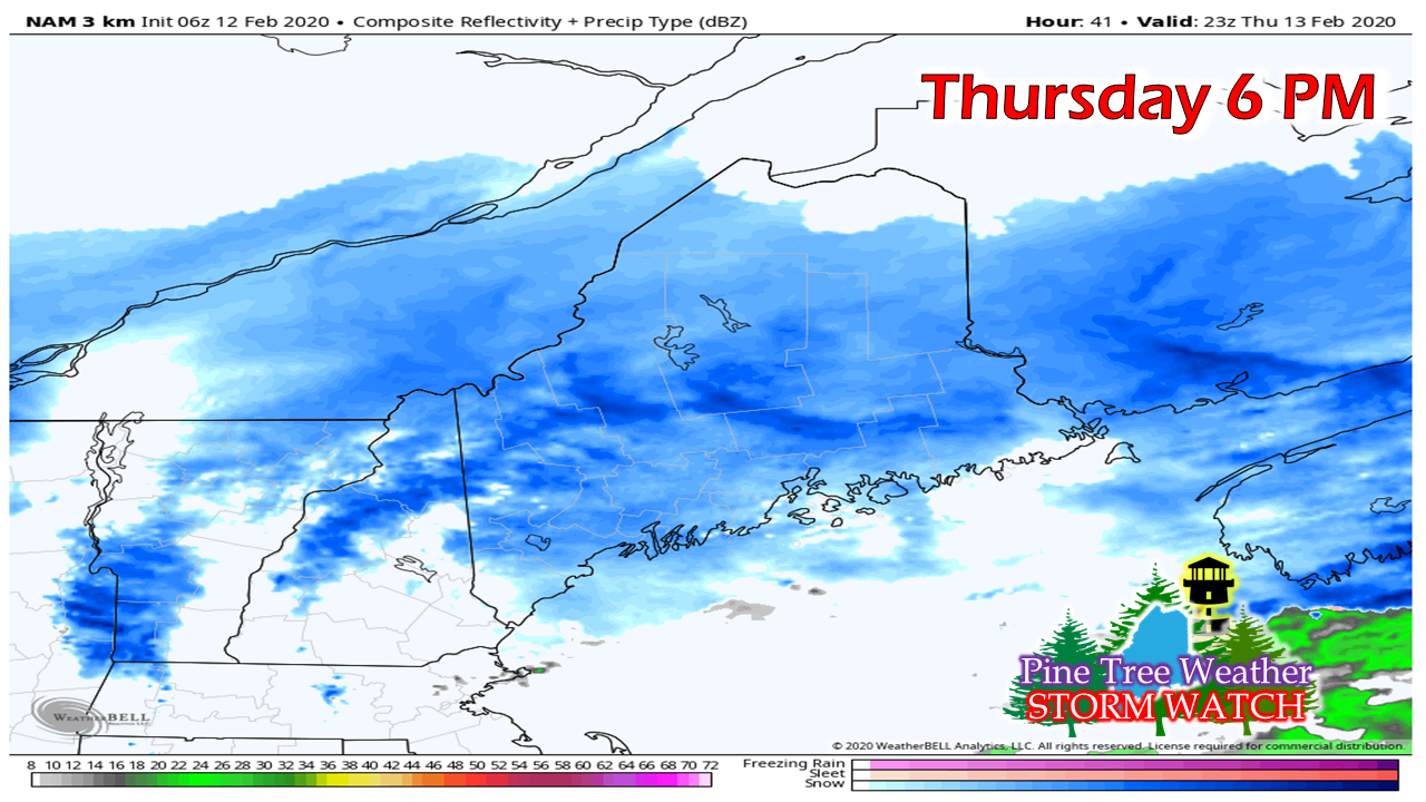
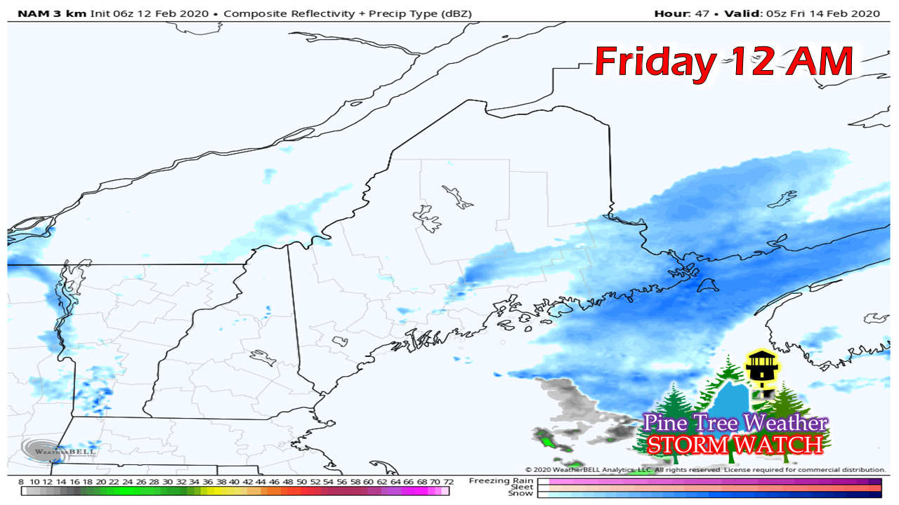
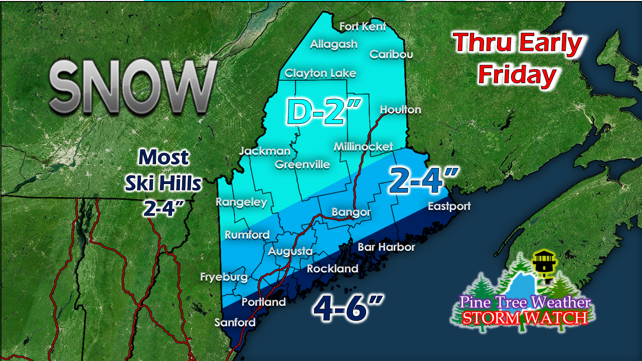
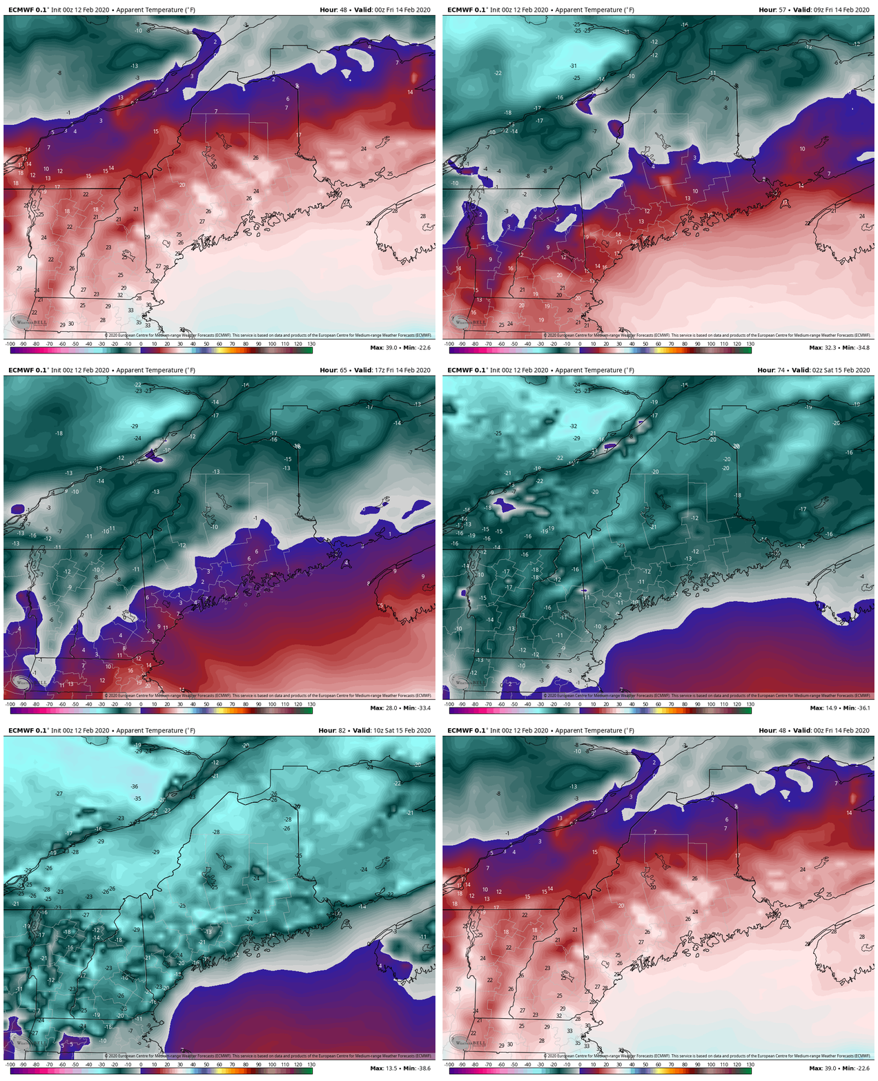
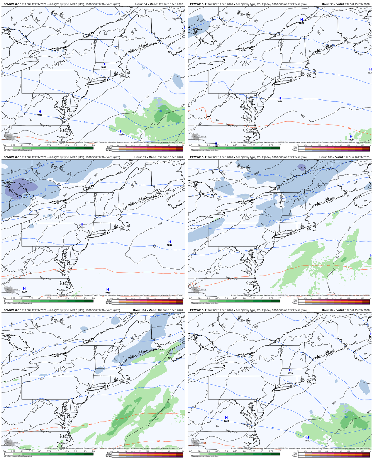
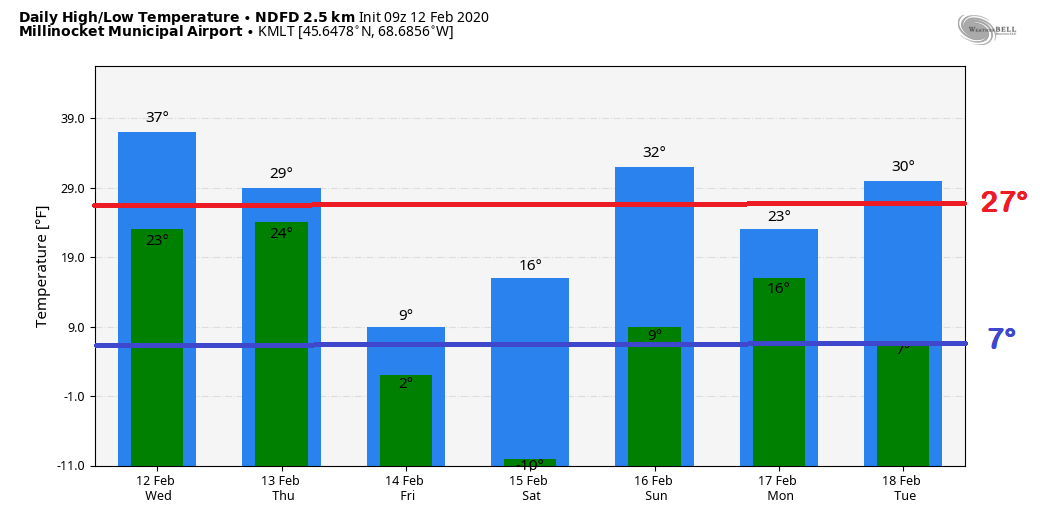
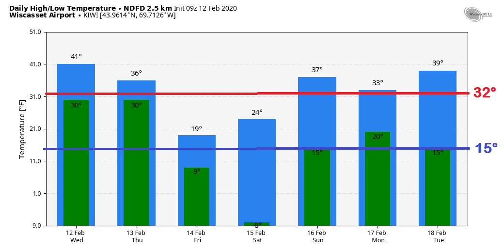
Winter is winteringIt continues to look like a garden variety snow event for the state on Thursday, It won't be anything major, but it will be enough to create some slick spots especially on the roads less traveled. After that, a solid shot of arctic air moves in to start the weekend. Temperatures rebound starting on Sunday. Timing and snow amounts for ThursdayThere is good chance most of the state will have to brush off the windshield before heading out the door Thursday morning. Plan for extra time to get to where you are going, and keep the broom handy to clean up as you head home. Storm type is another one of those flat, elongated low pressure systems which are disorganized and have a mind of their own, to a certain extent. This one progresses fairly quickly. There may be some banding that sets up, but by-in-large this is just a slow, steady, manageable snow event for the snow removal crews. Far southern areas may get clipped with a bit of a mix as warm air tries to nose in aloft around midday. Low pressure slides east Thursday afternoon. A cold front drops down from the northwest which continues snow shower activity through the evening commute. Snow showers gradually taper off Thursday evening, and end over eastern areas in the wee hours of Friday morning. No real changes in thinking on snow amounts. The ski hills should do well with this one. Load up the wood rackAs the cold front passes through the region Thursday afternoon, the wind shifts to the northwest and brings in the coldest airmass of the season. There could be some blowing and drifting of snow around on Friday, before high pressure settles over the region Friday night. With clear skies and radiational cooling, many areas start Saturday below zero and for interior areas, the mercury may fall between -40° and -30°. This is going to hurt. High pressure moves to the east Saturday afternoon and a ridge works in from the west. Moisture along the periphery of it brings some snow showers to parts of the state Sunday morning, with light accumulations possible. Temperature outlookThe outlook for Millinocket through early next week is about average overall when the numbers are all added up and divided. The same could be said for Wiscasset. After the bitter cold start Saturday, temperatures bounce back to slightly above normal through Tuesday.
► ► For the latest official forecasts, bulletins and advisories, please check in with the National Weather Service in Gray for western and southern areas, or Caribou for northern and eastern parts of Maine. ► ► Due to a revised budget there is a $125 shortfall for the year ahead! You can help keep Pine Tree Weather going with a donation of ANY amount now through VENMO @PineTreeWeather, a monthly donation on Patreon or messaging me on Facebook or Twitter to send a check in the mail. Thank you for your support! For more information from me, please check the Pine Tree Weather Facebook page as well as my Twitter feed. Always stay weather aware! - Mike |
Mike Haggett
|

