
The train is rolling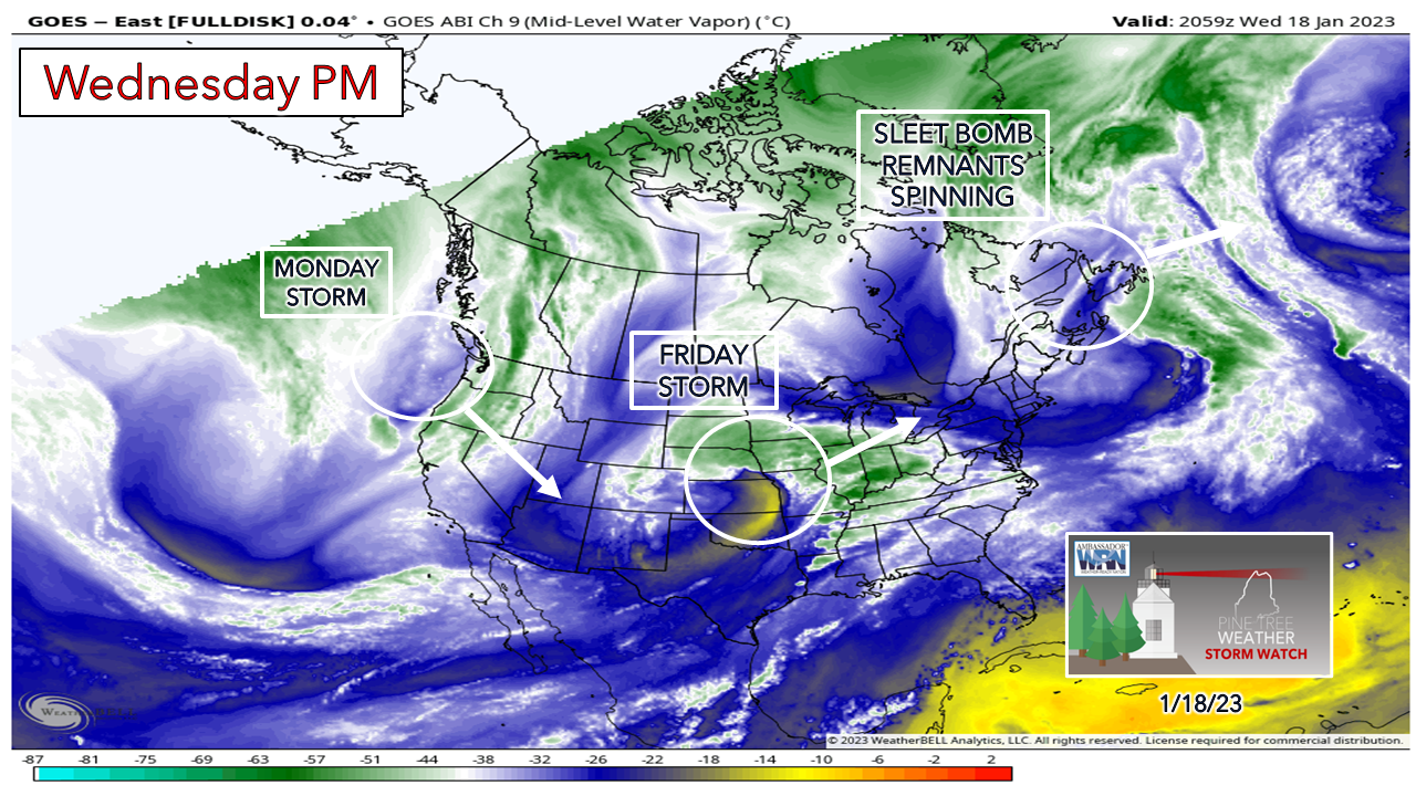 Things for your "to do" list: check the washer fluid in your car, make sure you have plenty of salt and sand stocked up, back pain medication, and have your storm supplies well stocked. While Old Man Winter has been relatively quiet around here outside of the recent sleet bomb and the parade of junk storms, he's humming a tune and clearing his throat and is about to unload. The appetizer comes Friday. The main course comes Monday. Then we'll see if desert comes mid to late next week. For the Facebook followers, if you have yet to turn on page notifications, I suggest you do. Click on the page and see the pinned post there. For my Twitter peeps, my latest update is pinned at the top of my profile page. Algorithms are a pain. Friday's stormThe ideas have shifted a bit north and the surface low intensity has bumped a couple millibars, so consequently there has been some changes. 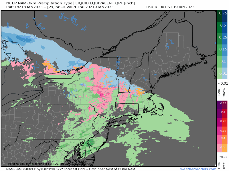 Thursday 6 PM to Friday 6 AM - The idea that a good portion of the snow will be down over southwestern areas is still true. It will be a mess to start the day over the south. Bangor will just be getting into it as the sun comes up. 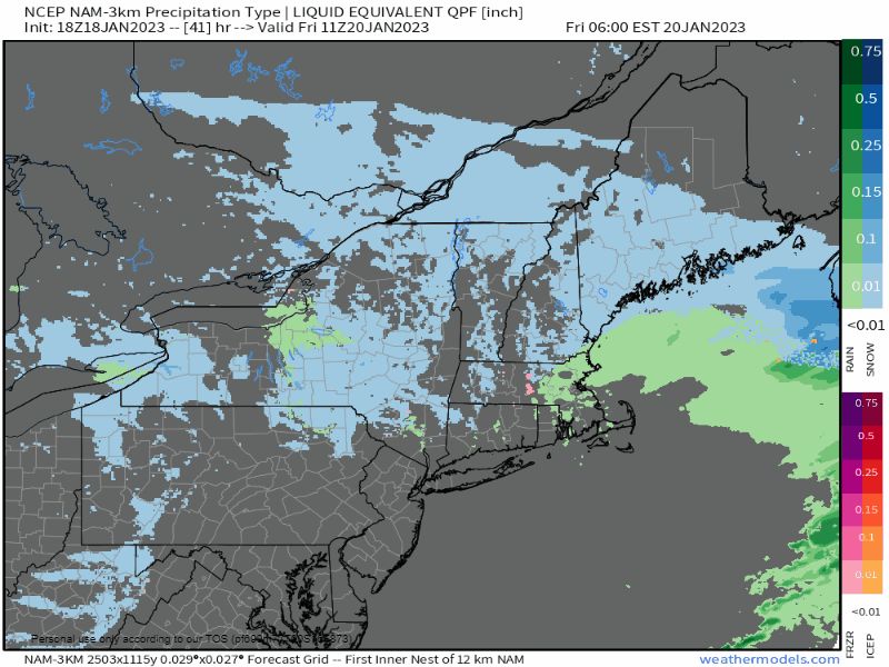 Friday 6 AM to Saturday Midnight - Snow is expected to continue through the morning and then gradually diminish from west to east late day into Friday evening. For snow removal folks, this may be annoying to you and make your day longer. Snowfall amounts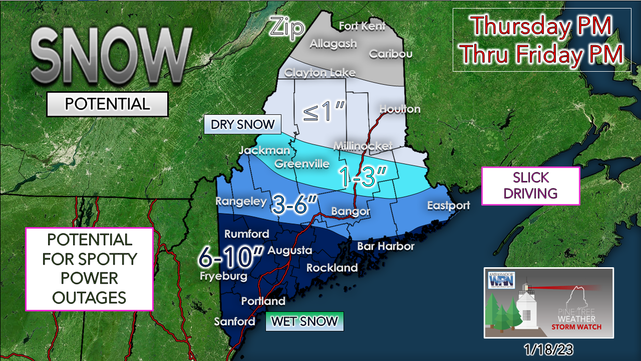 With the bump northward, a wetter snow is expected. Closer to the coast, the stickier it gets. Hence the potential for some power outages. Where the snow sticks may stay stuck until Sunday as temperatures are expected to be below freezing over much of the southwest interior. Temperatures are expected warm up on Sunday for the coastal plain which -hopefully- gets most of this off the trees and power lines ahead of the storm on the way for Monday. That will be important. The western ski hills will do well here with 6-10" on the summits. As far as bust potential, I fretted with this snowfall idea all afternoon as I was trying to sniff out a coastal front with guidance that could throw a wrench into this. The forecast storm track is virtually due east and south enough which limits the influence of the warm ocean for the most part. If the track moves a bit further north, then southern York County and the shorelines communities east of the Turnpike to Portland may end up in the 3-6" range of slop. There could be a bit of sleet mixing in in that area, but most people will be in bed and may not even notice it when go out to clear it Friday morning. The wet snow will compact the wetter it is, and that may look like less has fallen. The melted down liquid involved here is in the 0.6-1" range for the coast. As always, where the banding sets up may bring bonus amounts. Where the banding misses would bring lesser amounts. If you get short changed on this one, Monday is coming. I am not sure if this track done inching northward as of yet, so there may be some subtle tweaking to this. Monday could be a corker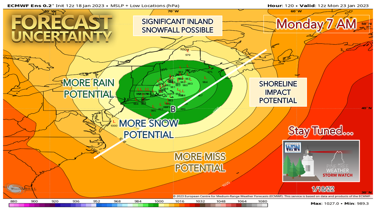 This one concerns me. This could be a high impact storm the way ideas are now. Astronomical tides will be at their peak, so the timing of this will be critical. I don't see where the coast escapes without some sort of impact, it's a question of how bad. 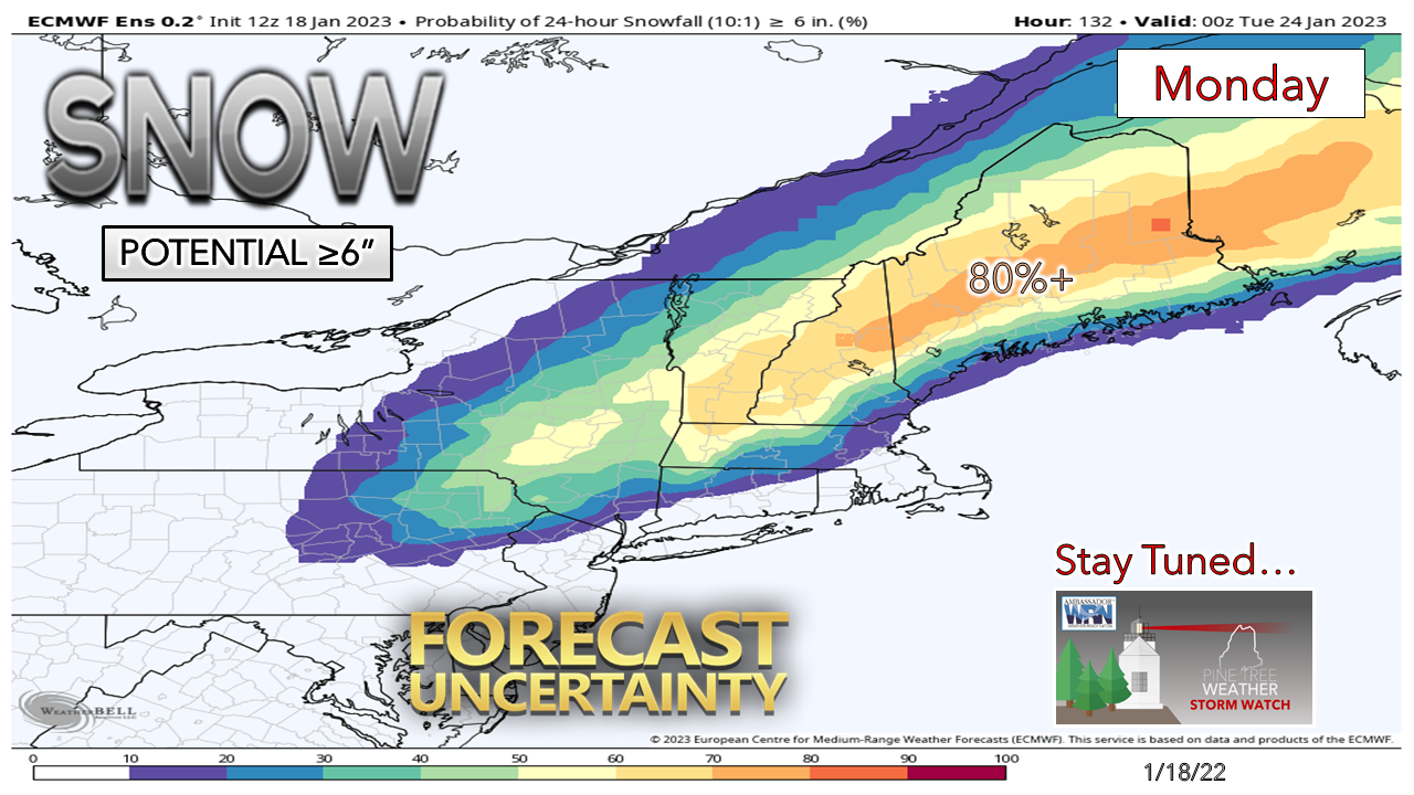 The kids in school may end up with a four day weekend where they cancel on Friday. This idea of potential for 6" or more of snowfall shows a strong probability of that, which means 12+" amounts can't be ruled out here. With a track in the Gulf of Maine, wet snow is a concern, along with wind, and potential for power outages. Stay tuned!  Temperature outlook through Monday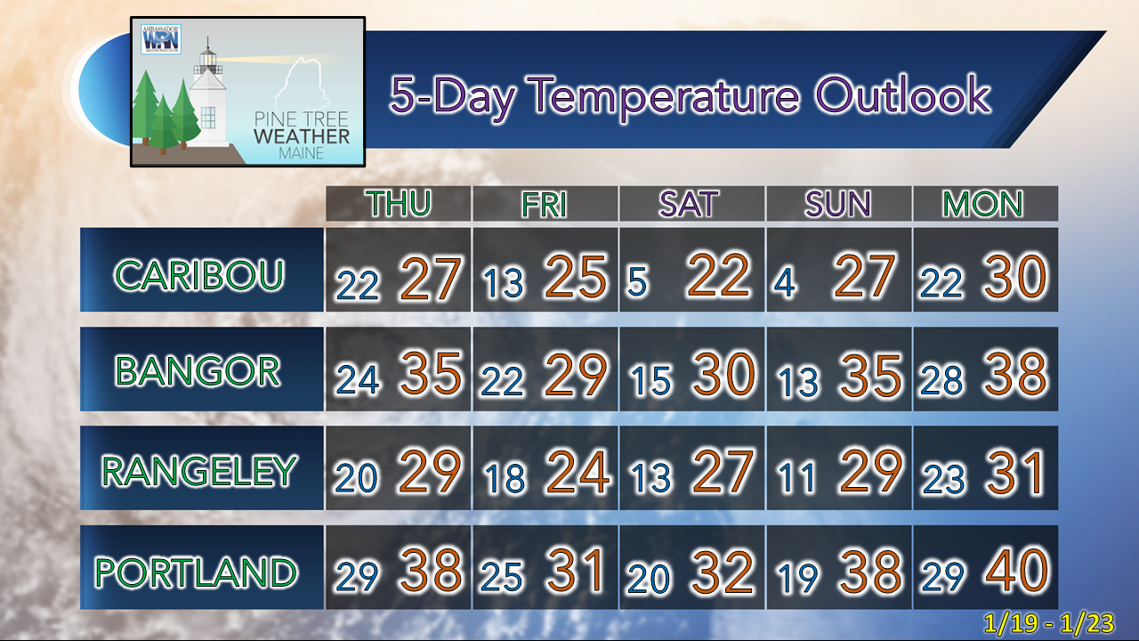 Thank you as always for your support! You may not like the weather, but I hope you like what I do! Please hit the like button on Twitter and Facebook, and share! Financial donations to fund what I do are always appreciated! Stay updated, stay on alert, and stay safe! - Mike NOTE: The forecast information depicted on this platform is for general information purposes only for the public and is not designed or intended for commercial use. For those seeking pinpoint weather information for business operations, you should use a private sector source. For information about where to find commercial forecasters to assist your business, please message me and I will be happy to help you. |

Mike Haggett
|


