
Two weather stories, one state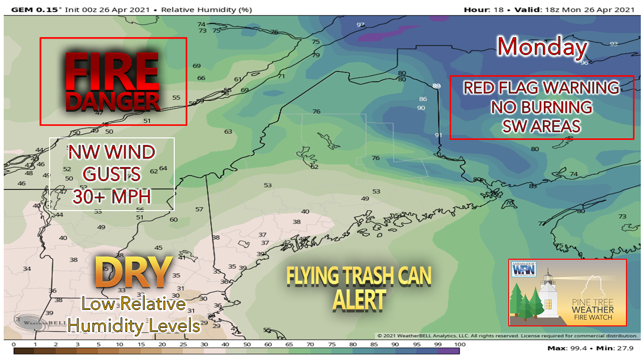 For those in southern areas, make sure any loose objects are secure and fasten the covers to your curbside trash cans. With low humidity values and gusty winds, a red flag fire warning has been issued. No burning of any sort is allowed. For northern areas, snowflakes are likely to be seen. Ah, spring in Maine! 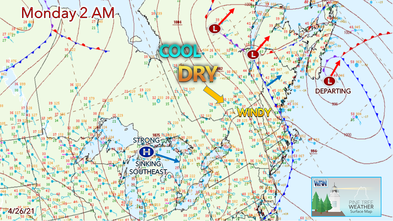 A cold front works through the state Monday morning. Dry, cool air and gusty west/northwest winds trail in behind it. A strong area of high pressure to the west slides southeast. The wind speeds settle down a bit overnight, but Tuesday will remain breezy until the evening. 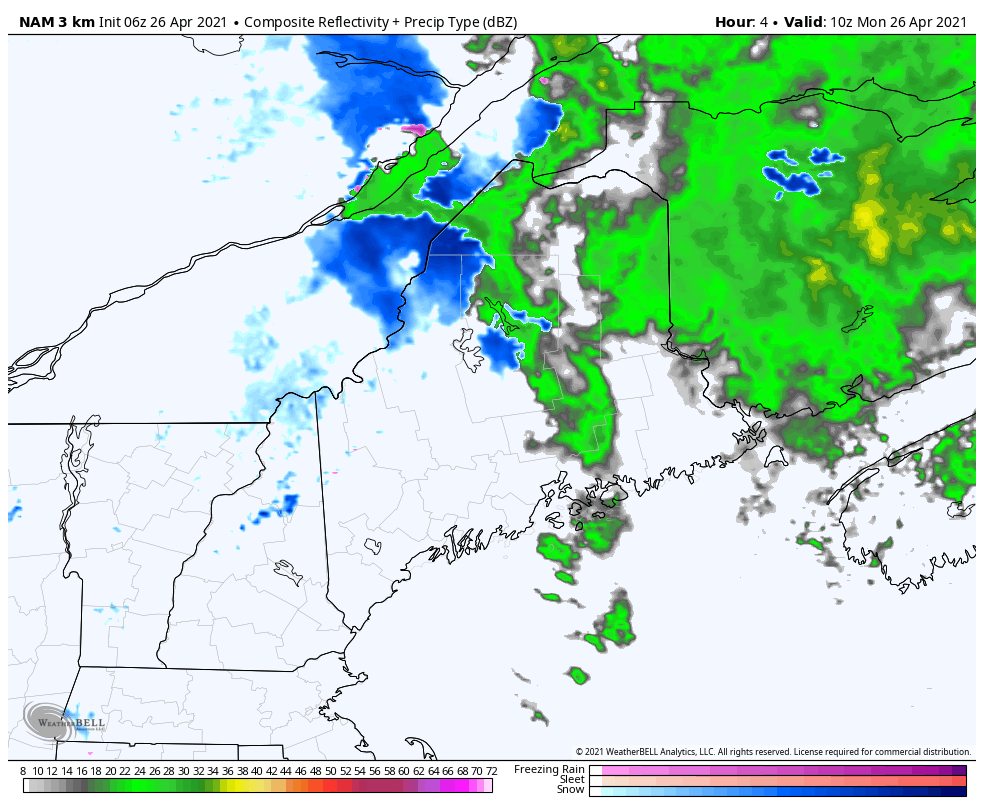 Any rain showers convert to snow showers over northern areas. Some parts of The County may pick up a coating to 2" of snow through early Tuesday. The storm departs Tuesday morning and brings improvement there into Tuesday afternoon. Unsettled outlook Wednesday onward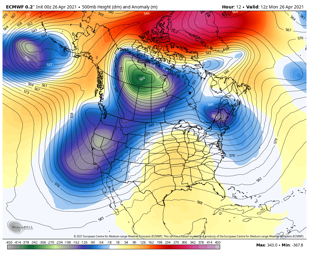 The good news is the blocking cold aloft has broken up over the north pole, which is a fair indicator that spring is well underway. The bad news is what cold pockets are around could still bring the chance for interior snow and frost/freeze threats statewide as we head into early May. The first of May is the latest average frost day for southern areas, May 13th for northern areas. 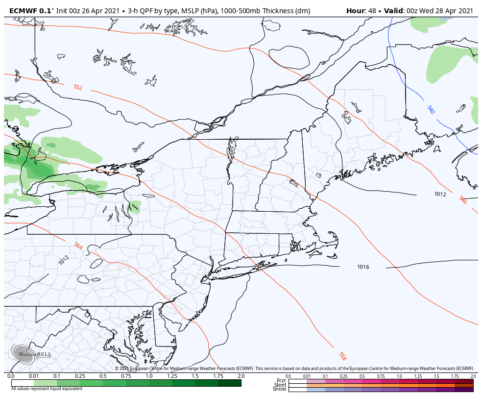 As the week progresses, a ridge from the southwest pushes a surface warm front into southern New England. With the cold lurking to the north, this sets up the chance for showers and thunderstorms over southwestern Maine on Wednesday into early Thursday. 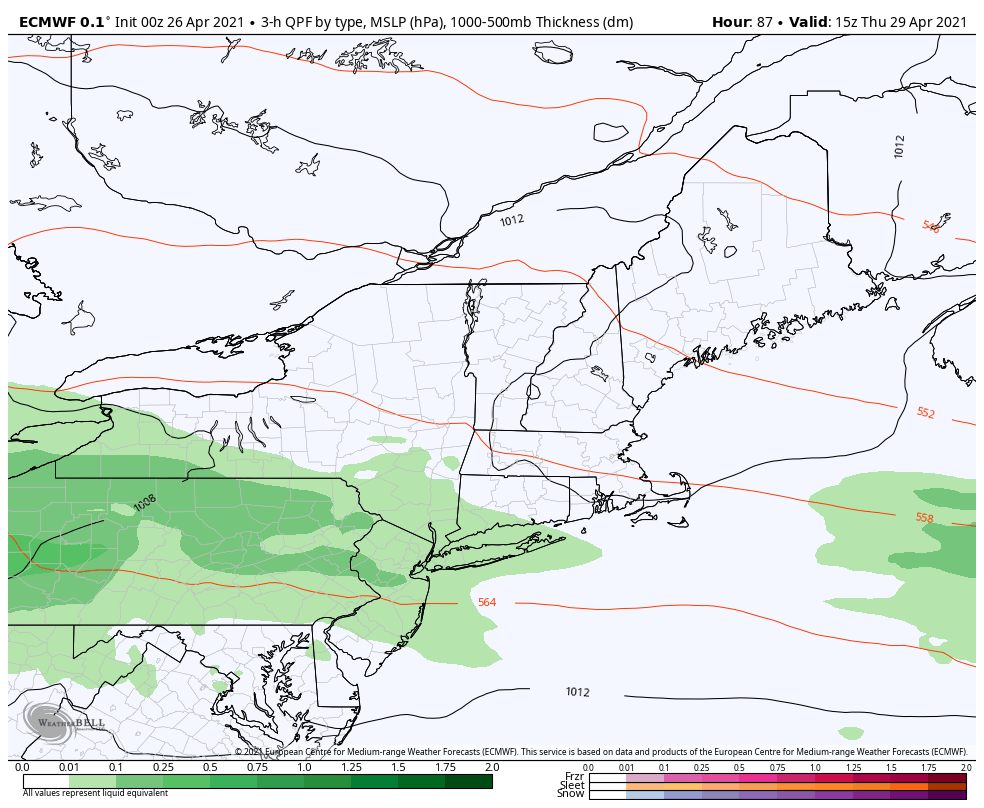 Warmer air tries to advance northeastward Thursday and keeps showers with a chance for thunderstorms through Friday. A strong area of low pressure may form along the front and bring cold air far enough south to bring a chance for snow for interior areas as we start the weekend. Red Flag Warning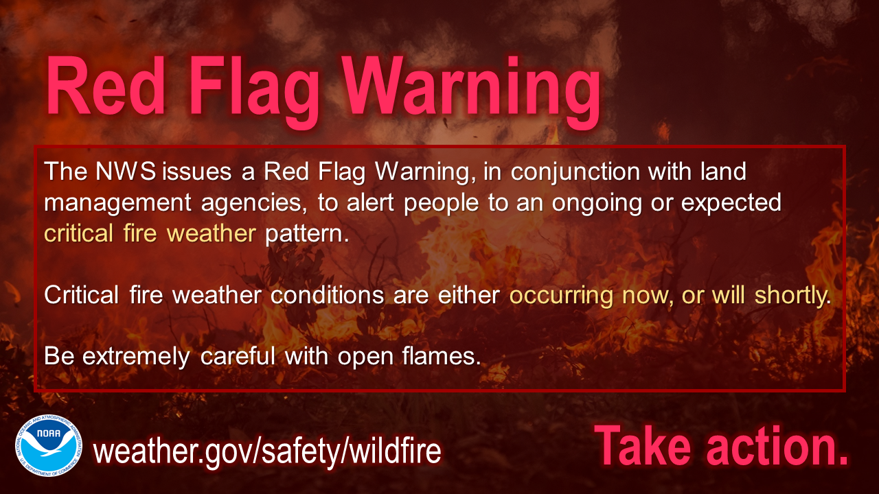 The NWS issues a Red Flag Warning, in conjunction with land management agencies, to alert land managers to an ongoing or imminent critical fire weather pattern. If a Red Flag Warning is issued, it means critical fire conditions are either occurring now, or will shortly. For more information, visit weather.gov/safety/wildfire-ww Seven-day temperature outlookTemperatures appear cooler than normal for daily highs in the north and slightly warmer than normal south to average it out to near normal overall. While Tuesday will be breezy in the south, it will be the pick of the week for high temperatures. 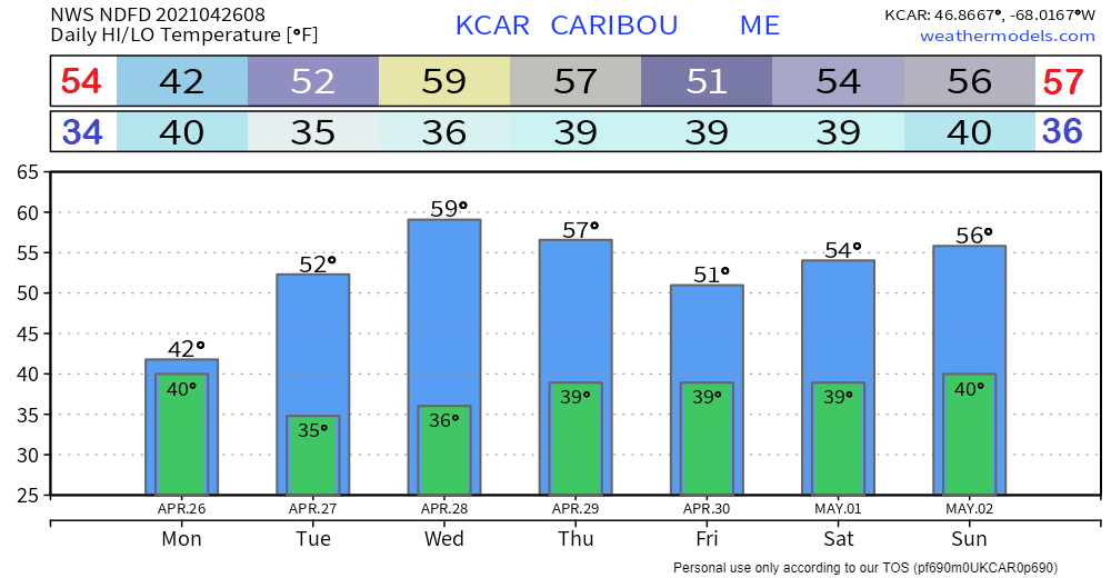 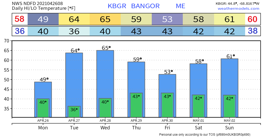 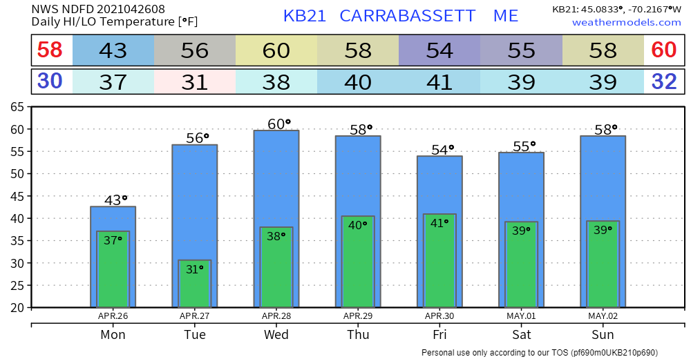 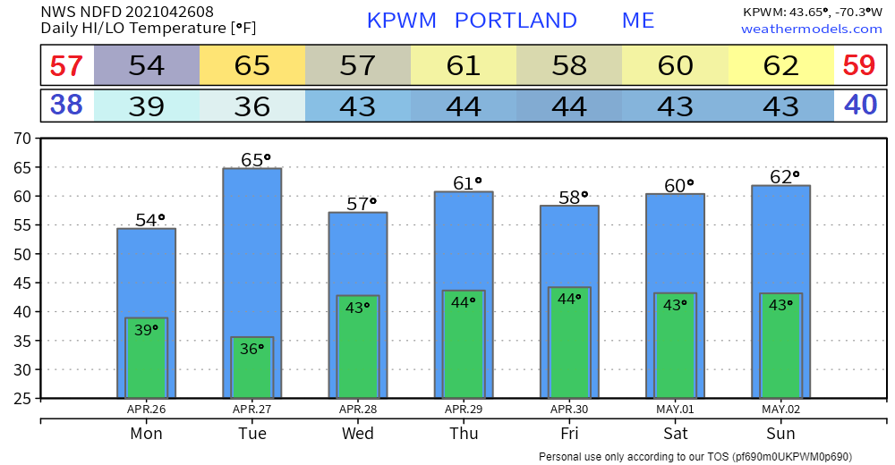 Be prepared to receive alerts and stay updated!
For more information in between posts, please follow Pine Tree Weather on Facebook and Twitter.
Thank you for supporting this community-based weather information source which operates by reader supported financial contributions. Stay updated, stay on alert, and stay safe! Thank you as always for your support! - Mike |

Mike Haggett
|


