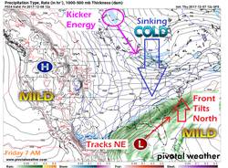
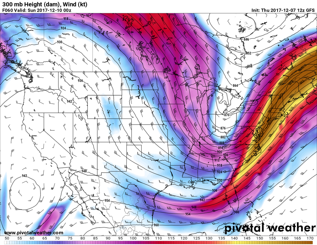
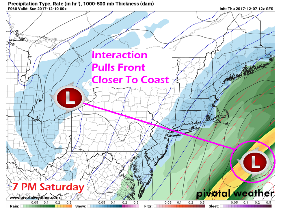
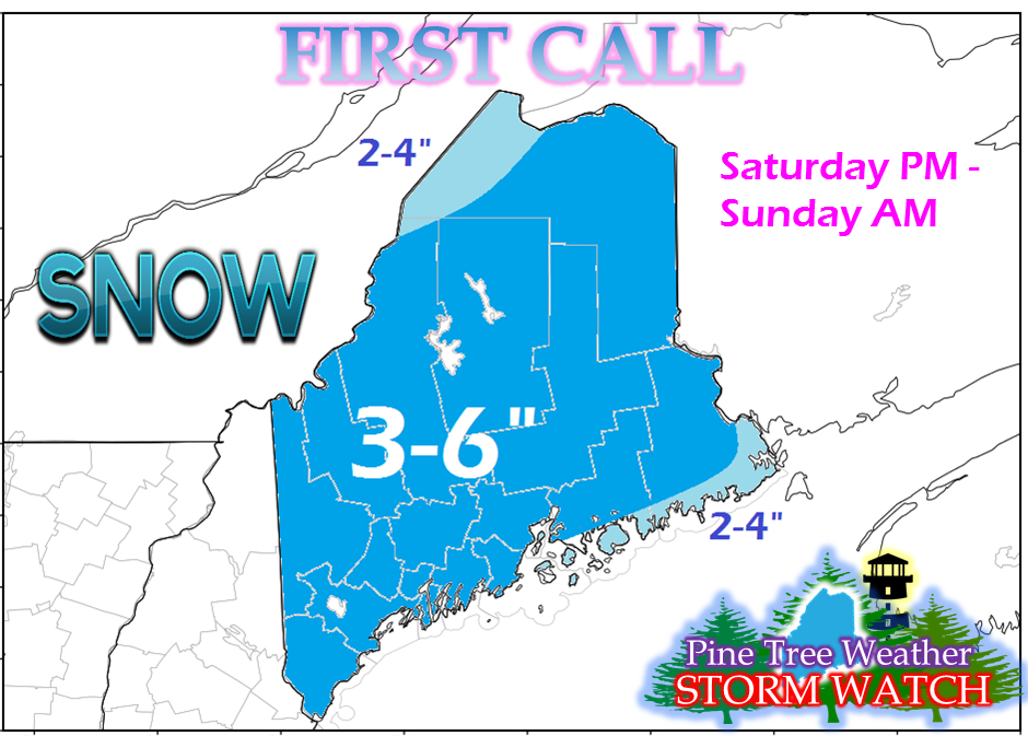
The scenery is about to whiten up The stage will be setting up Friday for the first widespread snow of the winter across Maine. In last nights update, I mentioned the kicker energy that was then in Siberia held the cards in how this would play out. That is exactly what is going to happen. In this chart, the influence of that parcel of energy is just beginning to show itself in the form of light snow over northern Manitoba. As the races south bringing cold air with it, that will tilt the front over the south northeastward Friday night into Saturday. Clouds increase Saturday with snow arrivingThis is quite the set up here. The polar jet drops down and picks up the subtropical jet, which will hold in the cold and bring moisture from the Gulf of Mexico up with it. That puts the northeast in the cross-hairs in the battle of the atmosphere. The strong ridge out west that is causing the horrific wildfires isn't going anywhere anytime soon, and neither will the cold with the trough over the east. By Saturday evening, most areas will see flakes falling from the sky. Surface low pressure associated with and upper level low interacts with low pressure riding along the front. That entanglement draws the front closer to Maine, and the result is widespread snow. Snow begins Saturday evening and will become heavier overnight into Sunday morning, tapering off to snow showers and flurries from mid to late morning, ending for most by around late morning to early afternoon. This snowfall forecast is preliminary and subject to change.
In my post last evening, I mentioned that Mid-Coast on up into Southern Aroostook could see the greatest chance of snowfall. That remains on the table. The 3-6" posted here over much of that region, may increase higher. The forecast is still on the tricky side due to the influence of the upper low to the west and the surface low to the east. There remains the possibility that the front could be brought in even closer, pushing snow amounts higher for interior areas, and perhaps a slushy mix for the coast. How far south the mix occurs will be dependent on the position of the front. For now, DownEast areas over to the islands of Penobscot Bay are in that potential area. This is NOT the final answer. I will be busy handling some personal matters as well as doing some announcing for a basketball tournament Friday and Saturday, which will make updates sporadic. I will do my best to keep you posted, but please also stay in touch with the National Weather Service for any official bulletins and forecast updates. Click on the 5-Day Outlook page for the latest regional outlook for your area through Tuesday. - Mike |
Mike Haggett
|


