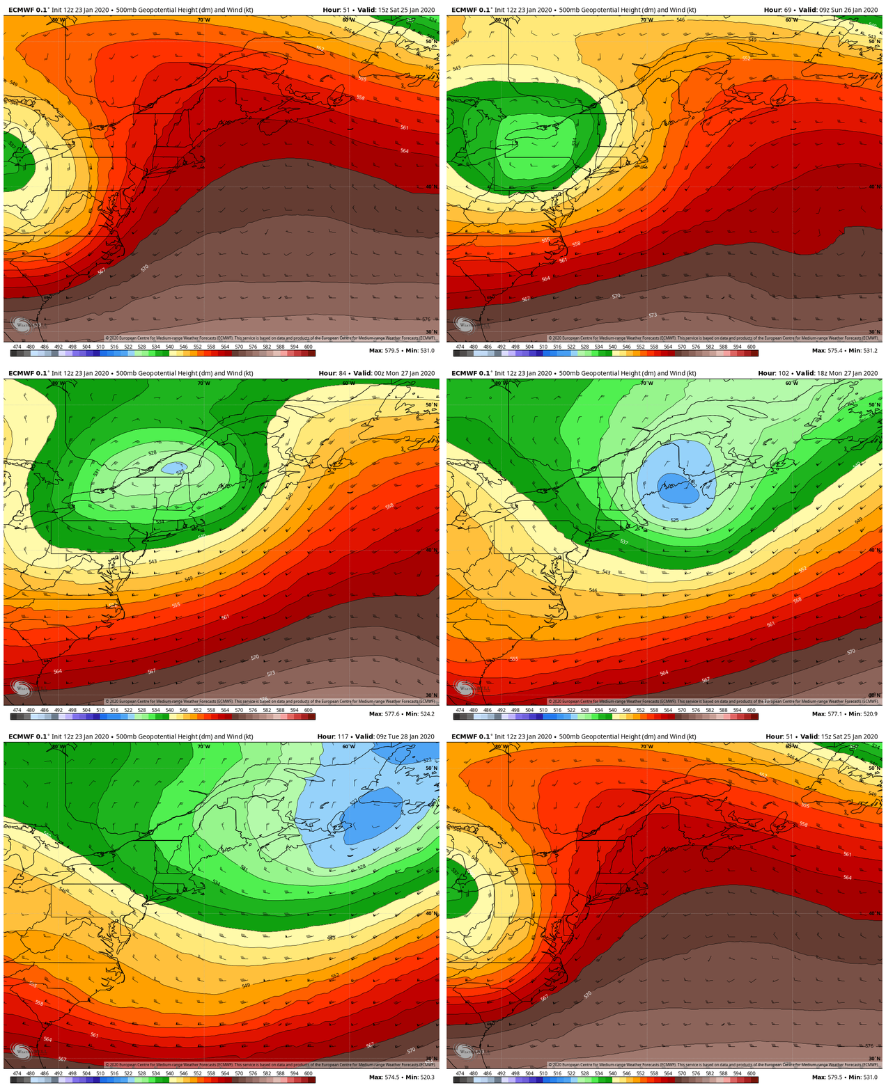
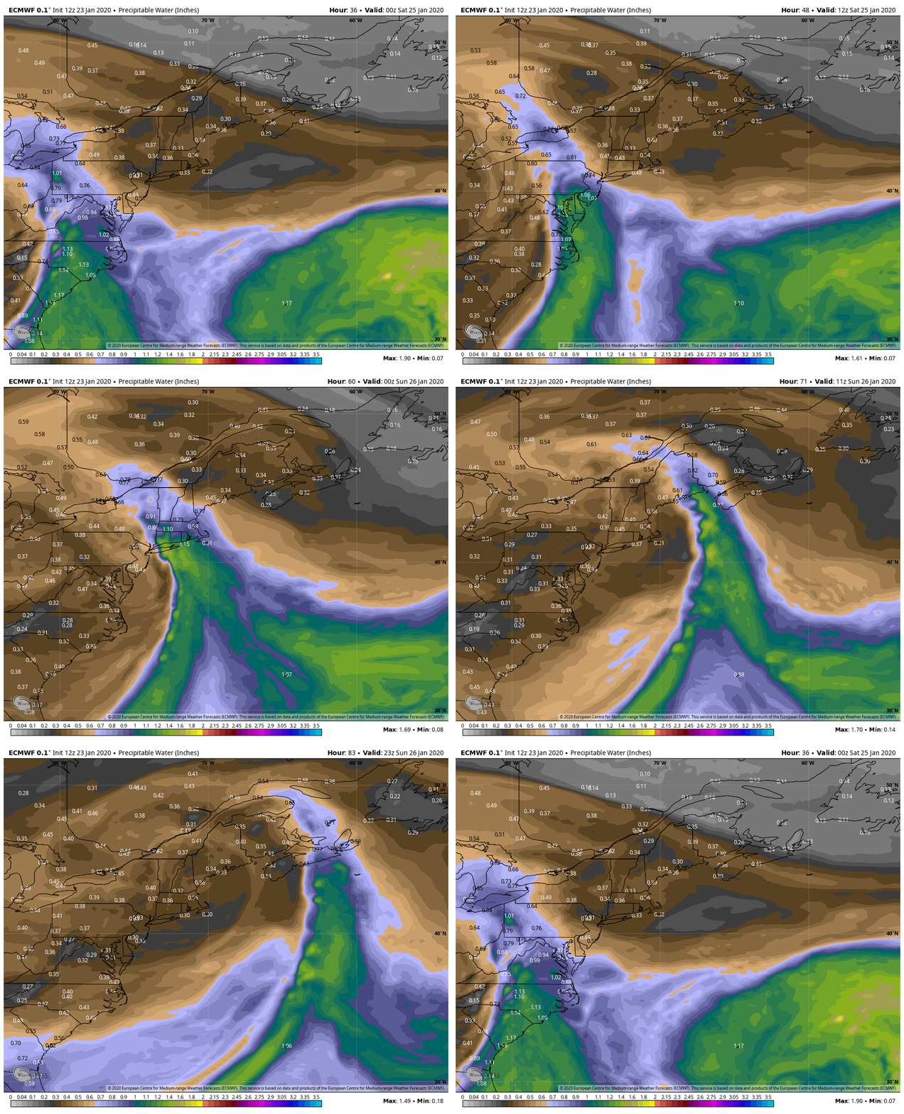
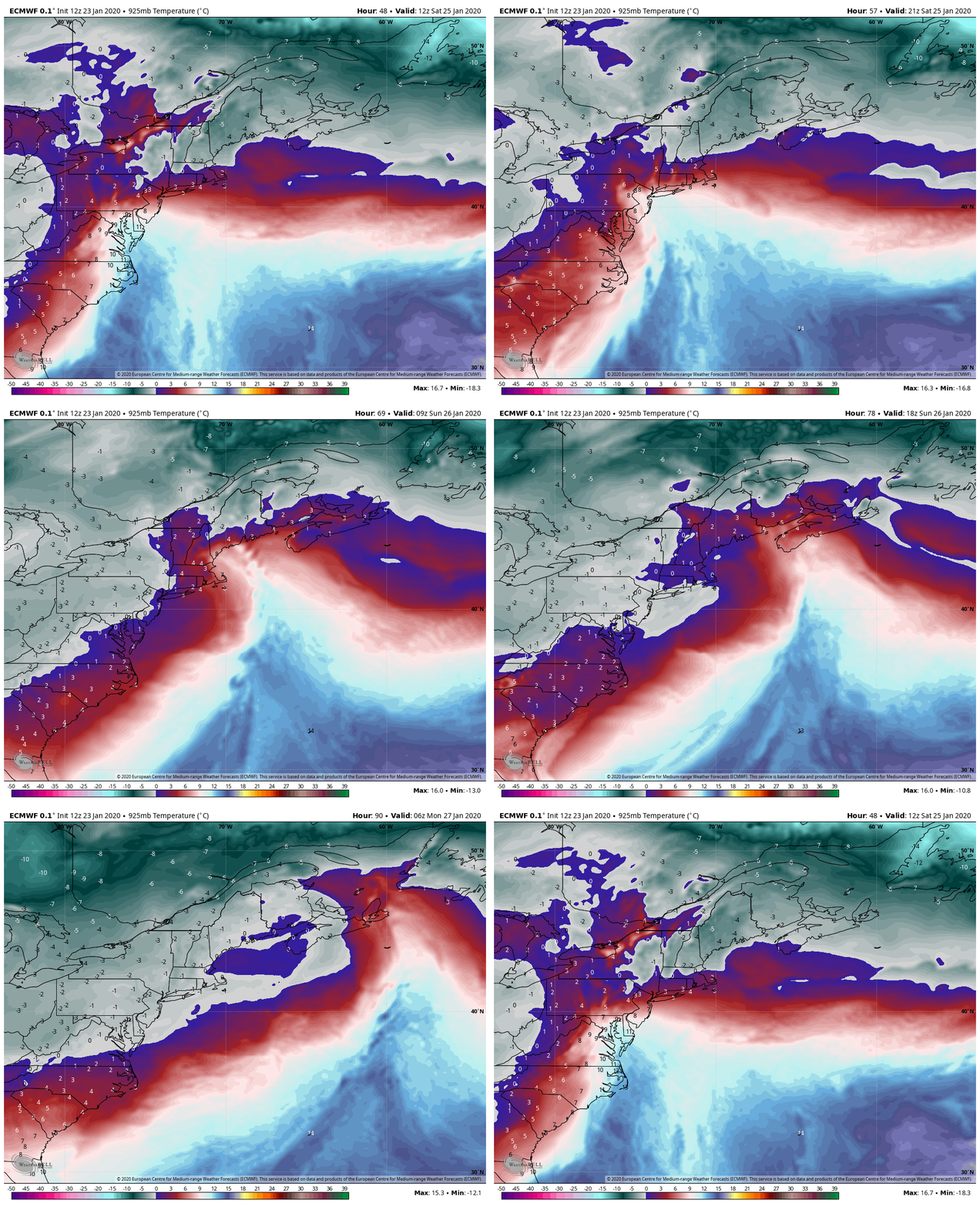
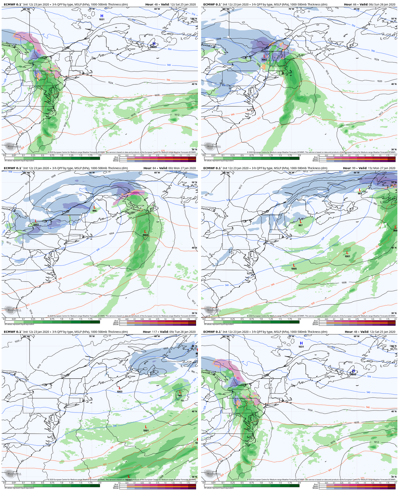
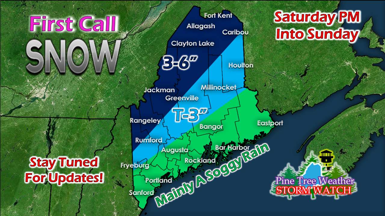
A tricky upper low holds the cards on this oneI've been banging my head against the wall all afternoon to try to come up with a graphic to best explain this one without causing confusion. The scenario is this: A cut off upper level low is expected to cross through the area. As I said in a previous post, these cut off upper level lows have a mind of their own, and are tricky to forecast. Like cold air, these upper lows will do what they want, so be aware of that, especially in interior areas. This system is expected to bring precipitation to the area, beginning late Saturday afternoon over southern and western areas and will overspread the state Saturday night into Sunday morning. Attached to the upper low is a surge of tropical moisture. While coastal areas can keep the shovels idle, there is a good chance for ~1" of rain from this. With areas that have snow, this will cause melting, and with rock solid ground, it may dampen some sensitive basements. Most of the heavy rain (and precipitation) is expected to work through the area late Saturday through around 9 AM Sunday. With the surge of tropical moisture comes warmer temperatures. This sets up potential mixing for interior areas. Thankfully there is no deep cold around, but cold air will do what it decides and could hover in the upper 20s to around 32° over the western foothills on up through the central highlands. There could be pockets of freezing rain and sleet, with rain in areas closer to the coast and snow for areas closer to the mountains and north. Putting all these ingredients on the surface map, it shows a track that splits the snow and mix from the rain. I can say at this point that this is NOT the final answer. I suspect there will be adjustments made. My confidence is low on this because I am not sure if the warming trend has completed as of yet. Stay tuned. ► ► For the latest official forecasts, bulletins and advisories, please check in with the National Weather Service in Gray for western and southern areas, or Caribou for northern and eastern parts of Maine. Your help is needed to wrap up funding needs!► ► Due to a revised budget there is a $125 shortfall for the year ahead! You can help keep Pine Tree Weather going with a donation of ANY amount now through VENMO @PineTreeWeather, a monthly donation on Patreon or messaging me on Facebook or Twitter to send a check in the mail. Thank you for your support!
For more information from me, please check the Pine Tree Weather Facebook page as well as my Twitter feed. Always stay weather aware! - Mike |
Mike Haggett
|

