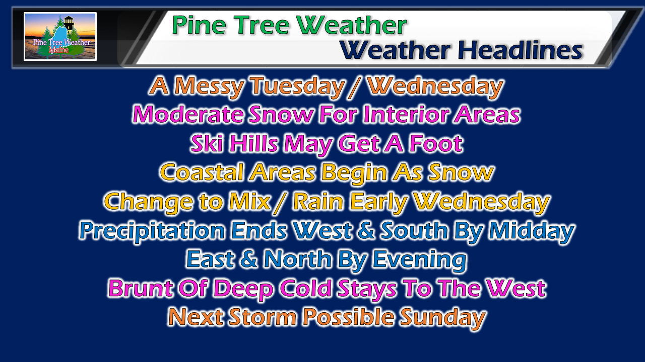
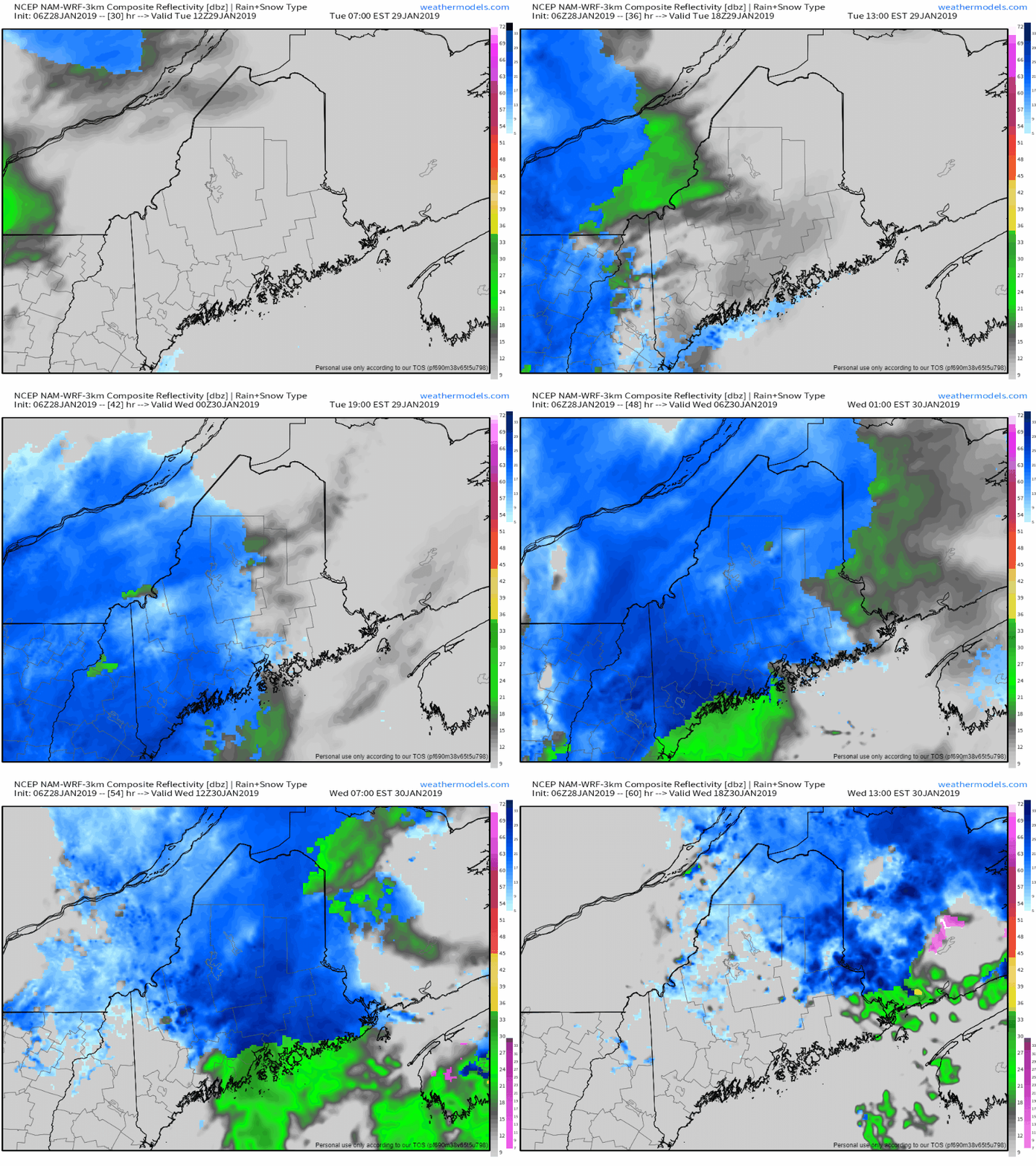
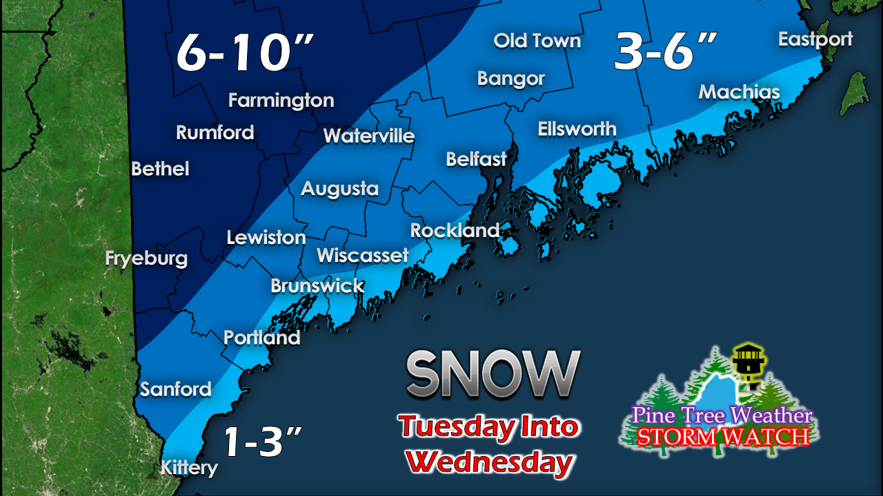
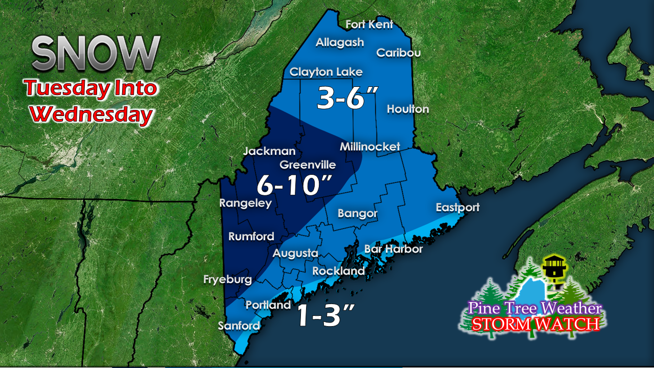
We've seen worse storms this seasonWhile it will be a bit messy for Tuesday and Wednesday, the rest of the work week appears cold, but quiet. The real deep cold over the Midwest stays to our west. There will be below zero starts for interior areas Thursday, Friday, Saturday and Sunday morning, but most areas will see the mercury climb above zero for daytime highs. We will likely have to deal with wind chill indices in the twenties to teens below zero at times from Wednesday night through Saturday morning. After this storm midweek, potential for another storm lurks for Sunday, and possibly next Tuesday. More details on that as the week unfolds. Greasy travel expected Tuesday into WednesdayFor western and southern areas, the afternoon drive will be greasy in areas as snow begins to overspread the region. Northern and eastern areas may see some outflow flakes in the afternoon, but the steady precipitation arrives Tuesday night. Precipitation tapers soon after daylight Wednesday for southern areas up into Oxford County, midday for Bangor, and by evening for northern areas. The shoreline areas will see a change from snow to a light mix to rain late Tuesday night into Wednesday morning, which will keep snow totals down there. The heavier snow appears to be in the mountains and foothills. Ski hills should pick up around a foot out of this. Factoring in dry air and potential for some mixing, 3-6" is likely for the coastal interior and interior areas DownEast. Northern areas may see dry air eat into snow totals up there.
Wind will increase Wednesday afternoon into the evening. Since this snow will be fluffy in nature, expect blowing and drifting snow to be an issue for interior areas through the remainder of the week. I will keep track on this and update either Monday evening or Tuesday morning. ► ► For the latest official forecasts, bulletins and advisories, please check in with the National Weather Service in Gray for western and southern areas, or Caribou for northern and eastern parts of Maine. For more information from me, please follow the Pine Tree Weather Facebook page and my Twitter feed. ► Your financial donations are much appreciated to keep this site funded and for further development. I sincerely appreciate your support not only financially, but also in sharing my efforts with others. Always stay weather aware! - Mike |
Mike Haggett
|


