
Models are still nutsThere are still some discrepancies in guidance, which leaves the potential open for changes. There is no doubt these spring snowstorms are bit a of challenge to forecast. That said, I have seen enough here to make a first call for snow amounts and discuss some impacts. First call snow amounts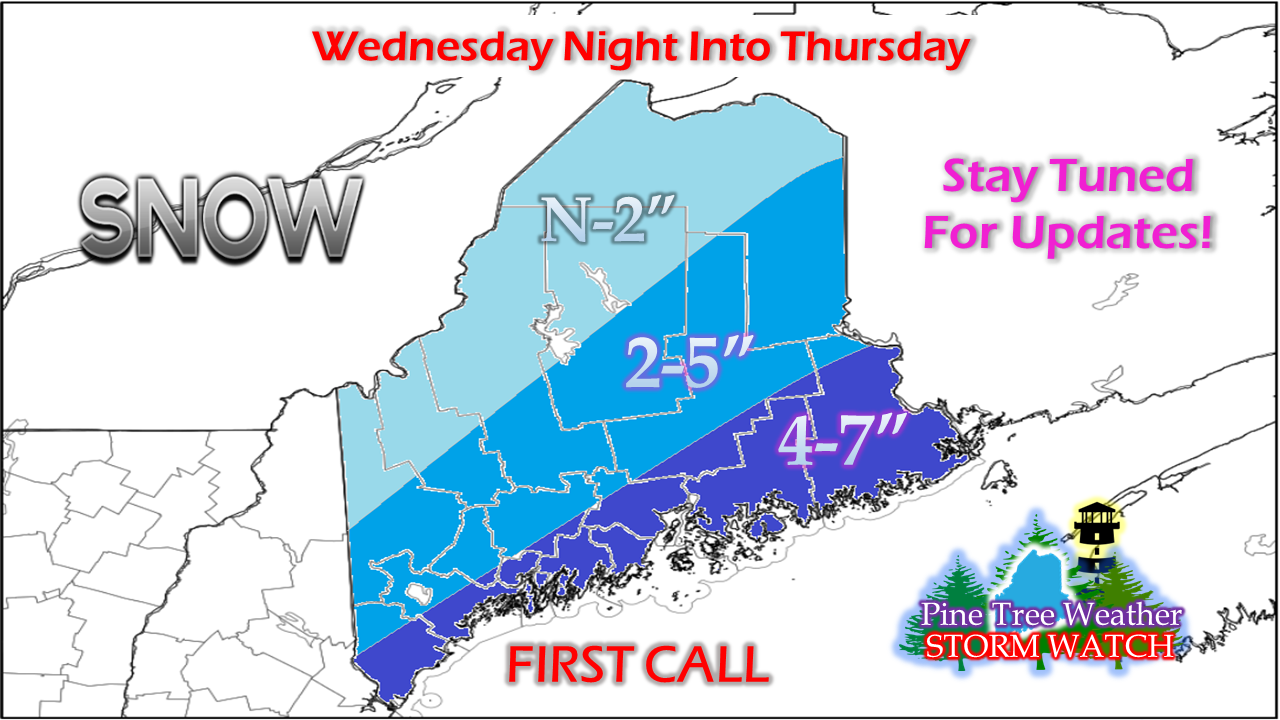 As discussed previously on this website, the main area of impact will be for the Mid-Atlantic and southern New England. For those of us in Maine, we're on the fringe for this one. The mountains and most of the north are likely to see little to no snow from this storm. The game all along here is to figure out how much snow the coast was going to get. That was the one certainty going into this, and continues to be the main area of concern. Poking holes into my own forecast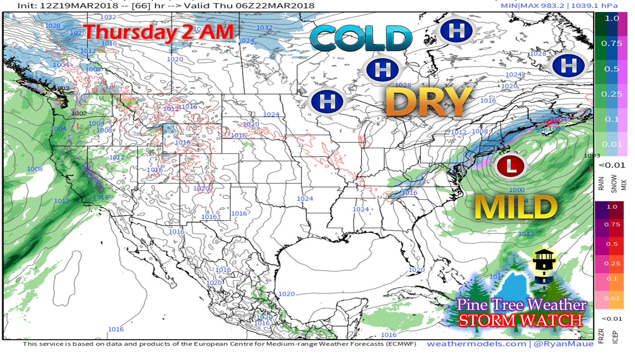 The thing that continues to gnaw at me with this forecast is the areas of high pressure and the cold, dry air that hangs over eastern Canada. Between that and the forecast track is what will more or less shut out the mountains and most of northern Maine out of this. 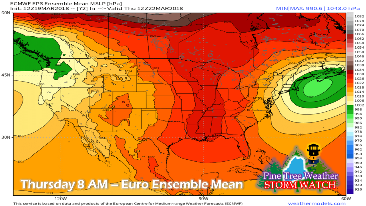 Looking at the ensembles, this is a flat system. It's not a very dynamic event. Sure, it's enough to cause issues to the south and southwest of Maine, but I am quite unimpressed with it as far as the state goes. I am not concerned over mesoscale banding that will pop up and dump snow wherever it pleases. I am not worried about big wind, although there will be some of that. The upper level energy associated with this doesn't impress me. Boundary layer influence appears minimal for southwestern areas, but with the warming of the day may bump totals to the high end for eastern areas. With all of that in combination of the dry air close by, I think there is still a fair amount of bust potential at this point. Timing... for now To put this loop into a nutshell, southwestern areas see most of the accumulation during the night until around sunrise and eastern areas get the bulk of theirs during Thursday daytime. The snow ends in southern areas Thursday morning, and the last of it exits eastern and northern areas by Thursday evening or soon thereafter. It will be enough to make a mess of the roads along the coast for sure. The Thursday morning commute could be greasy for the coastal plain up into the foothills of western areas, and for the Bangor and eastern zones on up into southern Aroostook during the day. Roads will improve fairly quickly with the warming of the day for the foothills south. As the snow shuts off over eastern areas in the afternoon, travel will improve towards the end of the day. We need to watch the shorelines again...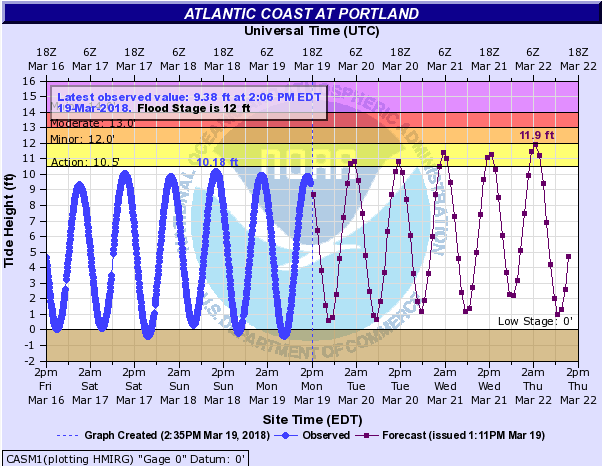 Astronomical tides come into play again later this week, and the tide for concern now is the 2 AM Thursday high water mark. Given the track of the storm to the south and east of the benchmark 40°N / 70°W point, that spares the region the worst of the storm surge and the stronger wind gusts. Those with shoreline interests should stay in touch with the National Weather Service for the latest on that. This isn't anything we can't handleCompared to the previous storm that dumped over 20" of snow around a lot of the area, this is nothing more than a nuisance event as it stands for now. We've seen far worse spring snow events. We're not out of the woods for another snow event as the cold air appears to hang around through the remainder of the month. We will see some melting for sure, but gradually. Given the ice jams in the rivers and streams from the previous two melting periods in January and February, this is welcome news to our interior water tributaries that have been impacted there. This will also help extend ski season also, and keep the snowmobilers happy for more action right into April. How to Facebook Pine Tree Weather A pleasant reminder to all of my Facebook followers on setting page notifications. Click on the "Following" tab and then "See First" to get my latest information. Feel free to follow on Twitter for even quicker snippets of information that I can pump out. More updates to come...As always, stay up to date from NWS Gray or NWS Caribou for the latest official forecast information, advisories, and bulletins.
Thank you as always for your shares and support! - Mike |

Mike Haggett
|


