
Finally, some better agreement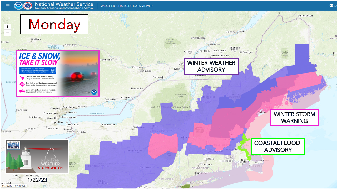 Sometimes the old jukebox needs a good punch to get the song going, and thankfully the capture of the northern stream by guidance did its best impersonation of Arthur Fonzarelli. Consequently, a better forecast has come out if it, with still the risk of a couple potential surprises that may come out of it. We'll give this a 'thumbs up' and get at it. Fast and flat, with a bit of fun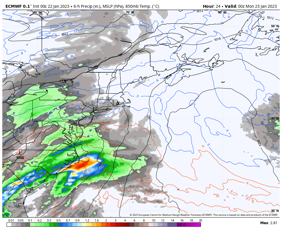 Sunday 7 PM to Tuesday 2 AM - I show this loop to present two things. First, the track is consistent from the overnight runs with a near benchmark 40° / 70° W south of Cape Cod to eastern Nova Scotia track. This favors more snow. Second, watch as a sneaky backside low develops in the slipstream behind the parent low. That might make things interesting for southern Maine as the storm departs Monday evening. Timing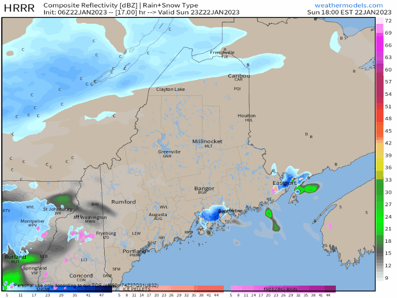 Sunday 6 PM to Monday 6 AM - The I-95 / Route 1 corridor is where the atmospheric battle lines appear to be setting up. This is where the best forcing takes place, and where the most precipitation is likely to fall. The darker shades of blue are where the heaviest snow is expected and could fall upwards of an inch plus per hour. The roads south of Moosehead Lake and Houlton are likely to be a mess to start the day. 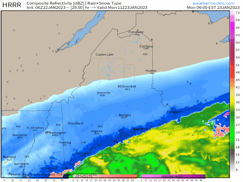 Monday 6 AM to 6 PM - While the parent low races off for Newfoundland, the sneaky secondary low develops in its wake, and this is where it gets interesting. Areas along the coast that may have seen a mix of sleet and freezing rain, even some rain, are likely to transition to snow as gusty northwest wind brings in cold air behind it. Folks along the I-95 / Route 1 corridor who had a rough start to get to work in the morning may have a harder time getting home in the evening. 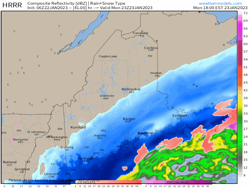 Monday 6 PM to Tuesday 1 PM - The secondary low follows the parent low and heads off to the northeast, and thus precipitation ends from northwest to southeast Monday evening. Snow and wind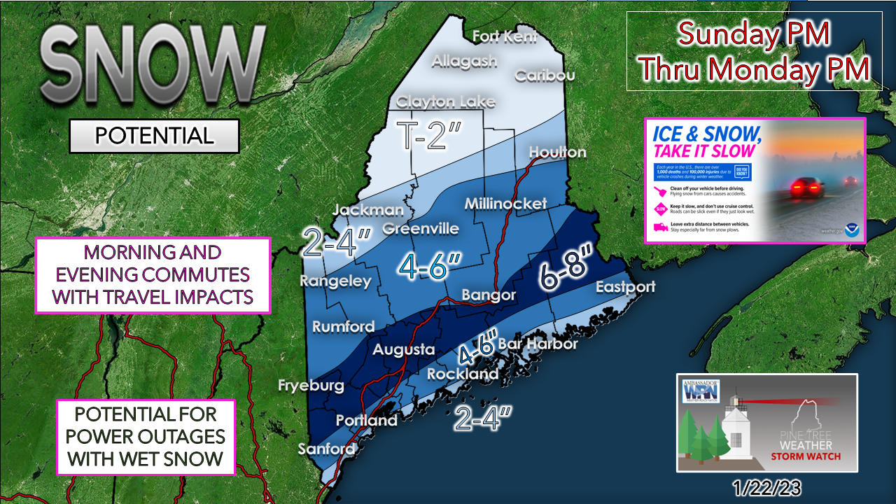 The closer to the coast, the wetter the snow. This could be very problematic for areas that still have snow stuck on trees from the storm on Thursday IF temperatures stay below freezing and a developing breeze on Sunday does not clean things up ahead of this one. Even if Mother Nature does her job and tidies things up, the wet slop could still cause issues given the recent stress from the weight of the recent snow weakening tree limbs. As far as bust potential goes, if the storm jogs 30 miles south of the forecast track, more snow and less mix is possible for the coast. If the coastal front and/or the secondary low really amps up higher than what is forecast now, some places may see upwards of a foot. The region from Fryeburg, Waterville, Bangor to Danforth south to the coast is where the confidence is lower on snowfall amounts given the situation, but this a reasonable idea for now. As far as snow removal goes, in the areas of wet snow, it WILL turn to cement as the cold air drops all locations below freezing Monday evening. 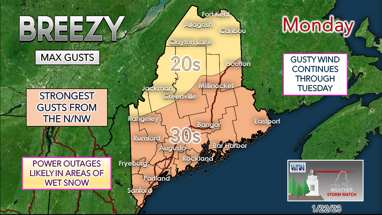 While this is not a big wind event on the front end, it will be more of an issue on the back end. As snow sticks where it falls wet with the cold air coming in from the northwest to freeze it where it sits could cause the threat of power outages through Tuesday. Folks along the coastal plain south from Fryeburg, Bangor, and Danforth south to the shorelines should prepare for outages. Charge your phones, back up batteries, draw water in the tub if you are on a well, and for those who have a generator, make sure that it is ready for use. Lastly, the shorelines escape with some minor flooding and some splash over, with a half a foot of storm surge expected.  Coastal hugger potential for Wednesday into Thursday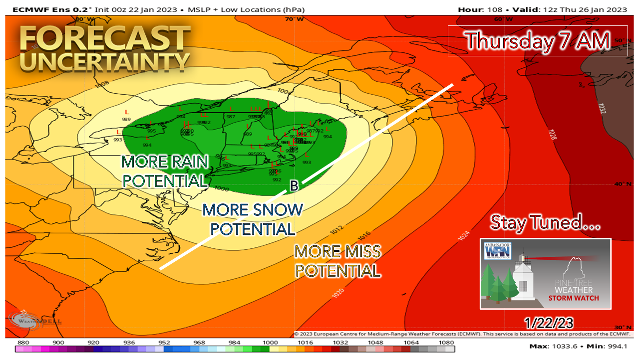 A couple quick thoughts on this one. It looks like snow is to start off that will transition to rain for the southwest and east with sleet and freezing rain "junk" potential for the western mountains and foothills on up into northeast Aroostook. We'll have to watch for potential flooding from snowmelt and keep watch on the shorelines as a southeast wind flow with the astronomical tides still a bit high may cause flooding issues there. We'll see if guidance behaves on this idea. Stay tuned. 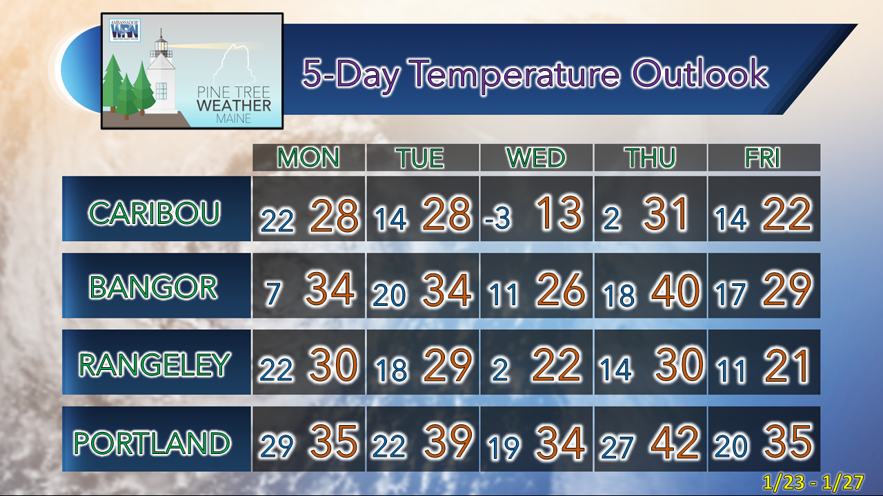 Thank you as always for your support! You may not like the weather, but I hope you like what I do! Please hit the like button on Twitter and Facebook, and share! Financial donations to fund what I do are always appreciated! Stay updated, stay on alert, and stay safe! - Mike NOTE: The forecast information depicted on this platform is for general information purposes only for the public and is not designed or intended for commercial use. For those seeking pinpoint weather information for business operations, you should use a private sector source. For information about where to find commercial forecasters to assist your business, please message me and I will be happy to help you. |

Mike Haggett
|


