
|
A Winter Weather Advisory has been posted for interior areas of the state ahead of the third storm of the week for Maine. Forecast ideas have become a bit cooler, and a bit juicer. As a result, snow total ideas have moved up a bit. A steady snow for Thursday Thursday 1 AM to Friday 1 AM - Snow begins to fall and accumulate over southern and western areas in the wee hours of Thursday morning before sunrise, which will make the roads slick in spots for the morning commute. For northern and eastern areas, snow begins after daylight into the mid-morning. Snowfall could be light to moderate overall with a few bursts of heavy snow possible. but for most areas, it appears to be steady through the day. Snow tapers off from southwest to northeast Thursday night, ending over southwestern areas by around mid-evening and northern and eastern areas by around midnight or soon thereafter. 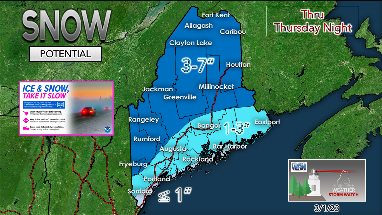 What makes this storm a bit tricky for accumulations will be the effect of solar insolation, like what was seen in the recent event on Tuesday. Since we are now in meteorological spring, the sun angle is higher, and that has the tendency to fool models a bit in lighter accumulation events. For the coast, snow early on appears to flip to rain, and then end as snow for areas east of Portland later in the day and into the evening. Expect snow to be wetter along the coastal plain, and fluffier to the north. Wind speeds on the front end appear minimal. As the storm exits to the east, the breeze increases Thursday night into Friday morning, which may cause drifting in open areas with gusts reaching 20-30 mph (mountains 30-40 mph). Expect slick travel and plan accordingly. Saturday shaping up to be a decent snow event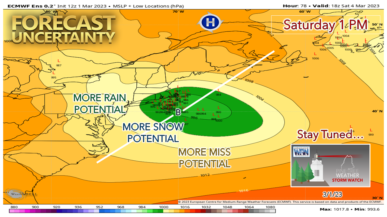 A couple key issues that pose questions. First is the strength and position of high pressure to the north. That will dictate how far north the system will go, and how much dry air may affect snowfall amounts for the north and east. The other factor is the track. Operational ideas vary from north (European), middle of the road (Canadian) and south (GFS). Seeing the model spread of the European ensembles indicates all that potential. There is wiggle room here. 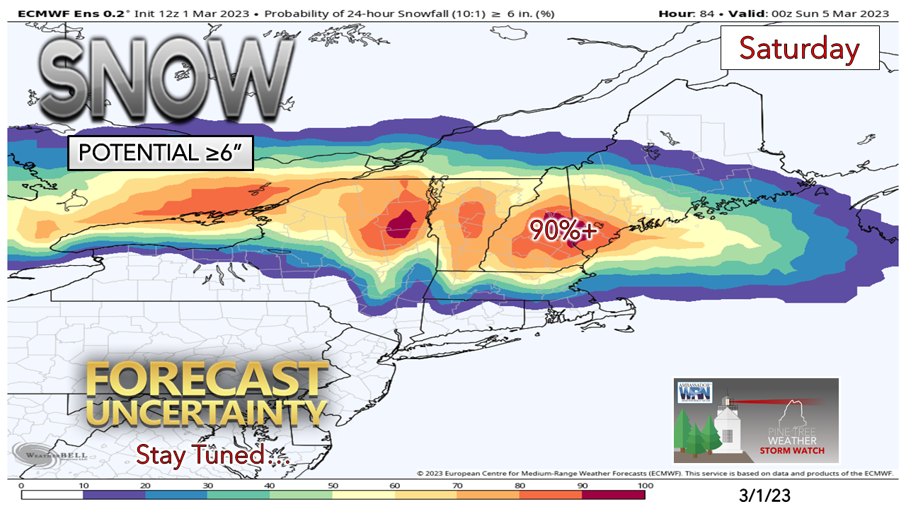 This is a good signal for a potential 6-12"+ snow for southwestern areas. While the details are still to be ironed out, it's a safe bet to plan for an impactful event. Along with heavy snow, wind gusts in the 20-30+ mph are possible, which will blow this around, making travel difficult. Stay tuned for more on this one.  Temperature outlook through MondayAfter Saturday's storm, Sunday and Monday appear quiet. The North Atlantic becomes a traffic jam which may set up a backdoor cold front / inverted trough scenario Tuesday into Wednesday. There is a lot to figure out with that one with all the moving parts. For now, it's chance for snow and/or rain both days. 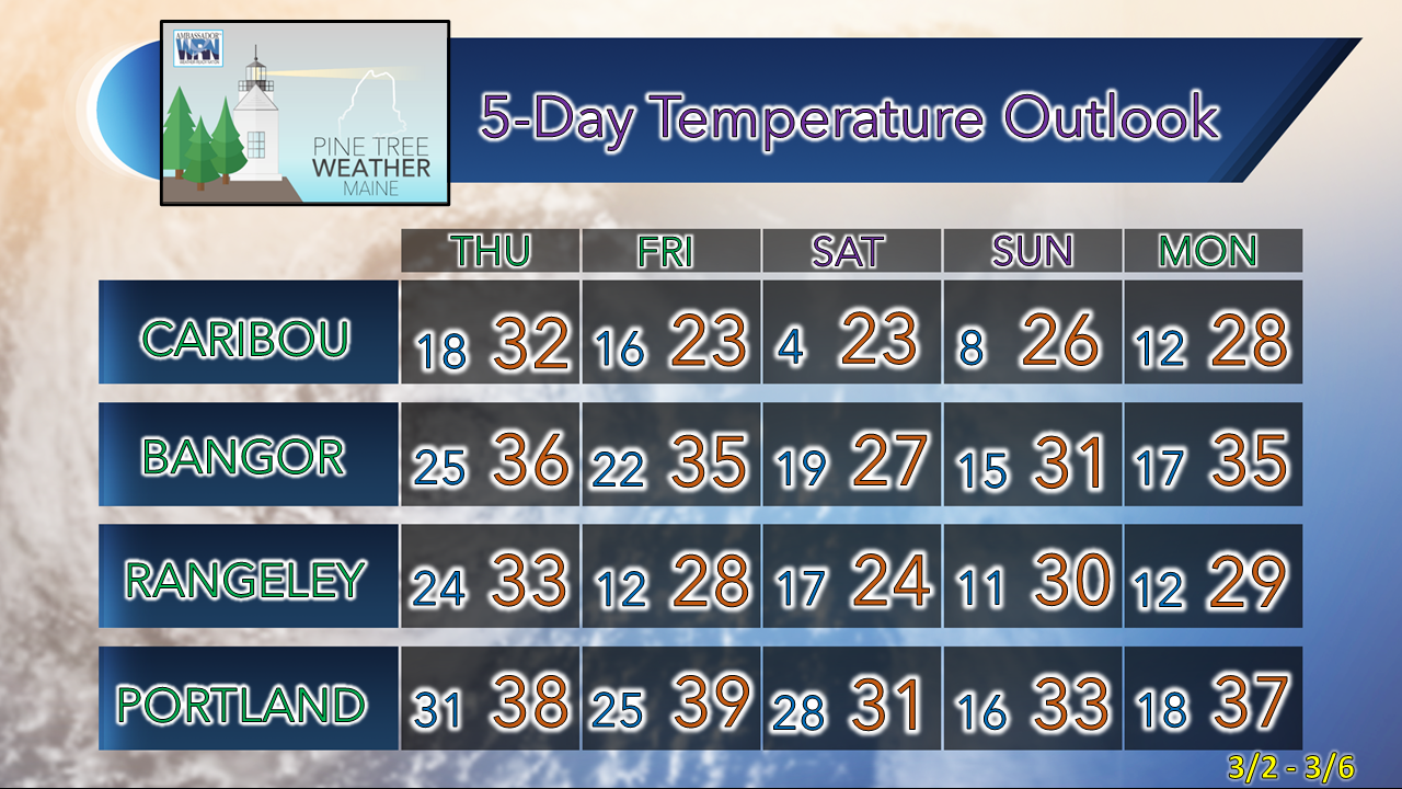 Thank you as always for your support! You may not like the weather, but I hope you like what I do! Please hit the like button on Twitter and Facebook, and share! Stay updated, stay on alert, and stay safe! - Mike NOTE: The forecast information depicted on this platform is for general information purposes only for the public and is not designed or intended for commercial use. For those seeking pinpoint weather information for business operations, you should use a private sector source. For information about where to find commercial forecasters to assist your business, please message me and I will be happy to help you |

Mike Haggett
|


