
No changes in snow amounts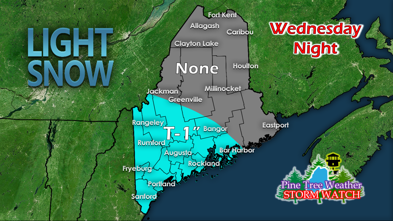 The forecast remains on track with no changes on snowfall amounts overnight. 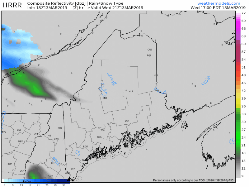 Snow starts over the Rangeley area this evening and drops to the southwest by 8-9 PM. The last flakes exit the coast by 2-3 AM. While not a lot of snow, there will be enough to cause some slick spots. Be aware of any ice from melting that will refreeze tonight that may be hidden from the light snow on the ground Thursday morning. Areas of fog develop as temperatures rise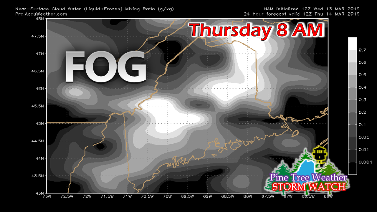 After the disturbance passes offshore Thursday morning, the ridge moves northward. Temperatures begin to rise. When warm air meets the snow, fog is likely to form. The low level stratus will cause impacts with driving visibility, as well as the melting of snow. While Thursday won't be foggy all the time, there will be pockets in various locations throughout the day. Areas of fog will remain in the forecast through Saturday morning. Rain and wind for Friday As I have said in previous updates, there is not a whole lot of rain associated with this storm. Showers will be scattered, some places may escape without a drop. With temperatures in the 40s and 50s statewide on Friday, melting will be the main concern. Rivers and streams that have dealt with ice jams from the December and January thaws may pose as flood threat. Rural and urban roadways may feature standing water, which may cause a hydroplaning risk. If you come across a roadway that is flooded, do not attempt to drive through it. Turn around, don't drown, and go a different route to arrive at your destination safely. 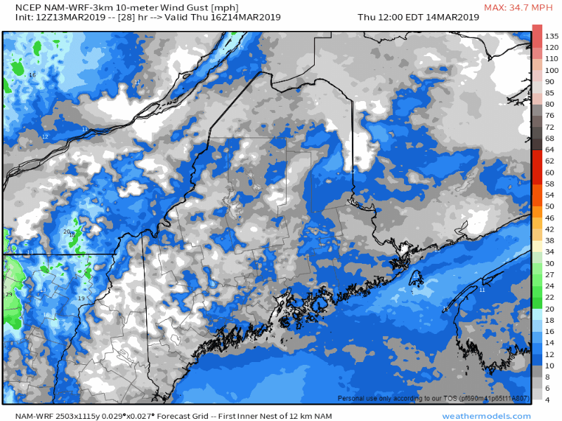 As the front approaches the region, wind speed are likely to pick up. This is likely to be a Flying Trash Can Alert day for much of the region. Wind gusts from the southeast at 30-45 mph are possible. This may cause some scattered power outages in areas. As a precaution, make sure you are prepared in case of power loss. Regional outlook through Monday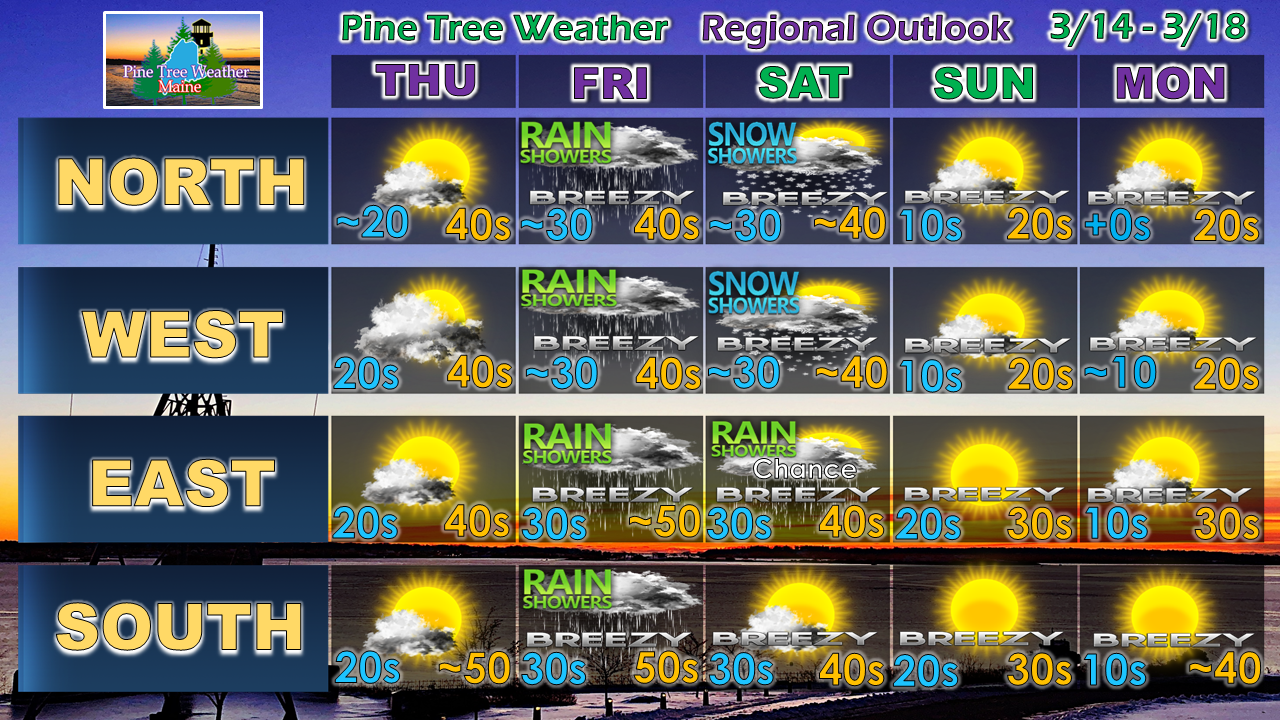 As we head into the weekend, the north and mountains may see some scattered snow showers, and eastern areas may see a rain shower on Saturday. While not as breezy as Friday, the wind continues into next week. Temperatures fall Saturday afternoon, freezing everything back up Saturday night. Areas of black ice will be a concern into the first of the week.
► ► For the latest official forecasts, bulletins and advisories, please check in with the National Weather Service in Gray for western and southern areas, or Caribou for northern and eastern parts of Maine. ► ► Your financial donations are much appreciated to keep this site funded and for further development. I sincerely appreciate your support not only financially, but also in sharing my efforts with others. Always stay weather aware! - Mike |

Mike Haggett
|


