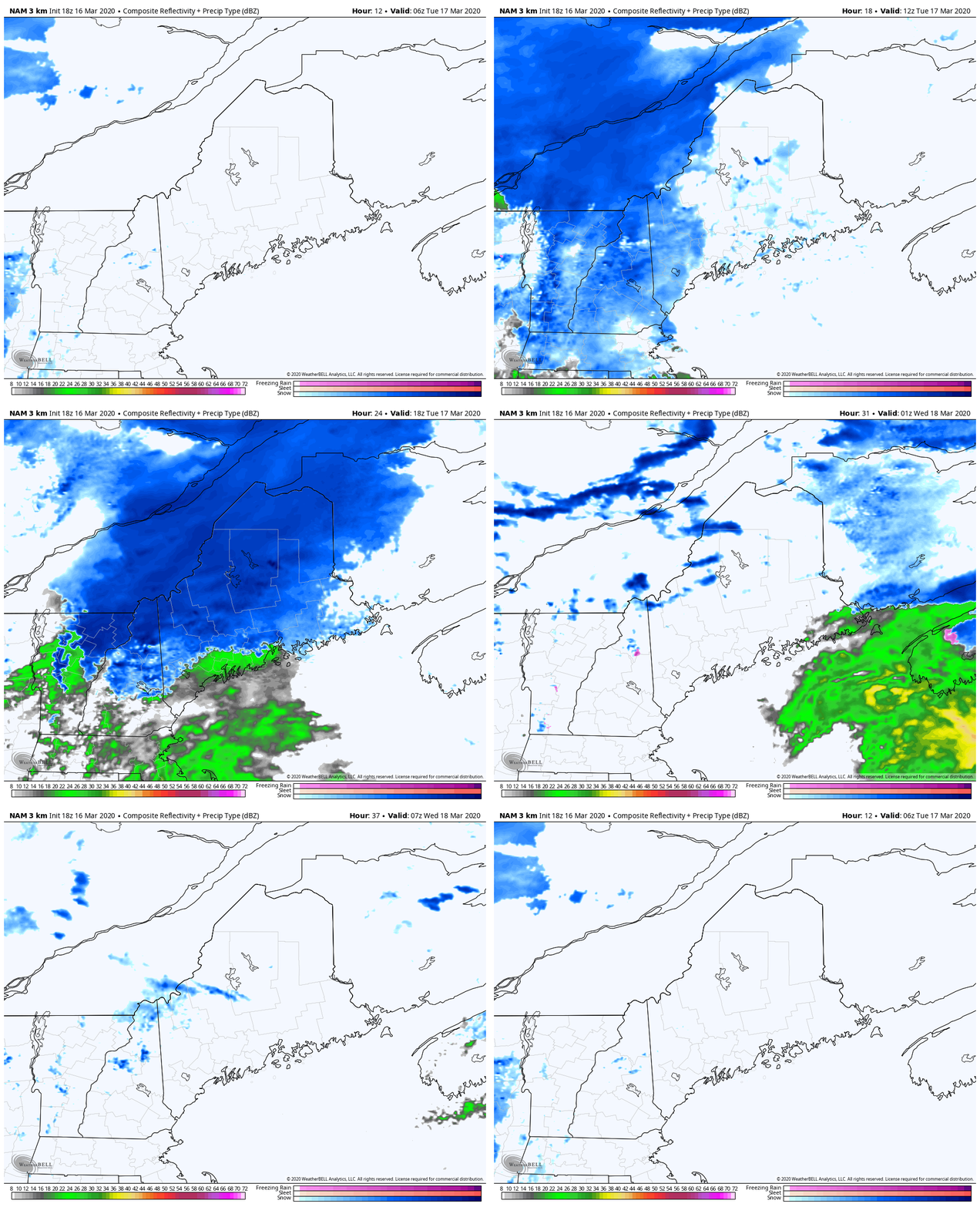
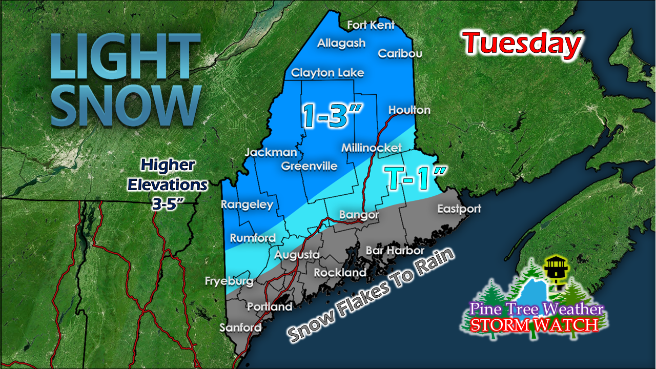
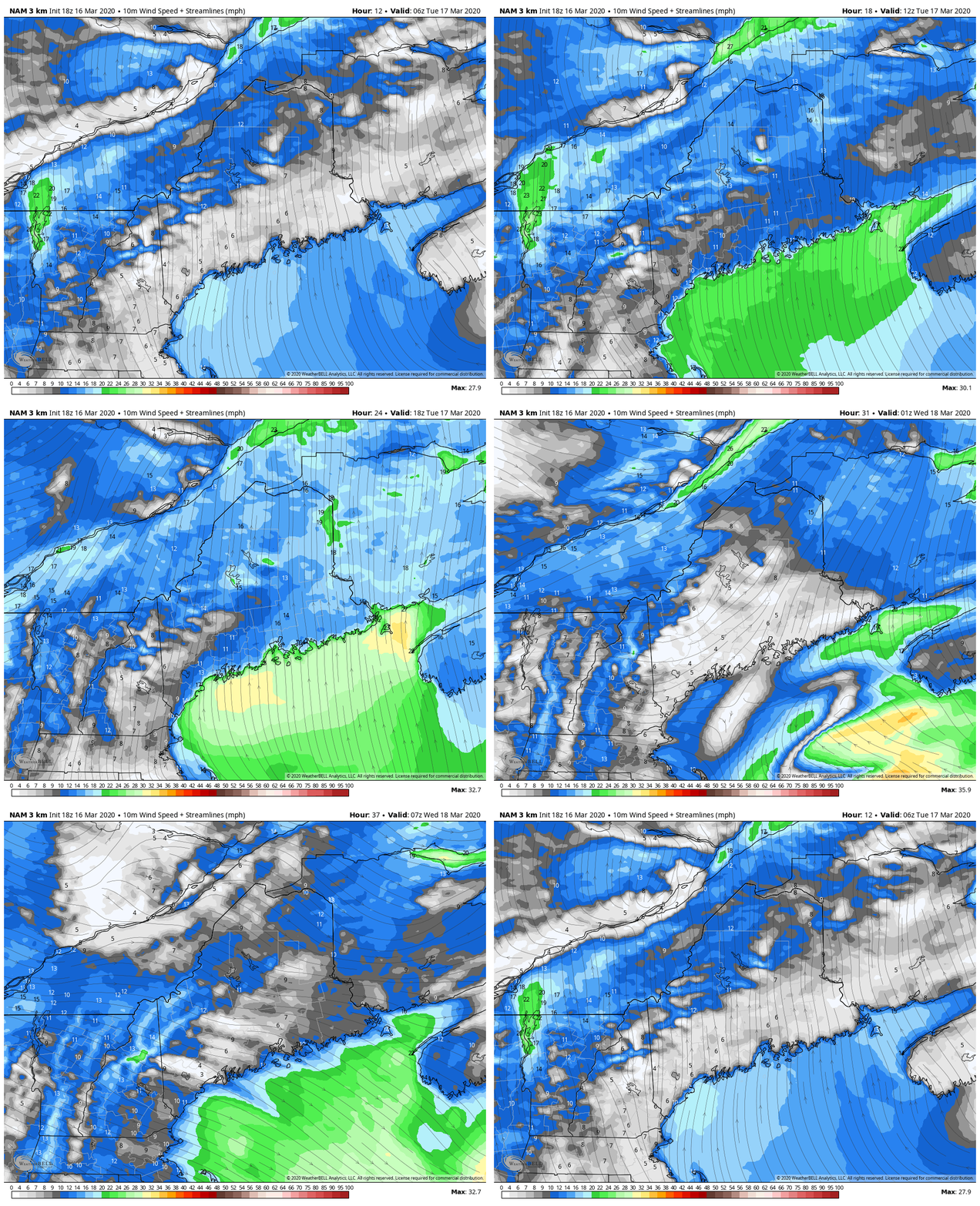
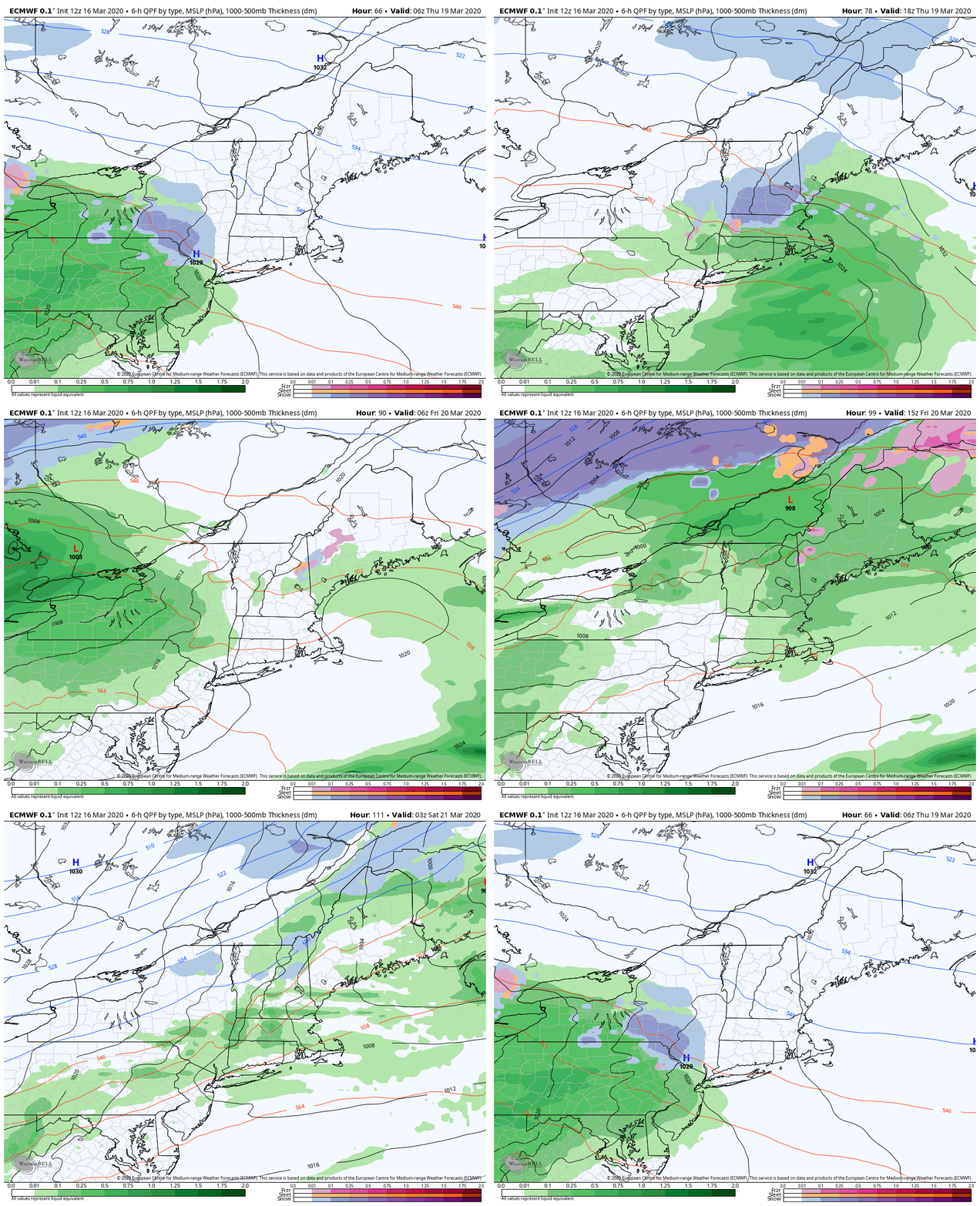
Forecast remains on trackNot a whole lot of changes to the forecast that was posted here on Sunday. Western and southern areas may see a few flakes for the morning drive. The steadier precipitation works through the mush region Tuesday morning, reaching northern areas by midday, and Washington County by early afternoon. Southern and western areas may catch a sunset as the storm accelerates into Atlantic Canada by Tuesday evening. The last of the precipitation over eastern and northern areas ends by around 10 PM Tuesday night. Just a subtle tweak to the snowfall map bringing snow a bit closer to the Bangor region. For much of the coastal plain, this is primarily a rain event, with some minor snow accumulation on grassy surfaces over the coastal interior. It's definitely a day for rain gear as the wind will increase as the warm front approaches. A brisk southerly wind gusting in the 20-30 mph range is possible ahead of the front. The wind shifts to the west / northwest on the backside Tuesday afternoon into the evening. Temperatures for the day start off in the single digits / teens north and mountains with 20s for the coastal plain. With the warm front, temperatures rise into the 30s for most areas, with low 40s possible for the south. Behind the front, the mercury falls into the teens for the far north, 20s elsewhere over interior areas to right around 30° for the shorelines to start Wednesday. Wednesday appears to be a mainly sunny day with clouds on the increase over western and southern areas in the afternoon. Highs for the day range in the 30s for the mountains and north, 40s for the coastal plain. Weekend forecast improvingThursday sees a chance for snow and rain showers, with little snow accumulation expected for interior areas. Friday appears to be a rainy affair statewide, and the warmest day of the week. Saturday sees snow showers in the mountains early, ending in the morning. It appears to be a sunny, but windy and cooler.
Keep the faith! We'll get through this unprecedented period in time. Thanks as always for your support! Feel free to use the many pages available on this website for many types of forecasts on rainfall, snowfall, marine, longer range CPC outlooks and maps. ► ► For the latest official forecasts, bulletins and advisories, please check in with the National Weather Service in Gray for western and southern areas, or Caribou for northern and eastern parts of Maine. You can help keep Pine Tree Weather going into the future with a donation of ANY amount now through VENMO @PineTreeWeather, a monthly donation on Patreon or messaging me on Facebook or Twitter to send a check in the mail. Thank you for your support! Always stay weather aware! - Mike |
Mike Haggett
|


