
Light snow for some areas to start off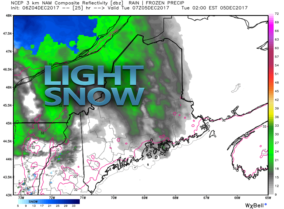 No changes to the idea I posted on Facebook this morning. Light snow is likely in the overnight hours. The only concerns for accumulations are for the western foothills and mountains from the vicinity of Route 2 on up through Greenville and the Katahdin region. Most of that will fall in the higher elevations, and that is anywhere from a dusting to 2". It should not pose to be a problem for travel Tuesday morning for most of that region. A bit of a lull before the rain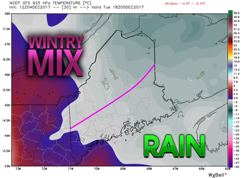 Given the cold air around, it is going to take time for a wintry mix in the north country to change over to rain. South and east of the purple line are likely to see it quicker due to a southerly wind picking up which will warm the surface quicker due to the ocean. The graphic here is that of around 1800 feet above sea level. All areas may see some flakes until the air column warms completely to support rain. 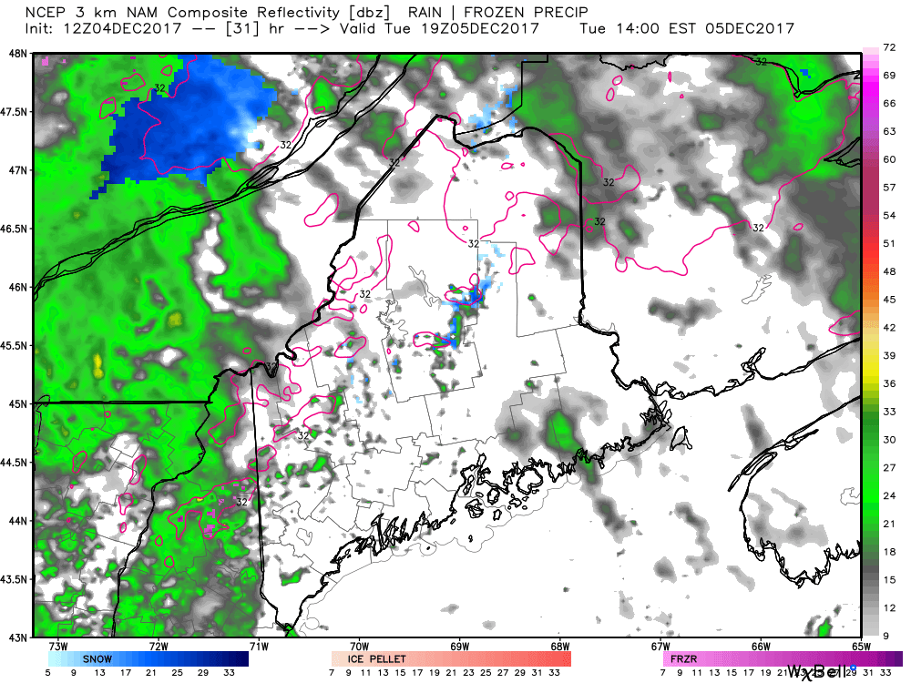 The lull between the warm front that will bring the light snow Monday night into early Tuesday will be a blessing for travel concerns. There is not a whole lot of precipitation expected Tuesday morning into early Tuesday afternoon. My concern for the north country will be Tuesday afternoon as the cold front approaches. There could be a period of a mix of rain and snow before it goes to all rain by Tuesday evening. Cold air loves to fool guidance, and I am not completely buying what they are selling for projected temperatures. It could be a melting snow of the higher traffic roadways, and may pile up a bit on the secondary roads and dirt roads before the change over. By evening the warm air will wind out and bring a steady rain, heavy at times Tuesday night into early Wednesday. 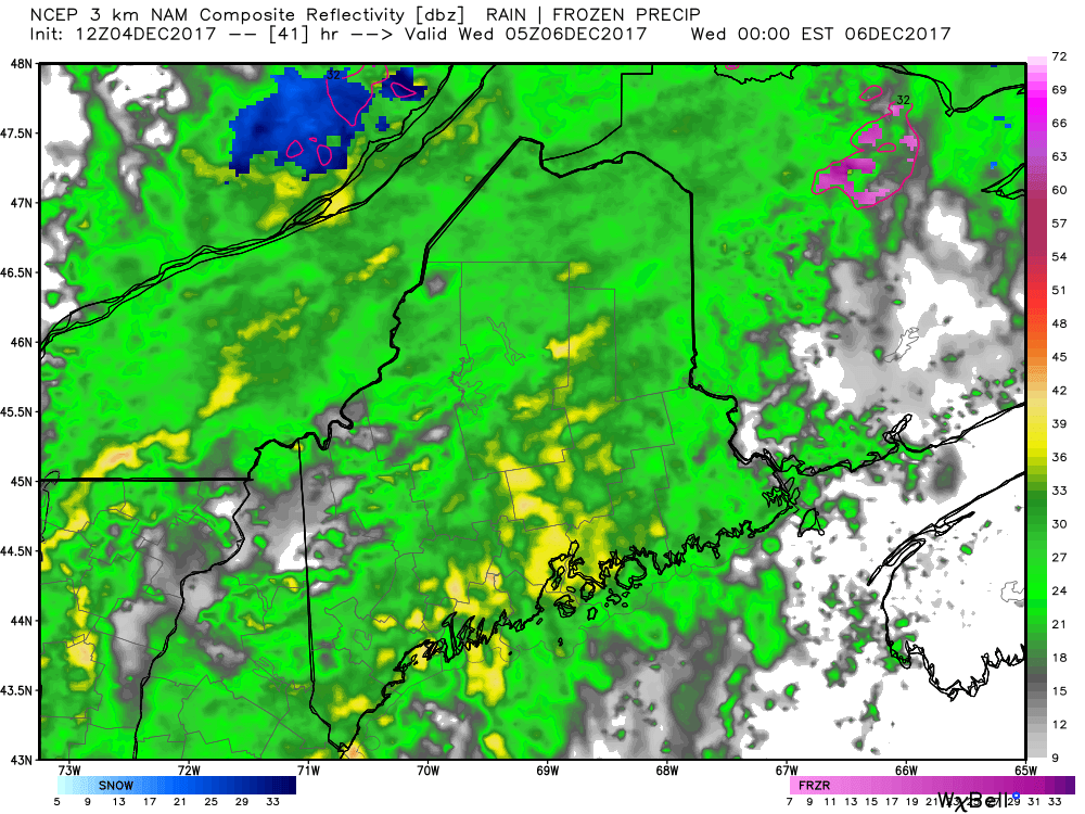 By around midnight, rain will be the dominating feature statewide. The high temperatures of the day will likely max out around the same time, and steadily drop as the front passes through. Wednesday gets tricky for the north & mountains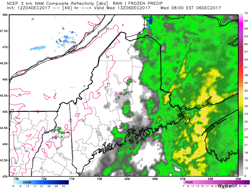 The backside of the front is likely to pass through the western and southern areas by the morning commute, and end in eastern and northern areas before noon. What makes this tricky is the amount of cold air pouring in behind the front. It appears that it will change the rain over to snow. This model does a poor job showing that. 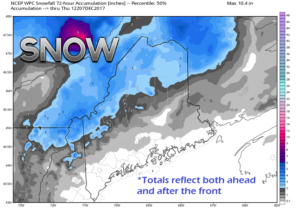 This snowfall amount forecast by the Weather Prediction Center does a better job at indicating that potential impact. While this chart depicts the grand total, it is in line with what I am thinking. It could be a bit slick in areas of the north and mountains Wednesday morning. It should not be a big deal as long caution is observed. Temperatures will be falling, and the western and northern areas will get cold first. 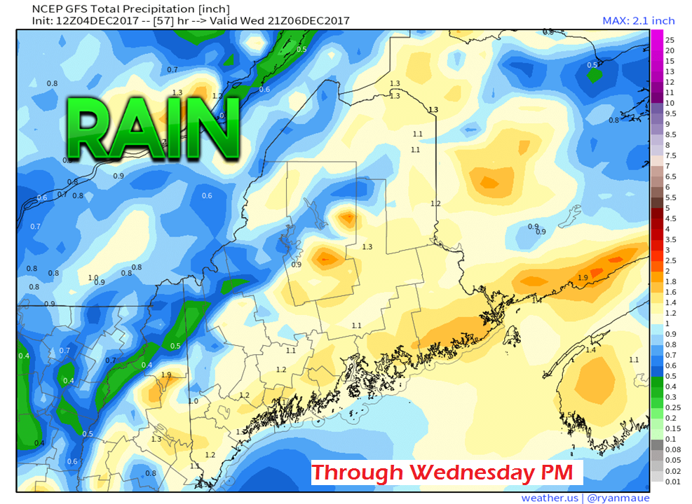 Total liquid equivalent precipitation appears to be around 1" for most. Some areas slightly higher or lower pending on actual results. This may hurt ski country a bit, but with the cold on the way, it won't take long for the snow guns to catch up for the loss. Given the falling temperatures, my concern for the south and east Wednesday afternoon and evening could be for potential ice on roadways from ponding of rain that may not be absorbed in time before freezing. And then there is the wind...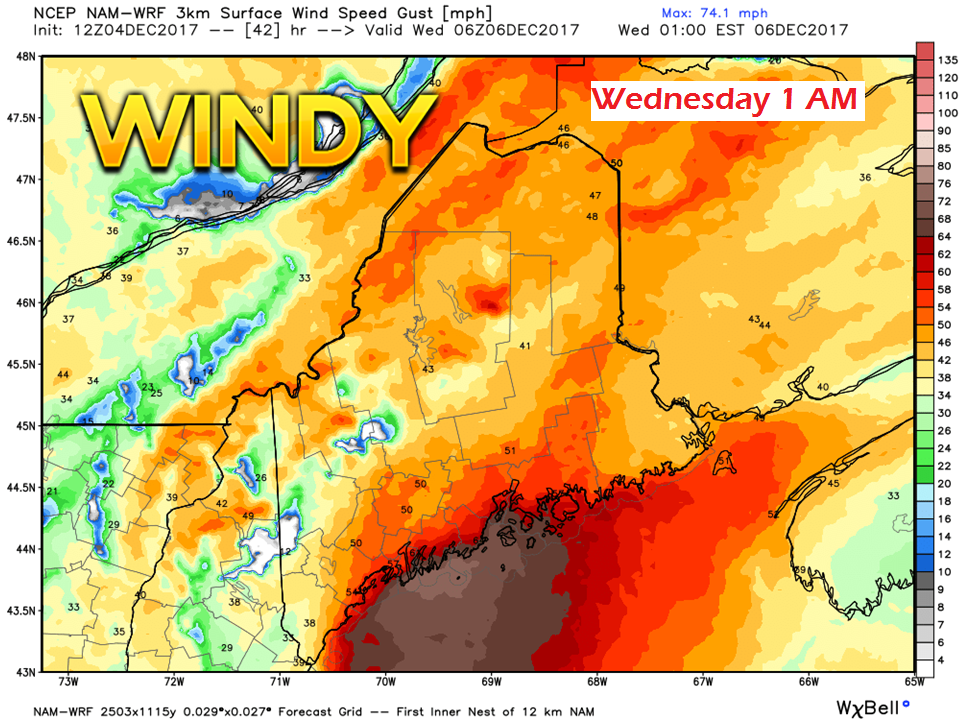 The wind aspect of this is likely the most concern. The National Weather Service is Caribou has issued a wind advisory for DownEast areas. I think it is a safe bet that spotty power outages can be anticipated for the entire coastline Tuesday night into Wednesday morning. Models are in agreement of gusts ranging 40-50 mph. How much mixing occurs in heavier rain is likely to play a role in gusts for the coastal plain and inland. I am thinking 30-40 mph on average over areas like Lewiston/Auburn, Augusta, Waterville and Bangor. The worst of the wind occurs ahead of the front. There will be gusty winds on the backside with the west/northwest winds, but that is likely to be in the 25-35 mph range. The wind settles to a breeze for most by Wednesday evening. Looking ahead to weekend snow potential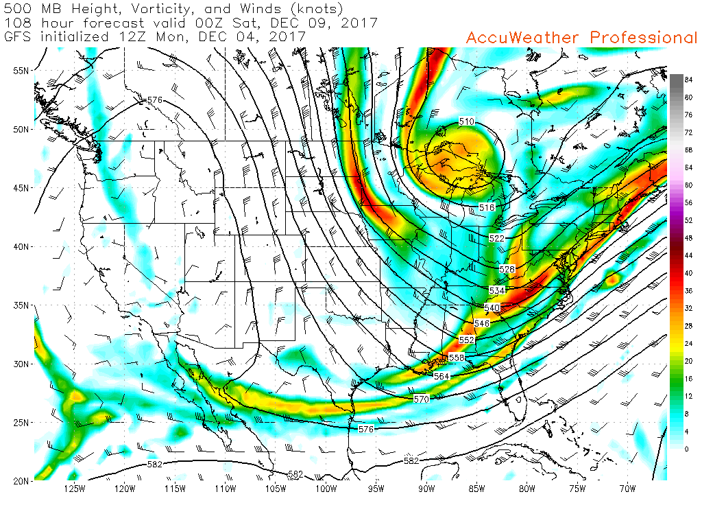 Models are still having some difficulty figuring out how the southern jet will maneuver around the deep trough coming in. There has been a few "ghost" storms that guidance has spun up over the weekend. The problem is that third piece over the Gulf of Mexico. 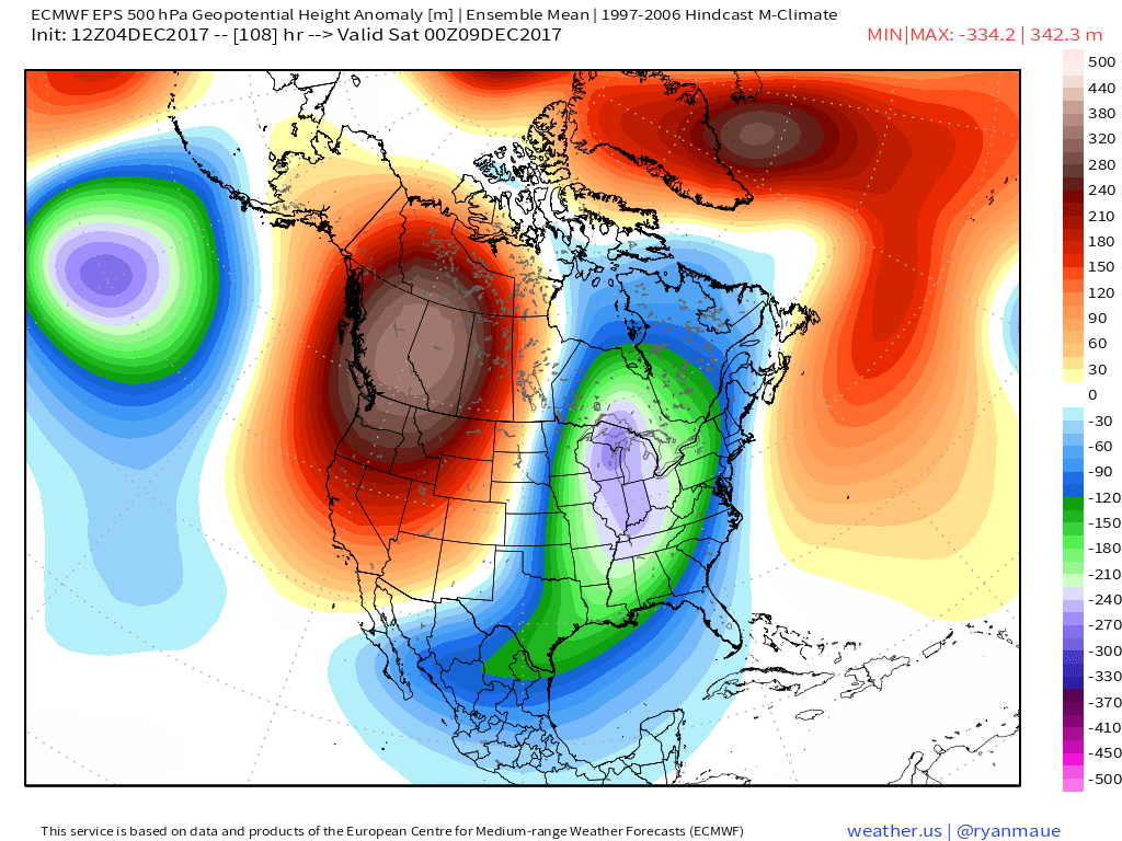 The axis of the trough by Friday shows a positive tilt to it. Given the proximity of the ridge to the east and where the cold is forecast to set up geographically, it means that Maine is on the fringe. In that scenario, waves ride up along the boundary between the ridge and the trough. Because of the positive tilt, ocean storms are unlikely to form. Snow remains in the forecast for Friday into Saturday, but for now it appears to be light in nature. Whether the road crews will be required for a scrape or a sand, time will tell. 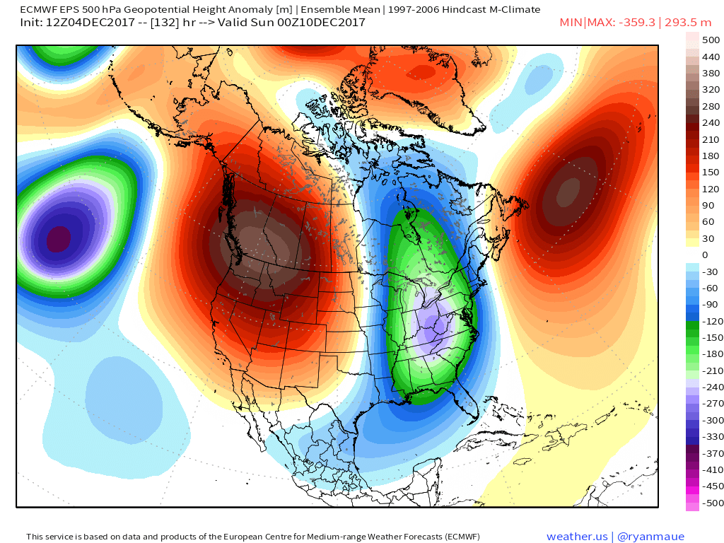 Sunday into Monday is a different scenario. The trough becomes more neutral which allows more moisture into the region. At this point, there is a better chance for a snowier second half of the weekend. It is still early, however.
Stay tuned. - Mike |

Mike Haggett
|


