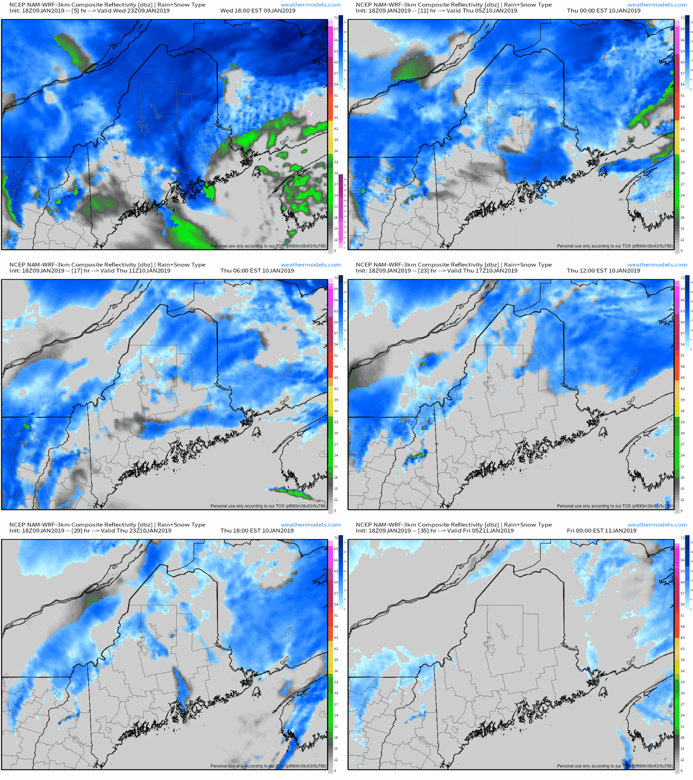
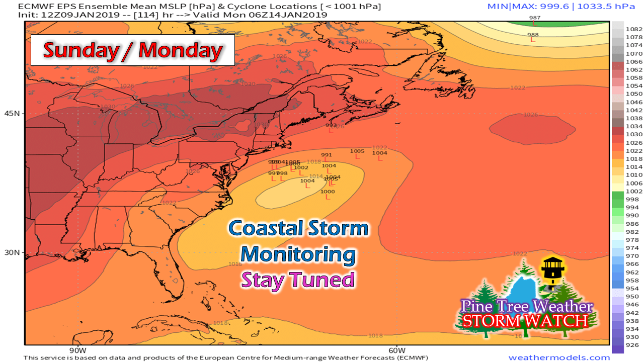
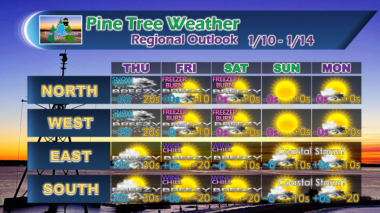
Snow showers continue for interior Thursday; bitter cold weekend; storm first of next week?1/9/2019 The upper low spins its way outThe storm slowly moves into Atlantic Canada Wednesday night into early Thursday. Moisture associated with the upper level low over the region will spin snow showers through the state. Northern and western mountain areas could see an additional 1-3" of snowfall during the day. I can rule out some isolated snow showers or weak squalls for the coastal plain, but the risk is a low one. Wind will increase and cause areas of blowing and drifting snow in areas. Expect that to continue into the weekend. Something to keep an eye on for early next weekA storm system will cut across the Ohio River Valley into the Mid-Atlantic over the weekend. Operational guidance has precipitation from the storm just offshore of Southern New England. Ensemble means from the Wednesday morning data run show the potential of that being a bit closer. It's close enough to keep an eye on for now. My followers from the South Shore should also keep tabs on this. If this storm misses the region, it could be the second half of next week before the next storm comes. Bitter cold outlook through MondayThe main focus over the next five days is going to be on the cold. The National Weather Service offices are already mentioning the idea of Wind Chill Advisories being issued in their discussions. It's definitely going to be a bundle up weekend no matter where you are in the state. Make sure your vehicles are ready with jumper cables, dry gas, (anti-gel for diesels), a blanket, and a cell phone charger in case it is needed. For those who have AAA, you may want to check and see that your dues have been paid in case you need a jump or a tow, if necessary. Storm Reports For Eastern & Northern Maine NeededThe National Weather Service Caribou is having issues with their Facebook page and Pine Tree Weather is here to help them get the valuable storm reports they need. I have set up a Facebook post for folks who are served by the Caribou office for report submission. If you aren't on Facebook or would rather contact them directly, there is information on the post to do just that. Just click on the underlined link above to take you there. Stay updated and thank you for your support!For the latest official forecasts, bulletins and advisories, please check in with the National Weather Service in Gray for western and southern areas, or Caribou for northern and eastern parts of Maine.
For more information from me, please follow the Pine Tree Weather Facebook page and my Twitter feed. Your financial donations are much appreciated to keep this site funded and for further development. I sincerely appreciate your support. Always stay weather aware! - Mike |
Mike Haggett
|


