
|
The confidence on the forecast through Thanksgiving is good with no major impacts to be concerned with for the state. How Black Friday and the rest of the weekend plays out is still to be determined with a wide variance of ensemble model solutions that I will touch on. Warm front advances north, cold front passes overnight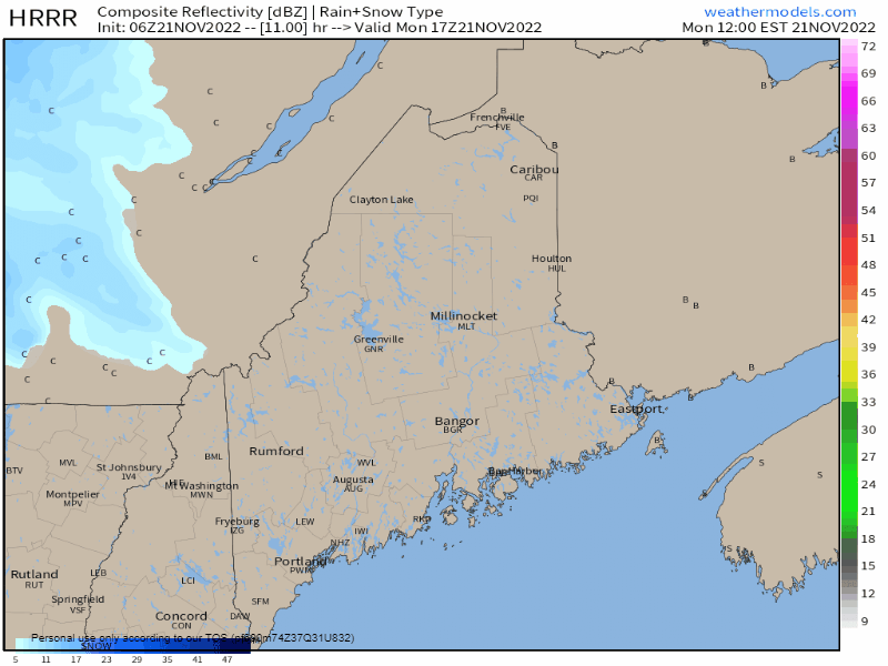 Monday Noon to Tuesday 6 AM - Clouds increase over the region as a warm front noses to the north and a cold front passes through overnight. Snow showers are possible along the Quebec border region on up into the rooftop of the state during the afternoon into the night. Snow squall potential is possible over the western mountains and foothills in the wee hours of Tuesday morning. 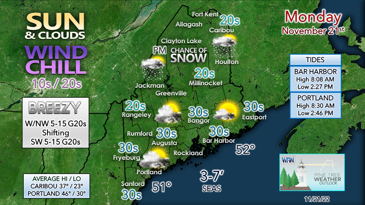 Well below normal high temperatures are on tap again with a wind chill that makes feel around 10° cooler than that. Expect the wind to shift to the northwest in the wee hours of Tuesday and expect another bitter cold start. Tuesday appears to be mainly void of precipitation chances and sees the morning arctic breeze diminish and bring slightly warmer temperatures in for the day, but still seasonably cool. A zonal flow sets up and brings a weak disturbance in for Wednesday which brings the risk of snow showers for the mountains and north. Thanksgiving appears to be mainly sunny and cool as high pressure controls the day. Late week storms ideas scatteredIt's kind of bizarre to see such a wide spread of forecast ideas in the day 5 outlook, but to prove the point that the outlook from Black Friday onward is a bit of a toss-up, I present the ideas that are on the table by the big three ensemble ideas that I rely on to formulate an outlook. 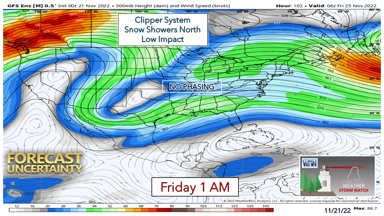 The GFS ensemble idea is about the least interested of anything significant of the three. An upper-low over Texas cuts off the influence of the southern jet, thus cuts off a moisture stream to the northeast. The end result is flurries and snow showers for the north, a bit of a breeze, and not much else. 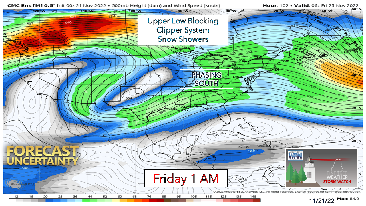 The Canadian ensemble idea has the upper low elongated and digs to the south enough to pick up Gulf moisture, but the phasing of the north and south streams occurs late, allowing for moisture to stay suppressed to the south. An ocean storm forms well to the southeast away from the area. The end result is similar to the GFS and that is snow showers and flurries for the north and not much else. 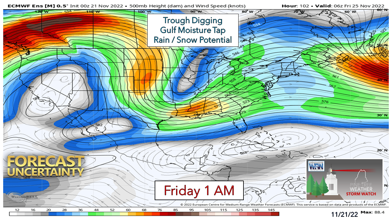 The European ensemble idea does not have the upper-low idea, but instead has a digging trough over the Midwest that allows upper-level flow to dig south to pick up Gulf moisture and transport it to the northeast. This is a stormier solution, and one that could bring some impacts. 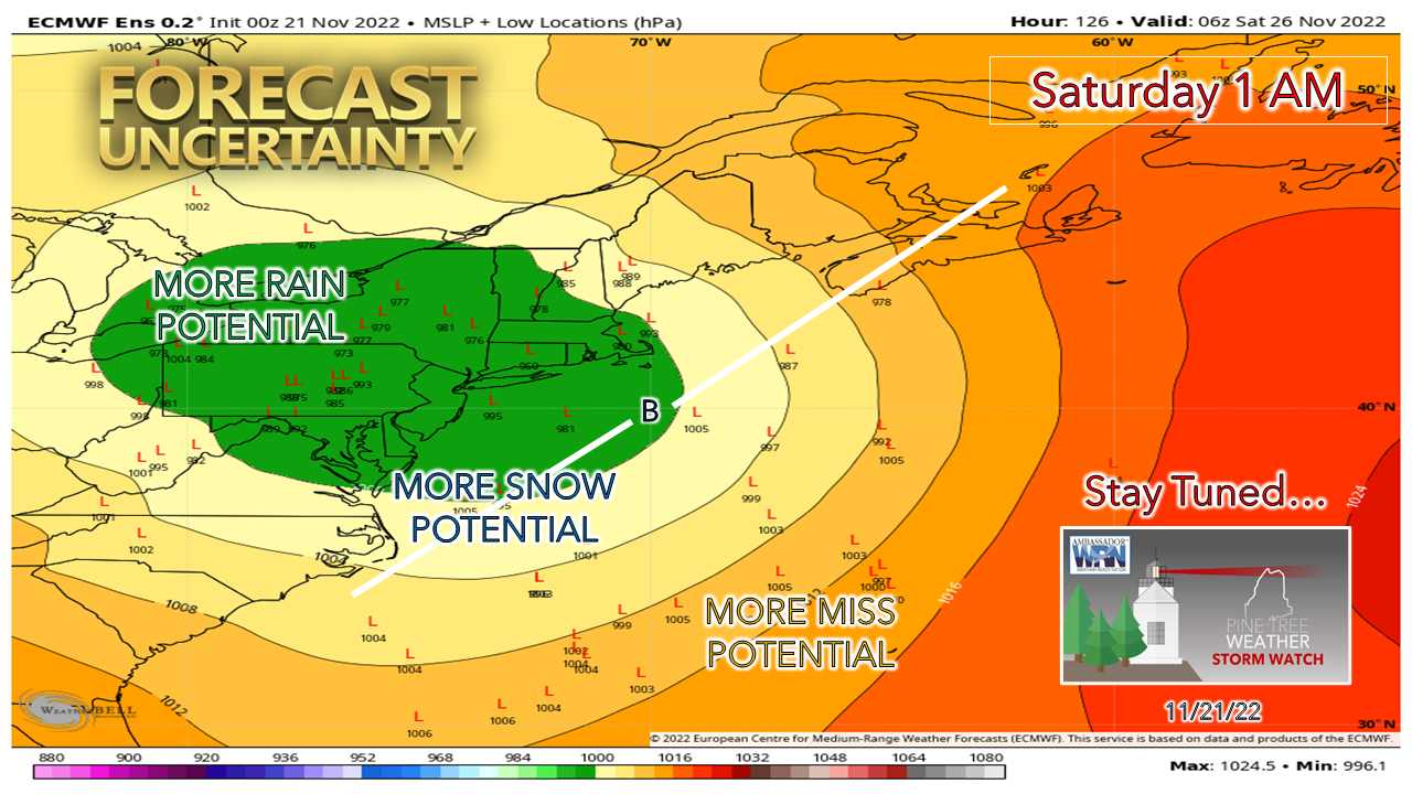 Taking it a step further and looking at individual ensemble ideas, one can easily see how widespread the solutions are. Roughly 60% of the European ensemble ideas favor a wetter outcome, whether that be an all-rain event or a heavy wet snow for the mountains and north with rain for the coastal plain with perhaps some mixing over the foothills. It's a fair bet that the area will get some sort of a storm out of this, but given the spread of ideas, there is not enough confidence to get into over impacts, precipitation type and specifics. For those traveling, it would be wise to plan some storm activity Friday and Saturday for now, with the outcome to be determined. Stay tuned! Funding for 2023 is currently at 35%...  Temperature outlook through Saturday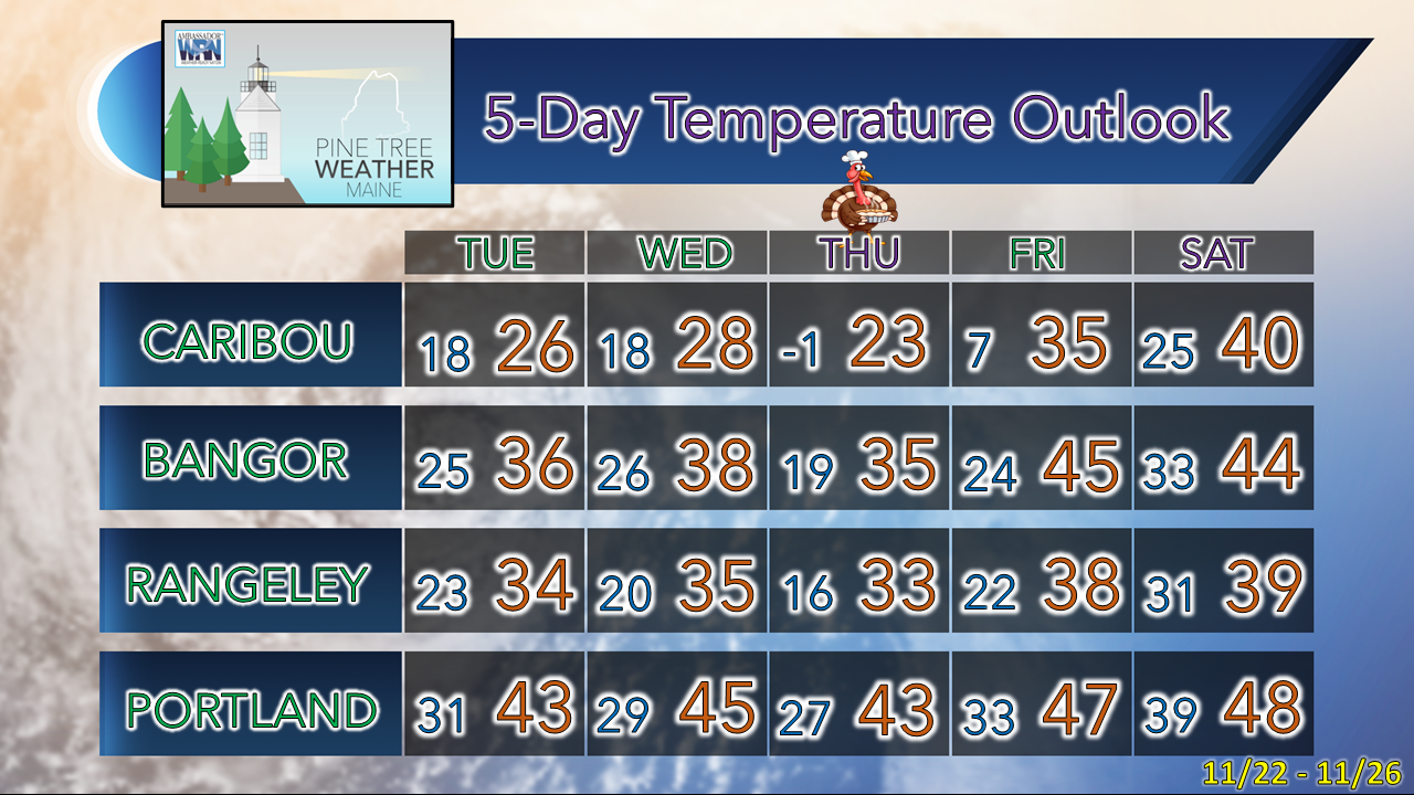 Thank you as always for your support! Stay updated, stay on alert, and stay safe! - Mike NOTE: The forecast information depicted on this platform is for general information purposes only for the public and is not designed or intended for commercial use. For those seeking pinpoint weather information for business operations, you should use a private sector source. For information about where to find commercial forecasters to assist your business, please message me and I will be happy to help you |

Mike Haggett
|


