Pine Tree Weather
  • DISCUSSIONS
  • DONATE
  • MAPS
  • NWS BRIEFINGS
  • SATRAD
  • MARINE
  • SNOW / ICE OUTLOOK
  • RAIN OUTLOOK
  • CPC OUTLOOK
  • Kennebunk
  • OBSERVING WEATHER
  • Who We Are
  • My Photography
  • DISCUSSIONS
  • DONATE
  • MAPS
  • NWS BRIEFINGS
  • SATRAD
  • MARINE
  • SNOW / ICE OUTLOOK
  • RAIN OUTLOOK
  • CPC OUTLOOK
  • Kennebunk
  • OBSERVING WEATHER
  • Who We Are
  • My Photography

Snow showers For Tuesday; weekend ice potential

1/9/2018

Comments


No accumulation expected

Picture
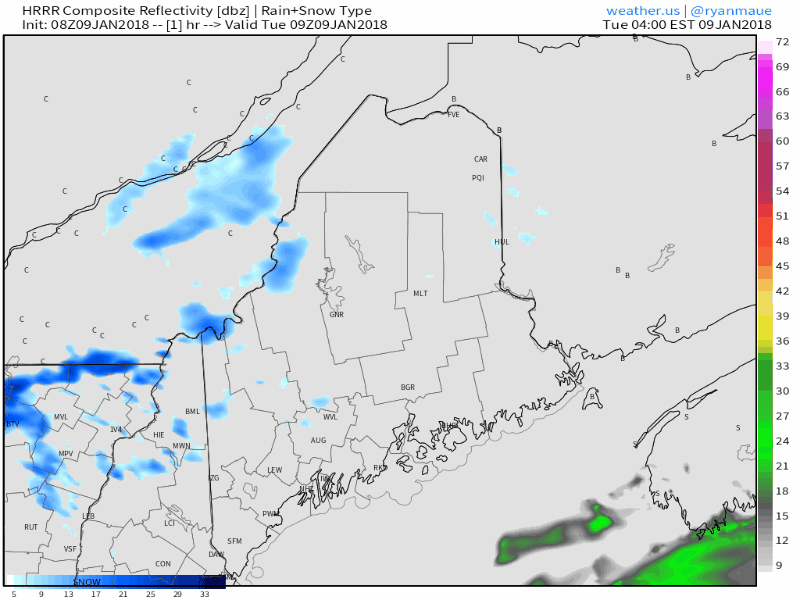
A few flakes will fly in the mountains and north today with a few stragglers reaching the shorelines. Isolated areas may get a dusting out it, otherwise, no accumulation is likely. Southern and eastern zones see high temperatures above freezing for the first time since December 26th. The mountains and north stay on the chilly side with highs in the 20s. Wind speeds will pick up in the afternoon, gusting from the northwest in the 20-30 mph range.

The breeze settles down tonight, skies clear out, and temperatures fall to around 0° for the north country to around 10° at the coast.  

Thursday through Sunday appear messy

Picture
This gif image is presented to you to get rough idea of what to expect from Wednesday afternoon onward. There is some light freezing rain to contend with Wednesday night into Thursday morning, but it will be light enough that accretion concerns are not a concern. Freezing rain changes to all rain statewide by Thursday afternoon. Rain continues into Friday. Low pressure forms along the cold front and moves northeast during the day Saturday, which will bring in some sleet, but the main concern will be for freezing rain. The end time of all of this is still in question for Sunday. Most areas may see some snow as a parting gift as the storm moves northeast and the frontal boundary slides offshore. Guidance has varying ideas when that will happen. A blend of their ideas as snow ending Sunday morning south and west and in the afternoon for the north and east. 

Stay tuned for more updates.

The 5-Day Outlook page has been updated through Sunday. 

- Mike 
Comments
    Picture

    Mike Haggett
    Kennebunk, ME

    Certified Weather
    Forecaster
    Penn State '21

    American Meteorological Society

    National Weather Association

    Weather-Ready Nation 
    Ambassador
    ​
    ​SKYWARN-CWOP

    Matthew 19:26


    Support
    Pine Tree Weather

    DONATE

    Picture

    Picture

    Picture

    Picture

    Picture

    Picture

    Picture

    Picture

    Picture

    Picture

    Archives

    January 2023
    December 2022
    November 2022
    October 2022
    September 2022
    August 2022
    July 2022
    June 2022
    May 2022
    April 2022
    March 2022
    February 2022
    January 2022
    December 2021
    November 2021
    October 2021
    September 2021
    August 2021
    July 2021
    June 2021
    May 2021
    April 2021
    March 2021
    February 2021
    January 2021
    December 2020
    November 2020
    October 2020
    September 2020
    August 2020
    July 2020
    June 2020
    May 2020
    April 2020
    March 2020
    February 2020
    January 2020
    December 2019
    November 2019
    October 2019
    September 2019
    August 2019
    July 2019
    June 2019
    May 2019
    April 2019
    March 2019
    February 2019
    January 2019
    December 2018
    November 2018
    October 2018
    September 2018
    August 2018
    July 2018
    June 2018
    May 2018
    April 2018
    March 2018
    February 2018
    January 2018
    December 2017
    November 2017
    October 2017

    RSS Feed

Proudly powered by Weebly