|
Thanks to the donors who pitched in, Giving Tuesday helped cut the funding deficit to $675 for the year ahead. I appreciate the kind words that came along with them. I was up at 2 AM to put this discussion together before I work a long day at the office. This is typical for me under the new normal. The donors make it worth my while to do this, and I don't mind doing it if the funds are there. If you have yet to contribute, please do so soon. I'd rather focus on forecasting than fretting over the budget. Thank you as always for your support! Snow showers around for Wednesday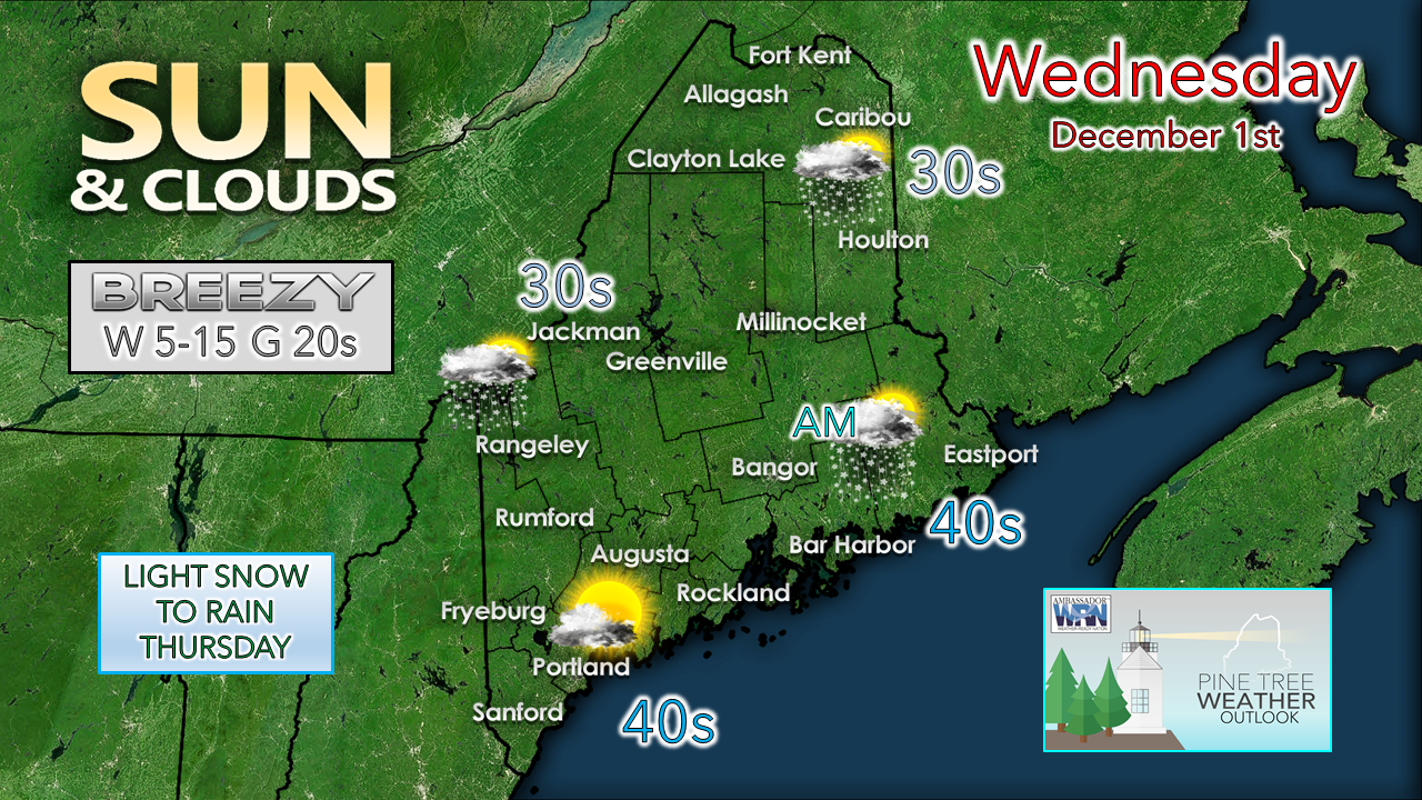 A weak wave passes through the region for the day and brings breezy conditions and a chance for snow showers for the interior. Eastern areas may see some snow showers to start off, but those appear to dissipate by mid-morning. Snow showers are possible for the mountains and north through the day. Western and southern areas feel the breeze in the morning which is on track to drop in the afternoon. Northern and eastern areas notice the breeze pick up this afternoon and diminish in the evening. 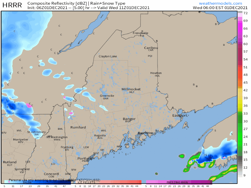 Wednesday 6 AM to 6 PM - A general idea of what to expect for timing of precipitation shows the weak clipper kicking up snow showers in the morning. As the front passes through, the snow showers taper off from west to east in the afternoon. Accumulations are expected to be light in areas that get any amount, and poses no real concern for travel. Snow to rain for Thursday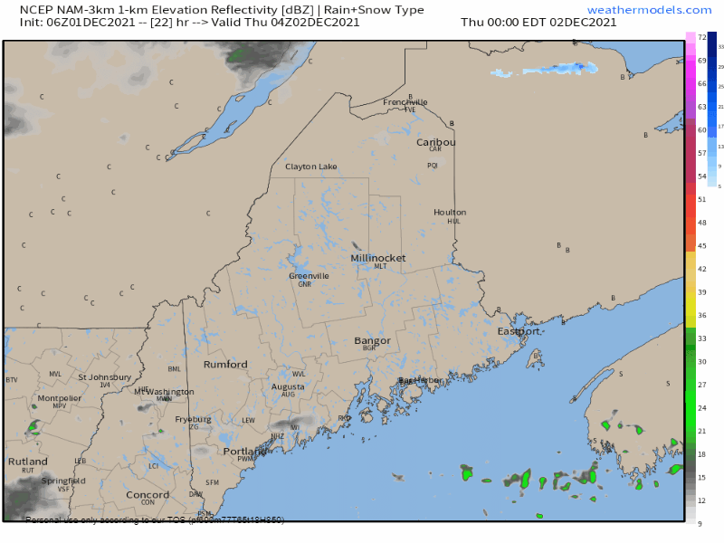 Thursday Midnight to Friday Midnight - A warm front moves in from the southwest overnight and is expected to bring rain and snow showers into the region. Interior areas may see light accumulations of snow and perhaps a bit of sleet before changing over to rain during the day. A cold front passes through in the afternoon and evening, and snow showers and squalls are possible over the Quebec border region heading into the overnight. 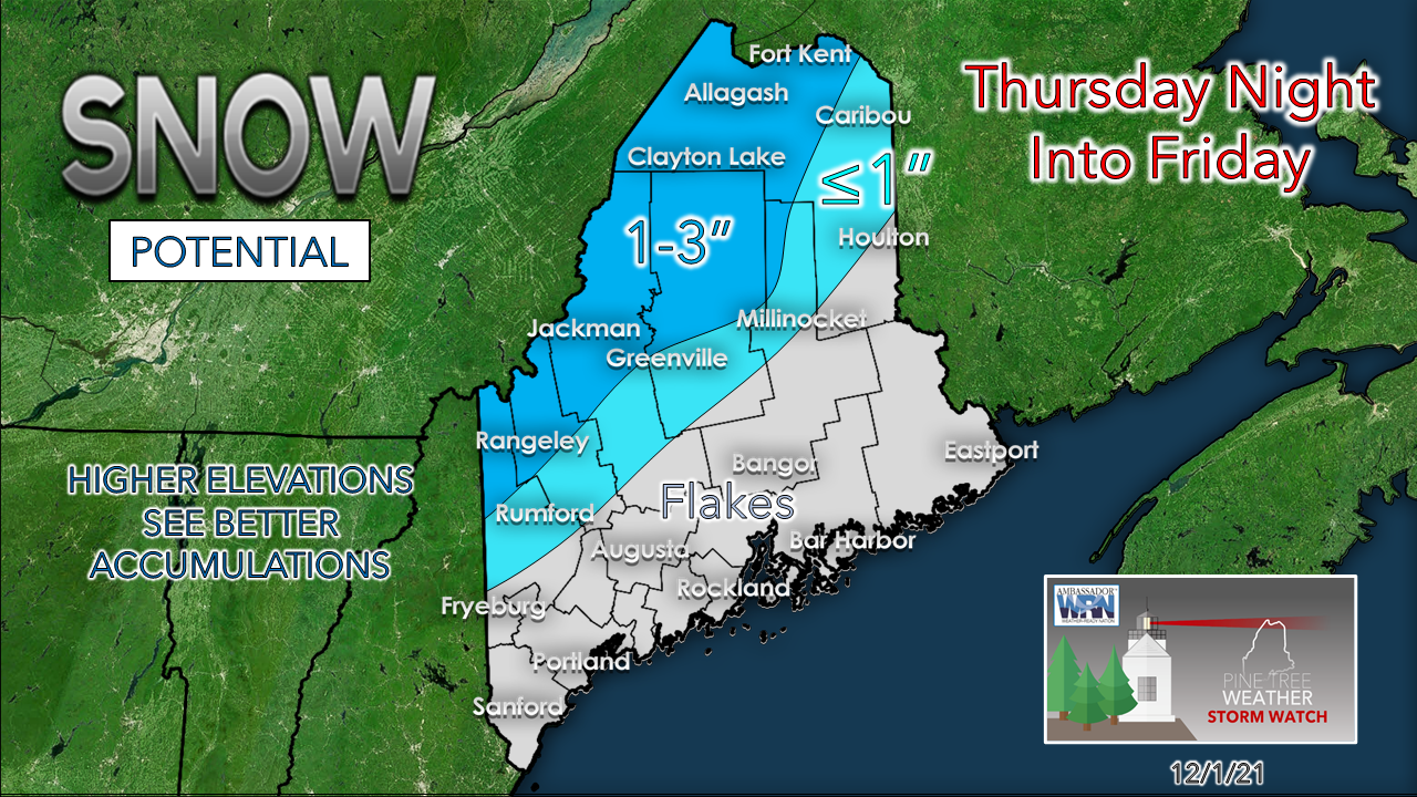 The system passing through is low on moisture. Eastern areas may pick up between ¼-½" of rain, with the rest of the region seeing less than ¼" in liquid form. The valleys in the mountains may get an inch of snow on the backside Thursday night, with the higher elevations potentially picking up as much as 3" from snow showers and squalls into Friday morning. Expect Friday to be a breezy day with wind chill values in the single digits and teens over much of the region. Wind speeds could reach 30+ mph in the mountains, and 20-30 mph elsewhere. Weekend outlook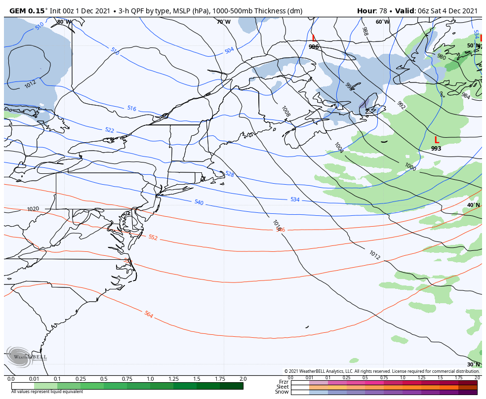 Saturday 1 AM to Sunday 1 PM - A weak impulse may touch off snow showers over southwestern areas during the day. High pressure controls the sky for Sunday. Expect chilly starts over interior areas with overnight lows in the single digits to start both days. Storm to watch to start next week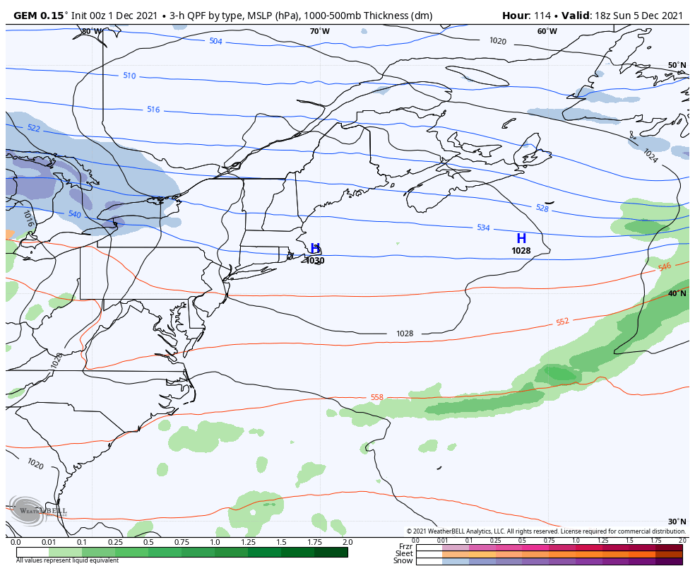 Sunday 1 PM to Tuesday 7 PM - As Thursday's storm is an "inside runner" with low pressure passing over the St. Lawrence River Valley, deterministic model ideas are pitching something similar. These ideas of the position of the low were more south, colder and snowier earlier this week, but have shifted northward in recent updates. 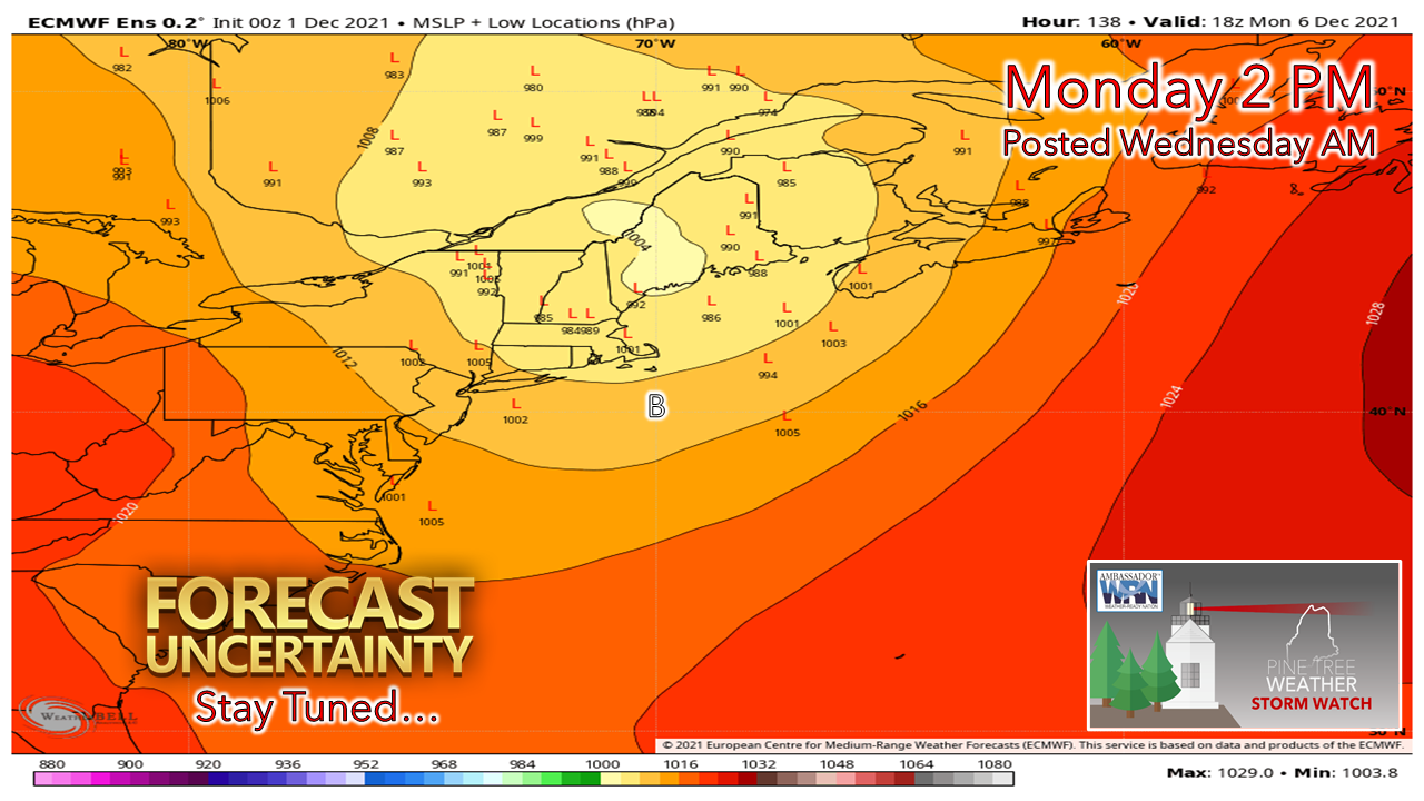 What sticks in my mind looking at this is the amount of cold around from the weekend may cause the current deterministic ideas to move further south again. Forecast models and cold do not get along well, which is a documented fact that I have discussed in discussions for years. It's something to watch and stay updated on in the next few days. Temperature outlook through MondayTemperatures run on the warm side through Friday before falling well below normal for much of the region over the weekend and to start next week. 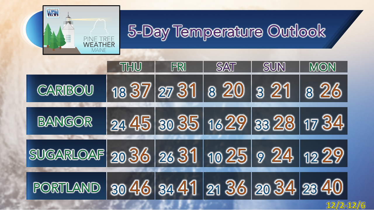  mPING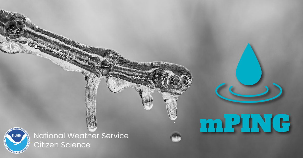 Check out the mPING (Meteorological Phenomena Identification Near the Ground) project. Weird name, cool app! You can report the type of precipitation you see where you are. No need to measure! Use the free mobile app to send reports anonymously. Reports are automatically recorded into a database, which improves weather computer models. The information is even used by road maintenance operations and the aviation industry to diagnose areas of icing. mping.nssl.noaa.gov #CitizenScience Be prepared to receive alerts and stay updated!
 For more information in between posts, please follow Pine Tree Weather on Facebook and Twitter.
Thank you for supporting this community-based weather information source which operates by reader supported financial contributions. - Mike |

Mike Haggett
|