A few slick spots around overnight into Thursday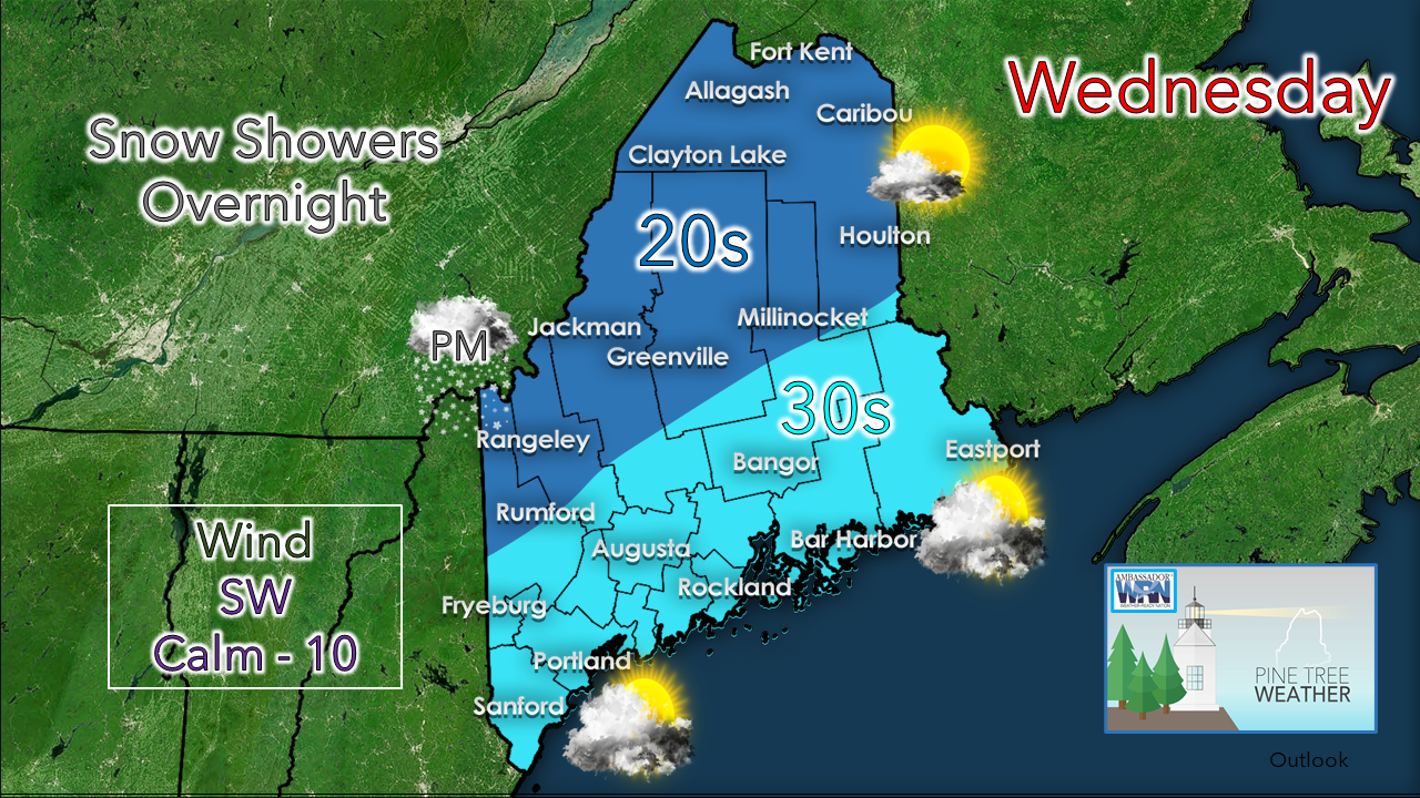 Finally a day with wind speeds on the low end after this breezy period. If you want to see some sun for more than an a few hours, head north. Eastern areas may see the sun early before clouds increase. Southern areas see the sun rise then clouds increase through the morning. Clouds become dominant everywhere by this evening. I know the glowing orb has been missing in action for several days. Unfortunately, it may be several more days before the region gets a blue bird sky. November is typically our cloudiest month of the year. We were spoiled in that regard with a nice stretch of weather through the middle part of that month. December started off cloudy, and it appears to stay that way in general terms at least into next week. 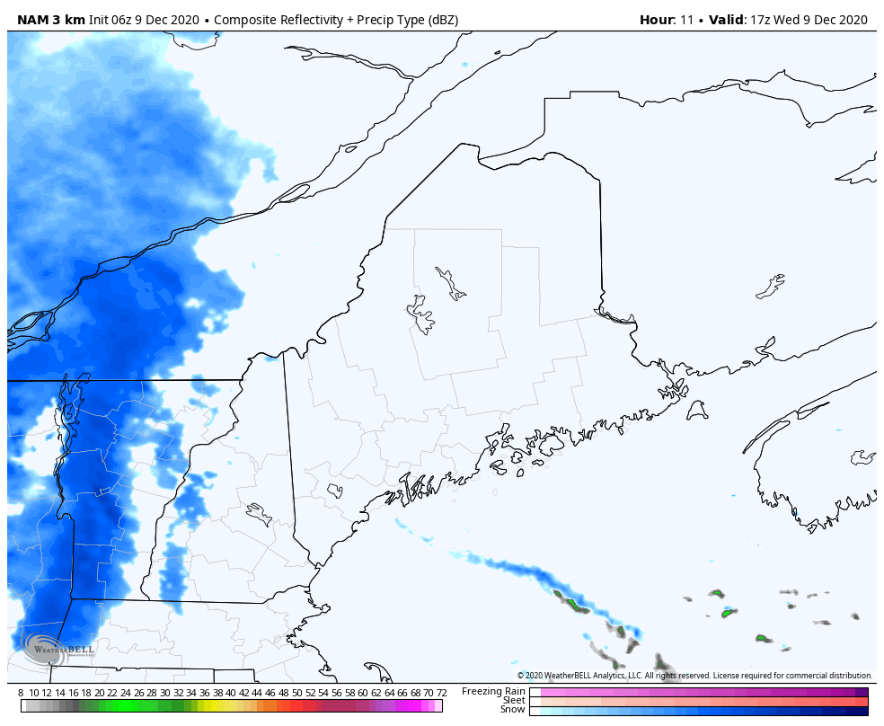 Snow showers are expected to creep into the region Wednesday afternoon into the evening. Notice the fetch along the coast. This has been a concern of mine over the past couple of days for potential enhancement. While this is technically a warm front, it has inversion characteristics to it. I could see an inch or more of snow accumulating from Portland over to Bar Harbor under the right circumstances. 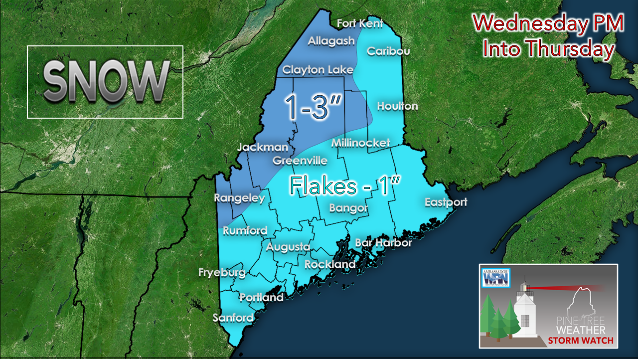 Higher elevations in the mountains get the higher amounts there. I revised this map to reflect the potential for a bit of a surprise elsewhere. For the snow removal folks who follow, have your sander trucks loaded as you may need it.  Cold air damming to watch for the weekend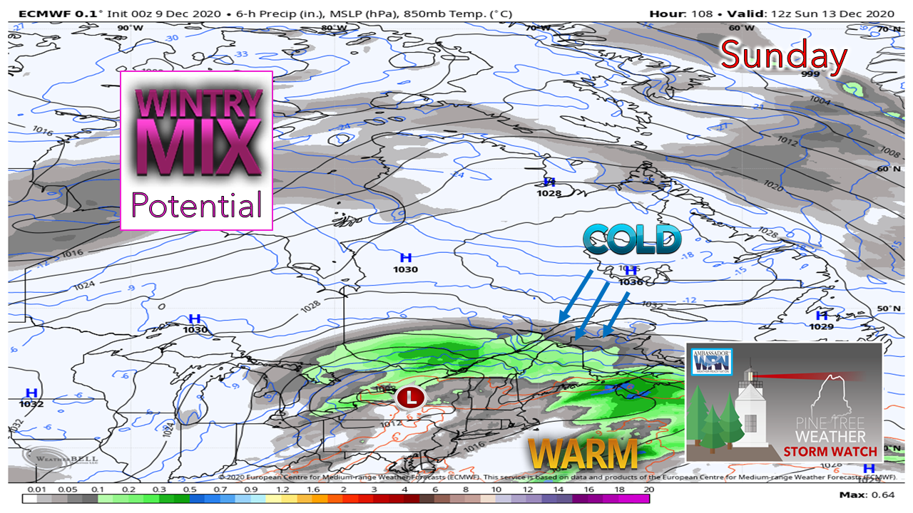 Anytime there is high pressure around Labrador with any amount of strength this time of the year, that is clear signal to watch for cold air damming. That is exactly the idea that is being pitched right now. Several model ideas are on it, although they vary with the intensity of the high, which has a direct impact on the outcome. Saturday looks fair for now. The region may see some sun & clouds early, but clouds are likely to be on the increase for the day. Snow may break out in the western mountains late in the afternoon or early evening. Precipitation then overspreads the state Saturday night. It's a bit early to nail down who gets what type south of the mountains and The County. It's a fair bet that the foothills, central, and interior eastern areas deal with snow, sleet and/or freezing rain. How close to the coast is yet to be figured out. Stay tuned. 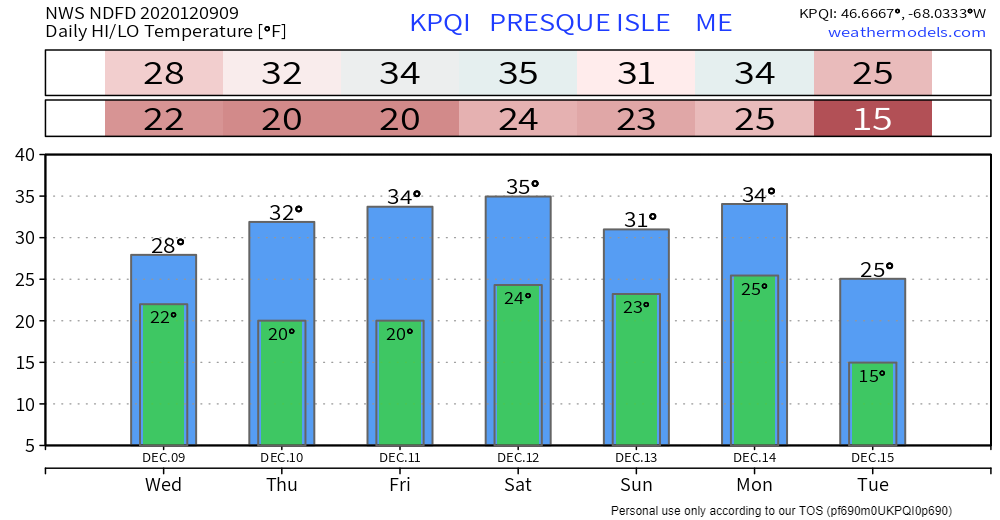 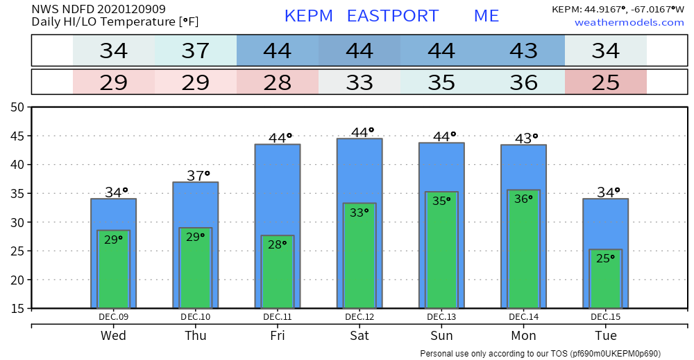 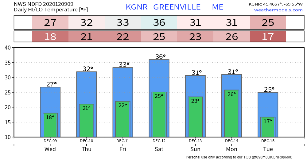 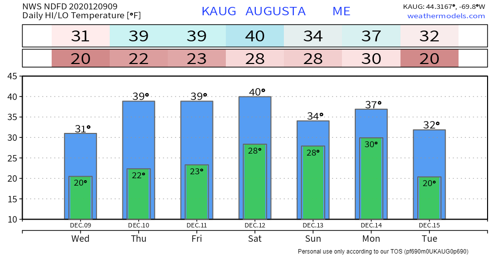 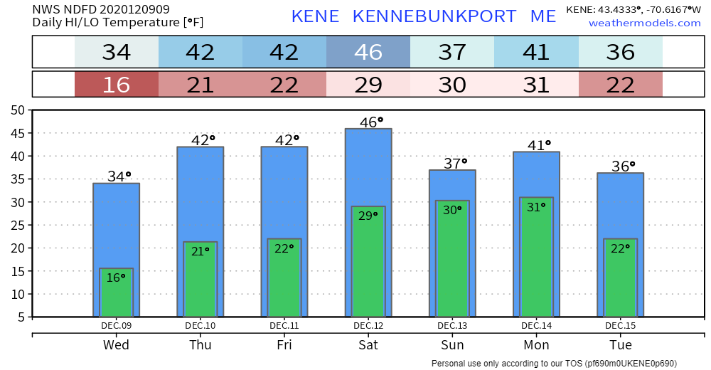 Become an mPINGer!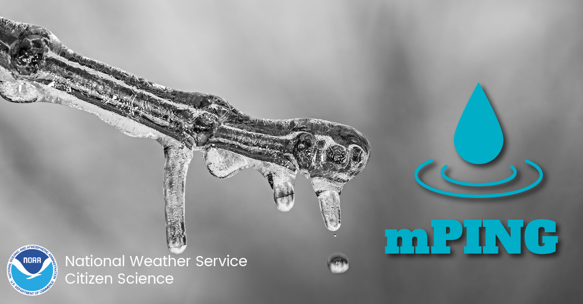 Check out mPING (Meteorological Phenomena Identification Near the Ground) project. Weird name, cool app! You can report the type of precipitation you see where you are. No need to measure! Use the free mobile app to send reports anonymously. Reports are automatically recorded into a database, which improves weather computer models. The information is even used by road maintenance operations and the aviation industry to diagnose areas of icing. mping.nssl.noaa.gov Be prepared to receive alerts and stay updated!
For more information, please follow Pine Tree Weather on Facebook and Twitter.
** FUNDING NEEDED FOR 2021 ** Thank you for supporting this community based weather information source that is funded by your financial contributions. Stay updated, stay on alert, and stay safe! - Mike |

Mike Haggett
|