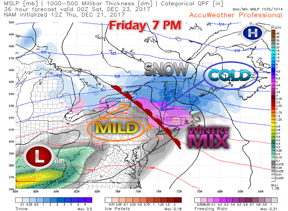
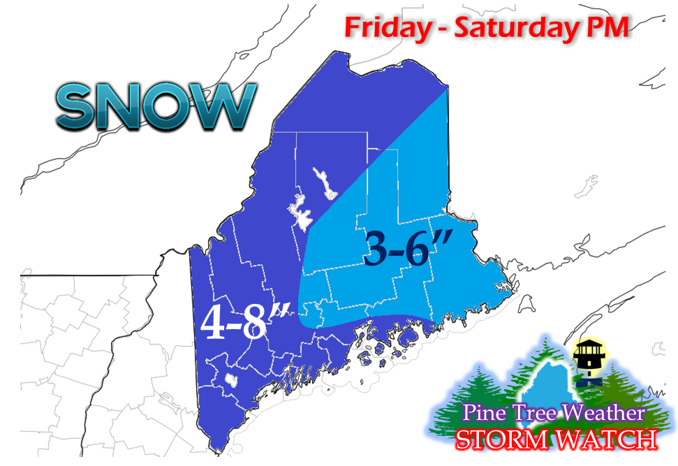
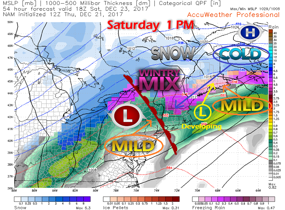
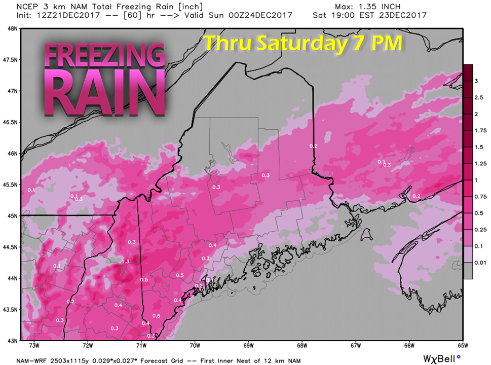
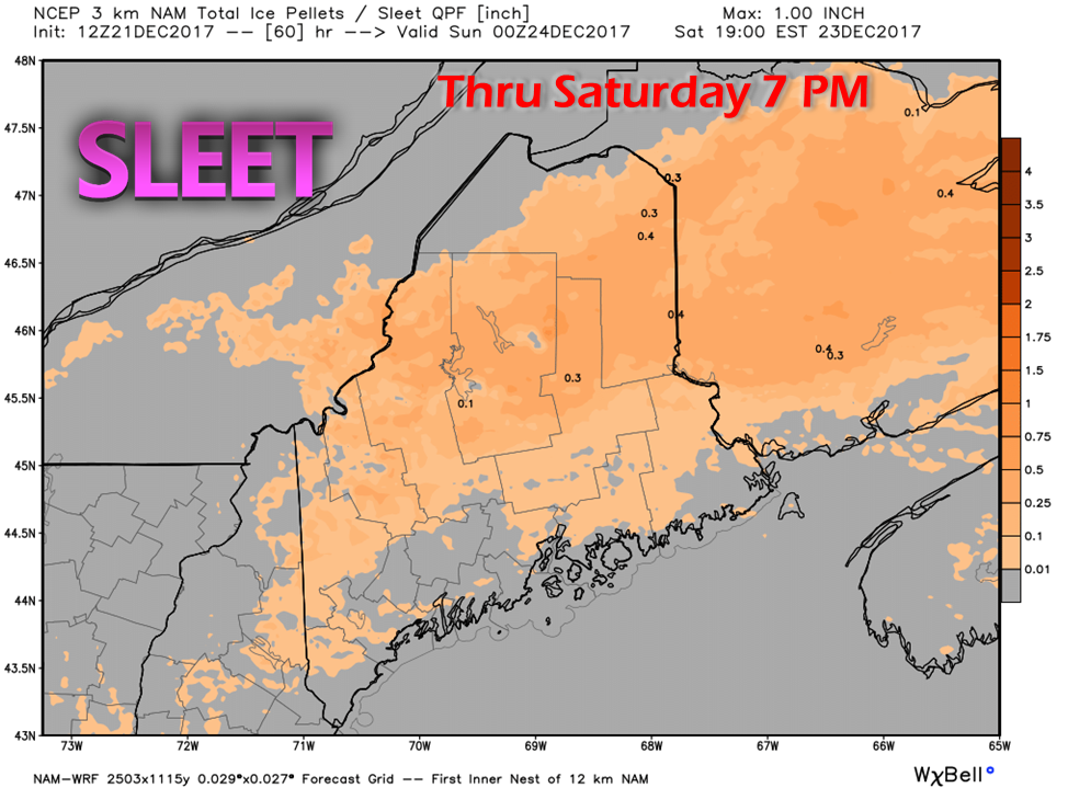
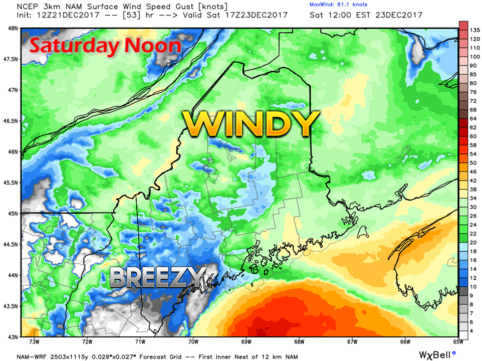
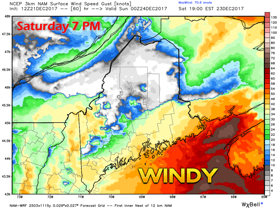
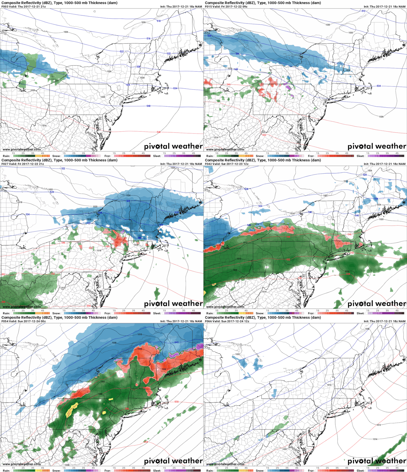
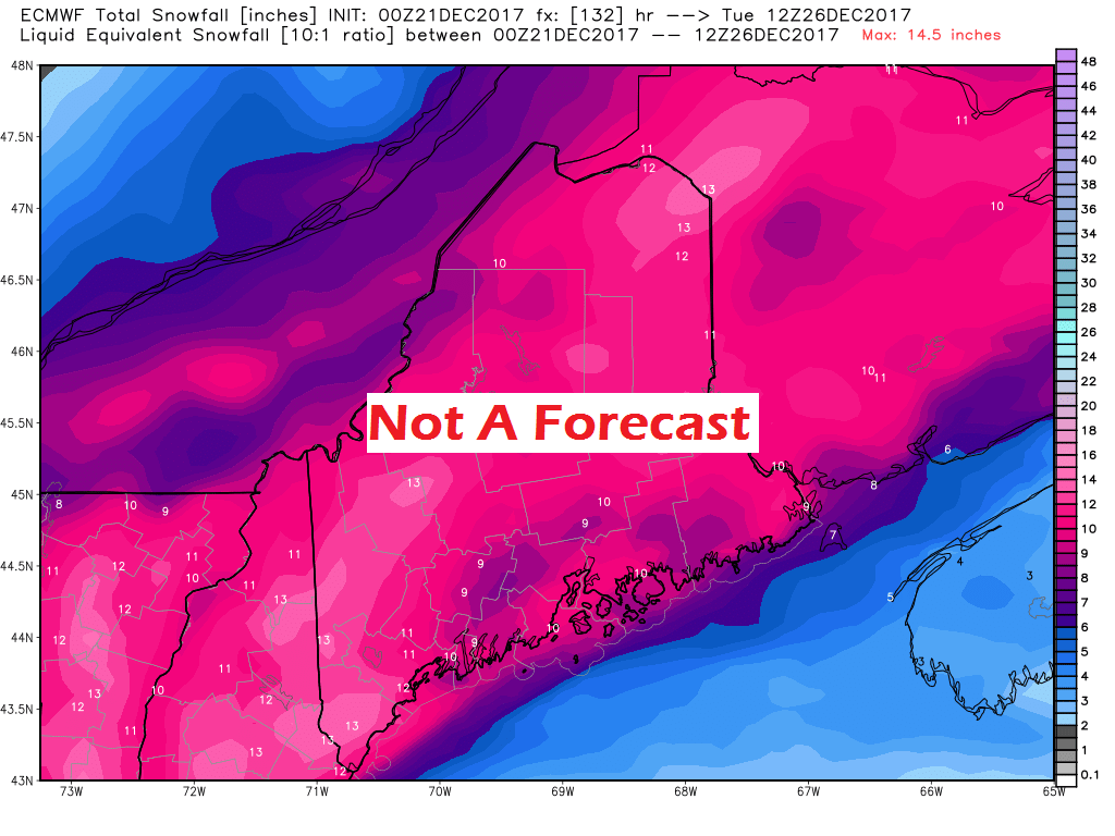
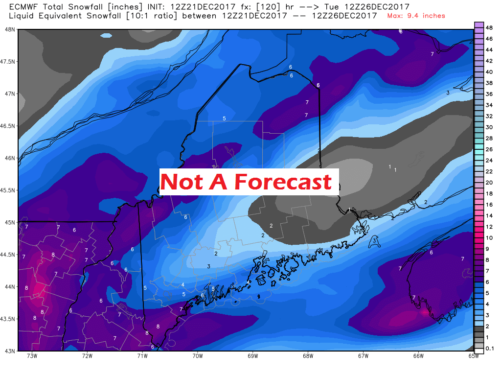
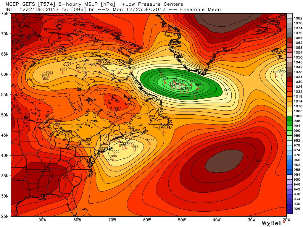
A messy Friday and SaturdayHow about some meteorological football play planning? If you've ever seen a football playbook or drafted one if you are a coach, you'll appreciate this post. If you don't like football or not into the X's and O's part of the game, you'll have to ride this one out. Like a pigskin plan on a napkin is how the first half of the weekend is going to play out. Strong high pressure to the northeast is going to wreak havoc with the surface as warm air overloads aloft. The initial push comes as snow. It begins in southern areas Friday morning and moves northeast during the day and into Friday night. Dry air from the strong high may eat up precipitation at the onset, but as the air column becomes more saturated, snow will reach the surface statewide. For The County, the day escapes with increasing clouds with snow developing after dark. I have tweaked the snow fall projections a bit to account for the fluff factor of the snow. For southern areas, most of this is down by around daylight, western areas by mid-morning, eastern areas by around noon, northern areas by mid to late afternoon. Saturday features all four meteorological food groupsBack to the playbook. The surface warm front hasn't gained a whole lot of territory since last visited Friday evening. The high to the northeast is still hanging on strong. Low pressure over New York hits the wall of cold and tries to find an escape and begins to transfer energy over the Gulf of Maine. While that battle rages on, the wintry mix becomes a real problem for western, southern and eastern areas as the cold at the surface just will not budge. As you look at this projected ice accretion chart, don't get caught up in the localized amounts as they are likely inflated. The key here is to look at the widespread area that could get freezing rain for at least part of the storm. If you're area is in the pink, expect at least some ice accretion to happen during the day on Saturday. As I have mentioned previously, a lot has to go right for freezing rain events. Any nose of cold air that holds on changes the outcome once it reaches terra firma. And it will be that nose of cold that holds below the warm where sleet is likely to be an issue. Any sleet that falls will eat away at freezing rain accretion, and for northeastern areas, snow. My snow map illustrates that chance. You may not see orange where you are, but that does not mean you won't see any. Just remember... cold air and weather models do not get along very well. All four food groups are on display for Friday and Saturday on this chart. All areas see snow. Best chance fora change over to rain is east of Penobscot Bay. West of Penobscot Bay depends on the cold. NOTE: This NAM model runs on the warm side. This chart is for discussion purposes only, and should not be used to indicate outcome. This is a very complicated set up, which this chart is being used to define it. And then there is the wind...This is where it becomes a concern for any event with ice as a potential. As the low transfers energy over the Gulf of Maine, it intensifies. With any intensification, comes wind. Given the projected track, western and southern areas may escape the strongest wind, that is track dependent however. With the icing that could come out of this, at least some power outages can be expected. The main area of concern for the strongest wind is for Lincoln, Knox and Waldo County eastward by Saturday evening. Western and southern areas are in for a fairly stiff breeze also. If the freezing rain does accumulate over the southwest interior up into the western mountains, power outages are possible there until the wind diminishes overnight into Sunday morning. Due to low tide occurring Saturday evening, I do not expect any coastal flooding issues. Futurecast radar from the 18z NAM model in three hour increments presented for time frame purposes, and not for precipitation type. Precipitation begins Friday morning and is expected to end Saturday night or the wee hours of Sunday. Sunday may see some widely scattered snow showers in the mountains and north, but otherwise should be void of precipitation. And then there is Christmas...I mention model volatility from time to time and also advise to beware of the foolish snow fall charts that go viral on social media. This type of science fiction causes more harm than good, and causes panic and fear which is unnecessary and false. Here's a perfect example in regards to Christmas. This is the European 00z run from Wednesday evening showing this outcome of potential snowfall accumulation from Friday to Tuesday ... And then the same model pitches this idea in data collected just 12 hours later for the same time frame... A very stark difference in snow totals from the same model. While the image shows the epic snow gets spread around, this one won't get a whole of traction, and chances are it won't get shared. This leads to my point about what to expect for Christmas Day... A look here at the GEFS ensembles shows most of the members with the storm offshore. The European model has changed its tune and is very similar. This has exploited a known bias in the European model on how it handles southwestern energy. Consequently, the energy has flattened out. What that means is snow is still in forecast, but at this point not a high impact event. The mountains and north see snow showers, the south and east higher accumulations due to proximity to the coastal storm. By higher, I am roughly thinking 2-5", but it is still early in the ballgame to nail down. If the storm shifts west, that raises totals; further east, lessens totals. Expect some snow, with more details to come on amounts and timing.
The 5-Day Outlook page has been updated through Tuesday. The link on the menu above will get you there. - Mike |
Mike Haggett
|

