Pine Tree Weather
  • DISCUSSIONS
  • MAPS
  • BRIEFINGS
  • SATRAD
  • MARINE
  • RAIN OUTLOOK
  • SNOW / ICE OUTLOOK
  • CPC OUTLOOK
  • Kennebunk
  • Weather Geekdom
  • Who We Are
  • DONATE
  • My Photography
  • DISCUSSIONS
  • MAPS
  • BRIEFINGS
  • SATRAD
  • MARINE
  • RAIN OUTLOOK
  • SNOW / ICE OUTLOOK
  • CPC OUTLOOK
  • Kennebunk
  • Weather Geekdom
  • Who We Are
  • DONATE
  • My Photography

Snow, sleet, rain, and potential ice

11/9/2017

Comments


Could be icy in spots Friday

Picture
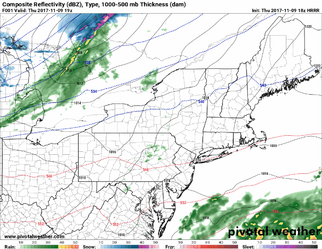
Now that you know what the potential is for wind from my previous update, I will turn attention to the snow and rain part of this. If you see rain, you need to think ICE. Once the front passes and the wind shifts, anything liquid is going to freeze.

The HRRR model idea here shows some juiced up bands of snow, sleet and rain. Southerly wind will help warm things up for southern areas. The cut off will be roughly around Greenville, Millinocket, Houlton areas northward which appear to be in the snow/sleet mix. 

As you can see, this isn't a strong precipitation event. It boils down to what moisture it can grab off the Great Lakes and outflow brought up from the south. 

In areas where it rains, do be concerned for icing. The wind may dry up most of it since there isn't that much of it. But a little ice on roadways could be too much ice. That could happen fast, so use caution if you see rain and/or see darken roadways that could be in the process or have frozen over. 
Picture
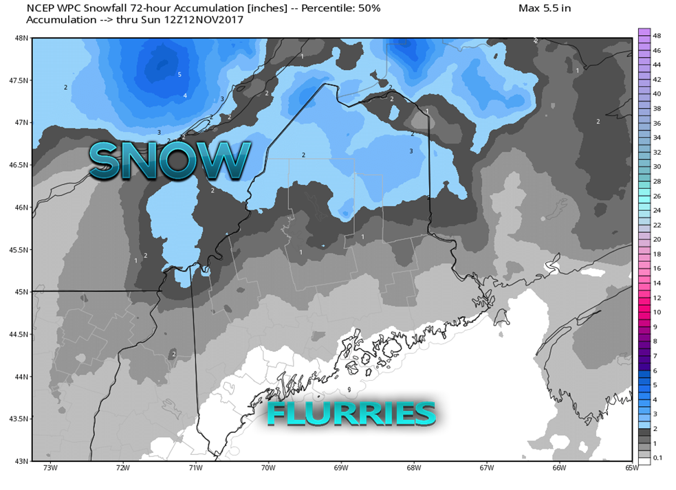
There is a bit more snow in the map posted by the Weather Prediction Center, but not much. It may dust the roads in southern areas and DownEast, but that is about it. I still think the ski hills do alright with this one as I think this is underdone for the higher elevations. 
Picture
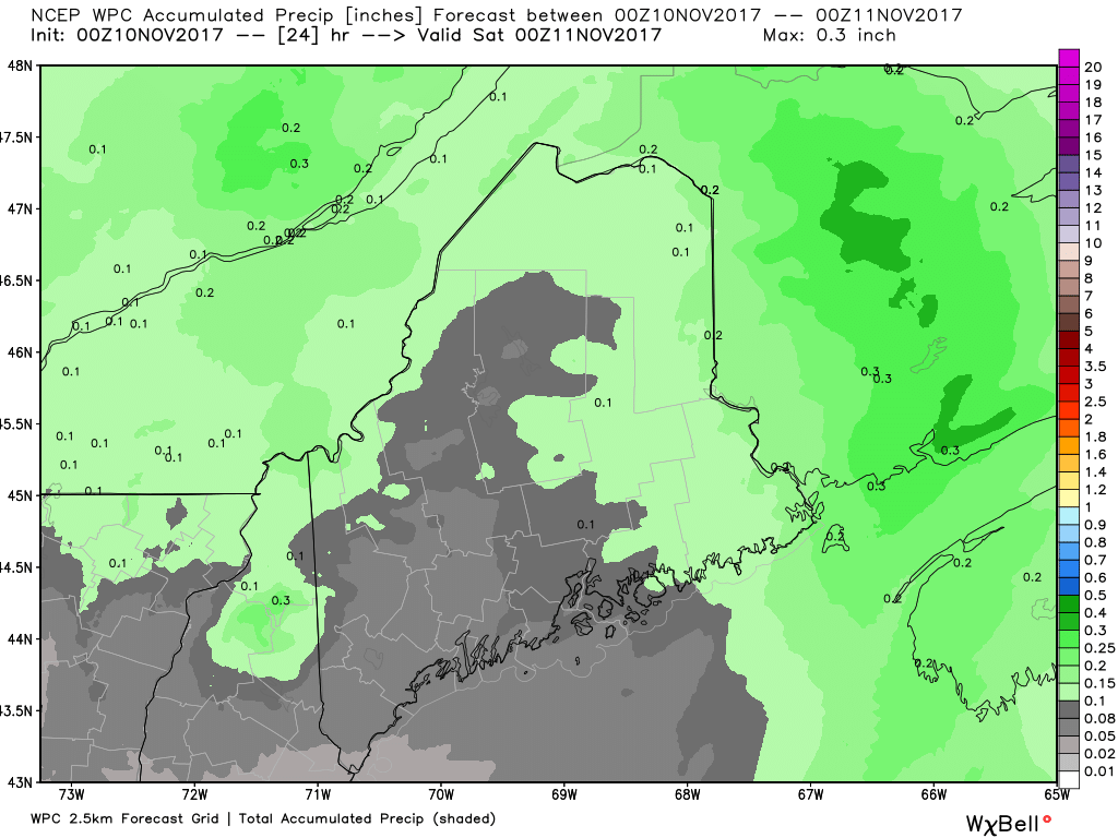
Adding the combination of total water in all precipitation that falls, there isn't a whole lot here. Since the air coming is in cold, that will fluff the snow up a bit. 

Just be cautious for some areas of potential ice as you travel around Friday afternoon. It won't be a nightmare to get around, but taking a safe approach is the right approach. 

​- Mike 
Comments
    Picture

    Mike Haggett
    Kennebunk, ME

    Penn State
    Weather Forecast Certification '21.
    AMS / NWA
    Weather-Ready Nation 
    ​SKYWARN-CWOP

    Picture

    Alex Hatfield
    Wakefield,MA


    Penn State
    Meteorology and Atmospheric Science ‘21
    PSUBAMS
    Campus Weather Service
    PSU Storm Chase Team
    PSU College of Earth &  Mineral Sciences Ambassador

    Picture

    Kaitlyn Lardeo
    ​Syracuse, NY

    SUNY Oswego
    Atmospheric Science
    Lake Effect Storm Prediction and Research Center
    Northeastern Storm Conference Contributor

    DONATE
    Picture

    Archives

    January 2021
    December 2020
    November 2020
    October 2020
    September 2020
    August 2020
    July 2020
    June 2020
    May 2020
    April 2020
    March 2020
    February 2020
    January 2020
    December 2019
    November 2019
    October 2019
    September 2019
    August 2019
    July 2019
    June 2019
    May 2019
    April 2019
    March 2019
    February 2019
    January 2019
    December 2018
    November 2018
    October 2018
    September 2018
    August 2018
    July 2018
    June 2018
    May 2018
    April 2018
    March 2018
    February 2018
    January 2018
    December 2017
    November 2017
    October 2017

    Categories

    All
    Maine Weather
    Pine Tree Weather

    RSS Feed

Proudly powered by Weebly