
New for winter: snow squall warnings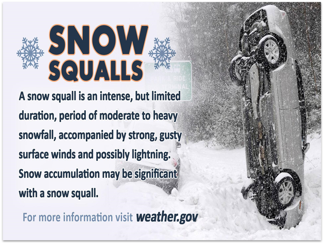 Snow squalls are winter's version of severe thunderstorms. For years the National Weather Service would issue Special Weather Statements, but unless one was paying close attention, those alerts went unnoticed. New to this year, NWS will be issuing Snow Squall Warnings, like they do Severe Thunderstorm Warnings. If you have a smartphone app from a reliable company, listen to terrestrial radio, or carry around a NOAA Weather Radio with alert function, you will be notified when these dangerous squalls develop. This is especially important for those who are travelling. If there is an alert issued for the region you are driving in, the suggested action to take is to pull over to the side of the road and wait for the squall to pass. Snow squalls can cause whiteout conditions from blowing snow and make the streets and highways slick with rapidly accumulation snow. In summer, severe storms are usually a hit or miss situation. Some places get them, some do not. Storm Prediction Center issues risk levels and areas of potential. In this case, we don't have criteria for risk levels. We're not going to have a Snow Squall Watch issued. When it happens, it may catch you by surprise. You know about the potential, because you read this. With Wednesday the busiest travel day of the year, many folks will be on the roads travelling to see family and loved ones. Snow squalls are in the forecast, and it would be wise to stay on alert for bulletins and take appropriate action for safety. Chance for squalls for most of the state An arctic frontal boundary will work through the state Wednesday afternoon and is likely to bring snow snow squalls along with it through the evening. Expect rapidly changing road conditions, gusty wind, and whiteout conditions. If you encounter a squall while driving, pull over to the side of the road, put your hazard lights on, and await for the squall to pass. Be aware that these squalls are especially dangerous after dark, and there is that potential given the timing of these. Thanksgiving to be one cold turkey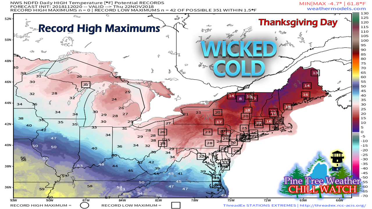 Much of the northeast is likely to set new record high temperature maximums for the date. Record low temperatures surprisingly appear not in jeopardy, so having cold air around this time of the year isn't completely uncommon. Forecast highs in the mountains are likely to stay in the single digits and teens are likely for the coast, but it isn't going to feel that way.  Wind chill advisory is likely for at least the mountains and north country Wednesday night into Thursday morning as wind chill values may bottom out -10° to -20° or worse in areas. Wind gusts could range 25-35 mph with some 40 mph gusts possible at higher elevations. Folks headed to the ski hills should be aware that delays on higher elevation trails are entirely possible. As the air mass works in, wind will begin to decrease late Thursday night into Friday morning. Bundle up, and be prepared to deal with the freezer burn conditions. Outlook through the weekend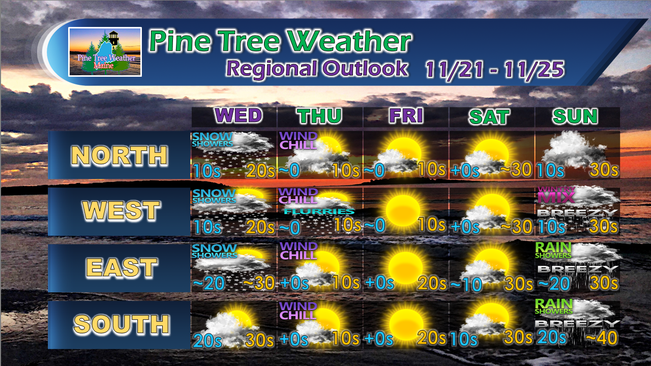 A few snow showers are possible Thursday morning in the higher elevations as the arctic high builds in. Keep in mind areas where there is powdery snow, it may blow around and cause drifting on roadways, so keep that in mind as you travel. The region stays precipitation free until Sunday, and temperatures gradually warm up through the long weekend. Your support is valued and appreciated!Please consider making a donation to keep Pine Tree Weather going through the year ahead. My data cost expense is increasing. The operation is 75% funded and needs your help to get through the winter. You can set up a monthly pledge on my Patreon page or send me a message from the Facebook page or direct message on Twitter to get my address to mail a check or set up bill pay.
For the latest official forecasts, bulletins and advisories, please check in with the National Weather Service in Gray for western and southern areas, or Caribou for northern and eastern parts of Maine. For more information from me, please follow the Pine Tree Weather Facebook page and my Twitter feed. Always stay weather aware, and thank you for your support! - Mike |

Mike Haggett
|


