
Cold air pours in The upper level low associated with this week's storm is finally spinning itself out. In its last gasp, it is on track to drag down January cold associated with arctic high pressure that settles in for the weekend. A weak trough slides down Saturday morning, and brings the chance for snow squalls that may bring a quick dusting and variable clouds in the morning, but are on track to clear out later in the day. Other than that, the weekend should be void of any precipitation. 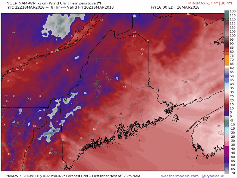 This is a look at wind chill values through 8 PM Sunday. We're not quite "freezer burn" level, but the mountains and north are likely to see "feels like" temperatures flirting with zero during the day and double digits below zero at night. Saturday night will be frosty everywhere. The air mass appears to moderate as we head into Monday with temperatures on the increase as we head into the workweek. While I cannot rule out snow for the foreseeable future, this is likely it for the bitter cold. Spring is gaining with the increase of daylight. A sure sign of spring...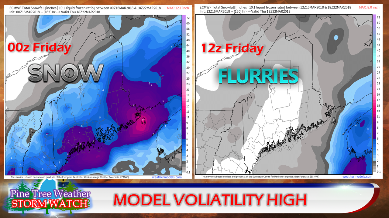 The change on seasons is on display in operational model output. As I regularly preach, models do not handle the cold well, which is part of the issue. Presented here are two operational runs of the European (ECMWF) model from Thursday evening (00z Friday) and Friday morning (12z) looking ahead to a potential storm next week. The 00z Friday indicates a decent snow fall, where the 12z Friday shows next to nothing. This is very typical model behavior for systems outside of the 5 day window. BEWARE of what you see on social media from now on in regards to snow events. Not only are they not handling storm tracks correctly, the 10:1, 15:1 and Kuchera style snow fall charts are most likely WRONG this time of the year. The ratio of snow to water is likely LESS than what these chart depict, especially for the coast. For example, the chart on the left indicating 6-7" of snow at a 10:1 ratio above may actually end up being rough half of that, or even less in some cases. We're entering the phase where snow ratios will vary by region, with a drier snow over the interior to a wetter snow for the shorelines. 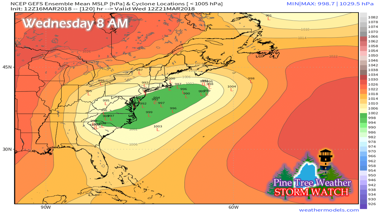 This idea of the GEFS (American GFS) ensembles also shows the volatility and uncertainty on the storm next week. The idea that I am getting from looking at guidance is that the idea of the lack of energy associated with this. The green ensemble mean idea on sea level pressure indicates the potential for it to be flat. In this scenario, there is nothing dramatic that would come out of it. The pressures listed on the little "L" ideas for potential areas of low pressure are rather tame.
At this point, if I had to make a call, the coast may get something out of this, and the jury is out how far inland the impact would be. The area I would have the most concern would be for the Mid-Atlantic and Southern New England at this point. The position of high pressure in Quebec may have the final say in what happens, along with where and when all the ingredients come together with this system. This is one to stay tuned on. Timing is still up in the air (literally) but a rough idea ranges from Tuesday afternoon / Wednesday and possibly into Thursday. By Sunday there will be a good idea of how this will play out. I will do my best to keep you updated. As always, stay in touch with NWS Gray or NWS Caribou. You can follow me on Twitter and Facebook as well. BEWARE OF THE HYPE! Have a great weekend! - Mike |

Mike Haggett
|


