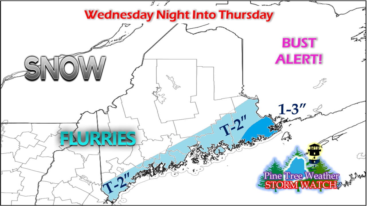
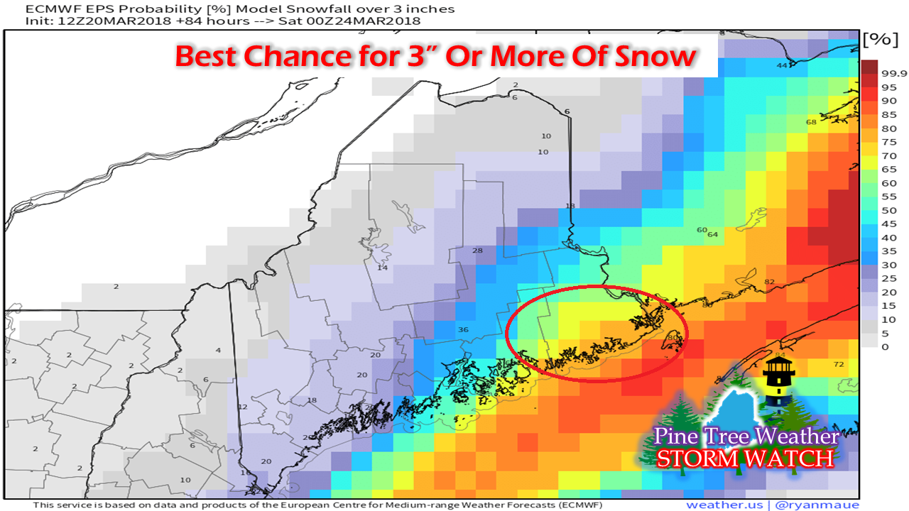
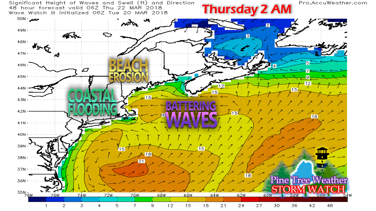
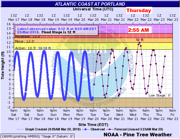
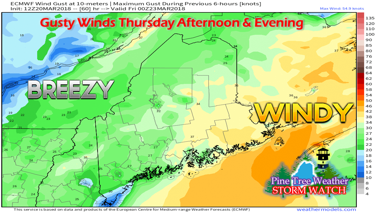
About that dry, cold air and high pressure...In yesterday's post I mentioned the fact that I did not like the way certain models were handling the cold, dry air and high pressure to the northwest of Maine. I had no problem poking holes into my forecast snowfall amount because I could smell the skunk in the barnyard, and it finally showed up. This wasn't a big event to begin with, and it is getting less impactful on the snow end as the event gets closer. All along I was saying the MidCoast and DownEast areas would likely see the most of this event, and that is still true. That said, there is a chance that the coast escapes with flurries by the time this over. The storm track is sinking further to the south and east, and the moisture associated with it is going with it. Southwest coastal areas to get battered againOur already battered shorelines are in for another round of wind, high surf, beach erosion and minor flooding from this storm, even with the more southeast track. The shorelines of the southwest coast are likely to see some splash over from the high tide in the wee hours of Thursday morning. This is when the height of the 1-2 foot storm surge is likely to accompany 9-14 foot waves along with the astronomical high tide from the full moon. Click here for the latest marine forecast. The wind will still blowAs the storm departs is when the wind is expected to pick up. This isn't anything too outrageous. It's high enough to cause spotty outages for the MidCoast and DownEast regions, but all in all the area appears to escape from the worst.
Due to time concerns, I have to keep this post short tonight. I will do my best to provide additional updates on this storm between my Twitter and Facebook feeds, and perhaps here on the website if time permits. As always, stay in touch with NWS Gray and NWS Caribou with the latest forecast information and bulletins. Thank you as always for your shares, retweets and support! -Mike |
Mike Haggett
|

