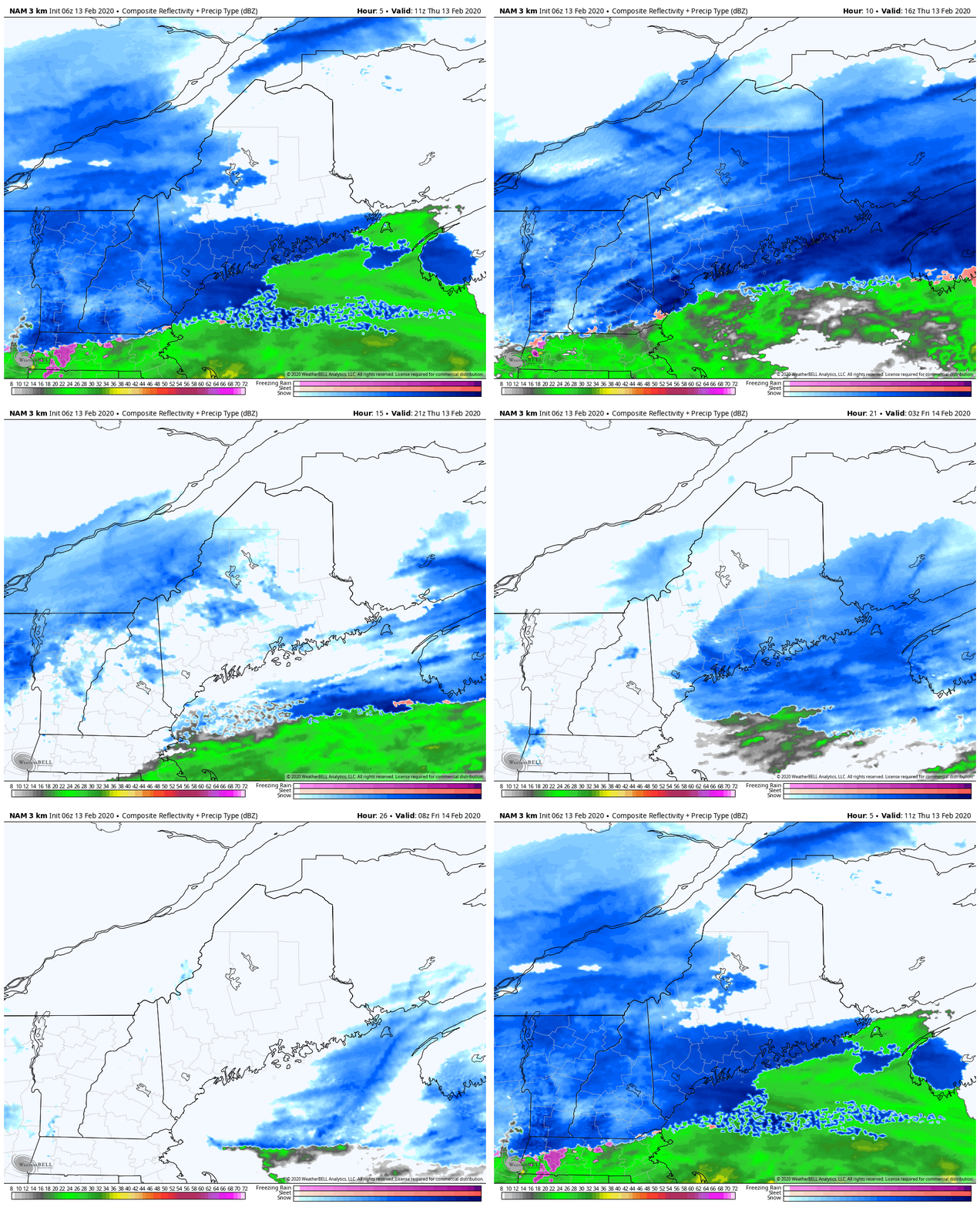
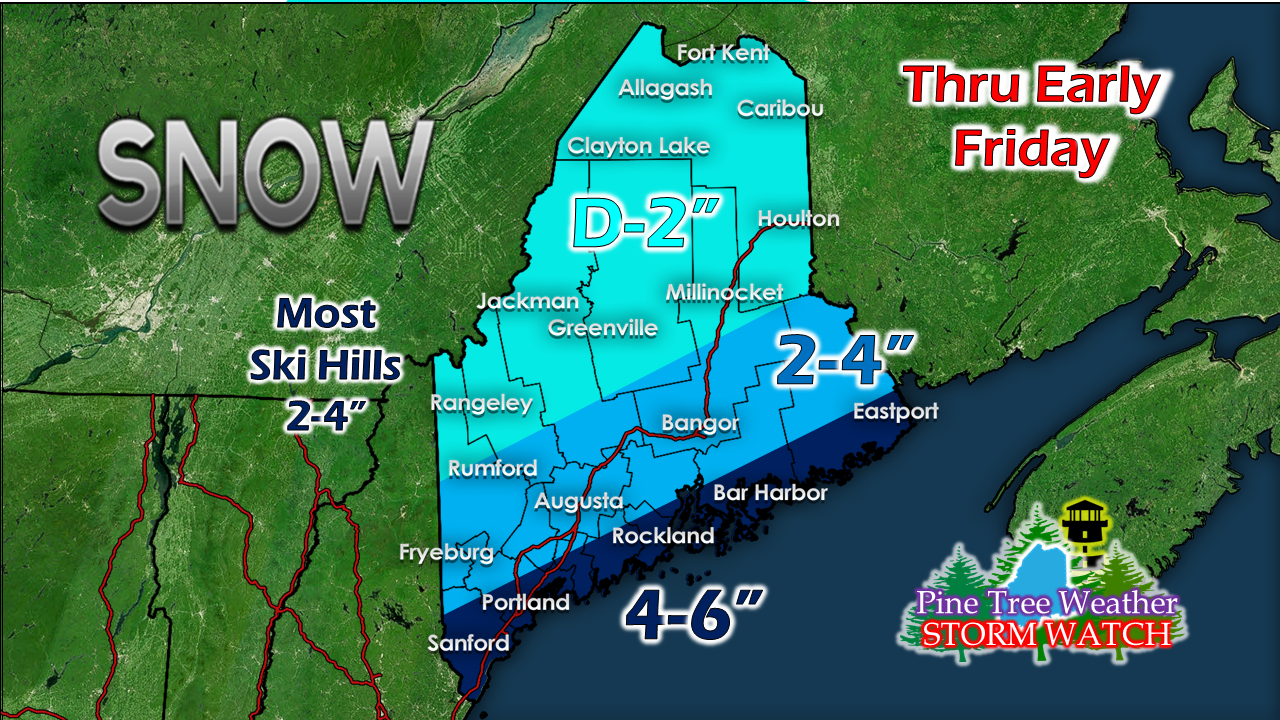
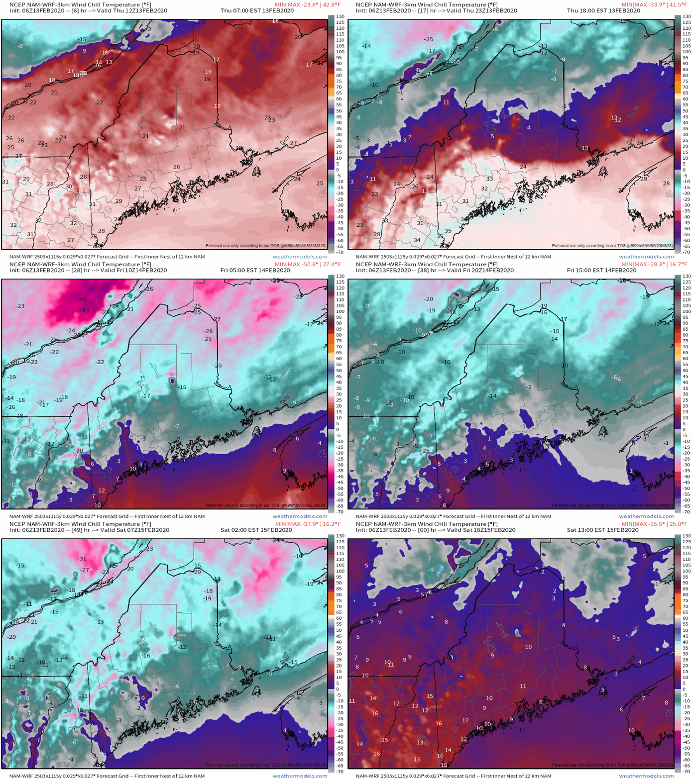
Storm track sags southAs low pressure skirts to the east, an arctic front drops in from the north. The combination of the two make for a snowy affair for much of the duration of the event. An inverted trough sets up later today and keeps the snow machine going in areas through Thursday night, with the final flakes falling before daylight on Friday. The storm track has drifted south, and as a result, adjustments have been made to snow prediction for the north and mountains: Far northern areas see little out of this one, more of a nuisance event than anything. Coastal areas have the best chance to get the most accumulation from this event, and have all along. A WIND CHILL ADVISORY has been posted for northern Maine from 1 AM to 9 AM Friday. Much of the region will be dealing with below zero wind chills through early Saturday.
Snow showers return to the region Sunday morning, with light accumulations possible. The next statewide weather event is possible Tuesday into Wednesday, which may feature snow, sleet, freezing rain and rain. I will have updates on that over the weekend. ► ► For the latest official forecasts, bulletins and advisories, please check in with the National Weather Service in Gray for western and southern areas, or Caribou for northern and eastern parts of Maine. ► ► Due to a revised budget there is a $125 shortfall for the year ahead! You can help keep Pine Tree Weather going with a donation of ANY amount now through VENMO @PineTreeWeather, a monthly donation on Patreon or messaging me on Facebook or Twitter to send a check in the mail. Thank you for your support! For more information from me, please check the Pine Tree Weather Facebook page as well as my Twitter feed. Always stay weather aware! - Mike |
Mike Haggett
|


