
While not as significant, still a decent snow event Forecasting data is only as good as what it puts out. The sudden shift of ideas of one of the more reliable models overnight Friday into Saturday is unnerving. While I have learned over the years to treat all guidance with a certain amount of skepticism, the sudden change in output of this storm makes me question it more. Forecasting is art. It is not an exact science. It's a blend of various ideas based on consistency of performance, compared to actual observation and performance. I would like to tell you that this forecast idea I present to you in this update I have good confidence in. What I am going to present to you is the best ideas based on the data I have to work with, and that bust potential will be a factor to consider in the next two days. Timing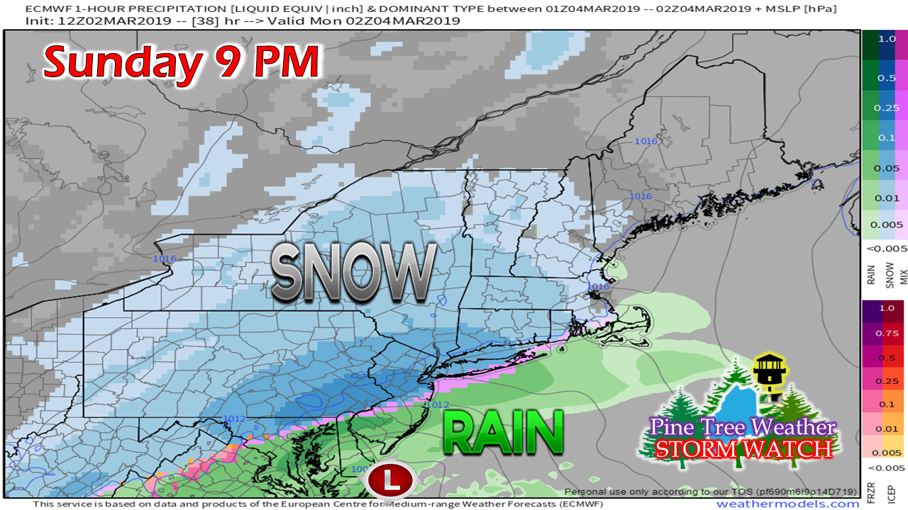 Sunday is a peaceful day overall. Clouds begin to increase over southern areas Sunday afternoon. Snow showers begin to break out Sunday evening over western and southern areas. 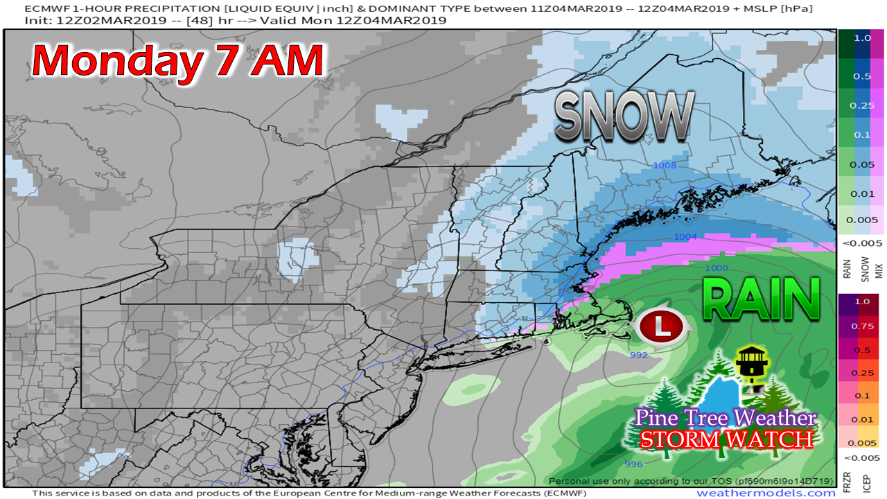 By Monday morning, snow overspreads the state. Storm track has the low crossing close to the benchmark 40°N / 70°W, which is an indicator that this will stay an all snow event for most of the state. Snow could be heavy at times over the coastal plain during the morning and into the afternoon. 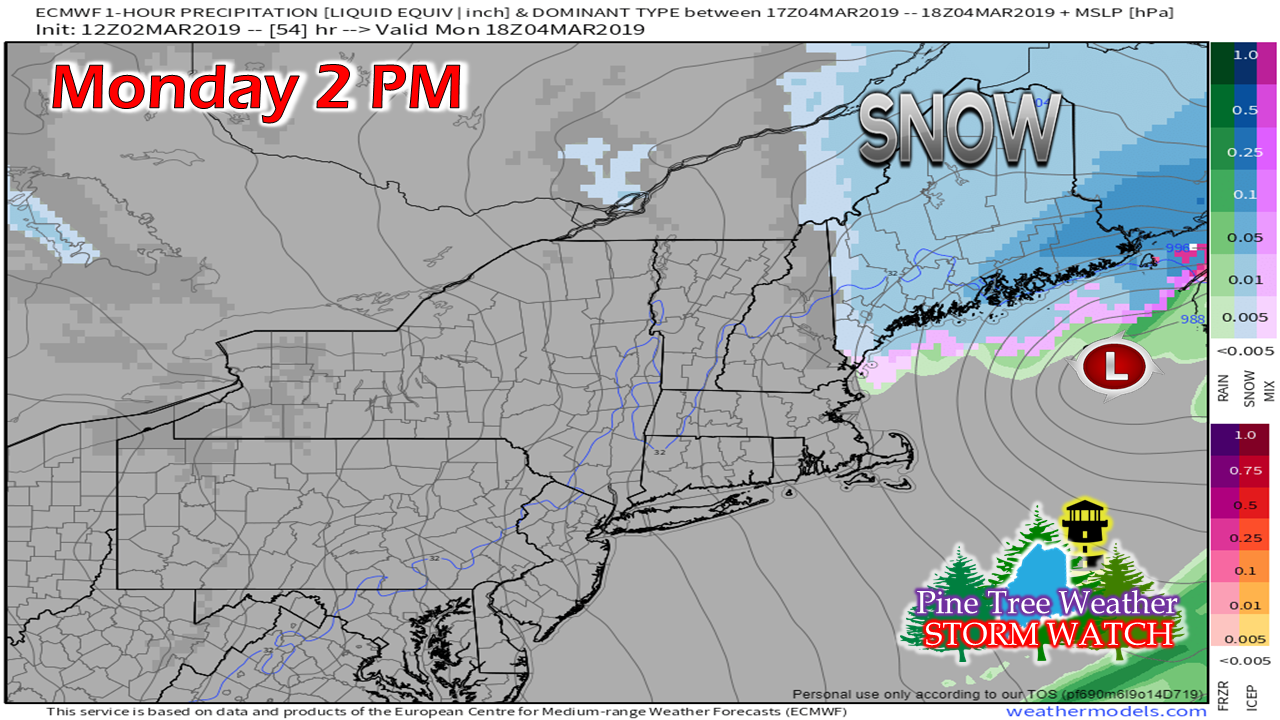 Low pressure travels toward Nova Scotia by afternoon. Snow ends over southern areas by late afternoon. Steady snow over eastern and northern areas continues through the evening commute. 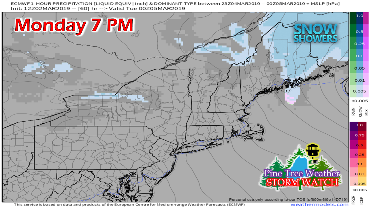 By Monday evening, snow has tapered to snow showers over western areas, and begins to taper off over eastern and northern areas. The storm clears the region by around midnight Tuesday. Snowfall prediction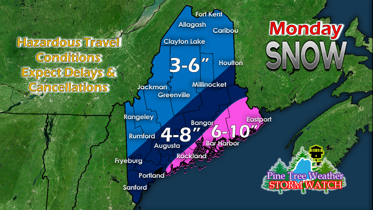 My concern for the heavier snows will be for the MidCoast and DownEast regions, with Washington County likely to be the jackpot zone for the highest totals. This is typical for benchmark snow storms, so it isn't a huge surprise. Outlook through Thursday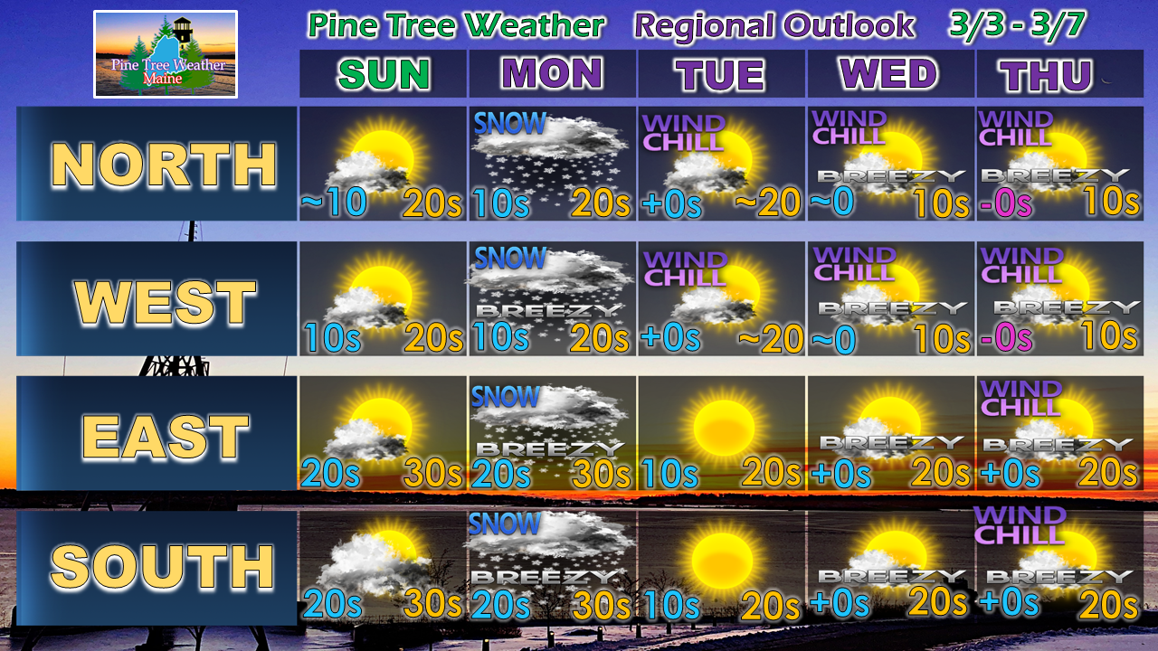 It is difficult to say at this point when the next storm will affect the region. Guidance is struggling three days out, let alone five or more days out. Confidence is good that cold air will be the main weather story as we head into the late part of the week. I will update beyond that as the week unfolds, and ideas last more than two runs.
NOTE FOR SUNDAY: I will once again be travelling out of state on Sunday. This is a last minute trip that has been planned. I will update on Facebook Sunday morning, and that may be it from me until Monday. ► ► For the latest official forecasts, bulletins and advisories, please check in with the National Weather Service in Gray for western and southern areas, or Caribou for northern and eastern parts of Maine. ► ► Your financial donations are much appreciated to keep this site funded and for further development. I sincerely appreciate your support not only financially, but also in sharing my efforts with others. Always stay weather aware! - Mike |

Mike Haggett
|


