
|
For the past couple of days I have been watching and seeing what has gone on and thought for January, this is sure acting like February. We usually get these lines of smacker storms as the change of seasons approach. With the trends I am seeing though, it's actually more like the December we didn't have. February looks cold, so keep that in mind. Most of the state to get a good dump of snow, but...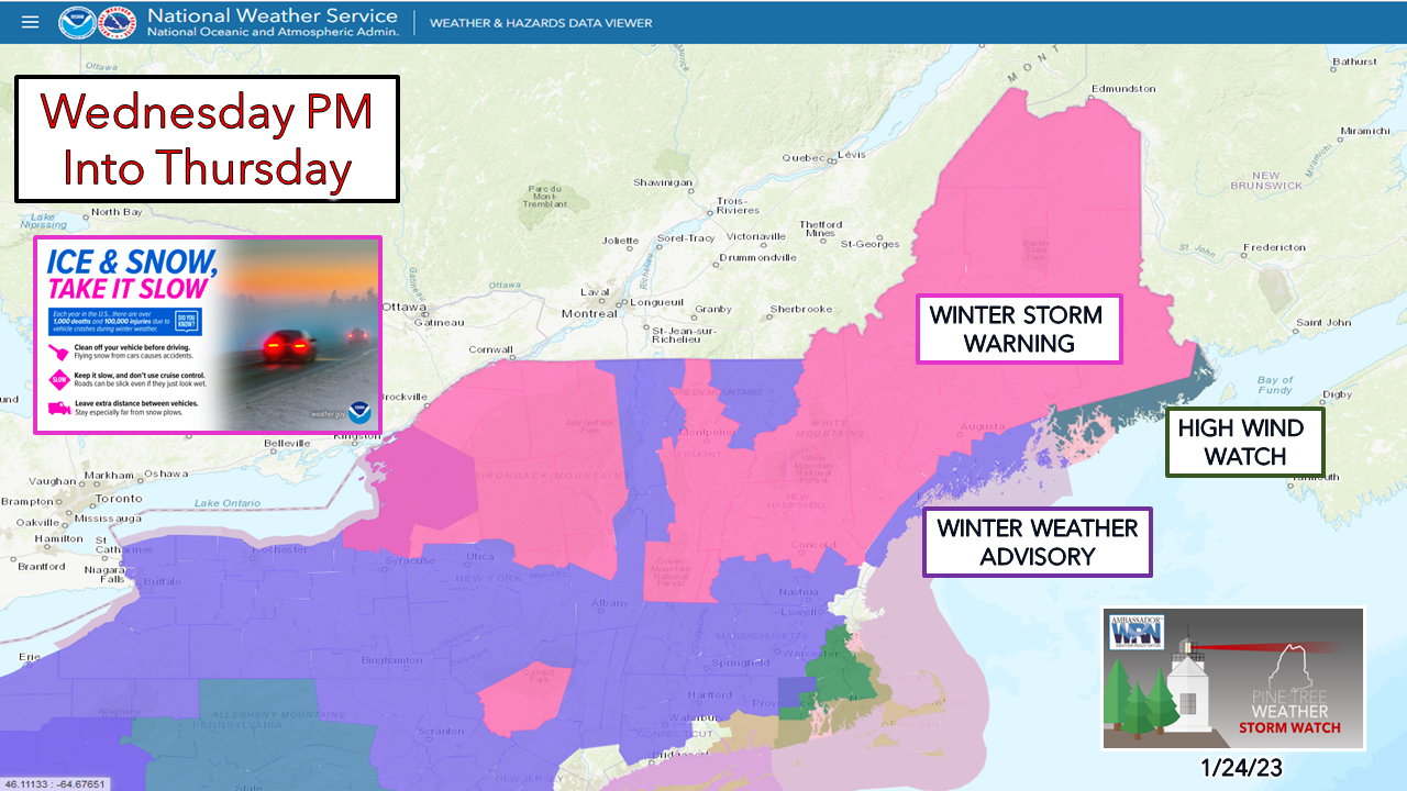 I am going to lay all of the cards on the poker table in true Omaha poker style and say it's these types of storms where it's like going all in with a pair of 2s at the casino with an ace on the board and people are loading the pot, and you can't fold since you are committed. Follow along... Timing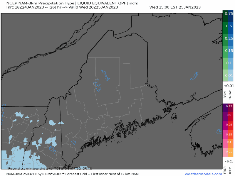 Wednesday 3 PM to Thursday 3 AM - Looking at the forecast for hourly precipitation amounts, the south starts off with snow, and as the warm front moves in, the transition begins to flip to rain. The rain could be heavy. Along the frontal boundary, snow could dump in 1-2" per hour rates, which is where it will add up fast. Where it rains, what snow has fallen is going to turn into a giant slushy. While I expect most areas are going to have slick roads to start off, the insult here is that once it flips to rain, and potential for heavy rain at that, it could miserable to move and/or drive in. 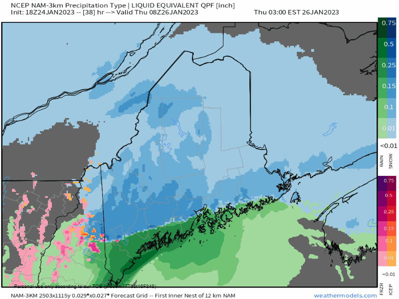 Thursday 3 AM to 3 PM - The transition to rain continues across the coastal plain and into eastern areas through the morning before most precipitation exits the region by early afternoon. The foothills and mountains may get a touch of sleet and/or freezing rain as a parting gift and may bring a bit of a crust, but it won't ruin any skiing plans. Precipitation type / wind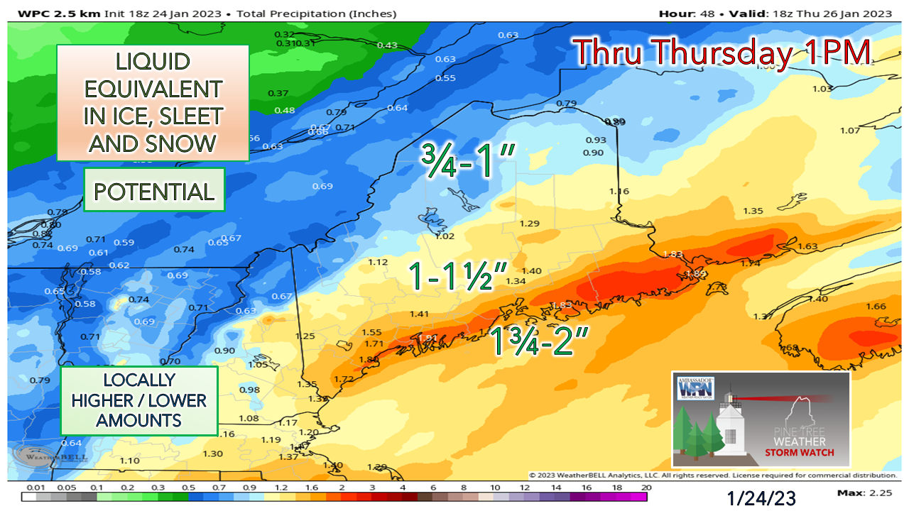 A lot of juice here for a later January storm. With the rise in temperatures and the amount of potential rain here that it may cause plugged storm drains, ponding on roadways and minor flooding from run off for the coastal plain, with more issues for the areas closest to the shorelines. 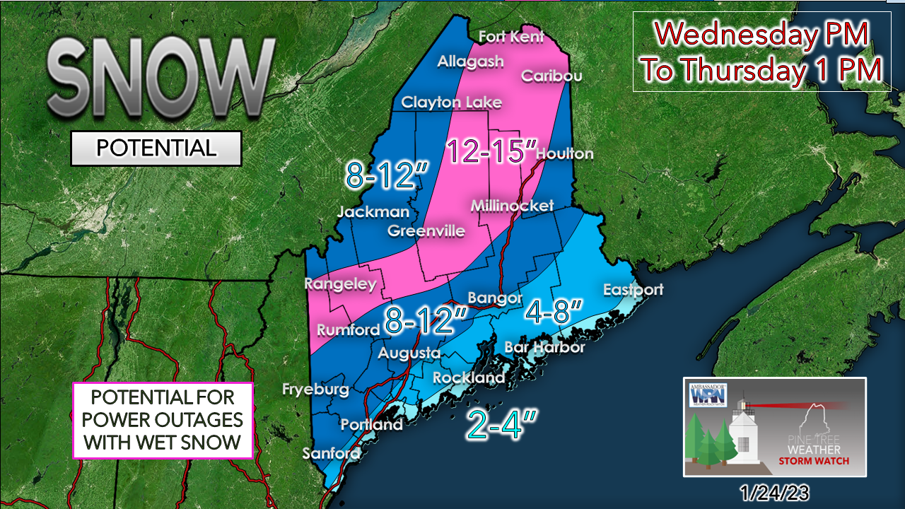 What makes this snowfall forecast extremely difficult to verify is the transition to rain happens when most folks are studying their eyelids. With heavy rain and rise in temperatures, it will compact and ooze like ice cream in a hot car in July. People could wake up over the south and the coast and say, "We were under winter storm warning (or advisory) for this!" and think forecasters should be committed to the nut hose. That is what makes this such a challenge. The good news is in areas where it rains and temperatures rise into the 40s, Mother Nature may do a good amount of the clean up on her own. For those areas that get caught with say 6-8" of snow and then get hit with rain that compacts that to slop, that will be a snow blower nightmare, not to mention heart attack level with the shovel. Just brutal. Be advised that this will all freeze up Thursday night, so at some point you should clean it up. The mountains will avoid the slop fest, so if you are planning on playing hooky to get some tracks on fresh powder, it's game on. That has been consistent, and I feel good about that part of the forecast. 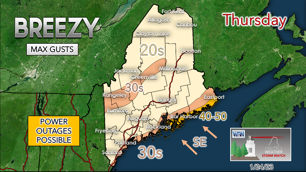 When the warm front passes through and flips snow to rain is when the low-level jet stream at 60-70 knots in conjunction with heavy rain is where the power outage threat may be highest. Where snow sticks to trees and powerlines, the wind could be problematic as well. The coast appears to escape yet again from any issues with flooding. Good news.  Outlook through the weekend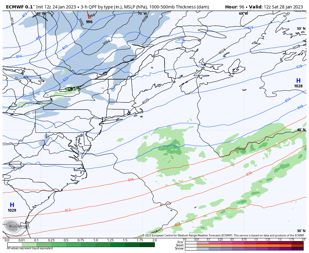 Saturday 7 AM to Monday 7 AM - Finally after this run of punching storms, we get a bit of a break here. The mountains may get some snow shower activity on Saturday. For the first time in a while we just get a lazy frontal boundary that may bring snow showers to the north and rain showers to the south on Sunday. After this, we'll have to watch for the next potential in the middle part of next week.  Thank you as always for your support! You may not like the weather, but I hope you like what I do! Please hit the like button on Twitter and Facebook, and share! Financial donations to fund what I do are always appreciated! Stay updated, stay on alert, and stay safe! - Mike NOTE: The forecast information depicted on this platform is for general information purposes only for the public and is not designed or intended for commercial use. For those seeking pinpoint weather information for business operations, you should use a private sector source. For information about where to find commercial forecasters to assist your business, please message me and I will be happy to help you. |

Mike Haggett
|


