
The headline list grows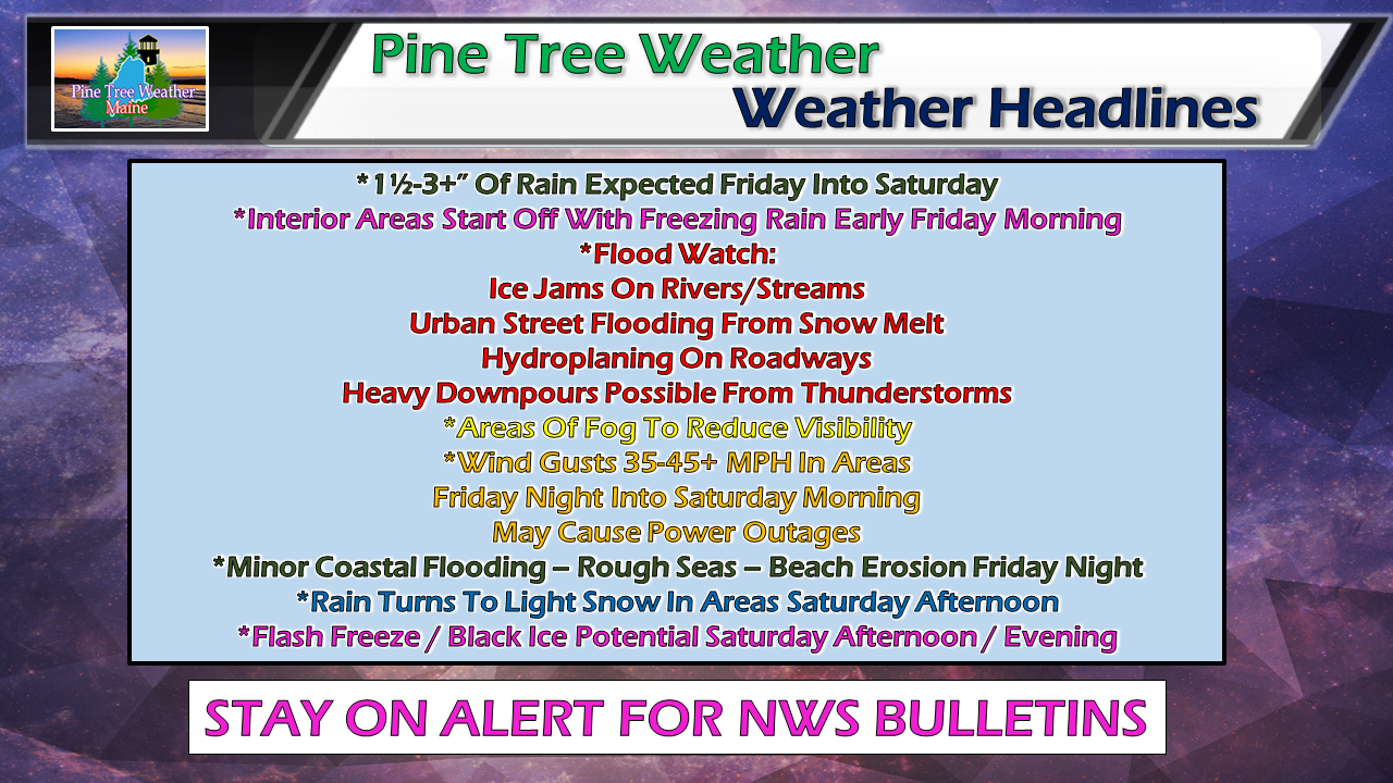 I won't excuse the pun... this is a very fluid situation here. Anytime there is a tropical cyclone in nature, it gets complicated. Add to the fact frozen ground, rivers and streams, and a healthy snow pack over interior areas, there is potential for a lot of problems here with this much moisture. Top it all off with the hustle of the holiday weekend approaching and all associated with it, there is a lot to be concerned with this storm. Precipitation / Timing Update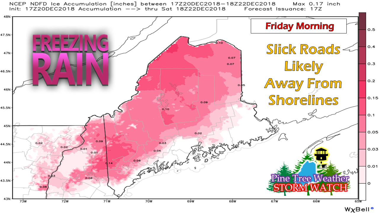 Rule of thumb... if you are away from the shorelines, anticipate ice as you travel through the morning. Not expecting a lot of accretion with this event, but it doesn't take much to put a vehicle where it does not belong. Conditions will improve as the morning progresses. By afternoon, it will likely be warm enough for straight rain. 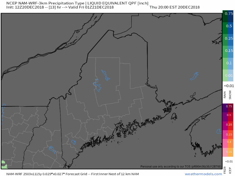 Precipitation beings around midnight over western and southern areas, advancing to the north and east as the day unfolds. Rain could be heavy at times, with downpours and thunderstorms possible through Friday night. By Saturday morning, most of the precipitation will have ended. Snow showers are possible on the backside as a cold front sweeps through Saturday afternoon. 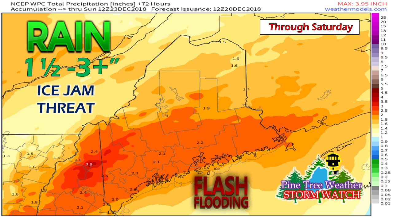 It's a soaker. As I mentioned in Wednesday's update, add up to 2" of additional water due to run off of snow to the total to get a better idea of impacts. Some areas could see 4" or more out of this. Flash flooding and ice jams over interior rivers and streams are likely through Friday and into Saturday. Ponding on roadways, urban street flooding, hydroplaning potential, reduced visibility in heavy rain and fog... SLOW DOWN on the roads. Wind still expected to crank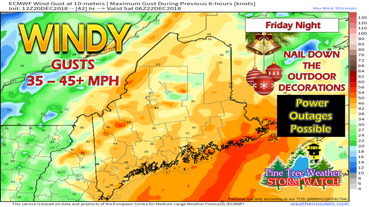 As of Thursday afternoon, NWS Caribou has issued a High Wind Warning for the DownEast coast. Their colleagues at NWS Gray has issued a Wind Advisory for Penobscot Bay to Massachusetts. The strongest gusts come Friday evening, diminishing Saturday morning. It will be breezy right through the remainder of the weekend. Power outages are likely in areas. Make sure you take care of anything outside that could go airborne, whether trash cans or holiday decorations. Coastal implications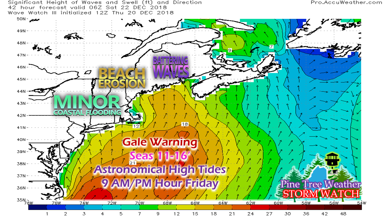 Our shorelines will see the affects of this, also. High tides for the shorelines in the 9 AM and 9 PM hours could bring splash over and minor flooding. The moon is almost full. Water levels will be high to start out, and will be enhanced by the storm, its wind and air pressure. Flash freeze / black ice concerns Saturday PM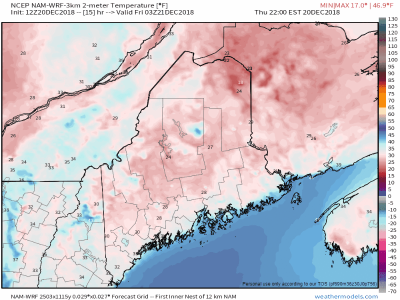 Timeline of temperature here from 10 PM Thursday through 7 PM Saturday shows the rise and fall through the period. Temperatures begin to drop Saturday morning. All of this rain and snow melt run off could freeze unexpectedly on the roads as northwest wind carries the cold in. If you are driving Saturday afternoon into the evening, expect slick conditions to develop. Remember, whatever your vehicle outdoor thermometer says, subtract 5° from it. Anything 37° or less... expect ice on the roadways. Expect surprises and stay on alert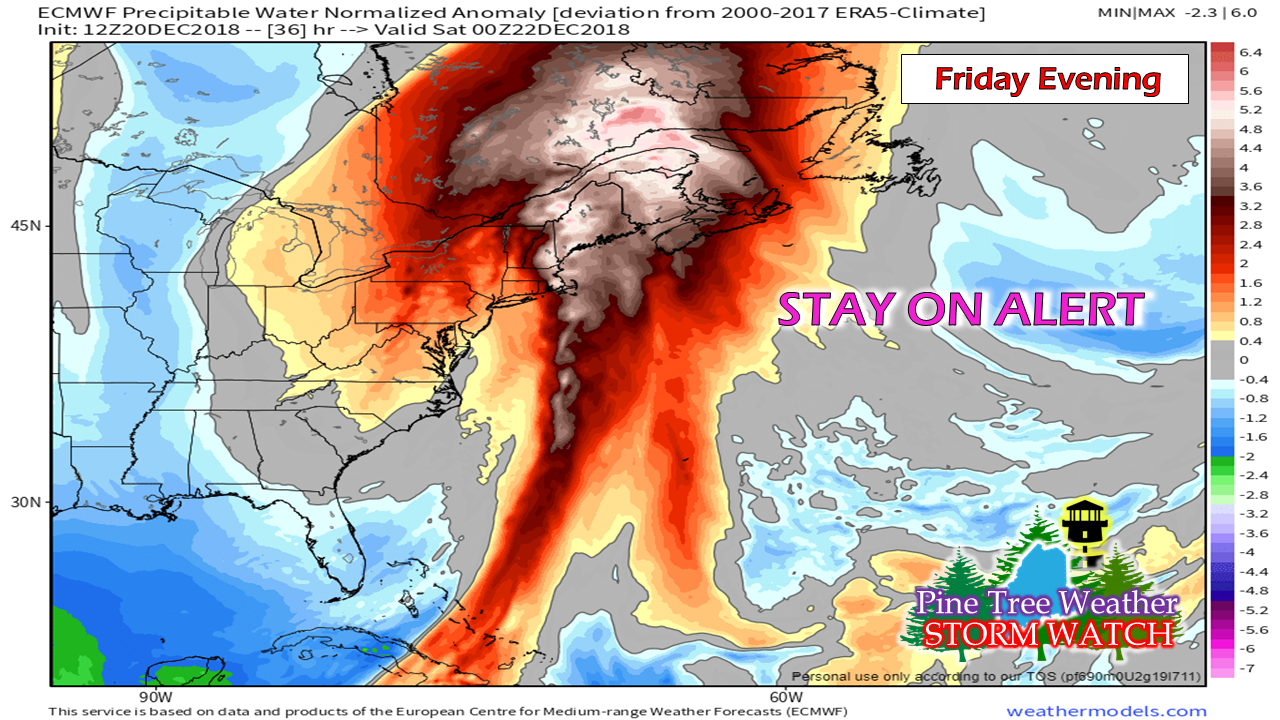 This is as impressive of a tropical event that can happen around Maine this deep into December. There will be records broken with rainfall, most likely. Anytime there is something tropical in nature involved, there is always the potential for surprises. It could be more rain, more flooding, stronger wind, greater impacts along the shorelines, or other impacts. I have a difficult time thinking it is going to bust. The closer to the coast, the more rain. I know some folks in ski and snowmobile country aren't happy about this. I don't blame you. This is surely a letdown after the snowy jump start in November. I am sure many of you wanted to get out for the holiday week. The timing is horrible. Just a reminder that Friday is the first day of winter. The snow will come back, and conditions will improve. We have a long way to go. Keep the faith. Outlook through Christmas Day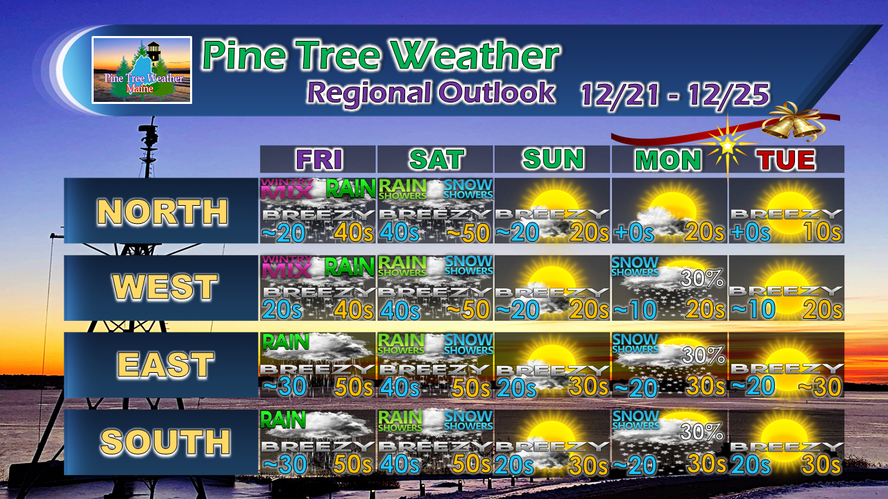 I am still hanging onto the idea that a touch of snow comes Christmas Eve for all but northern areas. I don't expect much, if any accumulation at this point, but it may help to get into the spirit of the day.
For the latest official forecasts, bulletins and advisories, please check in with the National Weather Service in Gray for western and southern areas, or Caribou for northern and eastern parts of Maine. Pine Tree Weather is now 90% funded to get through October of 2019. My anticipated current deficit now stands at $380 remaining to be raised to reach my goal. I am sincerely blessed and humbled by your financial contributions, cards, and messages of encouragement. It's been an amazing journey over the past 7 years, and to see my efforts appreciated by those that follow is a wonderful reward for my work. My request is for $1 per month / $12.00 per year through my Patreon page or by sending me a message on Facebook or Twitter to mail a check. The popular contribution has been $5 per month / $60 per year on Patreon, and the check donations average out to same amount as well. For those who have already donated, I sincerely thank you. For those who have yet to, I would sincerely appreciate your support in order to be fully funded by the end of the year. For more information from me, please follow the Pine Tree Weather Facebook page and my Twitter feed. Always stay weather aware, and thank you for your support! - Mike |

Mike Haggett
|


